
Puff (SDC #82, 2716′) • map • directions*
Indian Hill (SDC #75, 2240′) • map • directions*
Moan (SDC #77, 2939′) • w/Indian Hill
Puff
I had originally planned to loop Puff with Indian Hill, Moan, and Piedras Grandes, but Anna and I had extra time the day before and hiked Piedras Grandes on its own, leaving us with a shorter day and the luxury of being able to wake up with the sun. We had slept at the entrance to Mortero Palms Canyon, the starting point for Puff BM, which we decided to hike separately from Moan and Indian Hill to avoid having to walk 5+ miles of dirt road. It was below freezing when we got up at 7am, offset only by the fact that we were surrounded by beautiful orange rock that we’d missed during our drive in the night before.
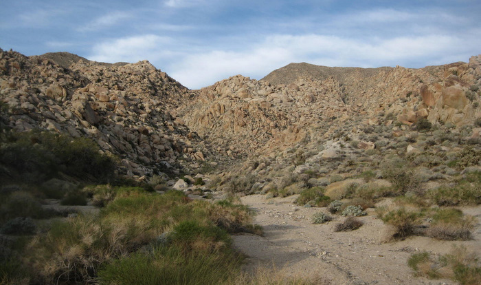
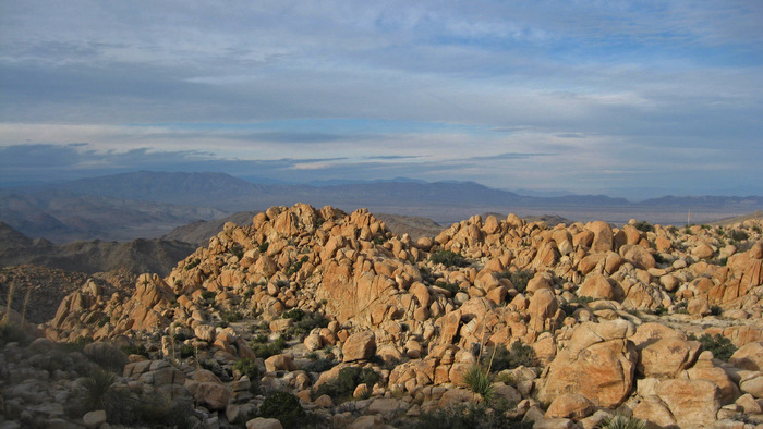
The view from our camp in the morning
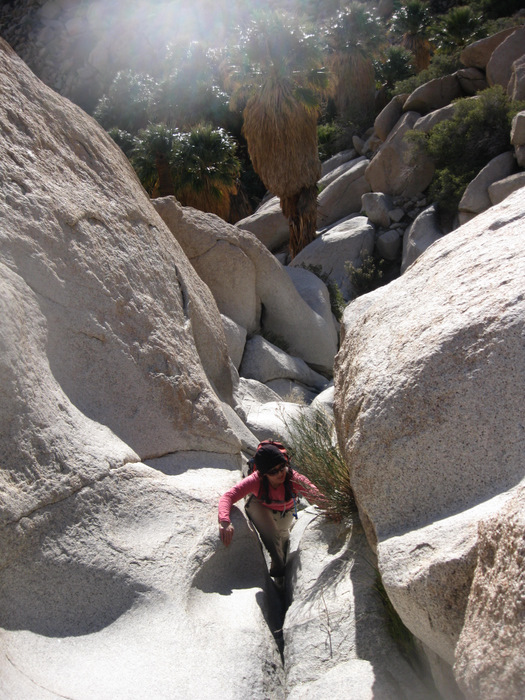
I was excited for Puff, as it is one of the best places to see the Goat Canyon Trestle, a 600 foot long and 200 foot high wooden truss built for the railroad in the 1930s. The history of the truss is quite amazing, with a good video explaining it here. After a bagel and cream cheese breakfast, Anna and I followed the sign from the parking area towards Mortero Palms Canyon, getting started just before 8am. We followed a use trail through the canyon, climbing over a few easy boulders in the process, and made it to the palm grove in 20 minutes from the truck. The palm tree oasis hidden within rock was seemingly very out of place, and was quite impressive, more so than the grove in Borrego Palm Canyon (at least to me).
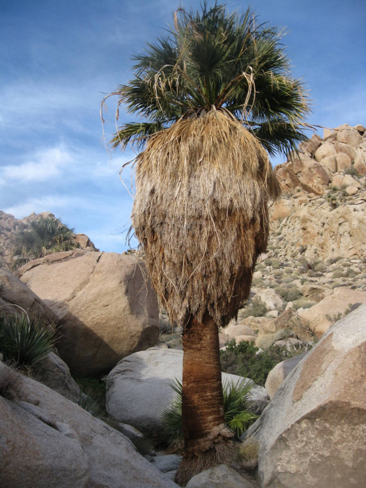
A giant palm
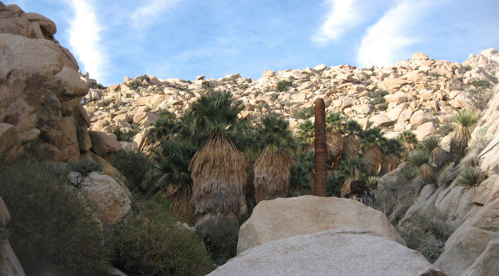
The palm grove
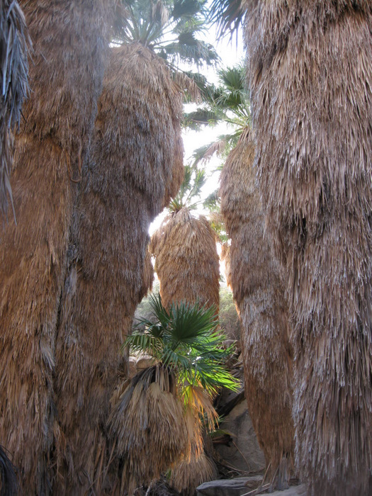
Hiking through
The dry falls behind the grove
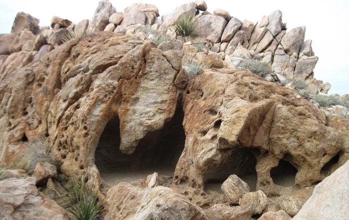
We spent a few minutes exploring the palms, essentially walking right through the middle of the grove in order to continue following the canyon to the west. Not seeing an obvious route, Anna and I climbed through a few class 3 dry falls behind the palm grove, before reaching easier terrain further into Mortero Palms Canyon.
About 2/3rds of the way up Mortero Palms
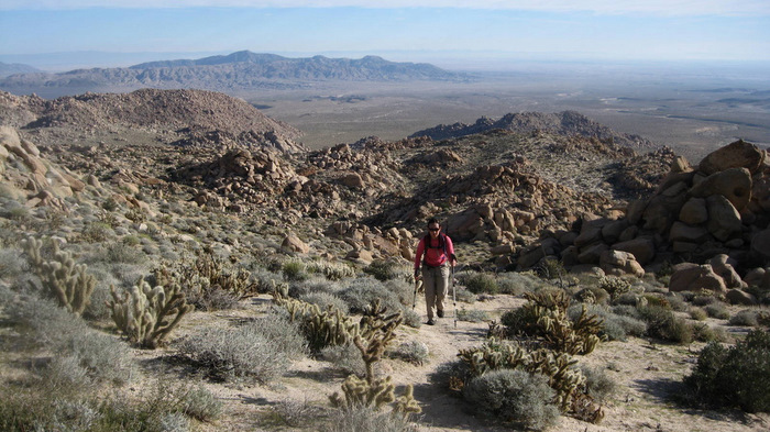
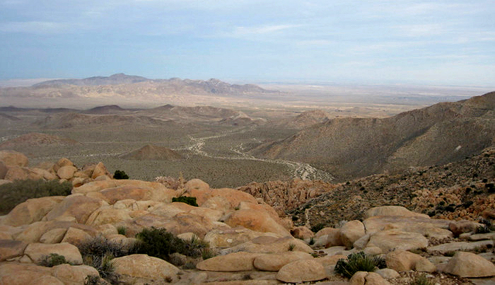
We were able to pick out a good route through Mortero Palms Canyon, usually finding a use trail on the right canyon wall when the bottom of the wash wasn’t clear. When we neared the end of Mortero Palms at around the 2800 foot level, we found a use trail heading up the left (south) side, and we followed it to the plateau between Mortero Palms Canyon and Goat Canyon. We continued to follow the trail over rolling hills for half a mile before descending into Goat Canyon, the luxury of the path luring us further down than we needed to go.
The view west towards the top of Goat Canyon from the top of Mortero Palms
Once Goat Canyon started to steepen into a rocky drainage (leading to the bottom of the truss), we re-evaluated our position and started the cross-country trek over to Puff. We hiked north over a few cactus-covered hills and were soon able to look down and see what we guessed was the Puff benchmark. After descending several hundred feet to the prominent viewpoint, we climbed across the narrow and rocky ridge to its end, to which we arrived at 10:10am.
Looking down at the ridge leading to Puff BM
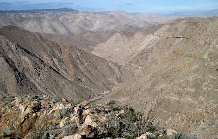
Almost down to Puff, overlooking Carrizo Gorge and the Carrizo Gorge Railway

The Goat Canyon Trestle
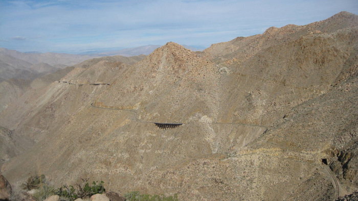
The Carrizo Gorge Railway
We spent at least 20 minutes admiring the amazing view of the Goat Canyon Trestle, Carrizo Gorge, and the Carrizo Gorge Railway. Wow. After we had our fill, we continued back towards Mortero Palms Canyon, taking a more direct route from Puff rather than heading back into Goat Canyon. We relocated the trail leading back down into Mortero Palms, this time finding the morteros (Native American grinding hole) for which the canyon is named. For the most part we followed our ascent route, with the exception of finding some large blocks to climb down on the south side of the canyon, rather than using the smoothed over dry falls we had come up from behind the palm grove. When we got back to the truck, we had a tuna lunch before making the drive over towards Moan BM and Indian Hill….
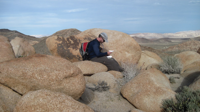
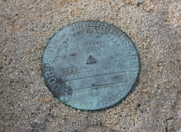
Anna at the Puff Benchmark
Puff’s survey marker
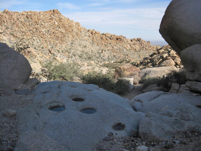
Morteros ground into the rock
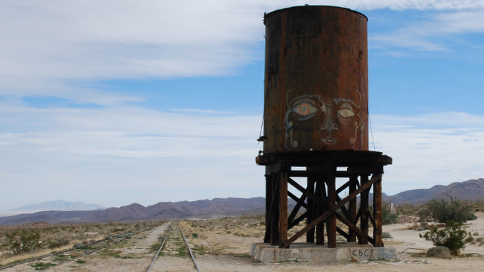
An old water tank near Dos Cabezas (on the drive between Puff and Moan)
Indian Hill and Moan
The drive from the Mortero Palms trailhead to the starting point for Indian Hill and Moan was an interesting one over mediocre roads. We followed Dos Cabeza Rd, crossing to the east side of the old railroad tracks near an old water tank, and continued along the road to its northern end. It took about 20 minutes to drive the five miles, and though four-wheel-drive wasn’t necessary, high clearance was again nice to have. I was surprised to see several vehicles parked at what would be our “trailhead”, in a circular clearing overlooking a large wash.
Indian Hill’s summit
On foot, Anna and I crossed back over the Carrizo Gorge Railway (part of the same tracks that we had seen from Puff BM) and started hiking southwest across the desert floor. I used my GPS to point the way towards Indian Hill, as I’ve read that there’s some discrepancy on which is the “real” Indian Hill. My GPS led us to a point just a few hundred feet above the desert floor, and we climbed class 2 slopes to its summit. It had taken us just 20 minutes to reach the top from the truck. I was surprised to find a summit register, and supposedly there’s a cave near the top that has a blackened roof from Native American fires, but I wasn’t able to locate it in the few minutes I spent looking.
From Indian Hill, we could see over to Moan BM, our next destination. It looked like a beast from where we were, covered in enormous boulders, and I had a hard time believing that it was just 700 feet higher and less than a mile from where we were. Knowing to trust my numbers more than my eyes, we started down the west side of Indian Hill and aimed for the base of a rocky ridge coming down from the north side of Moan BM. We were able to skirt around most of the boulders on the lower part of the ridge, and climbed through a steeper section from about 2300 to 2500 feet.

The steep boulder field
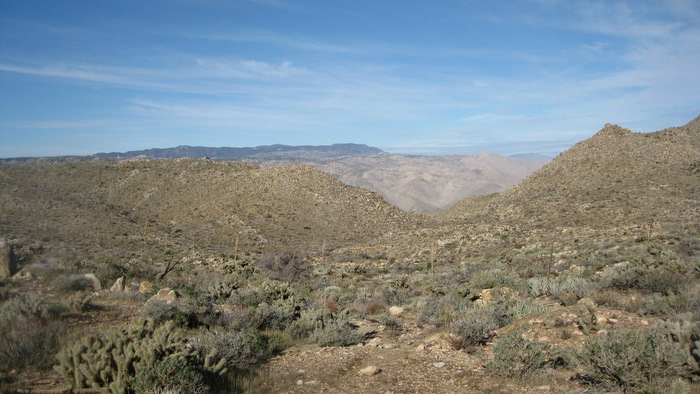
Views east while hiking Moan BM
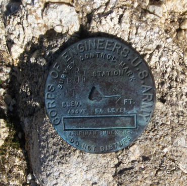
After climbing through the steep boulder field, the incline subsided as we walked across rock slabs and easy terrain, before steepening again over loose dirt just a few hundred vertical feet from the Moan benchmark. Approaching Moan from the north led us to some massive boulders that would require 5th class climbing, so we wrapped around to the right (counter clockwise) and worked our way up, finding the benchmark along with a register on top of those same house-sized blocks of granite. Its worth noting that the Moan Benchmark is not the high point of the mass of rock and dirt that it lies on, and though I normally don’t use a GPS, it’s been useful for finding obscure benchmarks.
Beautiful colors on Moan BM
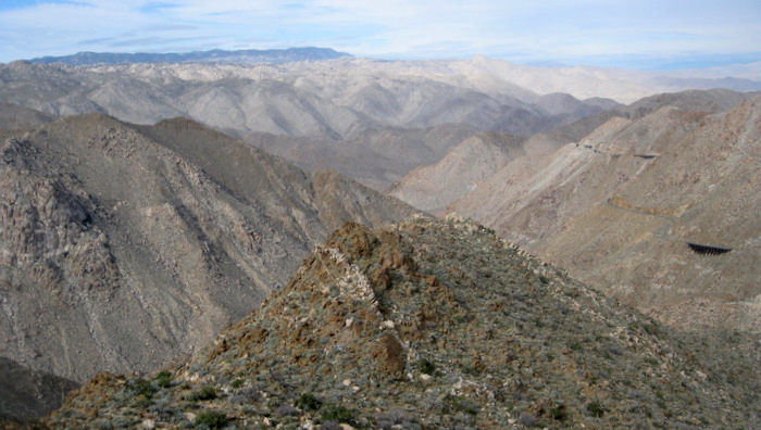
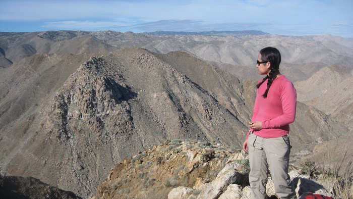
Anna and I were very content, savoring the unique views from Moan BM. We could see all the way to the Goat Canyon Trestle to the south, Carrizo Gorge to the west, and the rocky desert to the north and east. Anza Borrego never seemed to dissapoint, and the east side of Carrizo Gorge was no exception. We took our time on the way down, admiring some of the unique rock covering the slopes of Moan, and watched the sunset on the way back out to County Highway S2, thrilled about our first two days in 2011.
The Moan survey marker

Awesome views from Moan
Interesting rock on Moan
A clean slice
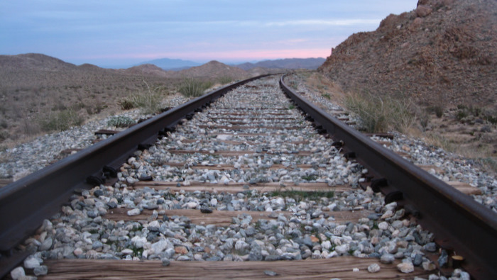
The Carrizo Gorge Railway, on the east side of the gorge
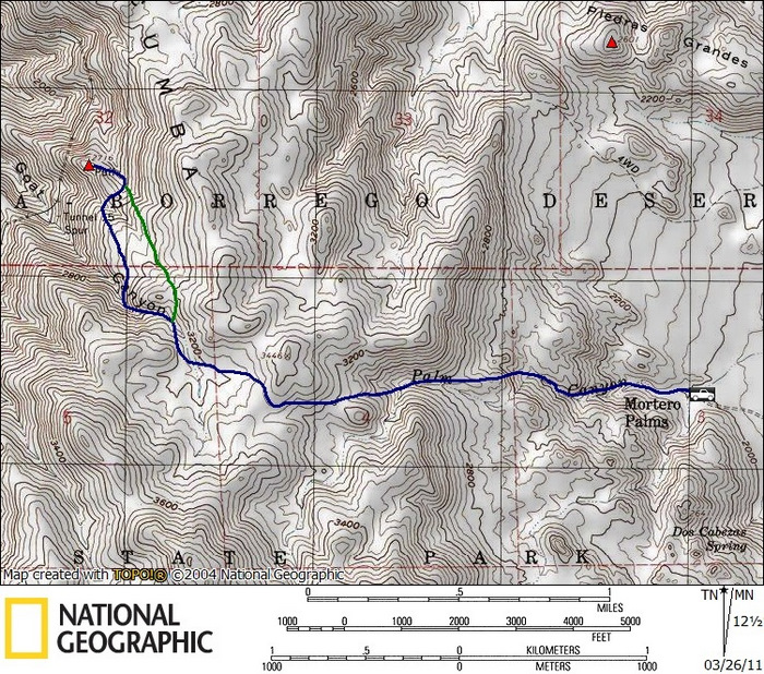
Puff stats: 5.6 miles roundtrip, 2600 feet gain/loss

Indian Hill/Moan stats: 4.0 miles roundtrip, 1100 feet gain/loss
*-For both Puff and Moan/Indian Hill, I’ve added intermediate points in the driving directions to keep you away from the rough northern section of Moretro Canyon Rd (the section between the S2 and Dos Cabeza Rd). For the Puff directions, the southern part of Mortero Canyon Rd is in decent shape and connects directly to Dos Cabeza Rd (that big loop in Google Maps is unnecessary).