
Stage (SDC #61, 2817′) • map • directions
Mine (SDC #70, 1850′) • map • directions*
Red Hill (SDC #73, 1720′) • map • directions
Piedras Grandes (SDC #78, 2601′) • map • directions*
Anna arrived at my house at 6am on New Year’s Day, neither of us with the sleep we would have wanted for our 2-day trip to Anza Borrego. We were looking forward to starting the new year off with a peakfest though, based around the southern end of County Highway S2. We had a total of 7 peaks or benchmarks left on the San Diego peaklist accessible from the S2, and we hoped to get them all in one two-day trip. Collectively the peaks add up to 22 miles of hiking and 8100 feet of elevation gain, with more than 75% of that being off-trail. Certainly not an un-reasonable plan, the success of which probably depending on getting between trailheads efficiently just as much as our speed on foot.
Stage
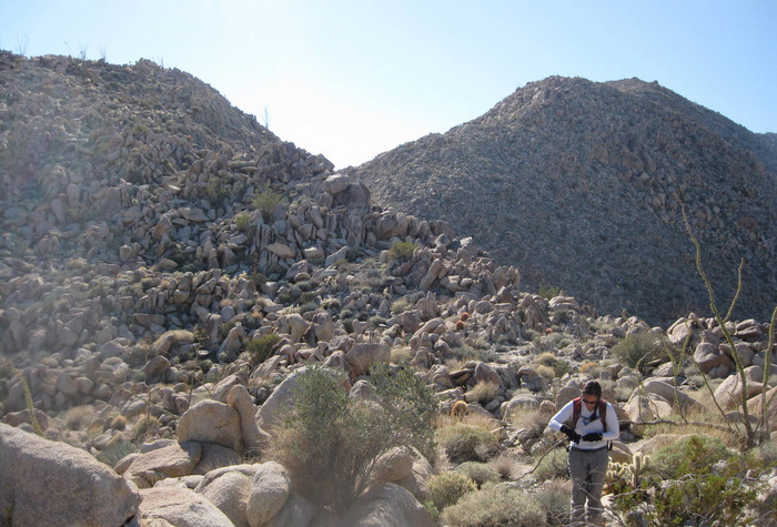
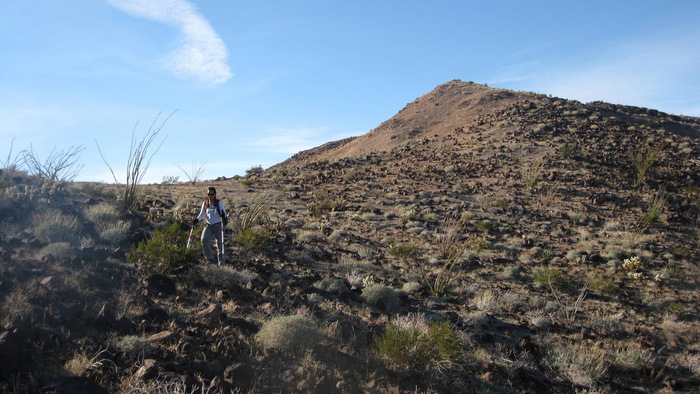
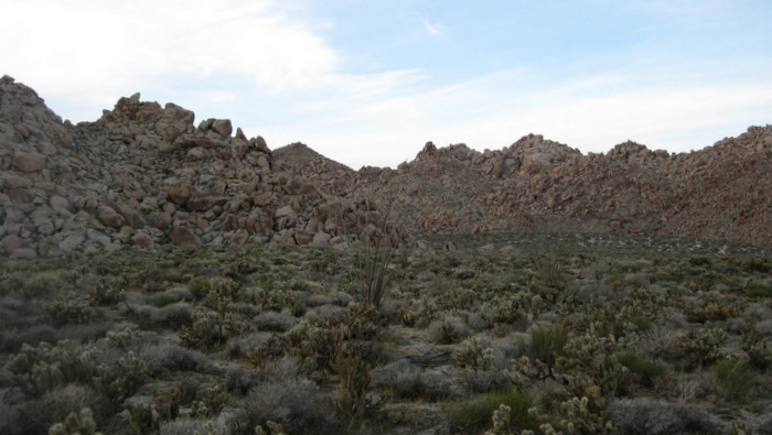
With plans to start north and work our way south, our first peak of the weekend was Stage Mountain. Stage mountain’s summit is located just a few miles from the S2, so we parked on a dirt shoulder off of the S2 just about even with the start of Stage’s northeast ridge. We went west from the truck, to an obvious wash running along the north side of Stage Mountain and started hiking up the ridge when it looked good.
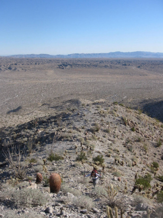
Anna starting up Stage Mountain
The first mile and a half or so was straightforward desert hiking, dodging teddy-bear cholla and other cactus on sandy slopes. At about the 2400 foot level the ridge turned rocky, perhaps class 2+, and we scrambled over a 100 foot bump on the ridge to a saddle before climbing another 20 feet through some large boulders to a false summit. From the false summit, the actual highpoint is a quarter mile west, and a 10 minute walk across another small saddle got us there at 9:58am.
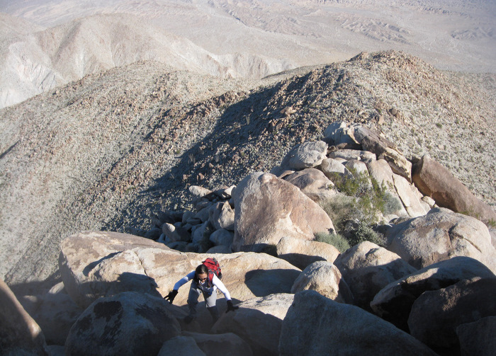
The last few hundred feet to the false summit
Near the summit of Stage Mountain
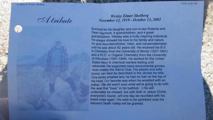
A tribute to Wes Shelberg in the register, one of the first people to climb extensively in San Diego
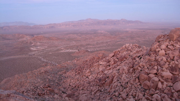
Anna and I enjoyed the desert views while thumbing through the register, which like a lot of the peaks in this area, had been seeing about one ascent per year. After a few minutes, we started back down the same ridge we had come up, stopping only once so that Anna could get her trekking poles out after getting down the rocky section. Once back at the truck, we didn’t waste any time starting towards the next hike…
The start of the rocky section (taken during the descent), the false summit on the right
Mine
After leaving Stage Mountain, we drove south on the S2 through Sweeney Pass and found the turnoff at mile 53.4 for Mine Peak. With high clearance, I was able to drive the West Dolomite Mine Trail all the way to the actual mine, making the hike to Mine’s summit under a mile one-way (a standard vehicle would put you on foot about a half mile from the mine).
Mine Peak from the S2 (shot taken 4-9-11)
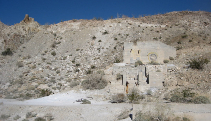
The Dolomite Mine
Leaving the truck at 12:14pm, Anna and I followed a dirt road to the right of and behind the leftovers of a concrete building, and then started hiking northeast up the ridge behind the mine. We eventually came across a use trail, which we followed through a drainage until we were on top of the broad summit plateau, just a quarter mile east of the actual summit. As the trail disappeared we continued on towards the highest point, taking in views from all directions.

Anna nearing the summit of Mine Peak, the Carrizo Badlands down below
We reached the summit at 12:43pm, in awe of the torn up earth that is the Carrizo Badlands below Mine Peak to the east. We snapped a few photos and reversed our route, making this a rather brief roundtrip to Mine Peak in under an hour.
The summit of Mine Peak and the view east
Red Hill
Upon reaching the highway after leaving Mine Peak, we literally drove for one minute to a huge circular dirt lot on the west side of the highway, seemingly a good starting point for Red Hill. Anna and I made it to the base of Red Hill without paying too much attention, and we hadn’t taken the time to figure out exactly where the summit was before we got too close to be able to tell. We started to walk north through a wash that twisted back and forth along the east side of the mountain, before we decided to just pick a slope and start heading up.
Red Hill from the S2 (shot taken 4-9-11)
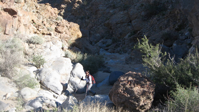
Anna in the wash
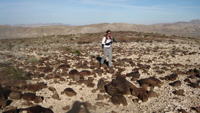
Red Hill’s flat summit
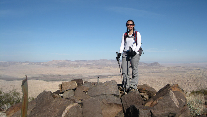
The summit was much closer than we thought, being just 500 vertical feet above the wash, and we made it to the huge plateau littered with volcanic red rock at 2:17 pm. We had to check a few spots before we found the register, and I recognized a few names from the other desert peaks that Anna and I had visited in the last few months. We opted for a more direct route down from Red Hill, taking the easy slopes south and then east from the mountain, and made it back to the truck in no time.
Descending the south side of Red Hill
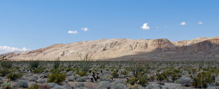
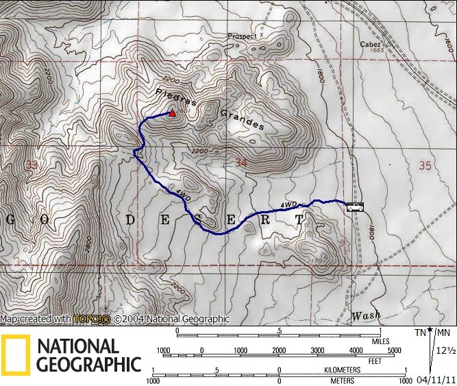
Piedras Grandes
Originally I had thought that Mine and Red Hill would take longer than they did, but it turned out that we had time for one more mountain, provided that we could find it in time. We decided to head for Piedras Grandes since it was the closest to us, though we had originally planned it as part of a large loop the following day.

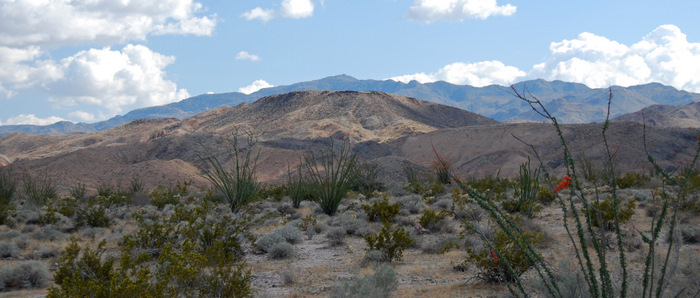
Piedras Grandes (shot taken 4-9-11)
Piedras Grandes is part of the Jacumba Mountains, and we were able to get to its base via the Dos Cabeza Rd off of the S2. The road wasn’t terrible, but high clearance was nice to have. It took us half an hour to navigate the 7 miles of dirt road and to locate a good starting point for the hike.
Looking towards Piedras Grandes from the start of the hike
We located a blocked off dirt road that ran up an easy slope towards the summit of Piedras Grandes, so we parked the truck and immediately started off, knowing we may be pushing a nighttime descent. The old jeep trail was a huge timesaver as far as getting through the vast amounts of teddy-bear cholla saturating the area, and it wound its way around some massive piles of rock that reminded me of Joshua Tree, quite an impressive part of Anza Borrego.
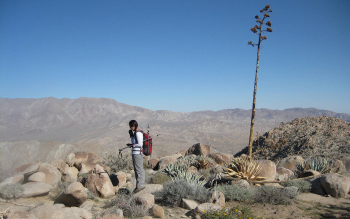
The view east from Piedras Grandes
Once we had 200 vertical feet to go, we left the comfort of the road and traversed north to a saddle just southwest of the summit of Piedras Grandes, from where we scrambled up the final slope to the high point. We found the register on top of some large boulders at 4:42 pm, and put our headlamps on just in case we needed them for the descent. We were able to make it back to the road before dark, and had a nice star-lit stroll back to the truck.
After reaching the truck, we drove just a few minutes away to the start of tomorrow’s hike, celebrating our successful first day of 2011 with pasta and beer before slipping into the warmth of our sleeping bags in the bed of the truck.
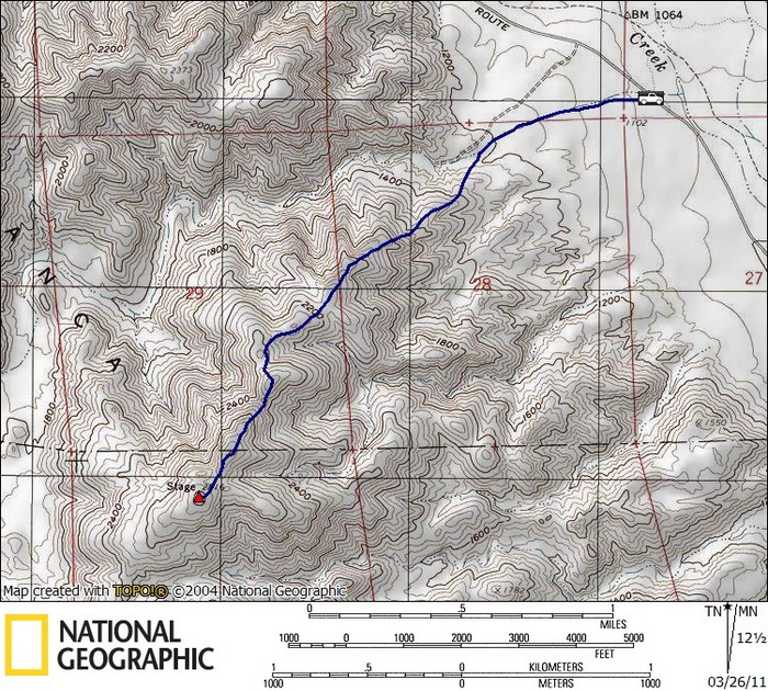
Stage stats: 4.4 miles roundtrip, 2100 feet gain/loss
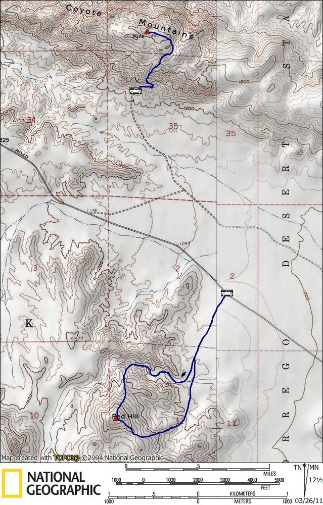
Mine stats: 1.6 miles roundtrip, 700 feet gain/loss
Red Hill stats: 3.2 miles roundtrip, 650 feet gain/loss
Piedras Grandes stats: 3.3 miles roundtrip, 900 feet gain/loss
*-The driving directions for Mine Peak will get you to the turnoff for the Dolomite Mine. Continue east and then north to get to the mine and the base of Mine Peak. Regarding the driving directions for Piedras Grandes, I’ve added an intermediate point to keep you away from the rough northern section of Moretro Canyon Rd (the section between the S2 and Dos Cabeza Rd).