
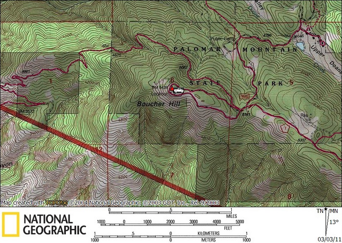
Black #1 (SDC #44, 4045′) • map • directions
Boucher
Boucher Hill is most definitely the easiest peak on the SDC peak list. You can drive right to the summit, the road is even paved. Anna and I paid the entrance fee for Palomar State Park, spent a few minutes driving to the summit, walked 20 feet, took a few photos and left just as quickly. We probably paid the equivalent of 25 cents a minute for our stay. I’m not quite sure why Boucher Hill is on the San Diego Peak list, maybe for the history and the views. There is a cool lookout tower on the summit, last in service in 1986, a replacement for an older tower first placed in 1921. And the views were great, especially in the northwest direction and now I’m wishing I’d taken more photos.
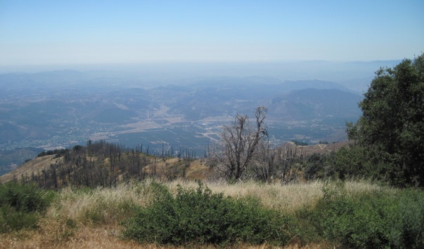
The view northwest from Boucher’s summit
I had thought about hiking the Boucher trail to experience a little more of the area, but I figured I have plenty of good hiking in store with the next 99 peaks (Boucher was my first peak since discovering the SDC list, though I planned on repeating the 17 peaks I’d hiked previously just for fun).
Palomar recon
On the drive out from Boucher we stopped by the Palomar observatory for two reasons. One – Anna had never seen the observatory, which is worth the few minutes that it takes to check it out, and two – to see if we could hike to Palomar’s true highpoint, another peak on the SDC list. From the observatory, it would have been a short hike, under an hour roundtrip I’m sure but would require trespassing. I hate trespassing but in this case it would save us a long and slow drive up a windy dirt road another day. As we walked to the observatory I kept my eyes on a possible route, it was so tempting seeing the summit so close, I could see the lookout tower that I knew was on Palomar’s summit. After checking out the observatory, Anna let me know she wasn’t too keen on a dash to the summit. There was no one around, but it was pretty open and we’d be easy to spot. No worries, another time…
Black #1
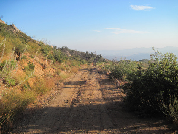
We drove north out of Ramona, catching Pamo Valley Rd for about 5.5 – 6 miles and found the obvious San Ysidro truck trail on the right. Pamo Valley was surprisingly scenic; a kind of hidden away spot that you wouldn’t know was there. According to Schad’s book, I expected to be able to drive 1.5 miles up the truck trail, and have a 3100 foot gain hike from there but when we reached the obvious parking area a gate was open and the road looked clear. Hiking on dirt roads doesn’t really excite me so we started up the road in the truck. The road was in decent shape, any vehicle with moderate clearance could follow it without too much difficulty. We kept driving up and up and I started laughing at how easy our day was going to be. Eventually I decided to just pull over at a narrow turnout and hike from there, as we’d already shaved a 1000 feet off the hike. It was insanely hot outside now, it felt like it was in the 90s and definitely wasn’t ideal hiking weather. It wasn’t so bad earlier and higher up on Boucher and Palomar, but it was just that, higher and earlier, and we weren’t exactly straining ourselves then either.
We started up the road on foot and mindlessly marched on, admiring sections of black oak and thick brush. We covered the first 1500 feet quickly before we came to a gate with a large parking area and one parked car. I would have been sure no one but us would have been out here with the heat the way it was. We went around the gate and started up the last 500 vertical feet, reaching the end of the road in about 10 minutes. From there it’s an easy off-trail 1/4 mile to the summit, and I started off to check out the way while Anna grabbed a snack out of her pack. After a few minutes I stopped to wait for Anna when I noticed a man a hundred feet above me, sitting in a chair under an umbrella tucked back into some trees. He seemed to notice me, then slip away into the trees behind him. It seemed weird but maybe he was acting as a fire lookout, I don’t know, maybe he was just hanging out and went to relieve himself. It was odd anyhow. Anna caught up and we finished the last few minutes to the highpoint, where a concrete structure now stood, I believe from an old fire lookout. The 360 degree views were great, we could see Lake Sutherland to the east and the views in all directions were only limited by the haze. I’d imagine you could see the ocean on a clear day.
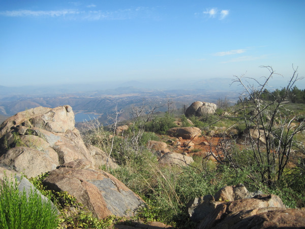
The view east from Black’s summit
I could see the weird guy’s chair and umbrella so I pointed it out to Anna, which made her a little uneasy, but I thought it was funny. A helicopter swooped in and circled the summit a few times and then split. We hiked back to the road and the weird guy had returned to his seat, but no one paid any attention to each other. It took us about an hour and fifteen to get back to the car, which is when we dealt with the crux of the day. The road and turnout were too narrow and I couldn’t turn the truck around. I didn’t remember a turnout farther up so I decided to head down in reverse. Now, going uphill in reverse is no problem, but downhill I can’t see the road itself or any minor obstacles on that road. I took it slow and after a few minutes my neck was killing me. I got pretty frustrated but was laughing at the same time about how ridiculous this was. Soon enough we found a large turnout and made the drive out and home. 2 peaks down in an easy day.
Boucher stats: 40 feet roundtrip, 0 feet gain/loss

Black #1 stats: 8.0 miles roundtrip, 2000 feet gain/loss
* – the driving directions for Boucher are incomplete. Continue on Boucher Lookout Rd (not shown on Google Maps) to the summit.