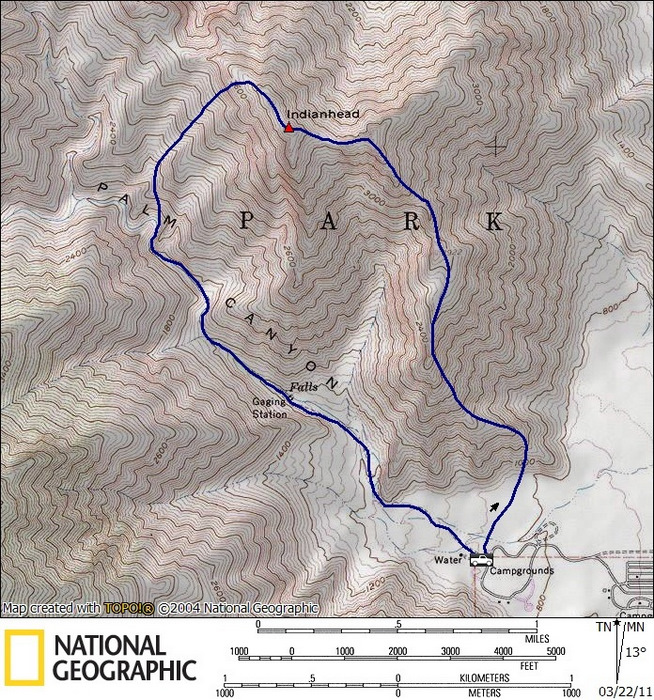
Indianhead (SDC #16, 3980′) • map • directions
Indianhead is a distinct mountain that towers over Borrego Springs, and mile for mile is one of the more rugged peaks in Anza Borrego. I had been up the mountain once before, just 9 months previous in March of 2010. I was again looking forward to the steep scrambling that Indianhead had in store for us.
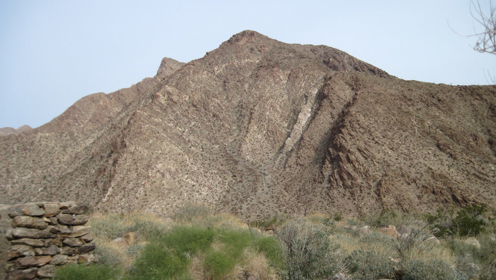
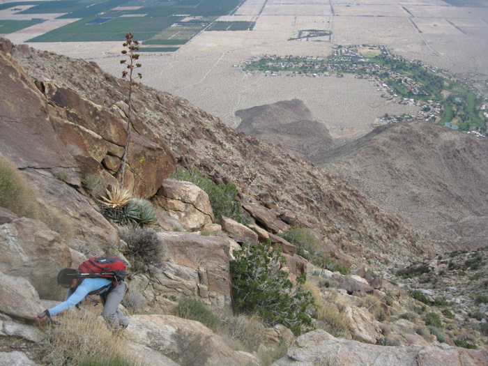
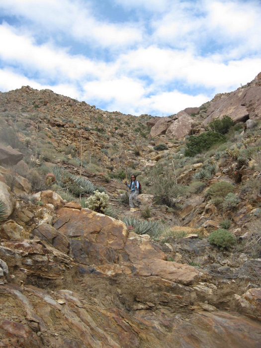
From the parking lot within the Borrego Springs campground (fee required), it took five minutes to walk over to the base of Indianhead’s southeast ridge. The ridge meets the desert floor so abruptly that literally, one step we were on the desert floor, and the next step we were on Indianhead. We’d hardly had time to warm our legs up before starting up the ridge which continues relentlessly to the summit, gaining 3600 feet in just 1.8 miles.
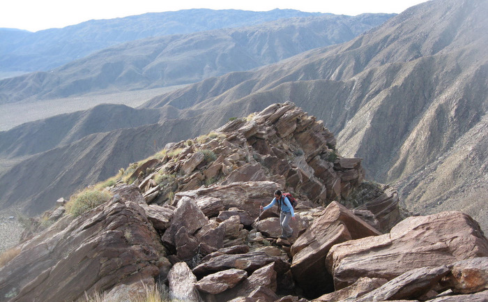
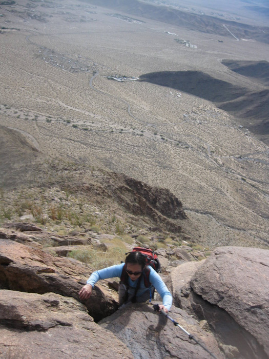
We covered the lower half of the ridge with little more than hard work, anticipating a slower pace through a few minor difficulties higher up. I had remembered a few rather exposed moves to get through a prominent notch about 2/3rds of the way up on my previous trip and I wasn’t sure if it would be within Anna’s comfort level. When we reached the notch Anna and I were able to climb some class 3 slabs on the hiker’s right, as opposed to the more exposed variation on the left that I’d taken last time, eliminating the need for the short rope I’d carried just in case.
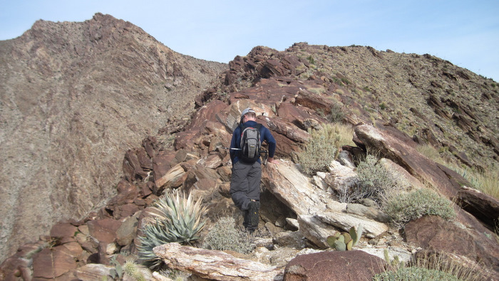

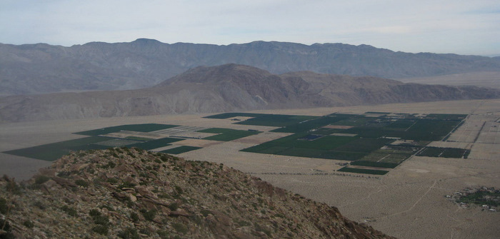
The sight of Borrego Springs from the upper ridge was amazing and it was hard to imagine that we were less than 3000 feet from the desert floor. At the 3600 foot level the southeast ridge meets with the main summit ridge, and we bypassed a large gendarme by entering the gully on its right, though sticking to the ridge would have been more exciting and direct. Once we reached the main summit ridge running east/west, we followed its crest to the summit, climbing over and around large boulders before making a final 200 foot slog to the register.
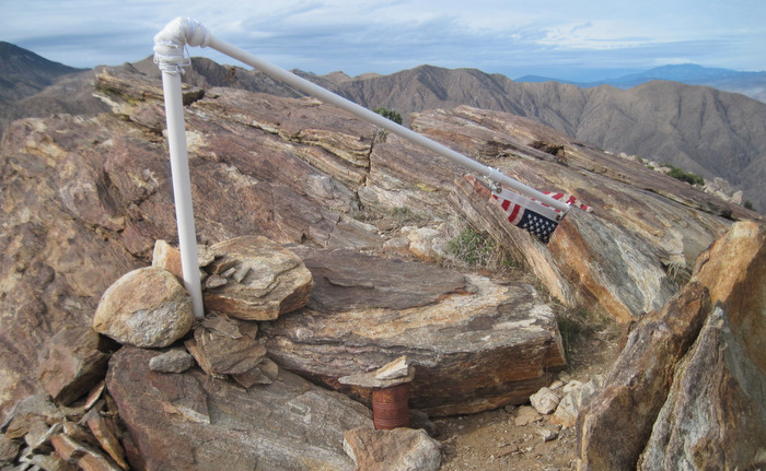
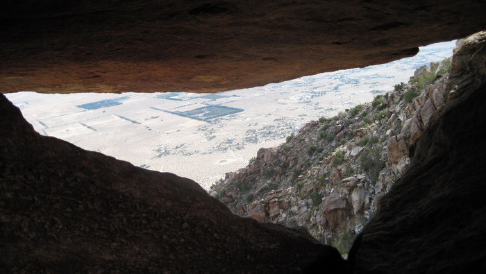
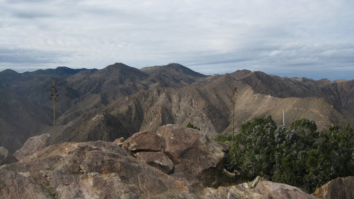
There was an American flag fixed to a broken pole on the summit, and I may be incorrectly remembering a pirate flag being up there on my previous visit. There was a fresh climber’s register and I was disappointed to see that the old one had been removed. From Indianhead’s red summit we had a clear shot of the Santa Rosa mountains to the east, and several peaks to the north and west that I’ve yet to get to, a few of which seemingly in reach from Indianhead. Perhaps if we had gotten an earlier start…
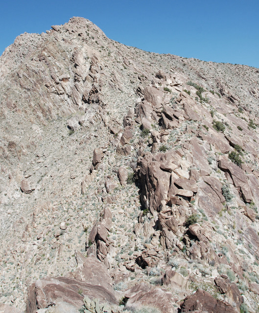
From the summit Anna and I dropped a few hundred feet to the west, the same way I had descended during my first trip. Indianhead refusing an easy inch, we climbed over boulders and dodged cactus, and were funneled through the same tight squeeze I’d been through before. Footprints indicated that others had found this way as well.

Once Anna and I were a quarter mile west from Indianhead’s summit, we could see all the way down to the bottom of Borrego Palm Canyon and we began the long descent down the southwest slope. We switched back and forth down class 2 terrain, weaving around cactus and troughs carved by rain, until finally reaching the bottom of the canyon almost two hours after leaving the summit. The descent wasn’t as bad as I had remembered it but its definitely tedious.
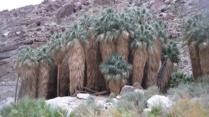
We took a break near the cool water running through Borrego Palm and started down a use trail on its south side. We crossed the stream several times, stopping once to catch (and release!) one of the many small frogs hopping around, eventually arriving to the grove of palms for which the canyon gets its name. There were several people exploring the huge palms and several more along the trail back to the truck. A bit of a culture shock after seeing no one for the entire day. On the drive home Anna and I celebrated with what was becoming a tradition of Mexican food in Ramona, Anna being especially thrilled, having completed her second class 3 route as well as her 50th San Diego Peak in just 4.5 months.