
Sunset (SDC #34 , 3658′) • map • directions*
Borrego, W. Butte (SDC #28, 1207′) • map • directions
Borrego, E. Butte (SDC #31, 1196′) • map • directions
Sunset
It had been a cold and windy night in Anza Borrego, so windy that Anna and I slept in the front seats of my Tacoma. We had parked on a shoulder just off of highway 78, and some how managed a good night’s sleep. We left the warmth of the cab of the truck at 7am, to be greeted with the same sub-freezing temps that we experienced yesterday morning. After brushing our teeth and gulping down a quick breakfast, we drove down the Pinyon wash and found a fork in the road 1.6 miles from the highway. I had anticipated that the road would require four-wheel-drive from the fork, but it looked like more of the same so we hung a left and drove another mile towards Sunset, being careful not to stop in one of the pockets of deeper sand.
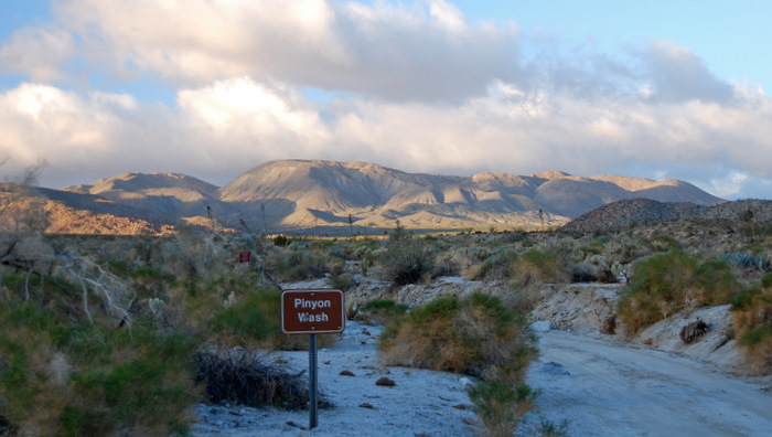
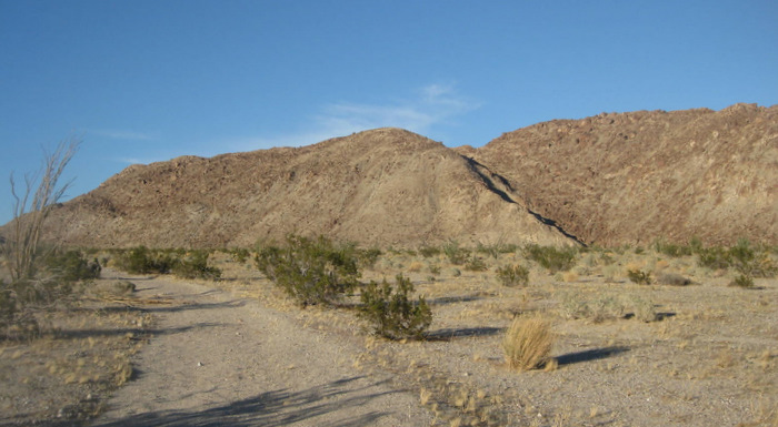
The start of the dirt road leading to Sunset Mountain
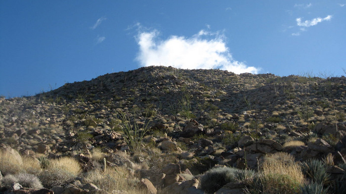
Looking up near the start of the hike
Sunset Mountain was in full view from where we parked, and I tried to pick out a route while we put on our ice-cold sunblock and filled our water bottles. Anna and I then hiked half of a mile to the base of the mountain, where the scrambling started in earnest.
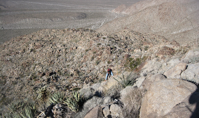
Scrambling on Sunset Mountain
More scrambling on Sunset
Overall routefinding wasn’t much of an issue and one particular slope or ridge didn’t look any better or worse than the others; we just went up, looking for the path of least resistance through the boulder and cactus choked slopes. The climbing never really exceeded class 2, though it was nonstop from the desert floor to the summit, with 1800 feet of gain in the final mile.
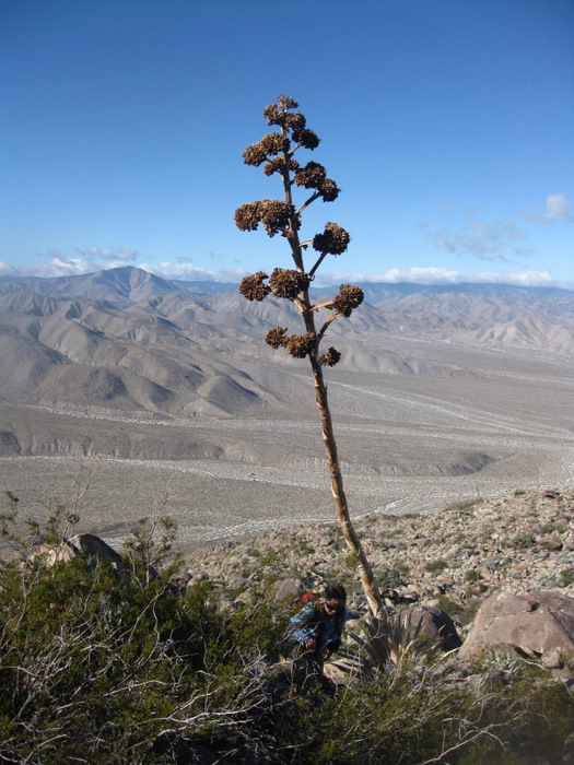
Giant Yucca near Sunset’s summit
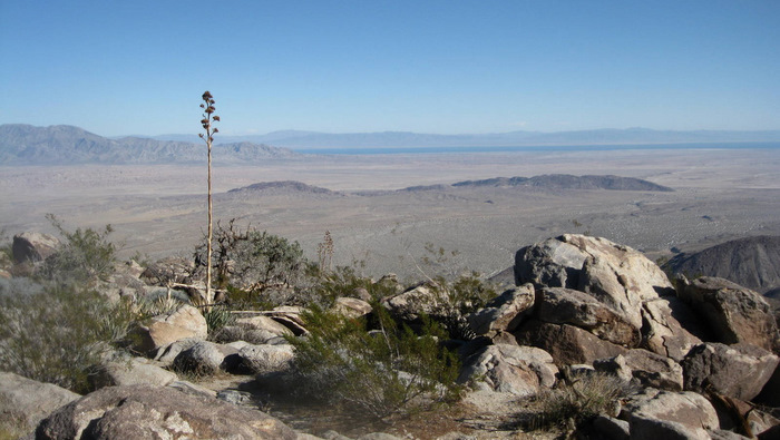
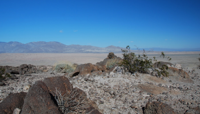
Northeast from Sunset, the isolated Borrego Mountains in the foreground, Salton Sea on the horizon
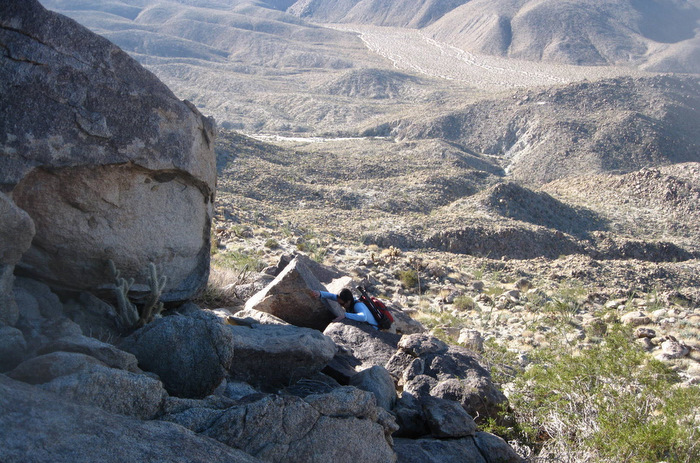
Located near the center of Anza Borrego State Park, the views from the summit of Sunset were impressive. We could see the Vallecito mountains to the south, Granite Mountain to the west, and the Borrego Mountains, our next objective for the day, to the northeast. The obstacles being more of a challenge than the actual uphill effort, it took almost as long to get down as it took to get up, and we arrived back at the truck at 11:30am, our pace hovering near the 1 mile per hour mark. We changed into clean shirts and drove back out to the 78, headed for the Borrego Mountains…
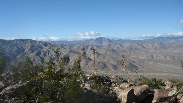
Looking west from Sunset Mountain, Granite Peak in the distance
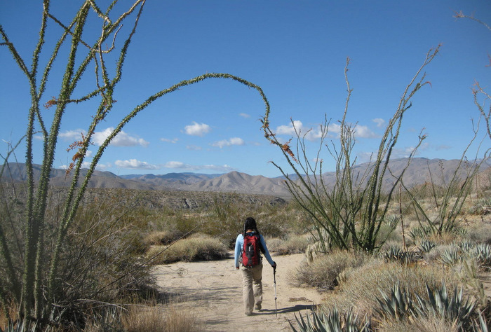
Giant Ocotillo on the way back to the truck

Sunset Mountain from the desert floor
Borrego, W. Butte
After leaving Sunset Mountain, we quickly found the turnoff for “The Slot” near mile 87.2 off of Highway 78. The truck’s high clearance came in handy in just one rough spot near the parking area, other than that the two mile long dirt road was well groomed. We found a faint use trail heading east from where we parked, and we followed it over a few small wrinkles in the earth towards the West Butte of Borrego Mountain. Once near the summit plateau, we scramble up through a short section of jumbled rock, and began looking for the summit register at 12:58pm, just 21 minutes after leaving the truck.
Near the summit of the West Butte of Borrego
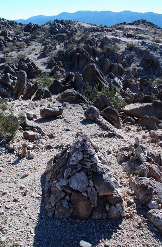
One of the many cairns on West Borrego
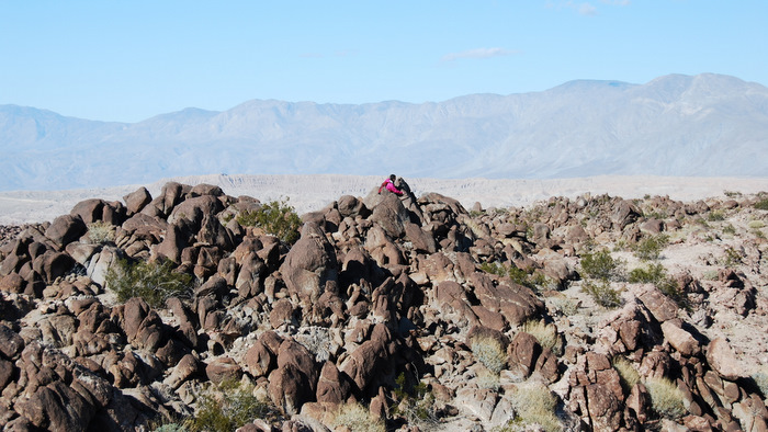
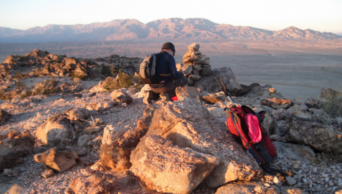
Searching for the summit register on West Borrego
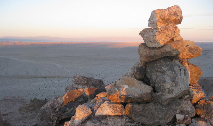
Anna and I checked several possible high points on the wide summit of West Borrego, finding several interesting cairns but no summit register. The views were expansive, but I was particularly drawn to the sight of the East Butte of Borrego Mountain, blending into the bare desert floor and the sand stretching on for countless miles behind the peak.
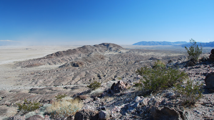
East Borrego from the summit of West Borrego
Dropping down to the Borrego Mountain jeep trail
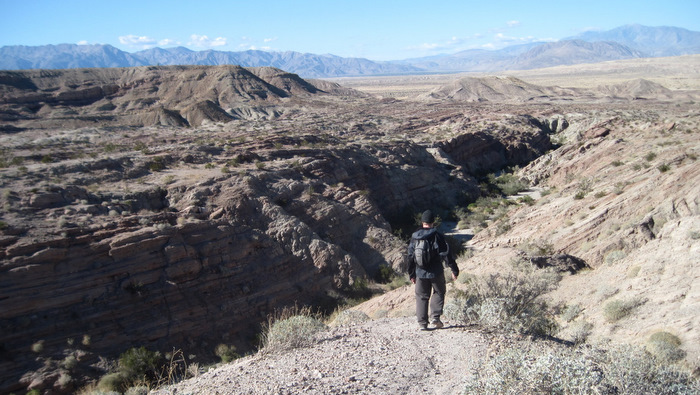
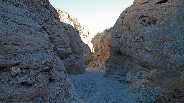
After dropping 150 feet or so back down the west side of West Borrego, we turned right at an obvious trail junction, heading northwest towards the Borrego Mountain jeep trail. A worn footpath led most of the way, and once down into the wash we turned south to explore the slot canyons on the way back to the truck. The slot canyons are worth a visit on their own, though care should be taken to avoid getting lost. In fact, Anna and I scrambled our way out of one dead end and we were lucky we didn’t have to spend more time backtracking, especially since we had one more hike to squeeze in before dark…
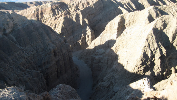
One of many narrow canyons on the west side of West Borrego
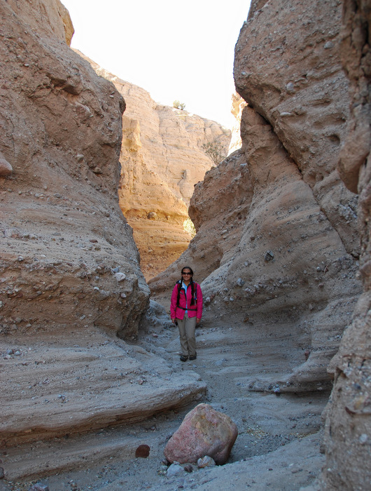
Fun hiking near “The Slot”
Part of the Borrego Mountain jeep trail, still open to vehicles
Borrego, E. Butte
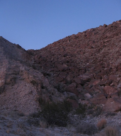
I wasn’t quite sure how we were going to approach the East Butte of Borrego Mountain, but pulling into the parking lot for the Ocotillo Wells ranger station/discovery center (not on the map) got us to within 1.25 miles of its summit, within easy striking distance. We spent 10 minutes walking towards a prominent gully running up the south side of the mountain, and though it looked atrocious from further back, it wasn’t so bad once we were staring up at it.
The east butte of Borrego from behind the Ocotillo Well ranger station, the gully we ascended on the right
The gully turned out to be a lot of fun, mostly class 2 (though we sought out some easy class 3) bringing us up 500 vertical feet in a quarter mile. From the top of the gully, we scrambled up onto the summit plateau and hiked a quarter mile over the moon-like landscape to the actual highpoint. We found the seldom visited register at 4:20pm, just as the sun was starting to set. We took in the views of the endless desert and the Salton Sea but took them in quickly, hoping to get down to the desert floor before dark. We put our headlamps on so that we wouldn’t have to stop on the way out, and had we been five minutes slower we would have had to actually use them. The round-trip had taken us an hour and fifty minutes, and either of the Borrego Mountains would have made an excellent list finish, both being mild yet highly enjoyable peaks.

The summit plateau of the East Butte
Looking east from the East Butte of Borrego Mountain, the Salton Sea in the distance
Signing the register on the East Butte
Our route on the East Butte of Borrego Mountain
Once back at the truck, we took our time packing up, hesitant to get mixed up with the countless trailers towing their off-highway vehicles home after the long Thanksgiving weekend. We stopped for what must have been our fourth or fifth time this season for Mexican food in Ramona, after another successful weekend in what was becoming one of my favorite places, Anza Borrego.
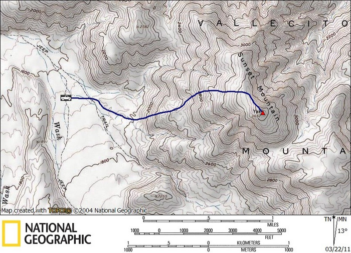
Sunset stats: 3.8 miles roundtrip, 2000 feet gain/loss
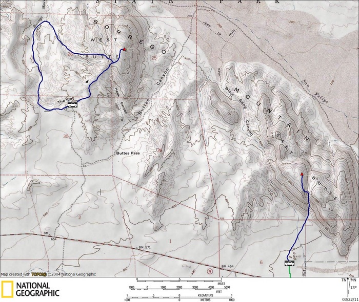
Borrego, W Butte stats: 3.6 miles roundtrip, 700 feet gain/loss
Borrego, E Butte stats: 2.3 miles roundtrip, 800 feet gain/loss
*-the driving directions for Sunset get you to the turnoff for the Pinyon wash. Continue south on the wash for ~2.6 miles to the base of Sunset, keeping left at a fork 1.6 miles from the 78. Be careful not to get stuck in the sand, which gets softer after the fork.