
Stonewall (SDC #55, 5730′) • map • directions
Cuyamaca (SDC #56, 6512′) • w/Stonewall
Middle Peak (SDC #54, 5883′) • directions
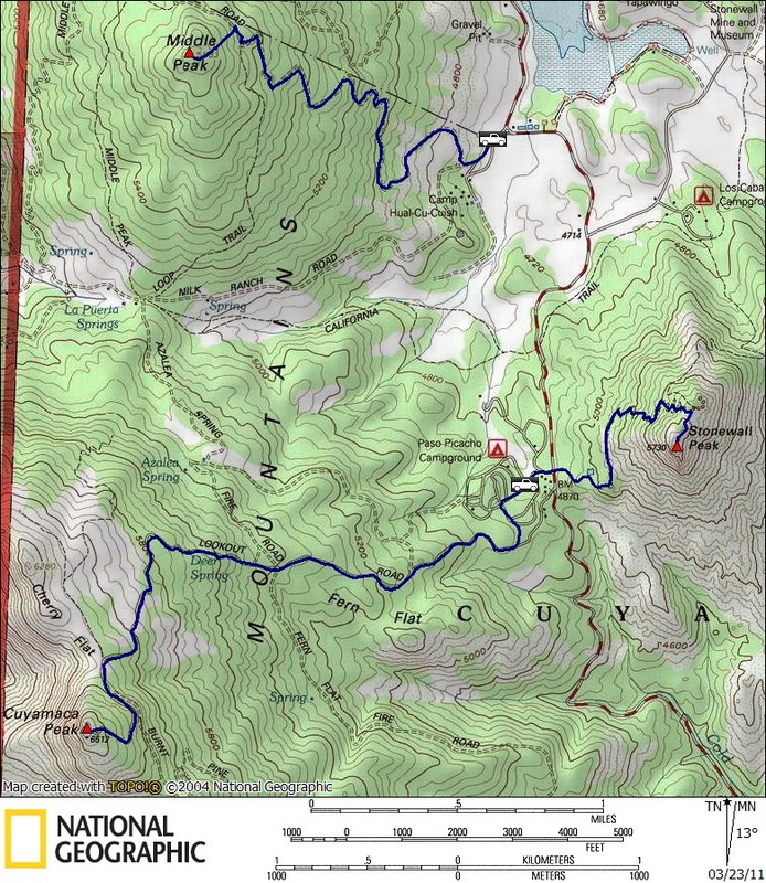
The sky threatened heavy rain while we drove towards what I call the Stonewall trio, a cluster of three peaks just south of Julian. The trio includes Stonewall, Middle Peak, and San Diego’s second highest peak, Cuyamaca. Though Cuyamaca is topographically dominant, Stonewall was my preferred peak of the three, and its presence is much more obvious from the twisted Highway 79, hence my use of Stonewall to classify the bunch. The weather was certainly less than ideal, though if we must hike in the rain, this cluster of 3 peaks was a good choice due to the fact that we’d be able to follow a trail for all but the last eighth mile on Middle Peak, and I had hiked all three peaks before so I knew there wouldn’t be any surprises.
Stonewall
The plan was to hike the more challenging of the three first, Cuyamaca, but upon our arrival Stonewall was poking through the only visible pocket of blue sky, so we started off with a sure thing. Originally Anna and I had entertained the idea of looping all three peaks together, but with the weather forecast we wanted the option of an easier bail out, should “it” hit the fan. From the parking area (fee required) of the Paso Picacho campground, we crossed the 79 and started up the switchbacks on the north side of Stonewall Peak, and were soon rewarded with a stunning view.
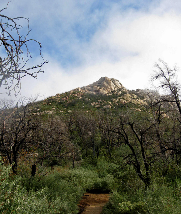
Stonewall Peak
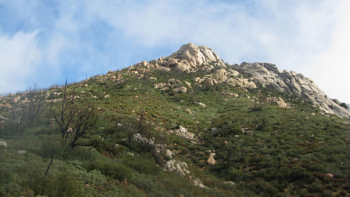
Another shot of Stonewall
Stonewall is of course named for the mass of granite that makes up the summit, which actually has a number of rock climbing routes on it. My first two trips to Stonewall were primarily for the rock climbing, and I did my first lead (trad) on Stonewall’s north face. The rock is of high quality and its tough to beat the views!
The view north from the Stonewall Peak trail
The trail on Stonewall
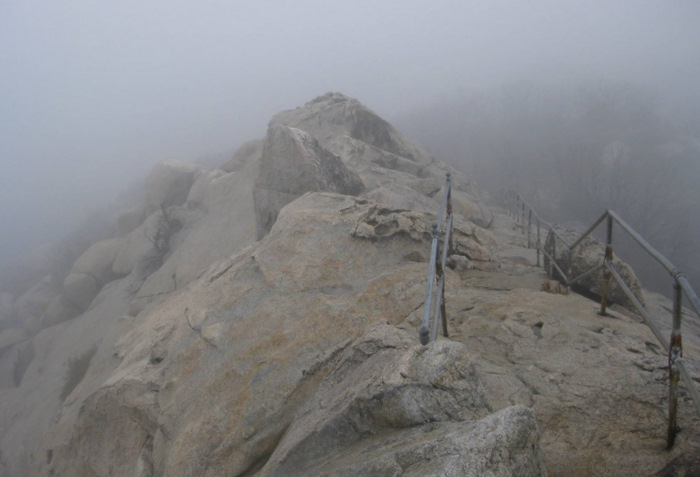
Looking down from the summit of Stonewall
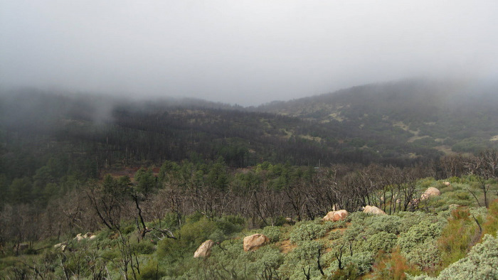
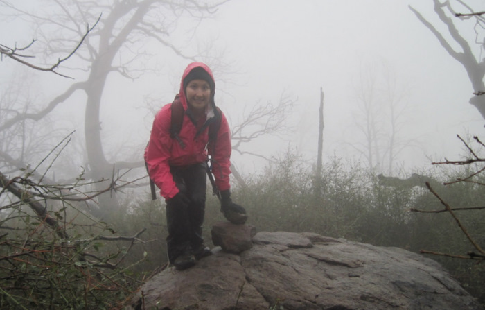
It took but 50 minutes to reach the rocky summit, shrouded in clouds by the time of our arrival at 10:45am. The rock and the steel hand rails were dripping wet from the surrounding mist, and a lonesome feeling hung in the air as the summit seemed to be rising straight from the clouds, a sight usually reserved for much higher peaks. We didn’t stay long, and we surprisingly passed two other parties on their way up the mountain as we cruised down the muddy trail, hiding from the now light rain in our thin shell jackets. Despite the lack of views we had had, Anna thoroughly enjoyed the peak and mentioned her intentions of bringing her non-hiking friends to Stonewall Peak in the future.
Cuyamaca
With a quick stop at the car, we had the luxury of changing our shirts before heading in the other direction towards Cuyamaca. We walked through the campground and found the paved service road, to which we would follow all the way to the summit. When I think of Cuyamaca, it reminds me of a blind man I had met on his way up the mountain, solo. I had chatted with him for a few minutes, learning that he hiked Cuyamaca every weekend, weather permitting. He received rides to and from the peak from his nearby home in Julian, but seemed to have little trouble navigating the path to the summit, using his cane to stay on the pavement. Truly an inspiration, and one I’ve thought about and mentioned to others several times.
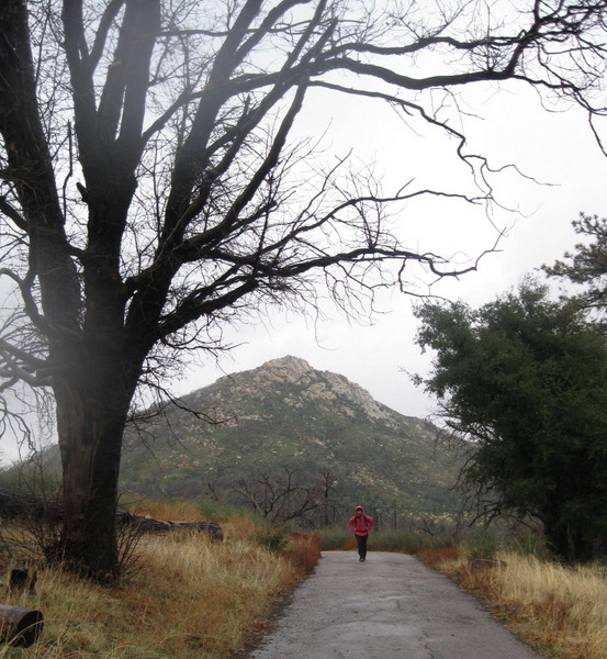
Starting up Cuyamaca, Stonewall behind
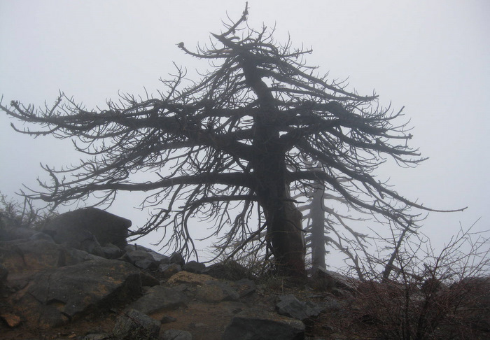
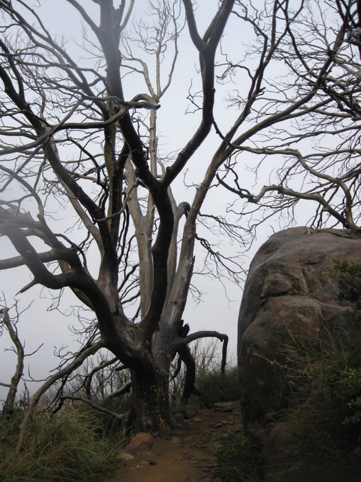
Trees on Cuyamaca
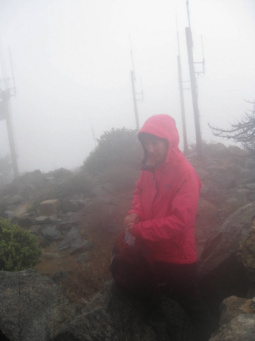
At San Diego County’s second highest point
Hiking up Cuyamaca was relatively uninteresting to me, at least by this route, and I was happy to get it done quickly. By the time Anna and I neared the summit on the 2.7 mile long service road, visibility was low and the elements had a clear advantage over the final few hundred feet, no longer protected by the surrounding mountains. Though we couldn’t see down the massive west face of Cuyamaca, its dominance could be felt by the powerful wind rising up and over the summit, again coating everything around with a layer of clean moisture.

The view northeast while descending Cuyamaca
Heading back down at 12:15pm, it was an easy walk back down the service road, the rich smell of wet forest filling the air. Upon reaching the car, we changed into a fresh set of warm clothes and even had the luxury of changing our saturated shoes, opting for boots to help with the wet bushwhacking we’d be doing on Middle Peak. We were just able to start warming ourselves with the car’s heater before the five minute drive to Middle Peak was over.
Middle
I had previously looped Middle Peak with Cuyamaca, but on this trip we opted to keep the hike as short as possible, parking on a dirt road (Milk Ranch Rd) just off of the 79 on the southeast side of the mountain. Almost immediately after leaving the car, we were greeted by large herd of deer, numbering somewhere in the 20s. They didn’t enjoy our presence as much as we enjoyed theirs, so our interaction was unfortunately brief. We hung a right onto the Middle Peak Fire Road, and soon discovered the tracks of an animal I preferred not to meet. There were two very distinct and seemingly fresh sets of tracks, one much smaller than the other, both from large cats. Though Anna didn’t share my enthusiasm, I was fascinated by the mountain lion tracks, wondering if the cats had been stalking the deer we had just seen. We continued to follow the muddy fire road, and to Anna’s dismay, the mountain lion tracks for a solid mile before we left the road and disappeared into the brush just past the junction with the Middle Peak Loop Trail (aka Black Oak Trail).

A fraction of the deer we saw en route to Middle Peak
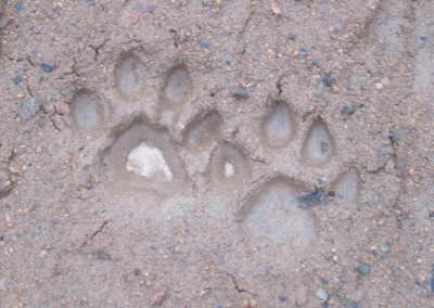
Recent visitors; no claw marks = lion
Middle Peak has a notoriously difficult bushwhack to get to its actual highpoint, and though normally I don’t mind a good ‘shwhack, Anna and I discovered that pushing through wet brush is a good way to get soaked to the bone. Within the first two hundred feet of leaving the trail, our clothes were soaked so thoroughly that water seeped down our legs and filled our boots, adding un-needed weight to our stride and sloshing with every step.
The summit of Middle Peak
It took a good 20 minutes to negotiate the eighth mile through the brush to the high point of middle peak, which we stumbled across at 2:57pm with a bit of luck. The summit was marked by a small stack of rocks on top of a rounded boulder, and nothing more. Even in good weather Middle Peak is lacking in views, the forest and vegetation just too dense to see through, and I’m still not sure of Middle Peak’s significance on the San Diego peaks list. Perhaps its giant trees covring its slopes or the fact that Middle Peak is visible (along with Cuyamaca) from much of San Diego, including my neighborhood 30 miles away. I have to admit that it is a nice feeling to see the mountain from so far away and know that I’ve been there.
Cold yet triumphant, we pushed our way back through the brush and onto the dirt road, with thoughts of a hot meal on our mind. Anna and I both started feeling the effects of being in wet clothes and shoes, and we were glad to be able to descend the muddy road and back to the car in just forty minutes, arriving at 3:57pm, just 6 hours and 2 minuts after starting up Stonewall. After defrosting our hands in the car’s heater and getting into a fresh set of clothes for the second time, we made our way to the nearest café and started off with a hot bowl of soup…
Stonewall rstats: 4.0 miles roundtrip, 900 feet gain/loss
Cuyamaca stats: 5.5 miles roundtrip, 1600 feet gain/loss
Middle Peak stats: 4.5 miles roundtrip, 1200 feet gain/loss