
Lawson (SDC #98, 3664′) • map • directions
Gaskill (SDC #97, 3836′) • w/ Lawson
Los Pinos (SDC #80, 4809′) • map • directions
Corte Madera (SDC #76, 4657′) • map • directions*
Morena Butte (SDC #85, 3919′) • map • directions
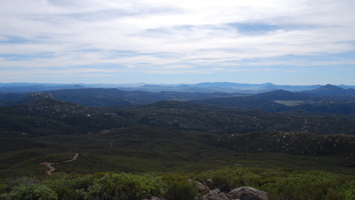
Having neglected the southern part of the Cleveland National Forest I was really looking forward to getting some time down here. I had the feeling that this part of San Diego had much to offer with the inclusion of things like Hauser Canyon, Morena Butte, and Corte Madera, all within an hour’s drive from the city. Anna and I had five peaks on the San Diego peaks list around this area and we hoped to get them all in a day, if possible, before heading out to the desert for the night.
Lawson and Gaskill
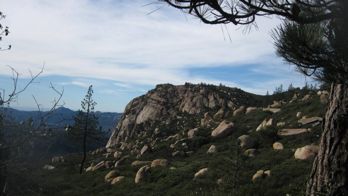
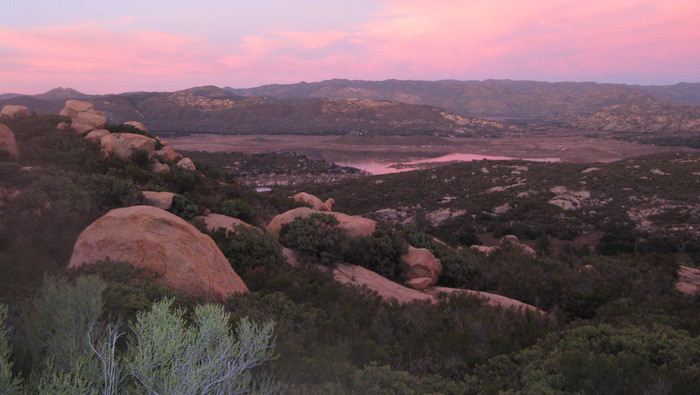
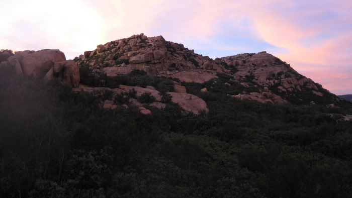
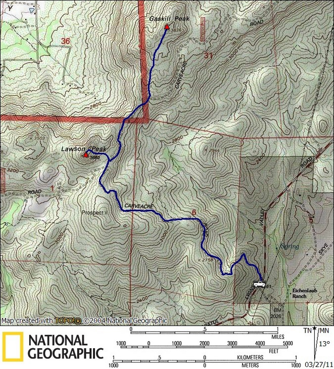
Starting with the westernmost peaks first, we made the scenic drive on Lyons Valley Rd and parked where mile marker 13.0 would have been (seems to be missing), setting our sights on Lawson and Gaskill. With perfect temps and clear skies we left the truck at 7:15 am and hiked up the badly rutted Caveacre jeep trail for two miles, admiring the changing views of both Lawson and Gaskill along the way. When we reached a junction with another dirt road (Wisecarver) 300 vertical feet from the top of Lawson, we found and followed an obvious use trail that ran up and around to the north side of Lawson’s rocky summit. We worked our way to west side of the summit block and came across what looked like one possible route up, a 20 foot rock climb with a rope hanging hanging down for assistance. We decided to continue on and find the chimney that’s described in Schad’s book, which we did just a minute farther.
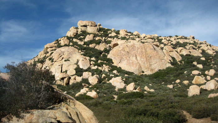
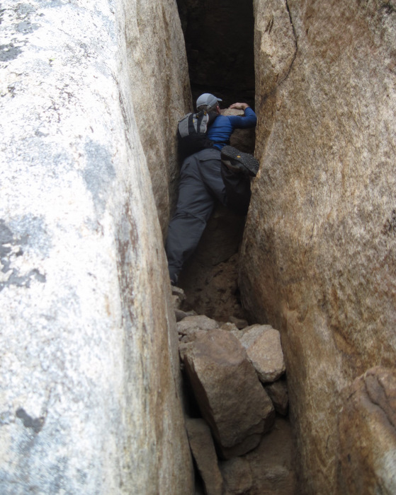
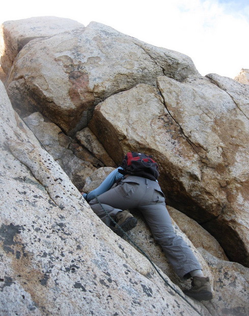
The chimney was more challenging than I thought, with a couple of big awkward moves to get up, fully committed to pieces of rock wedged in with soft dirt. I was questioning how I would get back down when I looked back at Anna who wasn’t having any of this chimney business. I climbed back down and went to check out the roped route. I yanked on the rope, hard, seemingly an adequate test before trusting our lives to it. I pulled on the rope to get up a few feet and within reach of some good handholds, then climbed 10 or 15 feet of rock up onto the summit plateau. I checked the anchor before watching Anna shimmy up the short climb without much trouble.
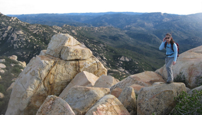
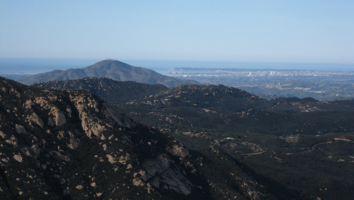
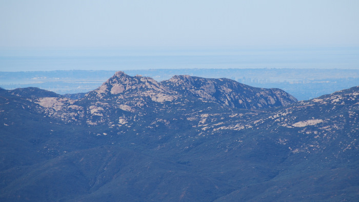
We arrived at the actual summit boulder at 8:13am and were amazed with the clear views. We could see Gaskill to the north, San Miguel and all the way to the ocean to the west, and the striking Lyons Peak to the south. I was blown away by Lyons, which I’d heard about but never seen before. Lyons unfortunately has had legal access issues for years but it’s now at the top my list for SD summits to hike (I did in fact reach the summit later). The benchmark on Lawson Peak was beat up pretty badly, looking like someone hit it with a hammer a hundred times in an attempt to steal it. Too bad.
When Anna and I were ready to head down, I gave her a quick lesson on using an arm wrap to descend using the rope. I went first and watched her come down, which she did comfortably. We pounded back down the use trail to Caveacre, and hung a left towards Gaskill.
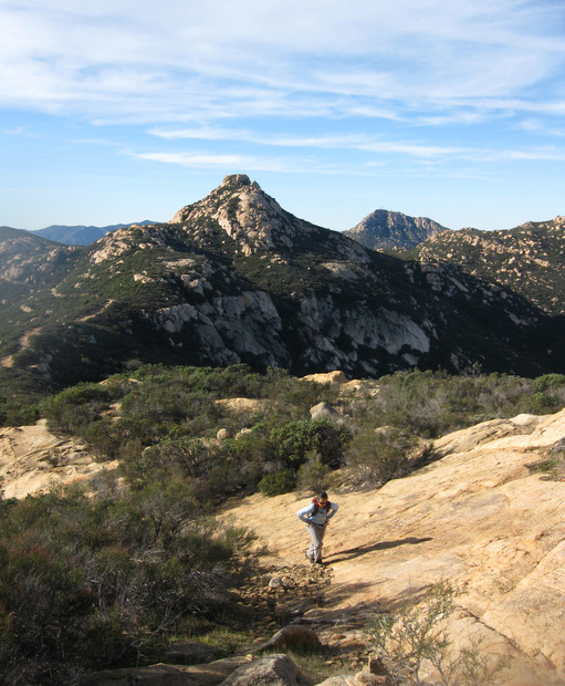
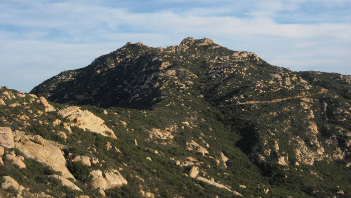
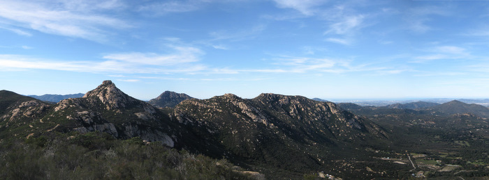
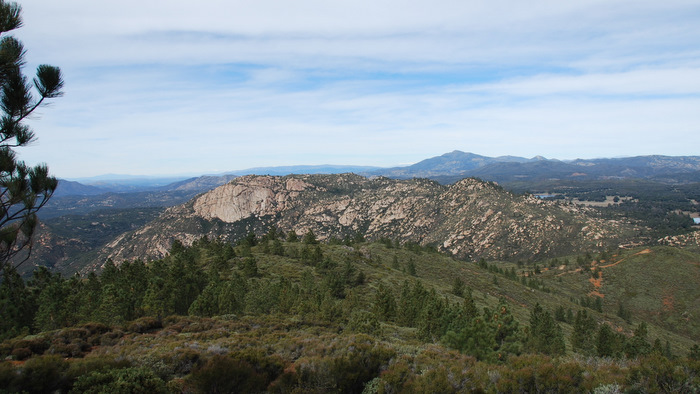
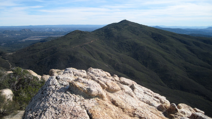
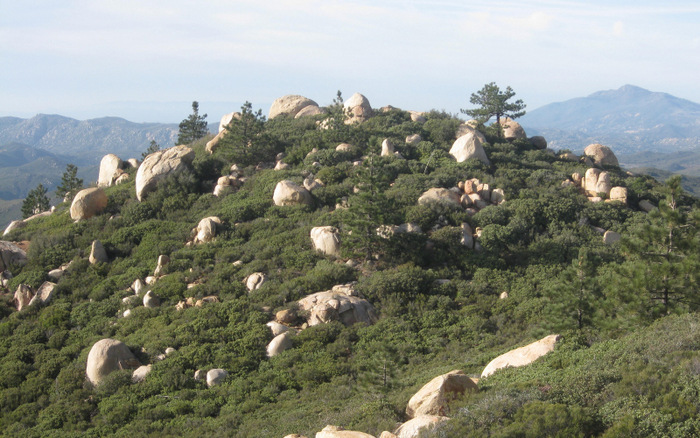
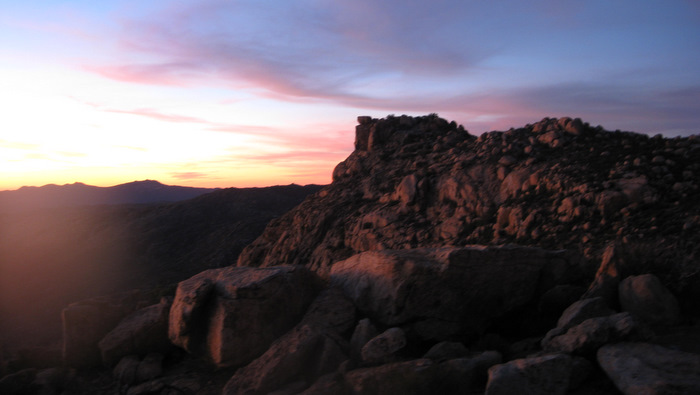
A half mile up the road from the junction with the use trail for Lawson was another use trail, this time heading up the south ridge of Gaskill. We followed it north along the ridge, admiring the increasingly awesome views of Lawson until the trail reached its high point on the summit plateau. Though Gaskill’s summit seemed to be to our left, a few ducks marked the way to a viewpoint to the right (east). The views east were awesome, especially of Corte Madera and Los Pinos, our next objectives for the day. Our attention however was back to what we now knew was Gaskill’s summit. The rock looked intriguing, and Anna stayed back and took a few pictures while I climbed a class 3 route on its east side.
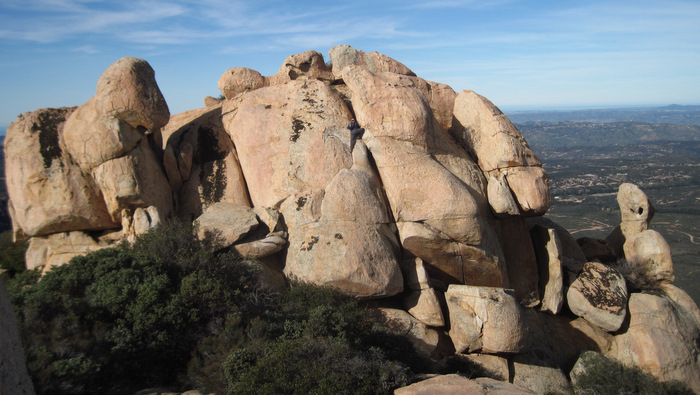
Upon reaching the top I looked around and to Anna’s relief found her a class 2 route through some boulders on the south side, she backtracked on the trail a bit to get there. She joined me on the summit at 9:22am, we rifled through the ammo can register filled with trash, someone’s used cd collection, and other junk. Again we could see all the way to the ocean but the distinct summits of Lawson and Lyons Peak to the south drew complete attention. After taking a few photos and cramming down a quick snack, we dropped back down Gaskill’s south ridge and started our descent down Caveacre Rd. At one point we shared the narrow one-lane road with a group of 10 or 12 jeeps crawling their way up. We arrived at the truck just after 10:30am and I started thinking that nailing all 5 peaks before nightfall might be possible.
Los Pinos and Corte Madera
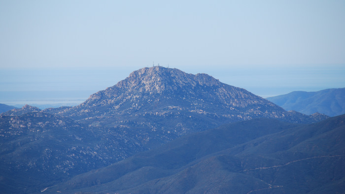
Next on the agenda were Los Pinos and Corte Madera, just seven miles across Pine Valley from Lawson and Gaskill. We drove to the east side of Los Pinos by way of Buckman Springs Rd and Corral Canyon Rd. Corral Canyon is dirt for the first few hundred feet and paved along the northern shore of Lake Morena and to the Four Corners junction. From Four Corners we drove up the south side of Los Pinos, via a one lane paved road with a handful of large turnouts. We parked at the locked gate a quarter mile from the summit and walked up to the lookout tower with just cameras in hand, arriving at 12:12pm.
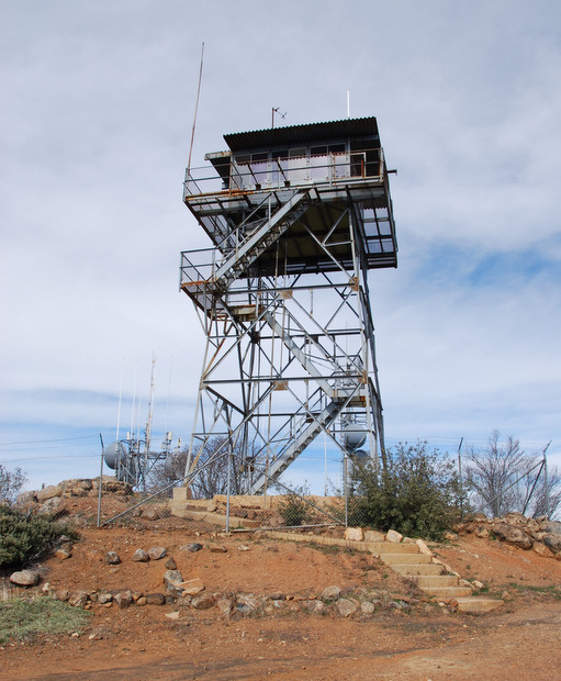
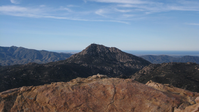
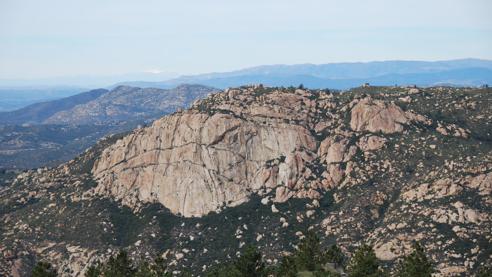
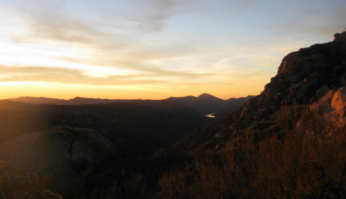
The lookout tower on Los Pinos is one of seven left in Southern California, and the only one that’s still active. The views are some of the best in San Diego with a 360 degree panoramic including Mexico and the Pacific Ocean. With how clear it was today, we were even able to see snow in the San Jacinto Mountains 65 miles away. Corte Madera also drew my eye – I’d read about the massive rock wall but it still took me by surprise.
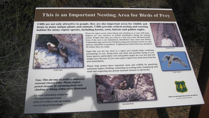
To reach the shortest hiking route on Corte Madera, we drove north from the locked gate near the top of Los Pinos and onto the dirt road heading for the saddle between Los Pinos and Corte Madera. The road was easy to follow and in better shape than I had expected, high clearance made it easy. After a slow couple of miles we drove through an obvious saddle between the two mountains, around a couple of sharp bends, and parked at a large turnout on the left. There was a sign notifying hikers of the birds of prey in the area, Anna followed me up the trail behind it.
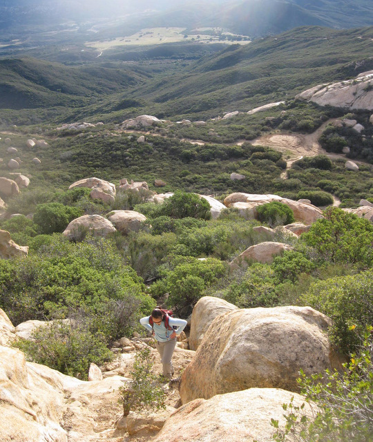
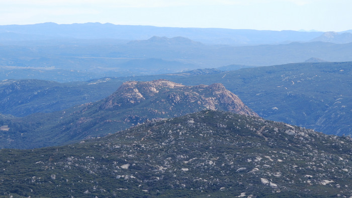
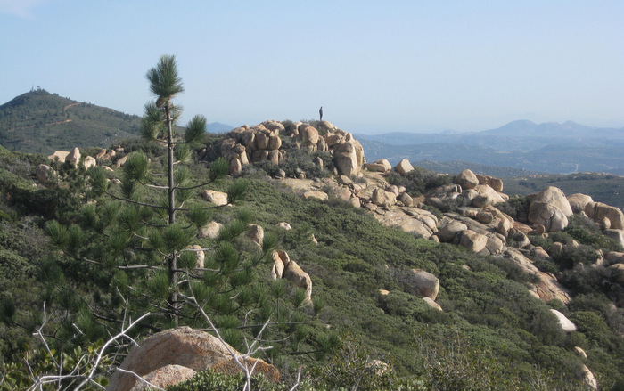
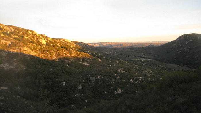
The trail gains elevation steadily up the broad east ridge of Corte Madera, and we crossed paths with several people on their way down, likely parked at the trailhead farther east on Corral Canyon Rd. Once we reached the long summit plateau we followed the trail south over relatively flat ground to what we though was the summit and an overlook perched over the south face, arriving at 1:37pm. The views were again impressive. There was a couple on the summit along with a solo hiker who splits his time between San Diego and Montana, and we all spent a good few minutes chatting before heading back down. The guy that’s half from Montana mentioned how cool of a hike Lawson is, hehe.
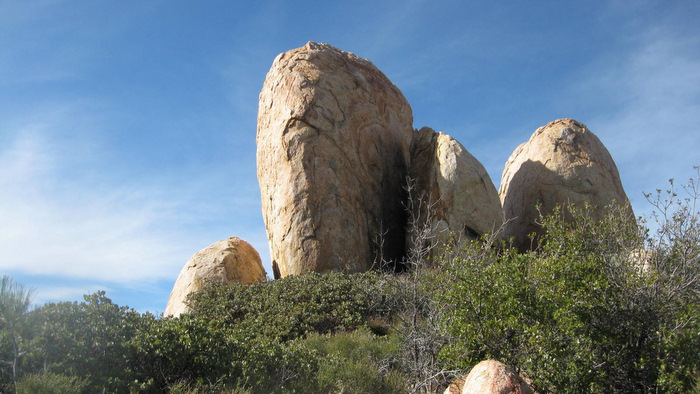
While heading back down the trail from the overlook, I stopped to check out the tall orange boulder that seemed to be the high point. It looked like a fun highball boulder problem and I was sure I could climb it via the chimney between it and a smaller boulder on its north side, but there was no way I was gonna climb down it without a rope. I then spent a few minutes looking west, fascinated by what looked like a higher point guarded by thick brush 500 feet away. In the interest of time I decided against going over to have a better look only to realize several months later that I had been staring at the actual high point. We’d missed it by 20 vertical feet. Upon our return to the truck, we drove up and over Los Pinos again and started the circuitous driving route towards our last peak of the day, Morena Butte.
UPDATE
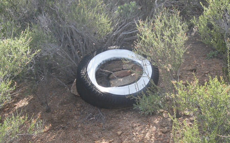
I returned to Corte Madera with my friend Christian on March 28th, 2012 in order to tag the actual summit and SDC listed point. A short bushwhack from the main trail got me there though I was unable to find a summit register. I did find a white-walled tire nearby though, the origin of which is baffling. Another great day in a great area.
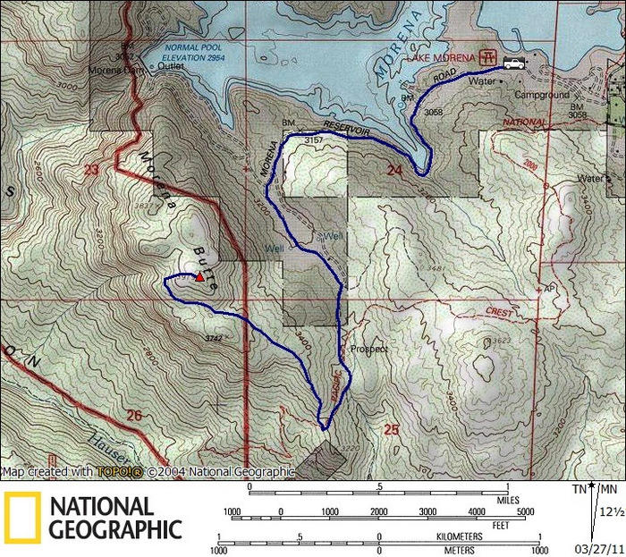
Morena Butte
We pulled into the parking lot at the Morena Ranger station within Lake Morena Country Park, Anna and I both content after indulging on snacks and fluids during the 45 minute drive from the base of Corte Madera. We walked in to pay our parking fee and stated that we were going to hike Morena Butte, I wasn’t surprised when I got the “you’re starting a little late, aren’t you?” After explaining that this was our fifth peak of the day and we’d actually gotten an early start I was met with, “what are you trying to prove?!”, which made me feel warm and fuzzy. I assured the ranger that we were prepared to come down in the dark, to which he insisted that I wouldn’t even make the summit before dark. “Oh, we’ll make it to the summit before then,” I said. It was all friendly and he’d let the other rangers know that we’d be parked in the day-use lot after dark.
Anna and I started hiking along the shoreline of the reservoir before I realized that the road I was expecting to be there was a hundred feet above us. We bushwhacked our way up to the road and really started moving, eventually turning south and catching the Pacific Crest Trail (PCT). We took the PCT south and found the junction with the Morena Butte Trail at the very crest of where the PCT crosses Morena Butte’s southeast ridge.
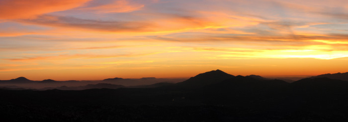
While starting up the rocky Morena Butte trail I could tell that we were in for a spectacular sunset. We continued briskly up the steep path until reaching a massive slab of rock and the summit plateau. The sunset had began to mature and we stopped to take some photos before scrambling up to the summit. We signed the log at 5:16pm just as the last remaining light disappeared, and unknowingly to me, what would be my last summit for a long time.
Just a few minutes after starting the descent I started experiencing sharp pain with any type of twisting motion in one of my knees. I’d been experiencing mild knee pain in the days after our last few outings but this was more severe and the first time it hurt while hiking. Once we were back on the PCT and the flat fireroad the pain subsided, but we decided to cancel our hiking plans for the next day. After a few days at home the pain increased so I went to the doc and got an MRI. I’d developed a slow healing overuse injury and I’d need to take at least several months off from peakbagging. The result of one of my busiest years in the mountains – 73 peaks in San Diego, several long weekends in the Sierra mountains, and a trip to (and relevant training for) Denali. So San Diego 100 peaks, to be continued ASAP…
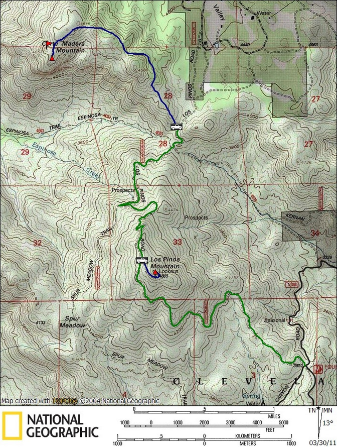
Corte Madera stats: 3.0 miles roundtrip, 800 feet gain/loss
Notes: green is the driving route, the red flag marks the actual summit of Corte Madera that we missed (reached on March 28, 2012).
*-The driving directions for Corte Madera should take you up and over Los Pinos. This parking area is not accessible from the north.