
Japacha (SDC #58, 5825′) • map • directions*
Anna and I pulled into the Green Valley campground just before 7pm on Friday night, looking to squeeze in a late hike since I needed to be home Saturday for another obligation.. I knew we couldn’t make the summit of Japacha before dark but I thought we’d get close. Japacha is really just a bump on the ridge to Cuyamaca and I thought it’d be a good choice for a night hike as there’s a trail 95% of the way. I’d been up Cuyamaca before and we’d be there again, so we’d catch the views another day. It would have been nice to link Japacha with Cuyamaca on this trip but it would have put us out too late.

We started up Airplane Ridge on the Monument Trail, named for a plane that crashed there in 1922 and a monument that was built to honor the men that died in the crash. The monument is made from the V12 engine block from the airplane, and I noted its approximate location on the map so that we could check it out. We were warned that it was easy to miss, and since we were short on daylight and we didn’t look very hard, we missed it anyway.
The trail was easy to follow and we made excellent time getting up Airplane Ridge, stopping only once to watch a small rattlesnake slither off the trail.
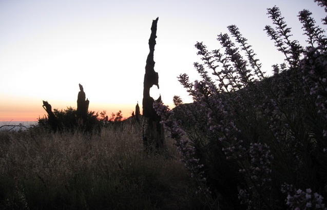
Near the top of Airplane Ridge the trail turns north, following the West Mesa fire road before breaking off to the left (west) and switchbacking up to a small saddle just north of Japacha’s summit. Soon after starting up the switchbacks, we lost our last remaining daylight and stopped to grab our headlamps. This part of the trail, an overgrown dirt road, carved through scattered trees and felt more like forest here than it did below. There was tall brush crowding parts of the road and I was recalcitrantly clearing spiderwebs strung between the bushes.

Soon we reached the saddle just north of Japacha’s summit where the off-trail portion of the hike begins. Only an eighth mile and less than 200 feet of gain, it wasn’t easy to find a great path to the summit in the dark. We backtracked a few times and climbed over a few rotten rock piles and through some bushes. This being Anna’s first off-trail hiking experience, she wasn’t too thrilled at her choice to wear shorts. She entertained the idea of waiting for me but I convinced her otherwise and a few minutes later we found the summit register.
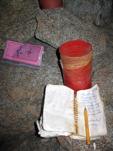
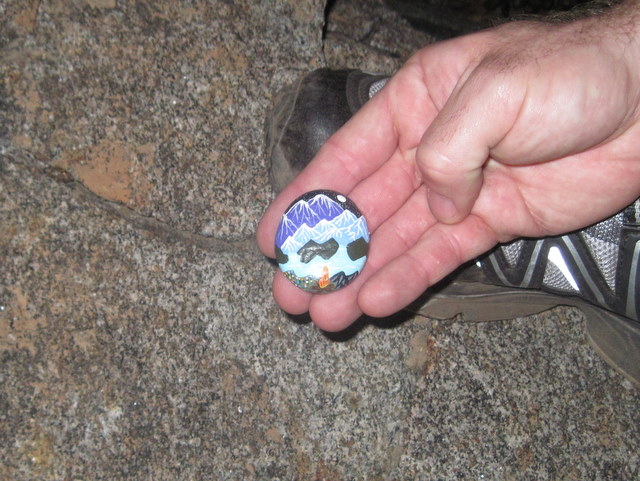
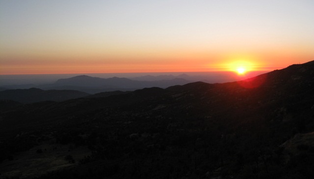
San Diego’s city lights were quite brilliant. We dug through the summit register and started back down after 9pm, later than I expected. We’d spent a lot of time thrashing around in that last eighth mile to the summit, but now all we could think of was the sandwiches that we’d left in the truck for a late dinner. We shot down the same route, and for the 2nd time this week I had an “encounter” with a strange person on the trail. I guess it wasn’t so much an encounter, but about 30 minutes short of reaching the truck I saw a guy dressed in light clothing about 100 feet upslope from the trail, sitting on some boulders surrounded by thick brush. I can’t imagine what he was doing there, after 10pm and no one else was around. I pretended not to notice and kept on moving, making sure Anna was close behind. Upon reaching the truck, we retuend to the campsite that we’d reserved on our way in, ate our sandwiches, had a beer, and went to bed. I wasn’t looking forward to getting up early for the hikes we’d planned for the next day…

*-continue into the Green Valley campground for the trailhead