
Bell Bluff (SDC #95, 3409′) • map • directions
I squeezed in a few late summer trips to the Sierra mountains and had neglected the San Diego peak list for a bit, but I’d been looking forward to Bell Bluff. It seemed to be relatively untraveled and was just interesting for some reason, maybe the name. We only had a half day to spend today so Bell Bluff fit in perfectly.
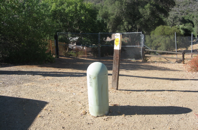
Saturday morning Anna and I pulled up to the trailhead on Via Dieguenos, easily missed had I not seen its location on the map. The trail here is really part of an old road called “Spanish Bit,” another cool name.
Immediately after taking the trail between two houses we came to a stream crossing. There was a decent amount of water and trees and vegetation back there, and someone had left a ladder to use as a bridge.
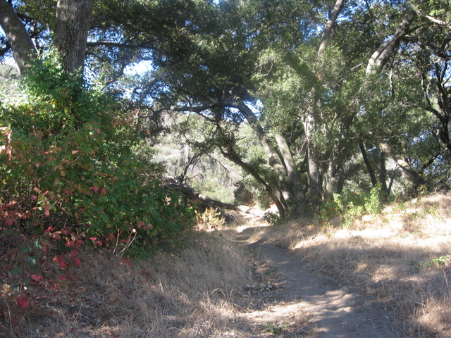
The trail quickly led away from the neighborhood, heading west before eventually making a 180 towards Bell Bluff. The going was easy and it wasn’t until about 40 minutes into the hike that we really got a great view of the impressive summit.
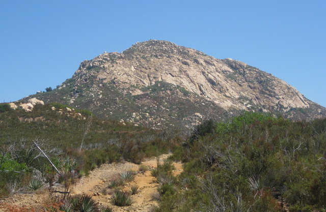
As we we got closer to the mountain, I kept my eyes open for an opening through the brush or an easy scramble up the rock. There seemed to be several possibilities though all appeared to involve some degree of a bushwhacking contest. Hoping for something better and seduced by the easy trail still gaining elevation, we continued east until the last minute.
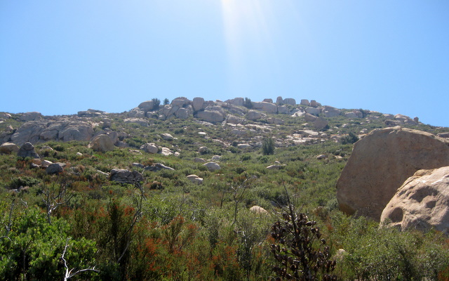
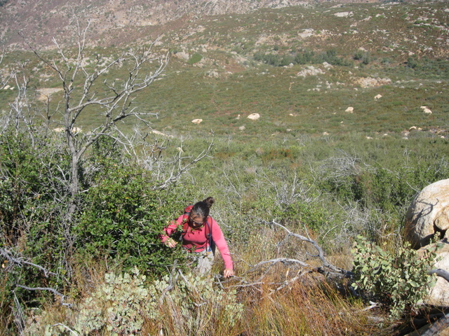
The manzanita was vicious, this part of the hike was anything but elegant. We climbed up and over a few welcomed boulders to get out of the scrappy stuff and didn’t catch much of a break elsewhere. Thirty minutes of thrashing brought us to the summit plateau where we found a few cairns and could see the high point about an eighth of a mile away. The bushwhacking calmed down a little until just before the summit, and some large rocks made that easy enough to avoid. We reached the summit in just under 2 hours after leaving the car, 45 minutes of which spent in the last half mile.
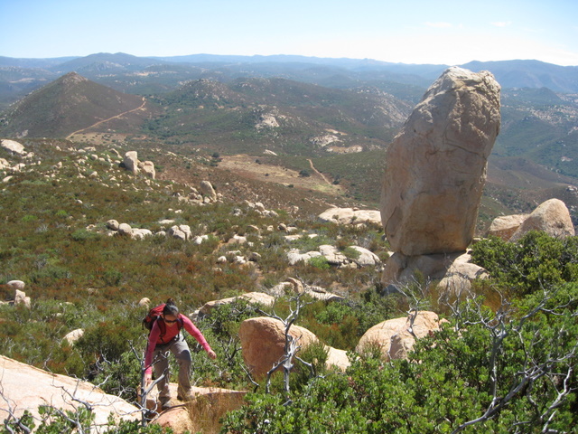
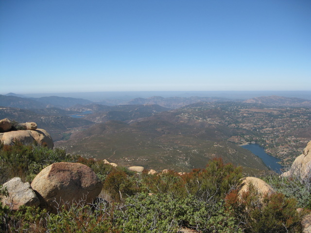
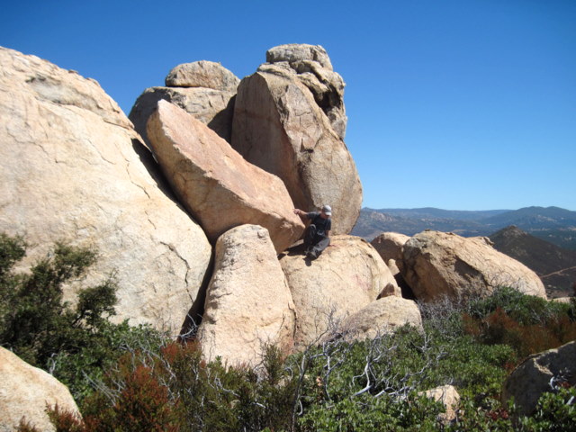
Bell Bluff sat a great deal higher than its immediate surroundings and though it was difficult to get around to appreciate each aspect, the views did not disappoint in any direction. The entire summit area seemed to be a mass of rock and manzanita, with one particular cluster of boulders higher than the rest. Once I started climbing up to what I thought was the summit block, I quickly realized that this was would be a tougher task than I’d hoped. After checking all sides for a way up, the easiest way I found was an offwidth chimney tucked into a corner on the west side of the highest boulder. I knew I could climb it easily enough but it was outside of my safe downclimbing abilities so I let it alone for another day.
Ready to head back, we started to retrace our steps but we were again seduced, this time by easy and plant-free low angle slabs to walk on. We went further east down the summit plateau than where we’d come up, and at first it seemed like we’d get much closer to the trail without nearly as much manzanita thrashing, but it wasn’t worth the trouble. It may have been worth finding a route down (or up for that matter) on the rockier west side of the summit. Once back on the trail we relaxed and enjoyed the remaining hike back to the car, never seeing a single person the entire day.

Note – a better route could probably be found near the yellow line