Israel (SDC #45, 1346′) • map • directions
For some reason, I had a hard time finding information on Mt. Israel. It was easy enough to figure out that it was in the Elfin Forest Nature preserve in Escondido but I found nothing about the location of the actual summit or the hike to get there. I did notice that the Elfin Forest Overlook within the preserve had the same elevation as Mt. Israel (1346′) and was in the appropriate location, so I decided that that must be it. You can find a pdf map provided by the Olivenhain Municipal Water District here and the Elfin Forest Overlook is labeled as #22.
Anna and I went to hike Mt. Israel after work and had no problems finding the well-marked and populated trailhead on Harmony Grove Road. It was 5:30pm and a large sign warned that the gates to the parking lot are locked at 7pm, so we parked just off of Harmony Grove outside of the parking area.
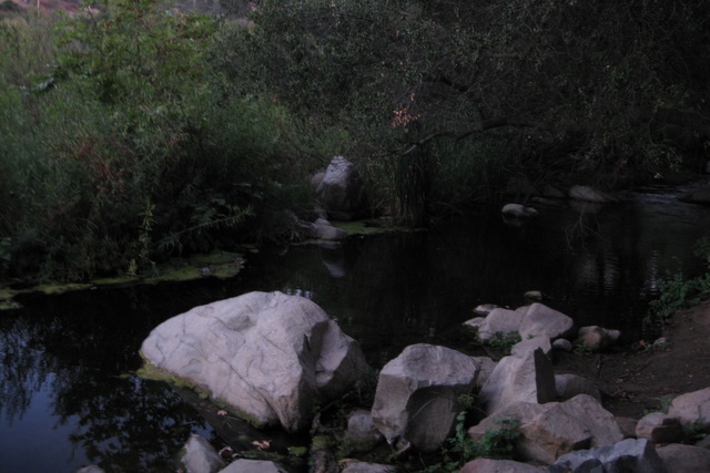
We threw on our shoes and packs, walked through the parking area, and crossed a small concrete bridge over Escondido Creek before starting up the wide dirt trail. Most of the 900 feet of gain are covered in the first mile of the hike, none of which was particularly steep, just consistently uphill. We weaved around mountain bikers and other hikers on their way down for about thirty minutes before the views dropped to the south and we could see the Olivenhain Reservoir.

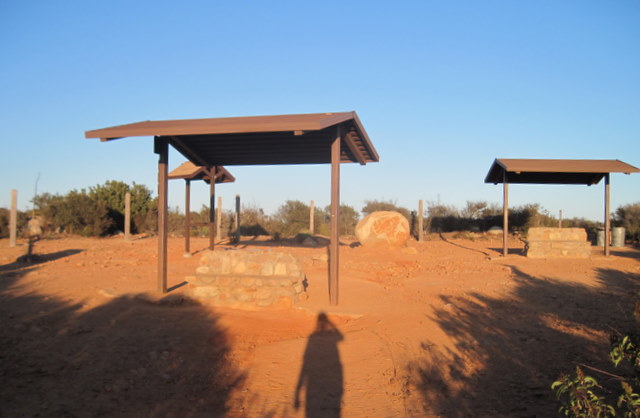
Another 3/4s of a mile brought us over a series of rolling hills to the actual highpoint, a big rounded hump marked by several benches and shade structures. I checked my GPS just in case and confirmed that the Elfin Forest Overlook is Mt. Israel. A bit disappointing for a summit hike but the views were nice and I did appreciate the San Diego peak list bringing me to an area that I’d otherwise never visit. The reservoir itself caught my interest, in that it was less than 10 years old and wasn’t on my map.

I briefly looked around for a summit register with no luck before Anna and I booked it back down to the truck. It was just after 7pm while we were descending the last few hundred feet and we could see the ranger in the parking lot, looking up at the trail with his arms crossed like an angry father. There’s a car in the parking lot so he can’t lock the gate, and he thinks its ours! I could feel his eyes burning and the second we reached the parking area and turned towards the exit and away from the lone car, he yelled out,
“Hey, this car isn’t yours?”
“No, sorry!” I said
“Always on my shift!” he said, “have you seen anyone else coming down?”
“Sorry man, haven’t seen anyone for a while, hope you get out of here soon.”
Throwing on a clean shirt back at the truck, I looked up and saw a couple about 400-600 vertical feet above the trailhead. I yelled back to the ranger and pointed them out. He thanked me but didn’t seem thrilled that he had another 20+ minutes of waiting to do. Anna and I peeled back towards home, hitting my driveway just before dark. I love these long summer days…