
Grapevine (SDC #32, 3955′) • map • directions
Sentenac (SDC #33, 3068′) • map • directions
Pinyon (SDC #37, 4492′) • map • directions*
Grapevine
Finally it was cool enough to head out to Anza Borrego. Cool enough but not necesarily cool. I’d been up a handful of peaks in Anza Borrego State Park over the past few years, but this was my first time out since starting on the San Diego peaks list, and I was looking forward to more, lots more. This particular weekend I brought the necessary maps and info for 5 peaks situated around Earthquake Valley, near the center of Anza Borrego State Park.
I like to start with the toughest peak first, so Anna and I first set our sights on Grapevine Mountain. We followed the directions in Schad’s book and had no problems finding a large circular turnout a mile off of highway 78, on an unnamed dirt road navigable by most passenger cars. We started off at 9:30am and within minutes we were swallowed up by the desert solitude.
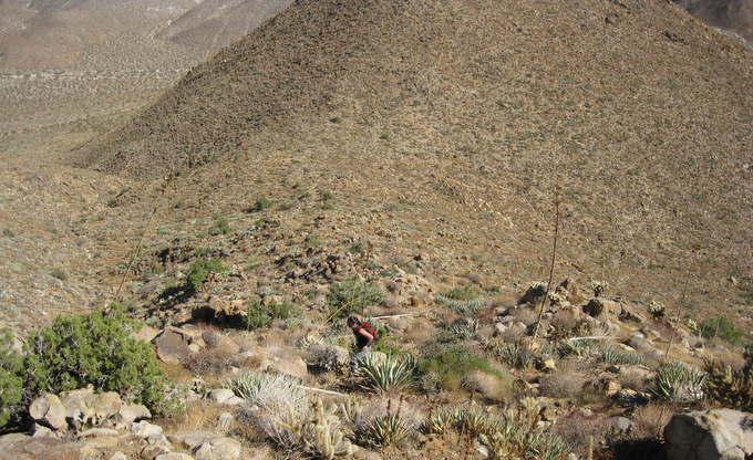
Anna in the first 30 minutes of the hike
As described in Schad’s book, we followed a prominent wash just east of Bitter Sweet Canyon, bypassing a large dryfall on its left side. We spent about 20 minutes hiking through the wash before starting up the slope just southwest of point 2620. Point 2620 is a very recognizable cone-shaped mini-peak near the start of the hike, and helped to confirm that we were on the right path. There was no trail or any evidence of anyone for that matter, giving me a great sense of being in the middle of nowhere. We were constantly weaving around desert shrubbery, rock outcroppings, and of course plenty of cactus, especially the dreaded teddy bear cholla. A straight line was pretty much impossible and I wouldn’t be surprised if we hiked an additional 25% on top of what the map shows.
The upper third of the hike up Grapevine Mountain
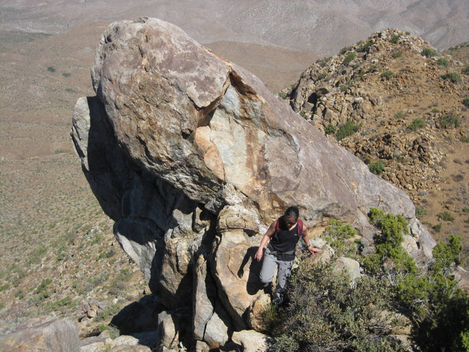
At about 3000 feet we bypassed a steeper bump on the ridge by traversing to our left, getting up onto the ridge itself at about 3400 feet. The ridge from there was awesome, with great views and some scrambly class 2 sections. It was quite enjoyable and made the entire hike worth it.
The fun part of the ridge
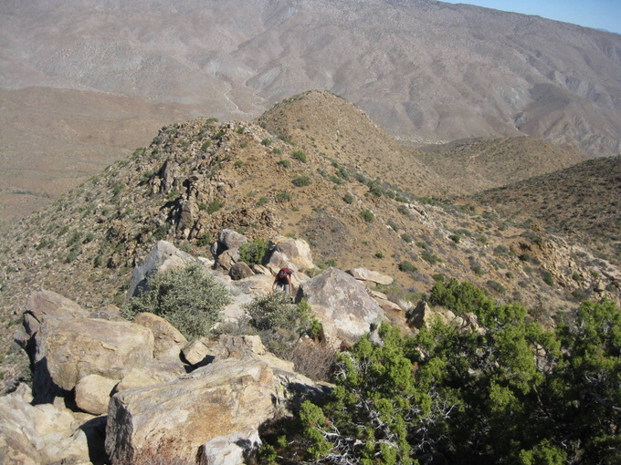
More fun on the ridge
We reached the summit at 11:30am and took a well deserved 15 minute rest, we hadn’t really stopped since we left the truck. It was definitely warm out but not unbearable, and it was perfect during the occasional breeze. I recognized a few names from summitpost.com in the summit register, which had seen just a handful of ascents per year.
I stared down into Bitter Creek Canyon to west, debating on whether we should descend that way to make a loop back to the truck. The canyon looked to be more challenging than our ascent route, but I was pretty sure I could keep from adding too much time. In the end though we decided to head back down our ascent route, we didn’t want to risk wasting any time on our first hike of the weekend.
Anna struggled descending and traversing the steeper part of the ridge on the loose desert sand. I’d been accustomed to it from my previous desert hikes but Grapevine did seem to be quite sandier than the other desert peaks I’d done, it was definitely more challenging going down than up. It’s often times less effort for me to go faster than to constantly try to slow myself so I hiked down Grapevine 5 or 10 minutes at a time, stopping to let Anna catch up and making sure she could see the exact route I was taking. Soon enough we were back at the truck, where a ranger had left a note on my windshield reminding me that I needed to use a metal container for campfires in the desert. They must have seen the bundle of wood in the bed of my truck. Anna and I immediately grabbed the small cooler from the shade underneath the truck and downed a liter of Gatorade each before pulling away to find the next peak.
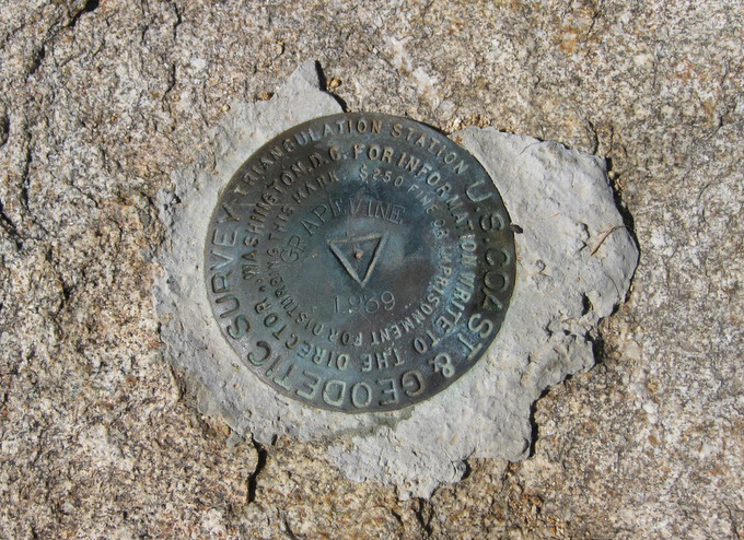
The survey marker on Grapevine’s summit
Sentenac
10 minutes after leaving the trailhead for Grapevine mountain, we pulled onto a turnout on the 78 right next to Sentenac, acutally right in between Sentenac and Grapevine. I wondered whether an ascent of Grapevine would have been faster from here, but that was all moot now, time to focus on the next hike. The only thing I knew about Sentenac is that it would be steep and cross-country, but it was also really short.

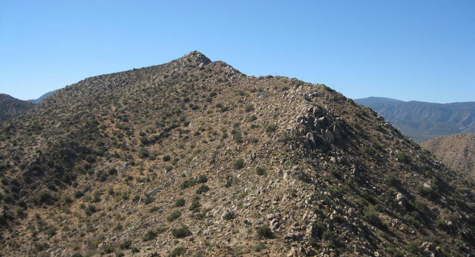
Sentenac from the S2 (shot taken 4-9-11)
Immediately after leaving the 78 on foot, we fought through what seemed to be a small marsh (the crux of the hike) and it may have been faster and easier to start this hike further down the 78. Once through it though we marched right up the south slope of the mountain, moderately steep and loose in a few spots but nothing too difficult. It took us 40 minutes to cover the 3/4s of a mile and I failed to take any photos until the summit, probably because the views and terrain were unimpressive in comparison to Grapevine. I was surprised to find a summit register, which had logged an ascent or two per year at best, way cool. We retraced our steps and arrived back at the truck in no time.
Sentenac summit with Grapevine in the background

Anna and I on Sentenac
Pinyon
We had the time and energy to hike one more peak before setting up camp, but we decided to take our time and let the heat subside a little. We found a shady spot on the side of the S2 and took a long lunch and put down some fluids, listening to some music and going over the maps for the rest of the weekend. We decided that we’d hike Pinyon (P4492) next, what appeared to be another easy peak, and we’d shoot for getting to the summit before sunset and have a nice night hike down.
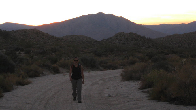
We started the drive down Pinyon Mountain Road, heading towards “the squeeze” and the Pinyon Dropoff, obstacles revered in the off-road community. We weren’t driving quite that far but we were hoping to drive right the base of Pinyon mountain. Hoping. At just over 3 miles from the highway we ran into an obstacle, a tall rock “step” that ran across the width of the road. It looked rough. Possible, but at about the limits of the clearance of my 2WD Tacoma. I feared the road would only get worse and that we’d waste more time trying to drive further, so I checked the map. It seemed that if we started on foot from here, it would add just over 2 miles in each direction with 700 feet of gain. Even on a bad road we could cover that ground easily on foot, so we decided to hoof it from there. We’d barely miss the sunset and have to make the hike to the summit in the dark, but I didn’t see it being too much of a challenge.
We grabbed our gear and started up the road, and it didn’t take long for me to realize that I should have driven it. There were a few rough spots but overall it was in good shape all the way to the base of the mountain. A 2WD vehicle with high clearance wouldn’t have too many difficulties, and I actually ended up driving the road at a later date.
Anna hiking Pinyon Mountain Road
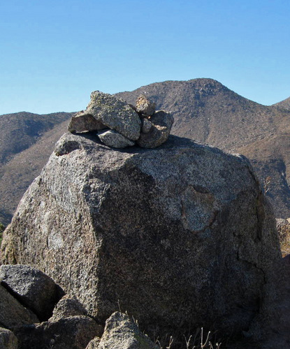
We started up a ridge on Pinyon Mountain’s southeast side after sunset, making the hike more challenging that it should have been. Right off the valley floor the slope was steep and loose, and I took a few waypoints with the gps on our way up just in case. The shape of the mountain would make it tough to get very far off route however. More localized routefinding was thre real challenge in the dark, as we could only see as far as our headlamps would allow, making it impossible to keep an efficient path through the cactus. We just kept heading up and up until the mountain flattened out, and just by chance we walked right to the summit boulder, which had the summit register buried in a pile of rocks on top. From the road the entire ascent took exactly 32 minutes.
The register had the familiar names of some local San Diego peak baggers, and it only had a few entries in it since they had placed it in January 2009. The desert night sky was quite amazing, but Anna and I didn’t stay long, hungry for our pasta dinner we had sitting in the truck. We found the way down without too much trouble, reaching the road at 7:30pm. Of course it would have been nice to be at the truck then, but overall walking the road had extended our day by less than 90 minutes, so it wasn’t the end of the world. It could always be worse of course, I could be at work.
Once we returned to the truck, we cooked and ate dinner and set up camp right there, getting into the sleeping bags in the bed of the truck just after 11. Plenty of time to get enough sleep for tomorrow’s adventure.
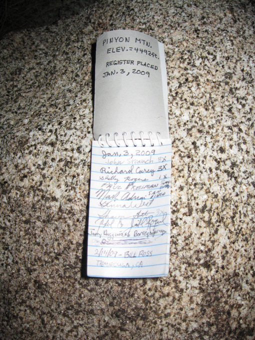
The register on Pinyon Mountain
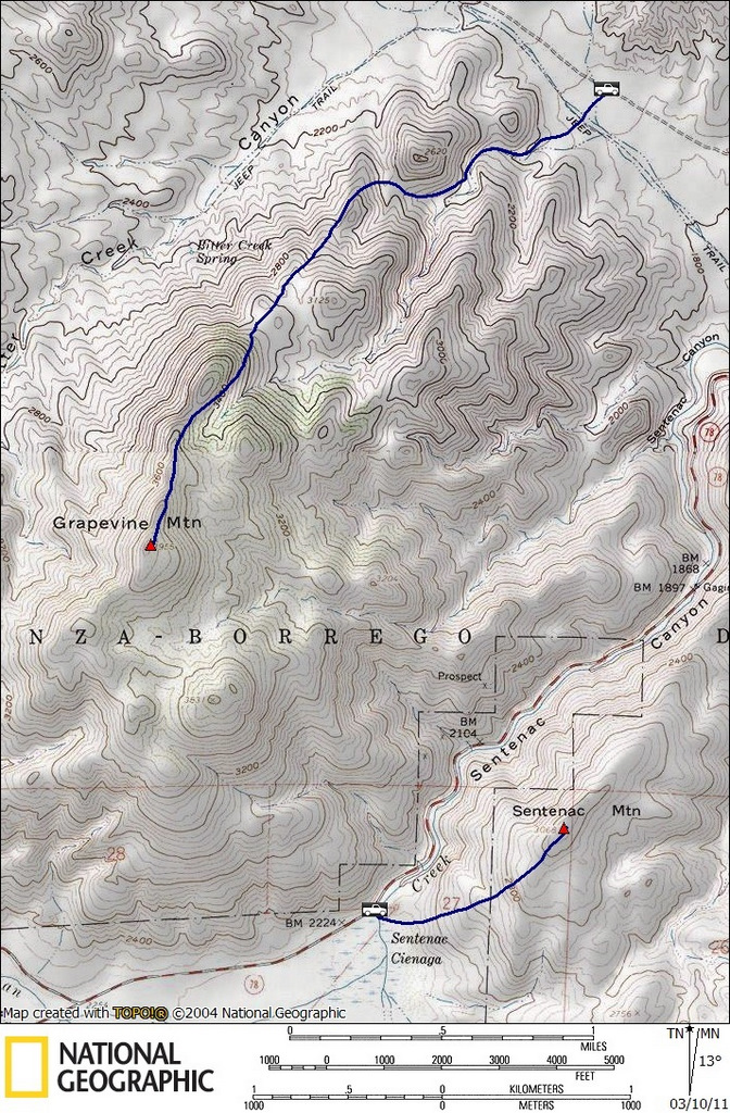
Grapevine stats: 5.3 miles roundtrip, 2100 feet gain/loss
Sentenac stats: 1.8 miles roundtrip, 900 feet gain/loss
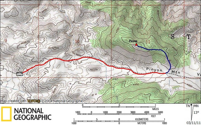
Pinyon stats: 6.0 miles roundtrip, 1200 feet gain/loss
Pinyon stats (blue route only): 1.5 miles roundtrip, 500 feet gain/loss
Note: high clearance vehicles may be able to drive the red part of the route
*-The driving directions for Pinyon get you to the turnoff for Pinyon Mountain Rd. Continue east on this road for the southern approach to Pinyon Mountain (high clearance required to make it all the way). See the satelite view in Google Maps for help in visualizing the route.