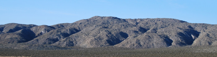
North Pinyon (SDC #35, 3660′) • map • directions
Ghost (SDC #51, 3420′) • map • directions
During the night I realized that I only had two peaks lined up for Anna and I today and both would be short, so we slept in until the sun was beating on our faces. A nice luxury after yesterday’s hikes and nighttime return. We crawled out of our sleeping bags and ate what would become our traditional peak-bagging breakfast, a bagel with cream cheese. After packing up we drove back towards the S2, narrowly being run in to by a few guys on dirtbikes, probably headed towards the Pinyon Dropoff.
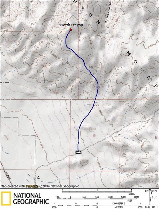
I wasn’t quite sure where to start for North Pinyon but the mileage and elevation gain would be reasonable from any nearby starting location. We ended up driving down an easy dirt road that forks north from Pinyon Mountain Road, just a few hundred feet from the S2. We continued east until I thought I saw a good route on North Pinyon then parked near some large rock outcroppings so that we could locate the truck more easily upon our return.
The Pinyon mountains are broad and round so it was hard to make out exactly where the North Pinyon summit was. The huge summit plateau was obvious so we just aimed in that direction. We hiked a mile or so across the desert floor before starting up gentle slopes on the mountains south side. I couldn’t see the entire route to be sure we wouldn’t have any unexpected drops in elevation but it looked good on the map and it ended up working out well.

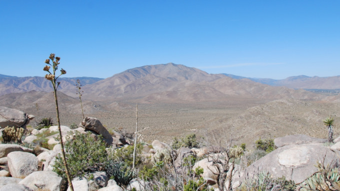
We had an expansive view to the west across Earthquake Valley for the majority of the hike, Granite Mountain being quite the eye-catcher. Only gaining 1100 feet in over 2 miles, the hike was mellow and we just kept heading north and up until we hit the high point, finding the summit without difficulty. Like most of the other peaks we’d hit in the area, the register had just an entry or two per year. We added our names, ate a snack, and started down, the hardest part of our easy day behind us.
On the way down I could see the rock outcroppings I had parked next to and looked to be a long ways away, but the scale of the desert is deceiving and we were back at the truck in under an hour. I didn’t realize how important my choice of parking really was until we got closer. With how tall the Ocotillo and other plants in the area were we couldn’t see the truck until we were less than 100 feet away. The road wasn’t visible at all until we were just about on it. We piled our stuff into the truck and drove towards our last peak of the weekend, Ghost Mountain.
Ghost
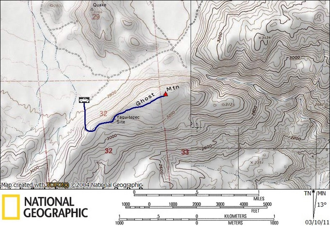
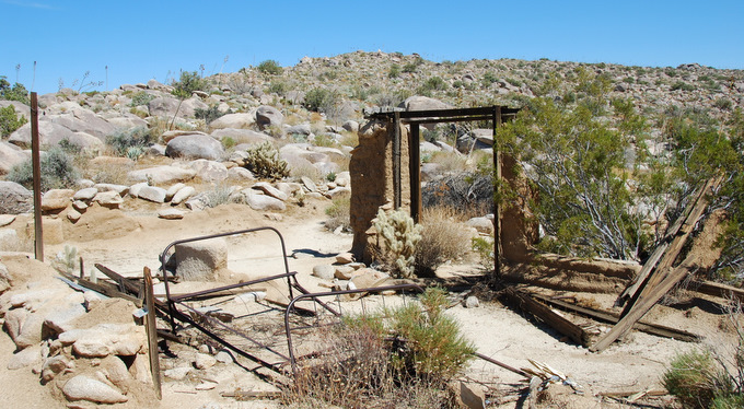
We pulled up to the signed trailhead for Ghost Mountain, our fifth and easiest peak of the weekend. Most people who had come to this trailhead were here for the Marshall South ruins site, located about halfway up Ghost Mountain. Marshall South had moved to and built a house on Ghost Mountain in 1930, living there as a writer for 17 years with his wife and two children. They braved through harsh winters and summers, carrying everything they needed up the mountain themselves. Hardcore.
I was looking forward to this hike because my Dad had been here several times, one of a few historical experts on the ruins and Marshall South. My Dad has met members of the South Family, done extensive research on their unique history, reprinted and distributed rare books and articles written by the family, and even written an article himself.

The entire hike to the summit was only 1 mile and 600 feet of gain, and a trail brought Anna and I to the ruins at the halfway point in under 20 minutes. We cruised right by though, saving their exploration for a break on our return hike. Once above the ruins the trail disappeared and for the fiftieth time this weekend we began dodging teddy bear cholla, ocotillo, and more. The cactus was dense on Ghost Mountain compared to the other peaks we’d done, making cross-country travel a little slower than we were used to. With just a half mile to go though it was largely irrelevant. What was not irrelevant however, was the piece of teddy bear cholla that sunk into my left leg. I had stepped on it with my right foot and it stuck to my boot, making a perfect transfer to my left calf. Ouch. I used two rocks to pry it off my skin, requiring a surprising amount of force to rip the barbs from my flesh. Double ouch. Anna made sure to get a picture.

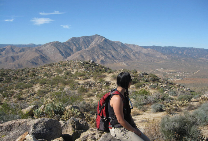
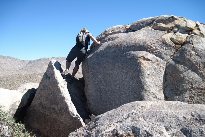
The summit was huge and broad and I wasn’t quite sure where the actual highpoint was. I checked a few places for a summit register but found nothing, finally concluding that a large round boulder was the highest point on the mountain. A few easy moves put me on top and I encouraged Anna to follow but she declined, not too pleased with the current daytime temperature.
We started down, stopping for a good 15 minutes at the site of the ruins. The idea of a westernized family living there was certainly very impressive. I tried to imagine what it would have been like and tried to convince Anna that I could and would live that life, though I knew otherwise.

Once back at the trailhead we celebrated a successful weekend with a single cold beer, relaxing by the truck for an hour before starting home. A ranger cruised by to see what we were up to, she’d seen us coming down Ghost Mountain and mentioned that the heat really wasn’t too bad, which we found to be amusing since she shouted that from her air conditioned truck. “It’s not too bad out here!” we joked, cranking the AC up on our pretend dashboard. Kidding aside we were happy she stopped by to say hello. She was, after all, the first person we’d said a word to all weekend.