
Pyramid (SDC #11, 3500′) • map • directions
Rosa (SDC #8, 5020′)
Mile-High (SDC #7, 5340′)
Villager (SDC #2, 5756′)
The Santa Rosa mountains mark the northeast corner of both Anza Borrego State Park and San Diego County. They are among the highest mountains in Anza Borrego and offer a great vantage point over the stark contrast of the Salton Sea. My first trip to Azna Borrego was to the Santa Rosas in 2007, a solo dayhike to Villager and Rabbit Peaks. I enjoyed it so much that I repeated it the following year. I was looking forward to coming back here.
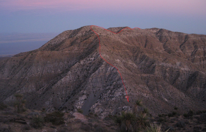
The San Diego peaks list includes five summits located within the Santa Rosa Mountains. Anna and I had planned to hike Travelers separately, leaving us with Pyramid, Rosa, Mile-high, and Villager, all of which we hoped to include in one long 17 mile loop. With over 7000 feet of gain and most of it cross-country, I expected this to be our toughest hike while working on the San Diego peaks list.. This would also be the most challenging day Anna has had to date. She was nervous about it but I knew she’d do fine and I reassured her so. The plan was to hike in a counter-clockwise direction, since I was familiar with Villager Peak and I could get us down in the dark from there without too much trouble.
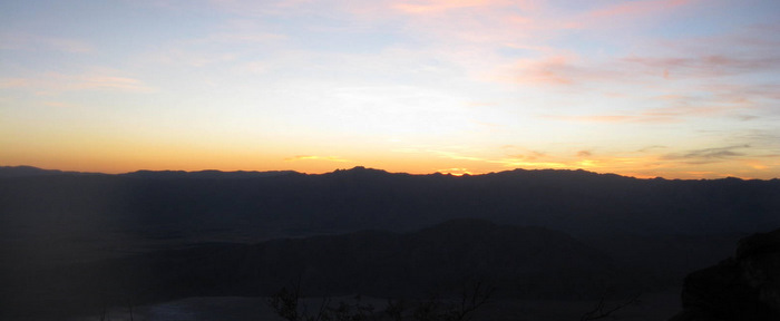
Just across the S22 from the start of the hike, we crawled out of our sleeping bags before daylight. We’d set up our “camp” on the side of the highway after yesterday’s hike and dinner in Borrego Springs. Originally we had thrown our sleeping bags in the back of the truck but after being repeatedly woken up by mosquitoes buzzing in my ear, I finally set up the tent on the ground behind the truck. I was slightly annoyed that I missed out on a good nights sleep, but Anna didn’t seem to mind about the lack of sleep, or me being annoyed.
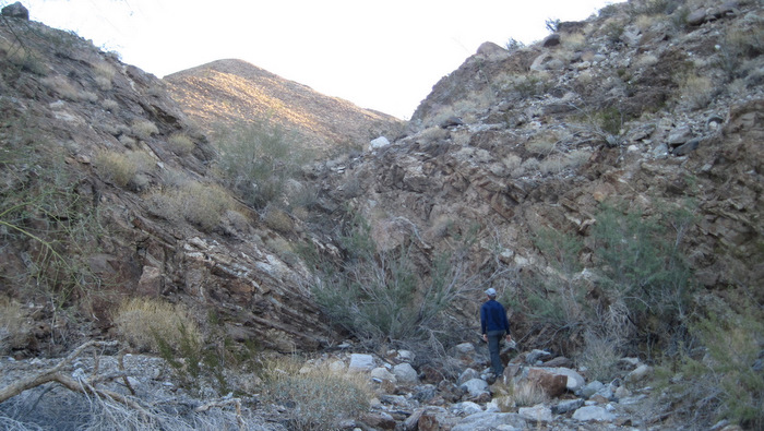

Anna and I crossed the highway at 6:45am and hiked a mile across the desert floor to the mouth of Palo Verde Canyon. We were looking for a side entrance to Smoketree Canyon, headed towards what’s labeled on the map as the Natural Rock Tanks. This “side entrance” turned out to be well hidden and I never would have realized it was there had I not known ahead of time. Anna and I ducked under a bush and climbed through a dryfall to get to an old Native American trail, which we found fifteen feet above us on the right hand side.
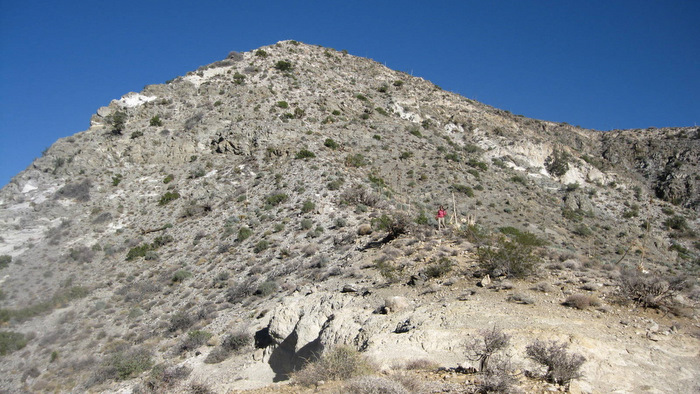
We followed the trail across Smoketree Canyon before dropping down to the Natural Rock Tanks. The tanks are large natural water tanks worn into a large rocky dryfall, a valuable source of water for the bighorn sheep in the area. The tanks were almost dry but I imagined that this would be just about the driest they’d ever be, just before the rainy season. We continued up a steep slope behind the sheep tanks and gained the south ridge of Pyramid Peak.
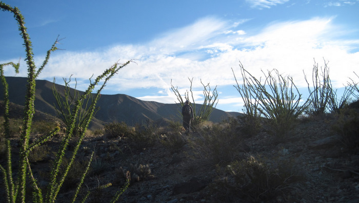
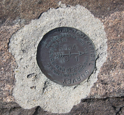
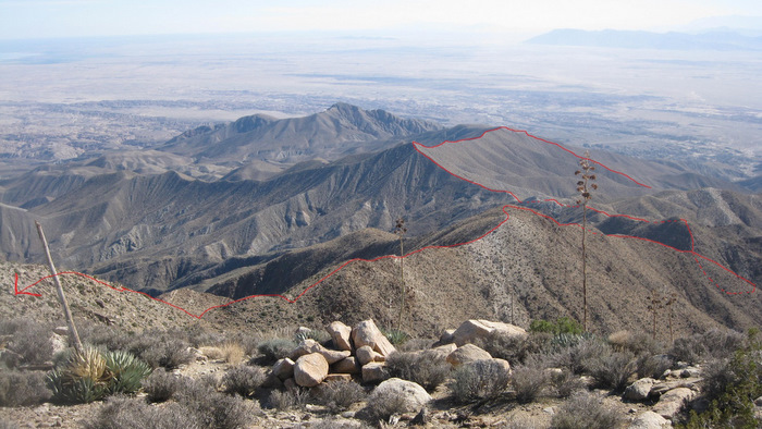
We continued north along the ridge, only straying from the crest when cactus or a large rocks blocked the way. Though we were far from the first ones to walk along this ridge, there was no evidence otherwise and it was easy to experience a great sense of remoteness and solitude. We arrived to the summit of Pyramid at 9:31am and signed in to the register, taking just a few minutes to cram down a snack before heading to our next objective, Rosa Point.
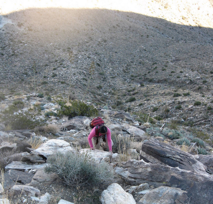
From Pyramid, Anna and I continued along the same ridge towards Rosa Point. We found bits and pieces of a helpful use trail along this section though it mostly disappeared about 3/4s of a mile out from Pyramid. After losing the trail we contoured left around a bump on the ridge (in retrospect I think the use trail probably went right), and continued up and northwest until we were at a prominent point (~3800ft), staring down at the start of Rosa’s 1800 foot tall south ridge. The ridge looked long and steep and Anna wasn’t thrilled, but I knew it looked worse than it really was. Plus once we would reach Rosa, we would have completed 2/3rds of the gain for the day.
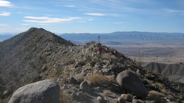
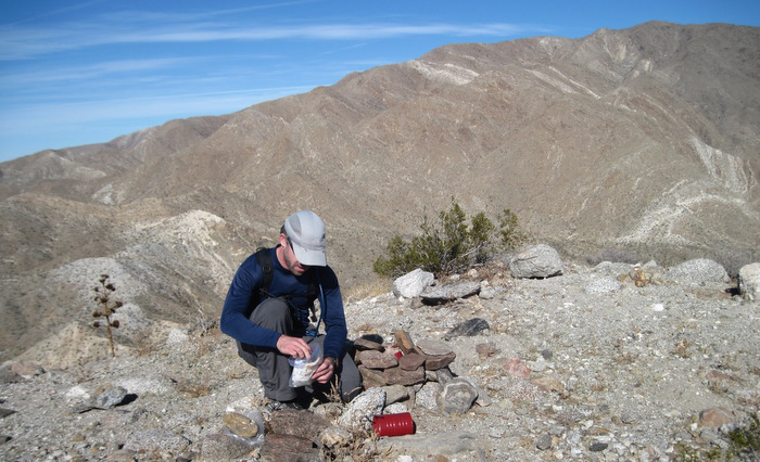
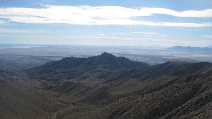
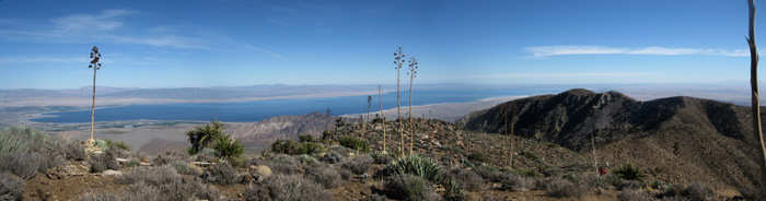
The ridge leading up to Rosa’s summit had a surprisingly worn use trail, allowing us to reach the summit from there in a little under an hour and twenty minutes. We found the register at 11:50 am and thoroughly enjoyed the unobstructed views of the Salton Sea. We took a 20 minute break, each eating a packet of tuna with some crackers and rehydrating.

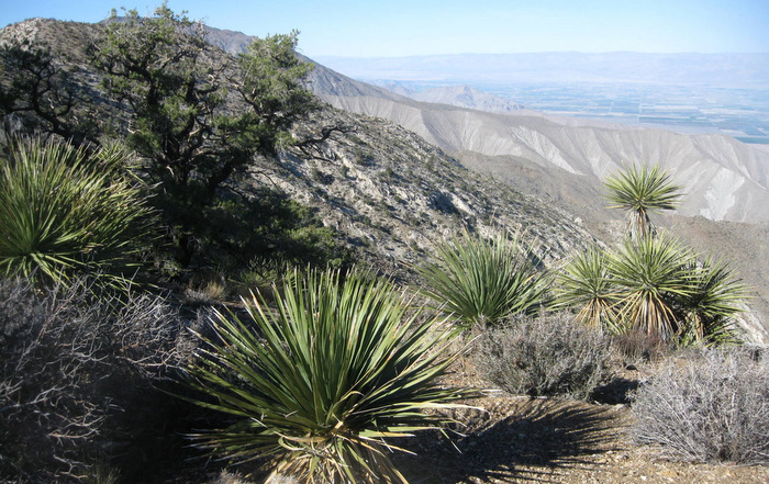
We started off a bit slower on the way to Mile-High, feeling a little relief from having made good time so far. The ridge connecting Rosa Point to Mile-High took us over a few ups and downs including two prominent false summits. It was less than 2 miles and 800 hundred feet of gain/loss between the two peaks. Anna and I reached the northernmost of four bumps on Mile-High at 1:56pm, where we found a register and again enjoyed views of the Salton Sea to the east. Mile-High seemed to have more and healthier vegetation than the lower part of the range, similar to what I had remembered from my previous trips to Villager.
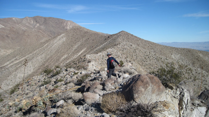
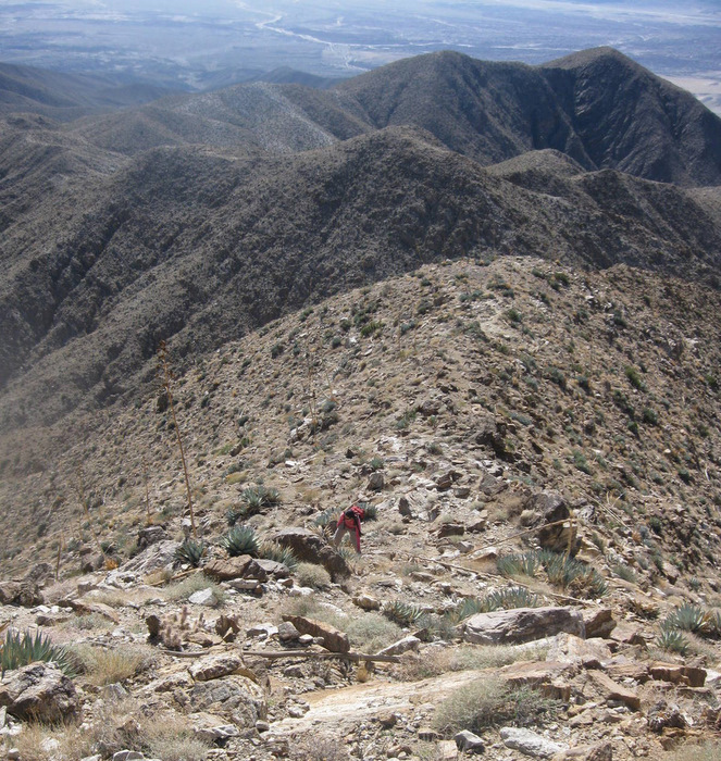
From Mile-High, getting to the gentle ridge leading to Villager looked rough, with a 1000 foot drop followed by 900 feet of gain, all within a mile. We started down the west side of Mile-High, steep class 1-2 on loose gravel and hard packed dirt. I used my hands in a few spots and Anna scooched down on her butt on the steepest sections. We took our second and final lengthy break of the day at the saddle between Mile-High and Villager, cramming in some much needed calories and looking for a route up to Villager’s south ridge.
The ascent to get up to Villager’s south ridge was fortunately easier than the descent down the west side of Mile-High. The ground was solid and there was plenty of rock to pull on. We topped out in just 35 minutes after leaving our break spot. We bumped into a couple who had chosen our top-out spot as their turn-around point for their hike to Villager, they were sprawled out on the nearby boulders and we chatted for a minute before parting ways.
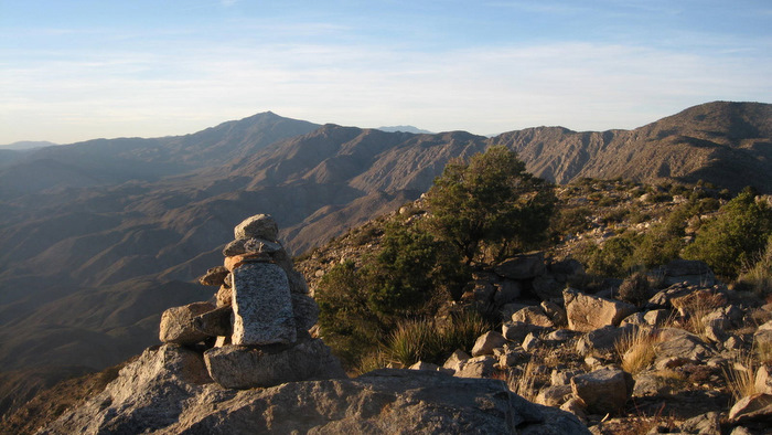
With a use trail on the gentle south ridge of Villager, the hiking here was some of the easiest of the day, good thing as we were starting to drag. We reached the summit at 4:25pm, feeling good about our fourth and final piece of the puzzle. We took a few minutes to enjoy the view and I was stunned at the overflowing summit register on Villager, a large increase in traffic over the last few years.
Anna and I started down, only dropping a thousand feet before breaking out our headlamps. Someone had pinned dime-sized reflectors into some of the Yucca plants and the reflections proved to be quite useful to guide our descent.
After walking mindlessly downhill for several hours we dropped down to the desert floor and walked the final flat mile to the truck, arriving at 8:15pm. At 13.5 hours, it had taken us a little longer than we expected but we were stoked on our big day. Our loop over Pyramid, Rosa, Mile-High, and Villager, was less mileage and gain than hiking Rabbit, but it felt comparable in difficulty. The Santa Rosas are just awesome. We arrived home in San Diego at 10:45pm with a well deserved stop at a greasy Mexican restaurant in Ramona.
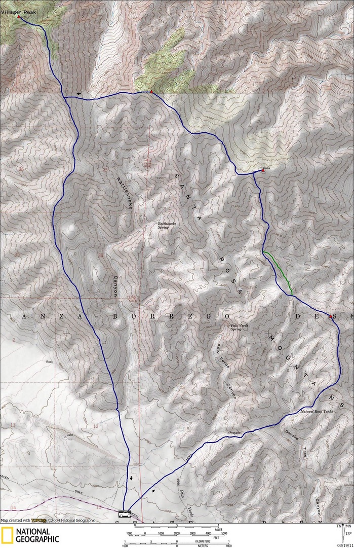
Note: the green line may be a better variation on the ridge between Pyramid and Rosa