
Wilson (SDC #30, 4586′) • map • directions*
Pinyon Ridge (SDC #29, 4614′) • w/Wilson
Palm aka Traveler FAIL (SDC #14, 2701′) • map • directions
Wilson and Pinyon Ridge
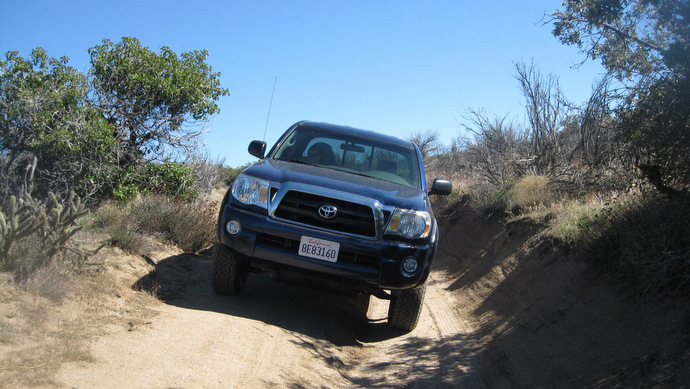
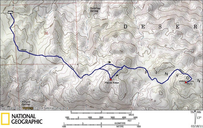
Pinyon Ridge and Wilson point are two unfrequented peaks that are accessed by an old jeep trail, now closed to vehicular traffic. We found the trailhead by following the directions in Schad’s “Afoot and Afield in San Diego County,” though by the time we found the signed trailhead I wasn’t too happy, as I’d put several deep scratches into my dark blue truck in the 3 off-road miles it took to get there. It was bound to happen as I was going to beat the truck up quite a bit over the next few months, so I got over it as soon as we were on the trail.
We followed the mellow jeep trail south and then east, aiming for the furthest of the two peaks first, Wilson. I knew that we were wrapping around our other planned destination, Pinyon Ridge, on the way to Wilson, but I couldn’t be sure of exactly which bump it was. I’d worry about that on the return however.
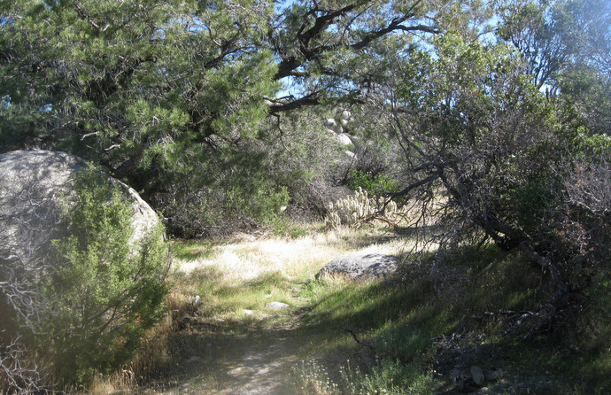
Where the road turns into a trail
The going was almost too easy, only gaining 1000 feet or so over 4 miles. The views were good though and it was nice not trying to blitz through the day as we normally do. Besides, we’d have plenty of time for that tomorrow. After an hour and twenty, the jeep trail fizzled out into a hiking trail. We followed it through some overhanging trees before leaving the trail and heading south to climb up the final 100 vertical feet to get to Wilson. We dodged cactus and other brush and climbed over rock and under low hanging trees that last 1/8th mile, but being so close it still took less than 10 minutes.

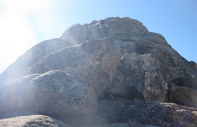
Near the summit of Wilson
The summit of Wilson is centered in the middle of a broad ridge, so we couldn’t see down to the desert floor, but we could see all the way to the Salton Sea, 30 miles to the east, and to Grapevine Mountain just across Grapevine Canyon to the west. The high point seemed to be a 6 foot tall boulder, and it did have a summit register. We signed in and started back down to the trail, stumbling across a few cairns that marked an easier path.
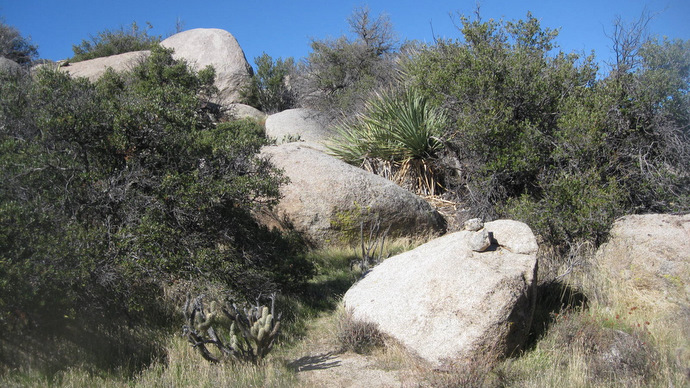
The marked turnoff for Wilson’s summit
Heading back towards Pinyon Ridge, it’s high point was much more obvious from this direction. We stayed on the jeep trail until we were at an apex just north of Pinyon Ridge, and it was simple enough to get to the summit from there. The summit block was a couple of fun and easy class 2-3 moves, the top of which was just big enough for a small crowd, very cool. We found the typical reddish-brown 2 can summit register, something we were becoming very familiar with.
The summit block on Pinyon Ridge
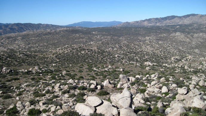
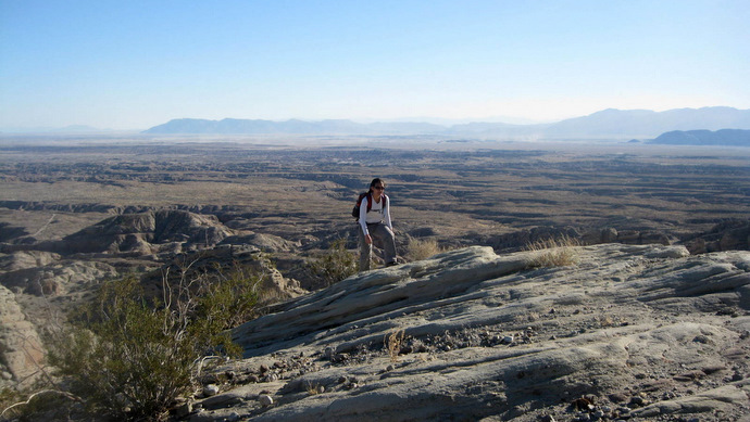
The view from Pinyon Ridge
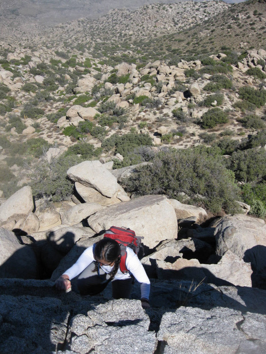
Anna climbing down from Pinyon Ridge
After getting back to the trailhead, I decided to try to get back to the S22 via another route, for the sake of my truck’s paint. We continued west from the parking area, the road was a littler rougher and uneven in a few spots, but it definitely had less brush than the way we’d come in. Once back on the highway, we dropped down into Borrego Springs and started heading for the Santa Rosas, hoping to squeeze in one more peak before calling it a day.
Driving out towards Oak Grove and the S22
Palm (Fail)
I hadn’t been able to find any information on hiking Palm BM, but after studying the maps it looked like the accessible calcite mine got fairly close to Palm, so I figured that would be a good place to start.
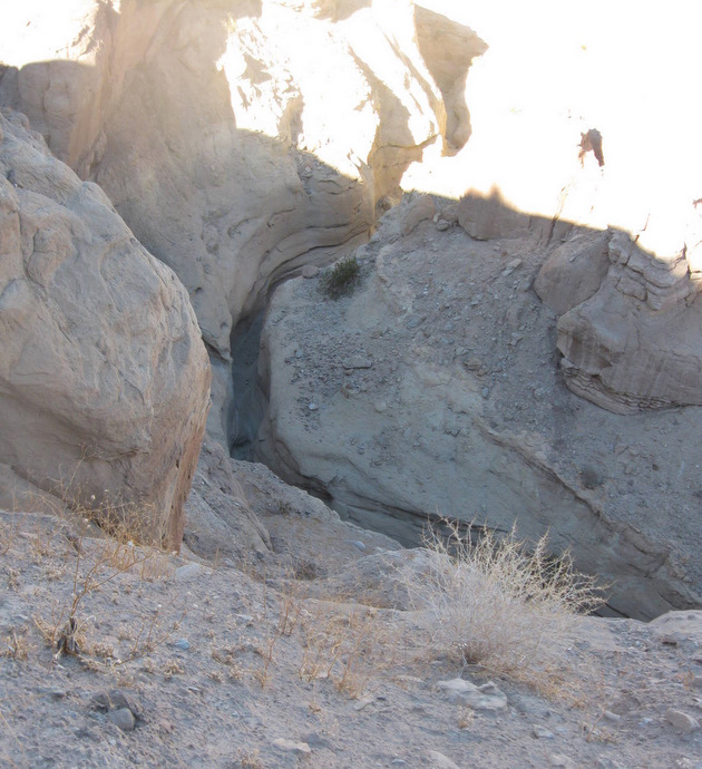
A slot canyon en route to Palm
Anna and I drove down the steep dirt road heading toward the calcite mine, following behind a caravan of jeeps. We parked at an obvious flat area before the road started to get rough, and we walked the last mile to the mine. The terrain was impressive, with slot canyons and just rugged and cut up earth. Once we reached the mine, there was calcite littering the ground and a few horizontal shafts that had been cut into the ground, but there didn’t seem to be much else to it. We found what seemed to be a use trail leading north from the mine, and I assumed that this would lead us to Palm. It would be our only chance since the daylight was going to be gone soon, as we’d gotten a late start in the morning.
Just above the calcite mine
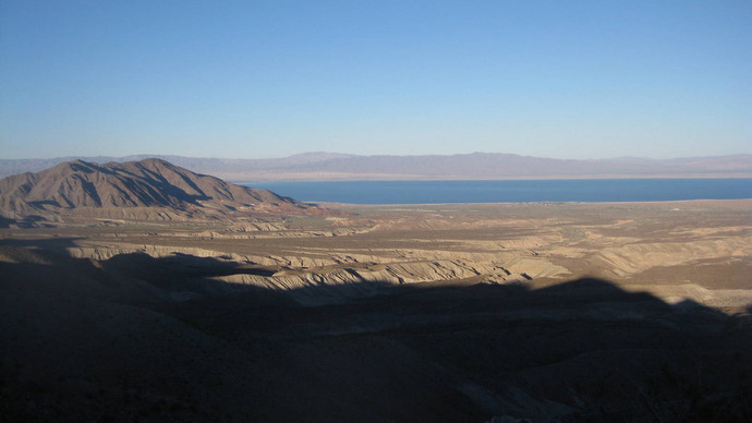
The Salton Sea
Though the hike above the mine wasn’t scary steep, it was very loose and caution was essential on parts of the ridge.

Loose stuff on Palm
Once cresting a bump on the ridge leading north from the mine, I saw two possible routes; a more direct but crumbly looking ridge, and what looked to be an easier but slightly longer route, which was our preference. We dropped down a hundred feet into a wide wash, and started heading up the heavily cactused slope. Thirty minutes of slogging up kitty litter brought us to a point at 2400 feet, and I stared a few hundred feet down to a saddle that connected us to Palm. It was at this point that I realized that we’d have to go back down. Not only was it going to be dark soon, but the remainder of what would have been our route was more than we wanted to do, concerned with saving our energy for the long day we had planned for tomorrow. I did climb partway up the more direct ridge on the way back, just to have a look, and it appeared to be very loose and exposed in a few spots, but certainly not unclimbable.
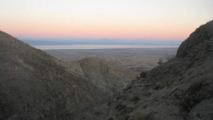
The Salton Sea from higher upon Palm
Palm, and what may have been a better route
By the time we we got back to the calcite mine, it was dark and we had to get our headlamps out for the walk back to the truck. Once we did get back, we threw on some clean clothes and drove into Borrego Springs for a couple of good burgers at Carlee’s. We watched some karaoke, some of it quite entertaining, before driving back down the S22 and setting up our sleeping bags in the bed of the truck near the start of tomorrow’s hike.
Wilson/Pinyon Ridge stats: 8.5 miles roundtrip, 1300 feet gain/loss

A better driving route for the Wilson/Pinyon Ridge trailhead
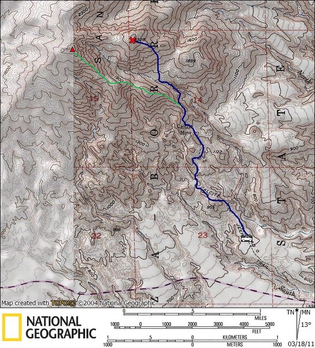
Palm stats (of our failed blue route): 4.0 miles roundtrip, 1500 feet gain/loss
Note: The green line *might* be a better route, though it looked loose.
I reached the summit at a later date via another route.
*-The Wilson/Pinyon Ridge driving directions get you to a turnoff heading east towards the trailhead. Please see the terrain view on Google Maps to get an idea of where you need to go as this approach can be confusing. Alternatively, see Schad’s book for a different driving approach, though my way had much less brush to scratch up your vehicle as of Nov 2010.