
Ode (SDC #19, 1510′) • map • directions
Kay (SDC #18, 3587′)
Sirens (SDC #20, 4401′)
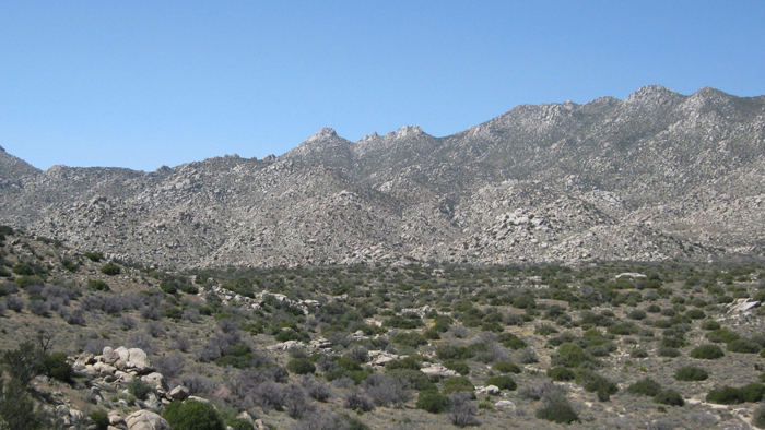
San Ysidro East (SDC #17, 5386′)
Webo (SDC #23, 4173′)
Ted (SDC #25, 2369′)
My alarm went off at 6am and I jumped out of the back of my truck and into the parking lot for Hellhole Canyon. I was without a full night’s sleep, but I was wide awake and excited to get going. It took me about thirty minutes to cram down half a steak quesadilla, paint myself with sunblock, and pack my things. When I was ready to set off, it was just light enough to not need a headlamp, so I left it in the bottom of my pack and set off towards the ridge containing the Ode, Kay, and Sirens benchmarks, rising to the west from the desert floor.
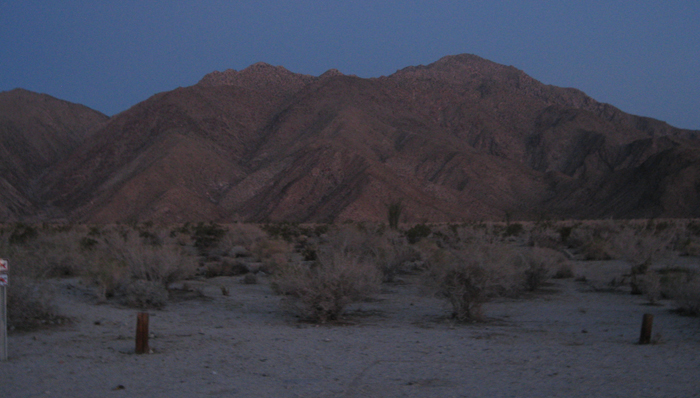
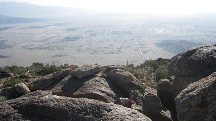
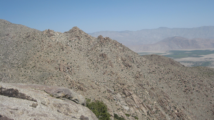
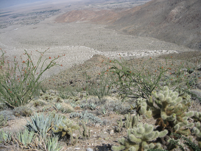
Looking towards San Ysidro from the east
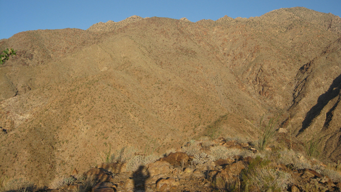
I walked about seven tenths of a mile across the flat desert, and started to climb up to the Ode benchmark, which required just 600 feet of vertical effort. I did find a register for Ode, signed in, and left for Kay at 7:07am. Reaching Kay would mean realizing half of my elevation gain for the day, so I set a brisk pace in order to relax a bit more later. The hike up to Kay from the Ode benchmark ascended 2000 feet in a mile, but was without much difficulty by staying on top of the ridge. I did use my hands to pull myself over the large boulders once I got near the Kay benchmark, and signed in to the register at 8:35am. After taking a few minutes to put down a snack, I checked my GPS for the day’s next destination, unofficially named The Sirens.
Looking east from Ode
Indianhead Mountain en route to Kay
Nearing the Kay benchmark
Borrego Springs from Kay
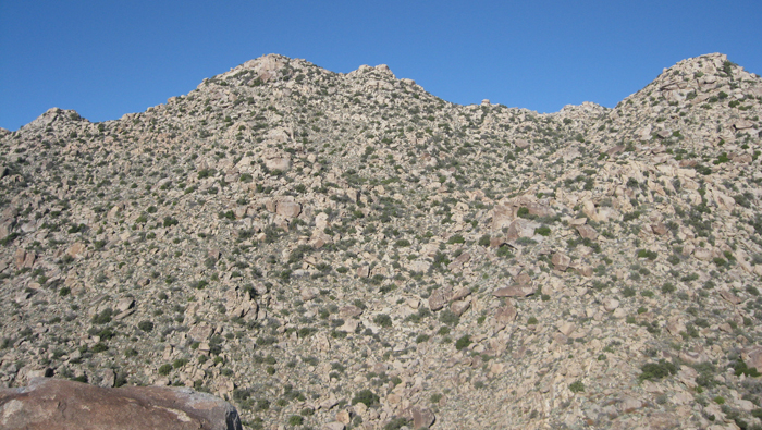
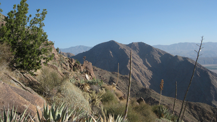
The Sirens from Kay
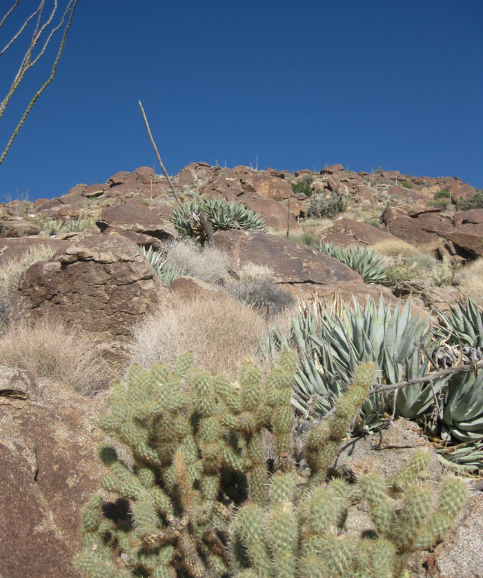
Though The Sirens was only half a mile and just 900 vertical feet from Kay, I wasn’t sure which pile of rocks was which. The terrain certainly looked less appealing from a distance though, choked with boulders and desert shrubs. I dropped a few hundred feet and made the most direct line as seemed reasonable. The going was easier than I had anticipated, and I climbed up between two rocky hills to until I was just southeast of The Sirens. From there the climbing got steeper, probably the steepest part of the day. A class 2 route could probably be found with enough searching, but I took a fun and easy class 3 route and came upon the register and great views of Anza Borrego at 9:39am.
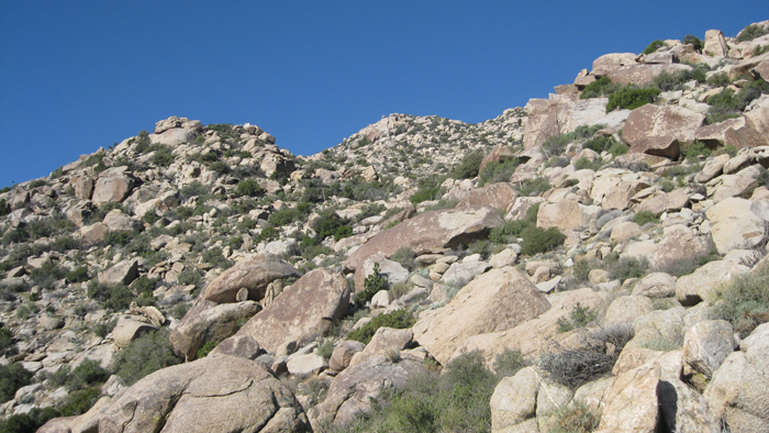
Climbing towards The Sirens
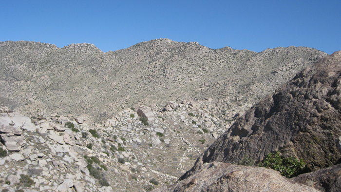
San Ysidro’s east summit from The Sirens
My big concern for the day had been the desert sun, and I definitely felt it pounding on my neck once it had reached a short ways into the sky sometime around 9am. I had been intentionally depriving myself of the four liters of fluids I had brought, but it was going to be tough to do that for much longer. Leaving The Sirens, I dropped down the northeast side and found some shade behind one of the many massive pieces of rock before cracking open my Gatorade, my much anticipated luxury item. After a few swigs, I continued on to my highpoint of the day, San Ysidro’s east summit.
Relatively easy going across the flatish section between The Sirens and San Ysidro got me to within one solid but short push to the crest of San Ysidro’s massive east ridge, though I slowed down and took a few multi-second breaks to stop from overheating in the still air and rising sun. Once I reached the top of the ridge, I followed it west towards the highpoint, staying to the left of a few false summits. The rock along the way was increasingly impressive, most notably a few massive chunks embedded into the mountain just below the east summit.
En route to San Ysidro East
San Ysidro East
San Ysidro East
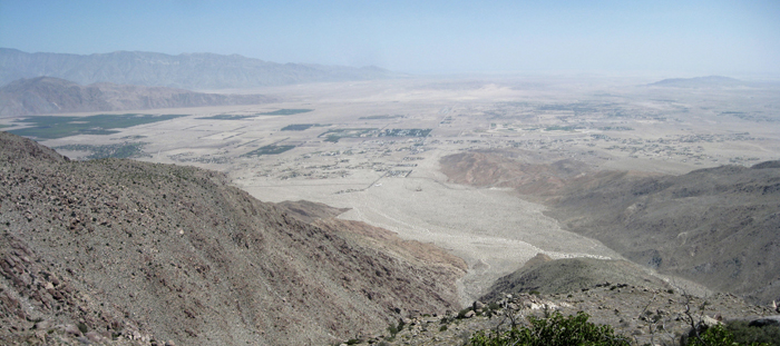
The view over Hellhole Flat
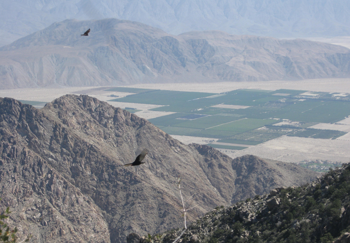
Turkey vultures near San Ysidro
San Ysiro’s register was found at the base of the easily stood upon summit boulder, and dated back to 1979. Very cool. From there I retraced my steps a short ways, pausing to snap some pictures of a trio of turkey vultures that had buzzed the ridge a few times and landed not too far from me. Once I had dropped down a short ways, I took a break underneath the shade of a nice boulder, and did a water check. I had 2.5 liters of fluids left, plenty to last the day now that most of the elevation gain was done. I took a big drink off of my Gatorade, and dropped down to Hellhole Flat. Crossing Hellhole Flat was easy going, though the desert brush occasionally ripped at my pants, seemingly wanting me to stay forever. A breeze that had started during my descent of San Ysidro grew stronger, and seemed to boost my energy twofold. The dryness in my mouth was slightly alleviated, and I could actually chew and swallow my granola bars and other snacks rather than turning them to unpalatable mush, so I ingested some much needed calories while on the move. I crossed over the Tuck benchmark (thought I didn’t see or bother to look for it), and contoured north up a short ways and around a short rocky point before reaching the wash that runs just north of my fifth and next destination, Webo.
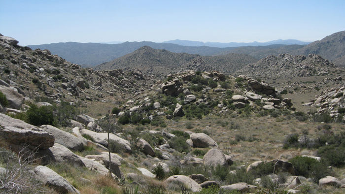
Hellhole Flat
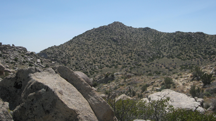
Webo
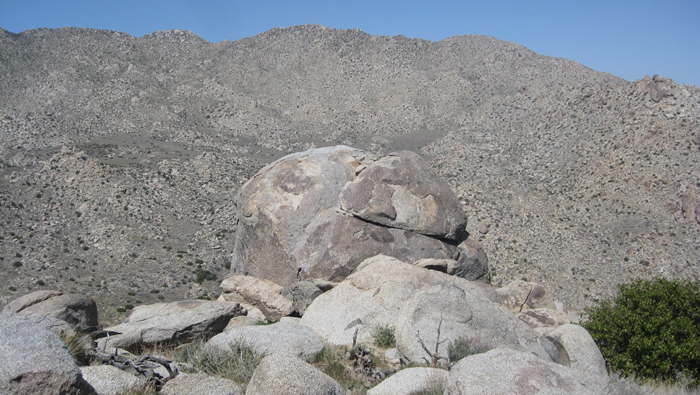
The Thimble from across Hellhole Flat
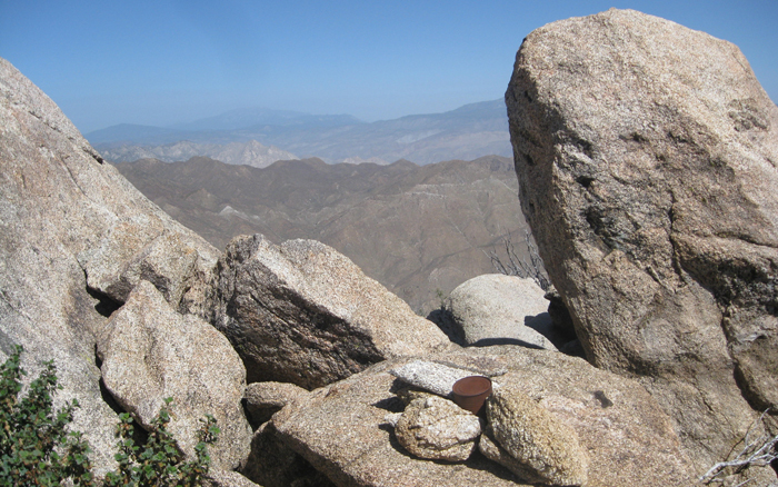
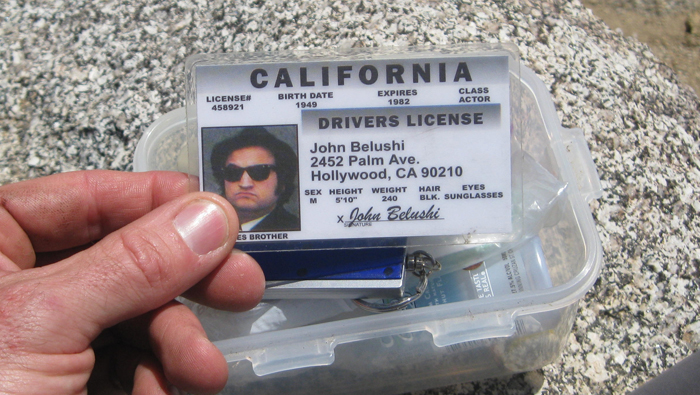
From Hellhole Flat, reaching Webo required just 400 feet of gain, the last uphill effort for the day. I walked up its northern slopes to its highpoint, setting my pack down near where I found a geocache at 12:52pm. The geocache was of the same style and had been placed by the same guy, “Gecko Dad,” as one I’d found on the Gasp benchmark just a few weeks previous. This one had a gimmick Jim Belushi ID card in it, pretty funny. I did search for the more traditional Borrego summit register, climbing up a few of the highest boulders but found nothing.
Possible peakbagger? 😉
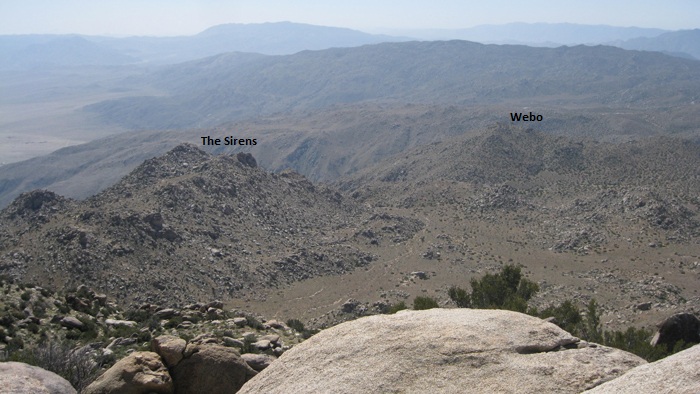
Satisfied that I had just a three mile descent left to finish out the day, I took a lengthy break on top of Webo. I drank my fluids down to 1 liter, ate some food and took some pictures. The profile views of The Thimble, which I had climbed just nine days previous, were some of the best I’d seen of that peak. The views back towards San Ysidro and The Sirens were great also; it always looks so much farther than it was.
The Sirens
Borrego Springs from Webo
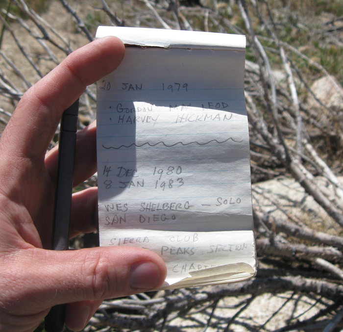
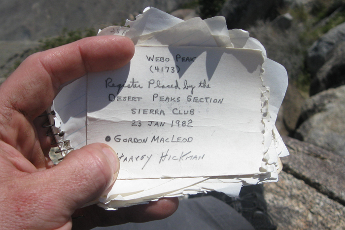
To kill another minute or two, I turned on my GPS just to see how far the Ted benchmark, my next destination, was from Webo. It was then that I noticed that the Webo benchmark didn’t coincide with where I was sitting, but was actually about 100 feet or so north of where I was. I went to have a look, remembering that these benchmarks aren’t always on the highest point, and scrambled eight feet or so up a large boulder, finding both the register and the benchmark. The register consisted of mostly loose pages sealed in a glass jar, and I read through quite a few of them before adding my name as the most recent entry. On the southeast side of the benchmark boulder, I noticing a downed survey pole (just a big stick really) as well as what looked like some kind of blasting cap. I’d seen these caps or whatever they are on the summit of Jacumba Mountain as well but have no idea about the origin or purpose.
The boulder containing the Webo benchmark, San Ysidro East behind
Webo
After killing half an hour hanging around the top of Webo, I suddenly felt rushed like I was on some sort of schedule and threw on my pack to begin the descent towards the Ted benchmark and my truck. The ridge was less steep than the one I had ascended, which is the reason I had chosen to do the loop in the direction I did, and I was able to drop elevation without pounding my knees too hard. Ted not being an obvious point on the ridge, I kept my eye on my altimeter and stopped to look around when I had dropped down to about 2500 feet. I went from one outcropping, to another, to another, and found nothing. I pulled out the GPS which led be back about 200 feet, where I located the benchmark and the register on a knee high rock, having been hidden from the west by a large teddy-bear cholla. The views from Ted were certainly sub-par as compared to Webo and the others, but there was a cool palm tree grove easily visible in Flat Cat Canyon, something I would have missed had I not stopped at the Ted benchmark.
The Ted benchmark, Webo behind
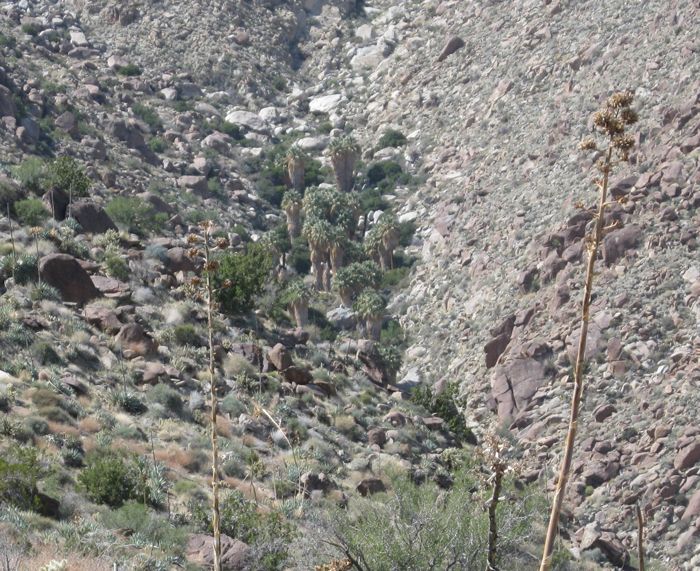
Palms in Flat Cat Canyon
Now looking forward to finishing out the day, I continued on until I reached the desert floor. I aimed for and then followed a wash that came out of Hellhole Canyon, meeting and then chatting it up with a few guys from San Diego who had just come from Maidenhair Falls. It had been a nine hour day in all, with plenty of time to grab some good Borrego Springs food before heading home.
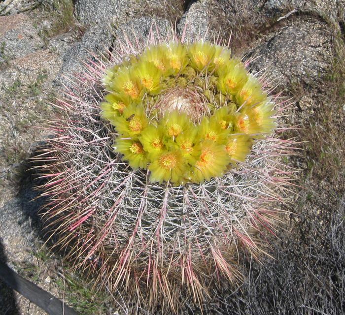
A blooming barrel cactus, not to be confused with a bloomin’ onion.
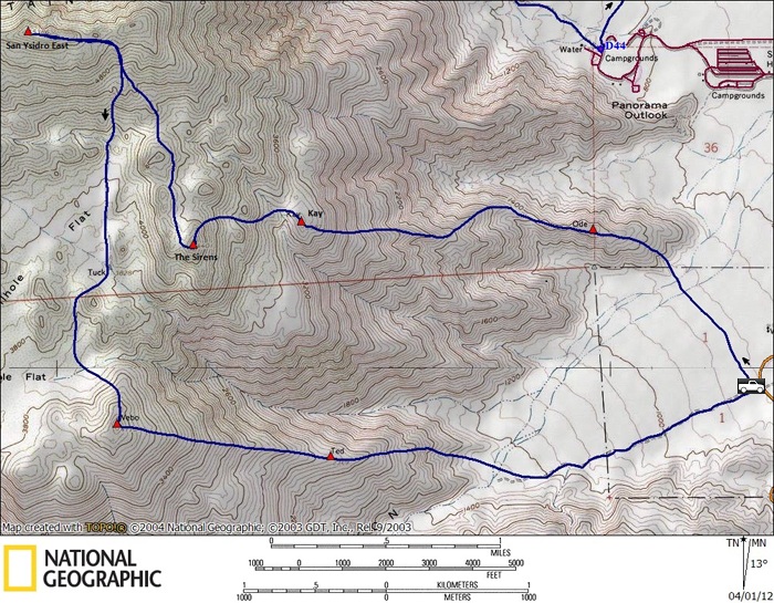
San Ysidro East loop stats: 9.5 miles, 5400 feet gain/loss