
Knob (SDC #6, 3431′) • map • directions
Collins (SDC #3, 4559′)
For some reason, I had it in my mind that I’d hike Mt. Collins from the west. I guess partly because of the few ascents I’ve heard of, they were all from the east. And maybe partly because I was interested in visiting Lost Valley, it just seemed so remote. And in theory, hiking Mt. Collins from the West wasn’t much less efficient elevation-gain wise than combining it in a future hike of Palms and Elder (two other nearby peaks I had yet to hike). So I drove out to Lost Valley Road on a Monday night, with intentions of hiking both Knob and Mt. Collins on Tuesday morning.
I passed Warner Springs and the Sunshine Summit and turned on to Chihuahua Valley Rd at 11pm, following it about 6 miles before catching the unpaved Lost Valley Road. I’d taken Lost Valley a short ways before on a hike to Mt. Combs and as I remembered it was in decent shape, easily navigable by any vehicle with moderate clearance. This time I hoped to drive about eight miles in, but was stopped short before mile seven when a no trespassing sign followed by a locked gate blocked my progress. $#&!#! I was afraid of that. My map shows a gate, but I’d hoped it would be unlocked. The Boy Scouts officially own some property in Lost Valley, but a Google search had come up with nothing as far as the road, other than a guy who claimed to have driven the road in his minivan. I’d found a contact number for the facility there but I’d been too lazy to pick up the phone ahead of time.
Now I hate trespassing but I rationalized this one out. Certainly the mountains and most of the hike were contained within Anza Borrego State Park, and I believe that just the road and the property in Lost Valley to be private. And certainly the Boy Scouts wouldn’t mind me walking just a mile of their road to enjoy the good outdoors, eh? So I crashed out in the passenger seat of my truck, and set my alarm for 6am. (Post-hike, I sent an email to ssrlv@ssrlv.org found here, and was granted permission to walk to the road, provided I tell them the date ahead of time. I told them I’d let them know 🙂 )
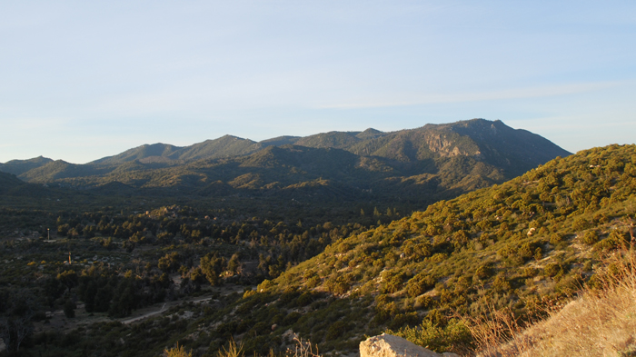
Hot Springs Mountain from the north
When I woke up, it was much colder than I had expected. Certainly colder than the night I spent in my truck just 3 days previous. Nonetheless I packed up my stuff, ate a small breakfast, and set off down the road towards Lost Valley. I used my GPS to find a predetermined location where I would leave the road and go cross country. It was brushy but not terrible, and I set course for the upper reaches of Sheep Canyon and hopefully the leftovers of an old trail. A few short ups and downs brought me to a narrow corridor that would lead me to Sheep Canyon. The corridor was clear at first but within a few minutes it became one obstruction after another, mostly fallen branches and thick brush, slowing my progress immensely. I knew going into this thing that my approach from the west would prove to either be a revelation as far as an approach to Collins, or it would beat me down like the senseless man I was. Unfortunately the latter would prove to be true.
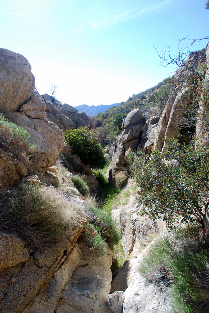
Upon reaching Sheep Canyon, I found no trail. Though only half-expecting it to be there, I figured I’d only have a few miles to cover anyway and how bad could it be? Though the only mention of upper Sheep Canyon I’ve seen remarks that pace is measured in “hours per mile” rather than miles per hour, but surely that wouldn’t apply to me. Not so. The canyon itself was beautiful; huge trees, hidden pools of water, and waterfalls, but those same features made it just about impossible to maintain any sort of pace. After spending 40 minutes covering just half a mile in the canyon, I was so frustrated that I thought of turning back. I opted for a much higher route on the north banks of the canyon, dropping down over large boulders and brush when the canyon seemed to open up, but I was again confronted by one obstacle after another. I finally decided that I’d have to leave the canyon entirely if I was to complete my day in a reasonable amount of time.
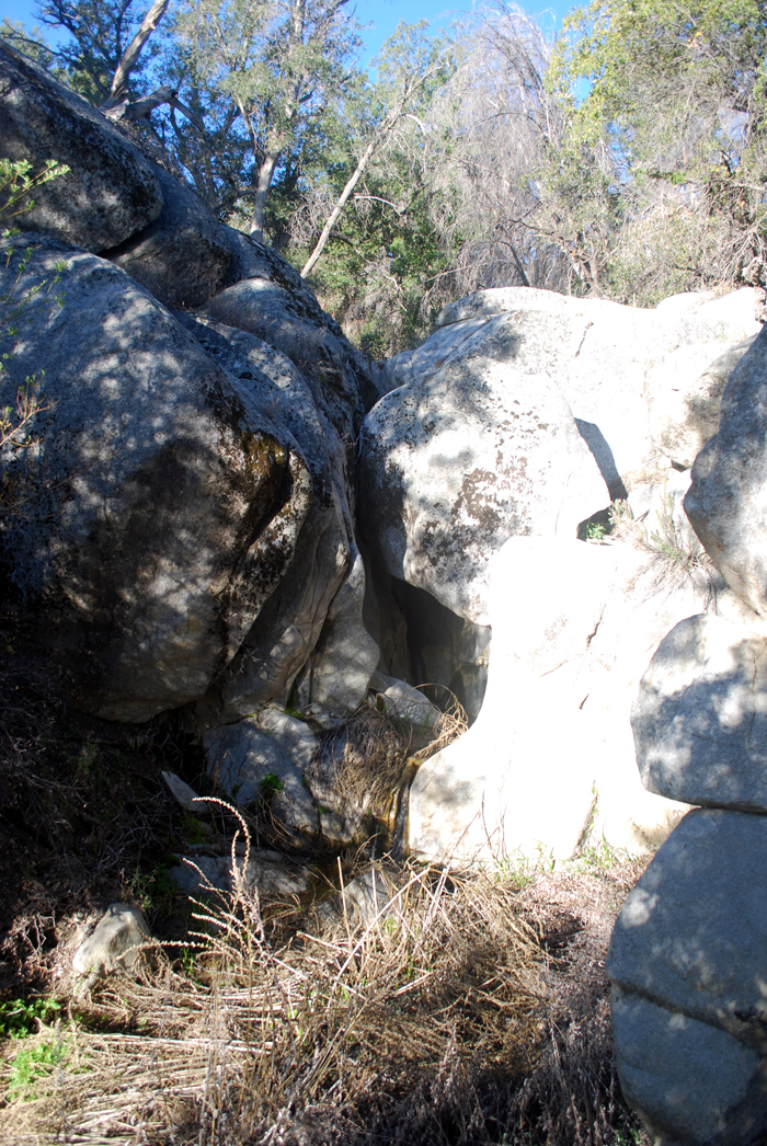
One of a thousand obstacles in Sheep Canyon
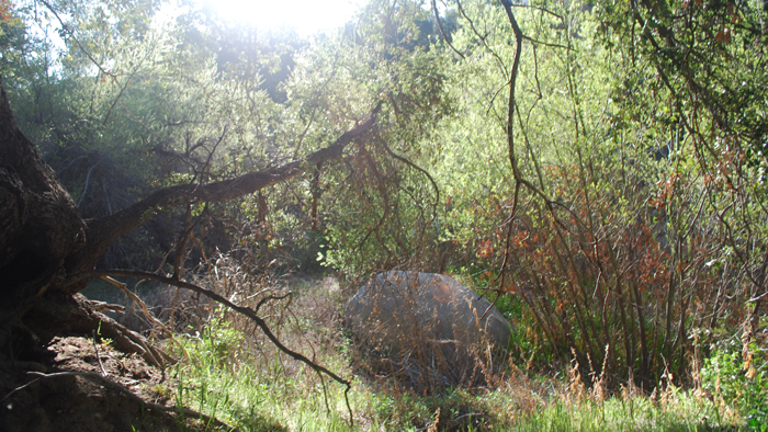
Sheep Canyon
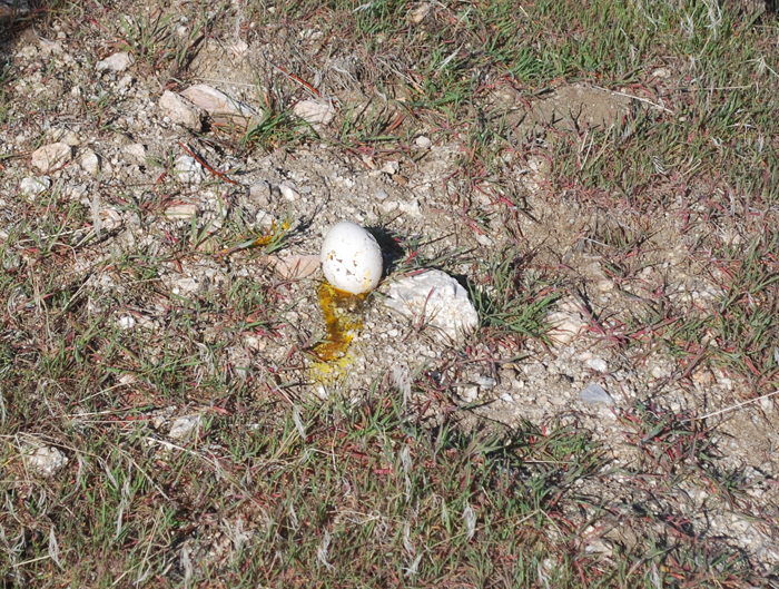
A rather large egg
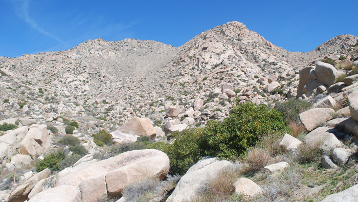
I hiked up the steep banks of upper Sheep Canyon, gaining about four or five hundred feet to reach easier terrain. There was lots of desert shrubbery, but my pace was twofold what it had been down in the canyon. I crossed a small flat before hiking over a small saddle, and into a dry and relatively clear wash that would empty at the western foot of Knob. I’d been able to identify Knob during the approach, an interesting looking peak for sure. There were two single palms at its base, and I passed beneath one of them before starting up for Knob’s summit, the first elevation gain of the day.
The dry wash I used to get to Knob

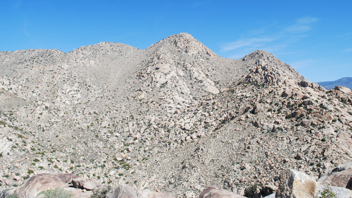
Knob in the center
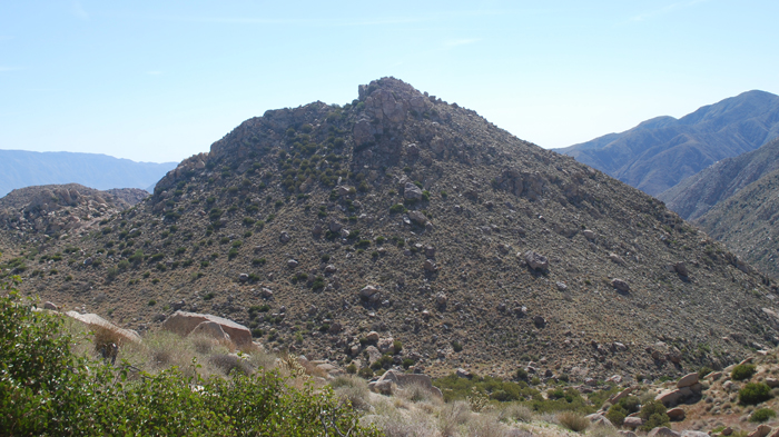
Knob
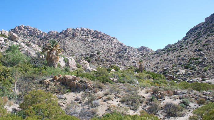
A few palms at Knob’s western foot
I ascended Knob up class 2 slopes on its northeast side, eventually climbing through a break in its rock capped summit on the northwest side. With less than 300 feet of gain, it took just fifteen minutes to get to Knob and its register from the wash below. Knob is an outstanding vantage point over lower Sheep Canyon, and I was glad to be taking in the views from above on this lonely day in the desert. Collins looked pretty mean from Knob as well, though I would soon find that not to be so true.
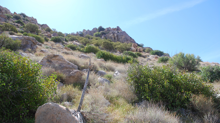
A short ways to go
Mt. Collins from Knob
Palms and Elder from Knob
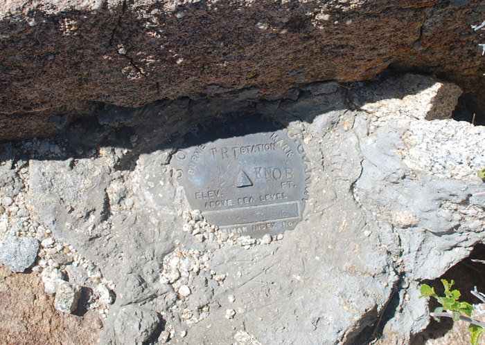
The benchmark
I didn’t spend more than a minute or two on top of Knob, hoping to get to the top of Mt. Collins before it got too hot. It was already after 10am when I started down towards Collins, much later than I had hoped. Fortunately the way over to Collins went fairly quickly. I stayed on a relatively direct route towards the saddle just west of Collins’ summit. The slopes were open, and I was limited only by my legs and the creeping mid-day heat. A straightforward ascent, I was on Collins’ summit plateau before noon, admiring the views looking north into Fig Tree and the surrounding valleys even before I scrambled up its highest point.
Working my way towards Collins
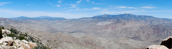
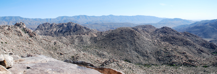
The system of valleys running between Anza, CA and Borrego Springs, Toro Mountain on the right
I found a glass jar containing the summit register near the top of a pointed cluster of rock, the highpoint of Mt. Collins, most easily climbed from the west. The register was most recently signed by David Francis (same with Knob’s register), who I’d happened to meet on Squaretop’s summit just a month previous, and who had been noticeably busy with the SDC peak list summit registers recently. What a small world, this southern California peak-bagging game was.
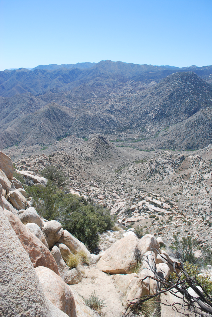
Looking north from Collins, Knob far below
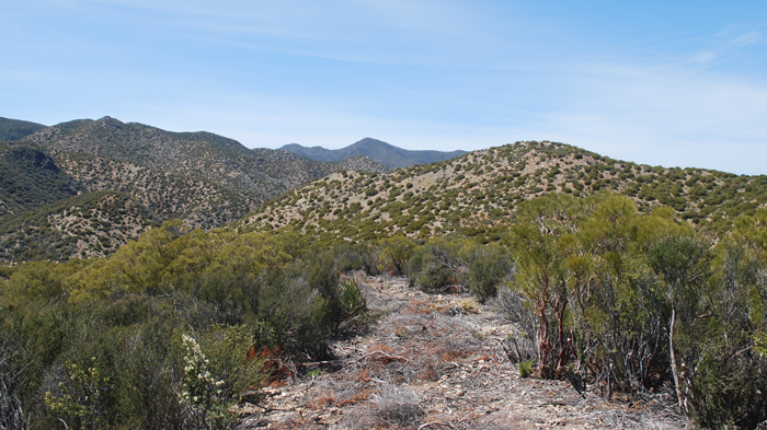
Ready to finish out the day, I descended in a westerly direction from Mt. Collins, looking to follow a ridge out to the same flat I’d hiked through before descending towards Knob. Along this ridge, I took an easy side trip to visit Peak 4695, a place worthy of a visit according to the map. I was surprised to find a register, with just five entries since 1979. This is definitely the most exclusive register I’ve signed, entry number six, very cool.
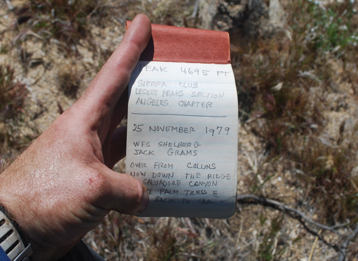
Five entries since 1979
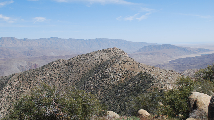
Collins from Peak 4695
Continuing on towards the truck, I lost and then gained elevation several times before climbing 600 feet up to a sort of plateau near the same elevation of both Peak 4695 and Mt. Collins. From there the brush got thicker, and I expected a slow pace but I almost immediately identified some sort of cut path. This cut path was as wide as a road, and hadn’t been cleared of the debris. In fact, it seemed like maybe it was the first stage in creating a road, a project abandoned some time ago by the looks of the cuts and dead vegetation.
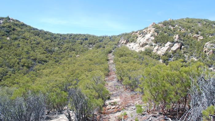
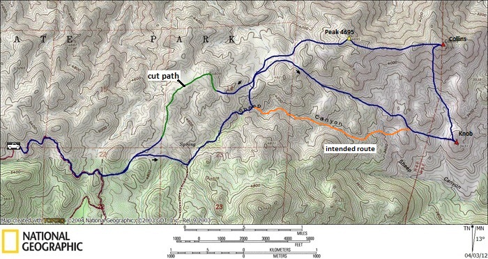
The cut path
More of the cut path
I followed the cut path as it meandered back and forth, wondering if it had been done by a machine. The machine would have had to be incredibly tough to make it over the rugged terrain, over rock and up and down through steep-sided washes. Regardless of what had made it, I was happy to have its assistance. I followed it to within a half mile of Lost Valley Road, which I reached easily from there. Another 20 minutes got me back to the truck and a much-anticipated cooler full of cold drinks I had waiting for me. A successful day on the edge of Anza Borrego State Park, though one I may not be repeating!
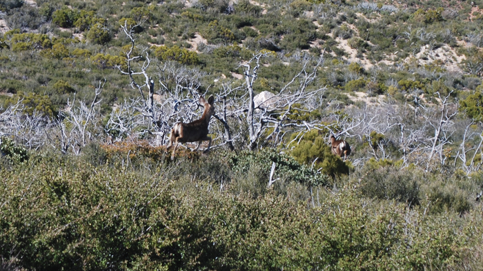
Deer from Lost Valley Road
Collins/Knob hike stats: 11 miles roundtrip, 4000 feet gain/loss