
Tule (SDC #83, 4649′) • map • directions*
Groan (SDC #81, 2732′)
Gasp (SDC #79, 3223′)
I’d scouted the area after a hike to Jacumba Mountain just a few weeks previous, so I knew just where to park for our loop hike of Mt. Tule and the Gasp and Groan benchmarks. I was joined in this trip by Tom Waggoner, a long time friend from college and someone who I’d been on many climbing trips with in the past. It was hard to believe that I hadn’t seen Tom since our trip to Denali in 2010, so it was great to have him along and catch up on things between catching our breath.
Tom and I left the truck and started off towards Mt. Tule at 9:30am, walking along a dirt road that leads partway up its northern slope. The starting point had been just west of the Sacatone Overlook, a spot any vehicle with moderate clearance could reach without problems. We could have driven the road towards Mt. Tule and gotten even closer, but it wouldn’t have helped us out any since we would be returning to the truck from the opposite direction. Tom and I followed the dirt road until it ended, about 400 feet below the summit of Mt. Tule, which we then reached in less than 30 minutes after leaving the truck.
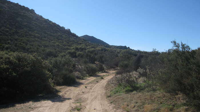
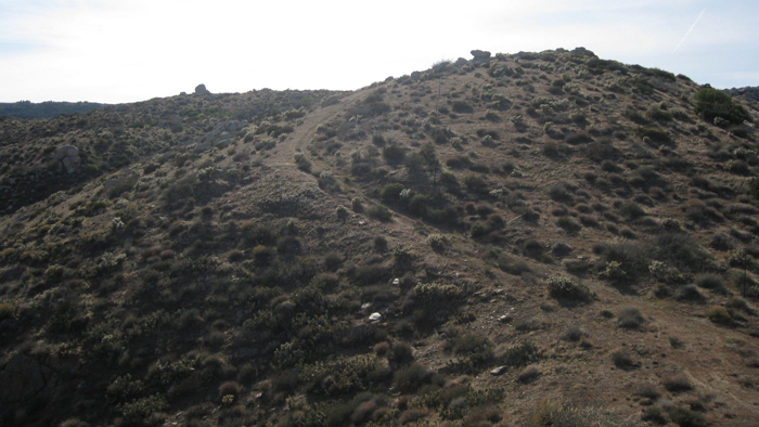
Hiking the road towards Mt. Tule
1/2 way up Tule
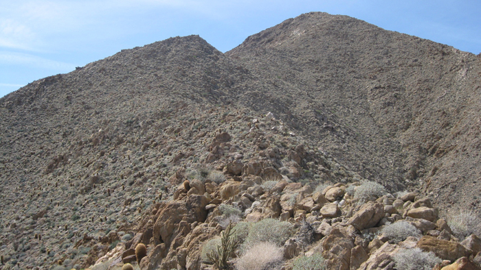
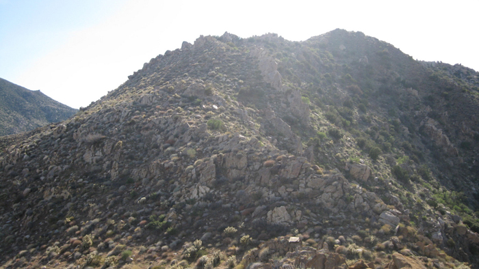
Mt. Tule
The summit register was in rather bad shape, being a more popular summit than the majority of the mountains in Borrego I had become familiar with over the past few years. We signed our names anyway and departed in an easterly direction, dropping elevation quickly as we took aim for our next and more exciting objective, the Groan benchmark.

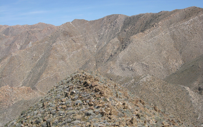
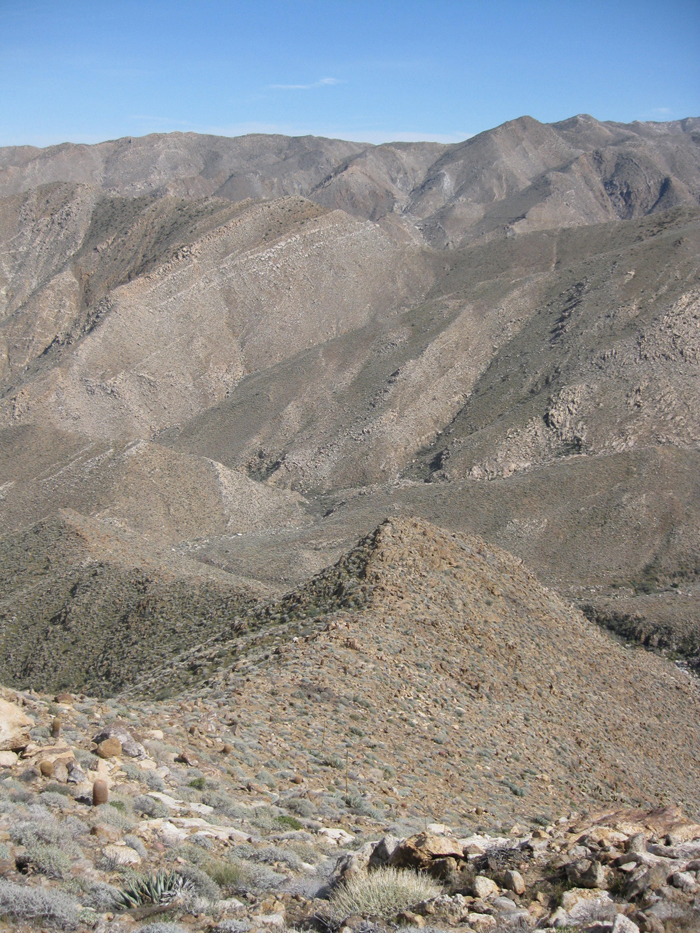
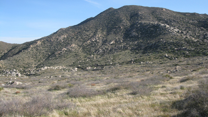
Looking out towards Groan, hidden behind P3679
Looking back towards Tule
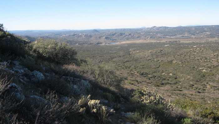
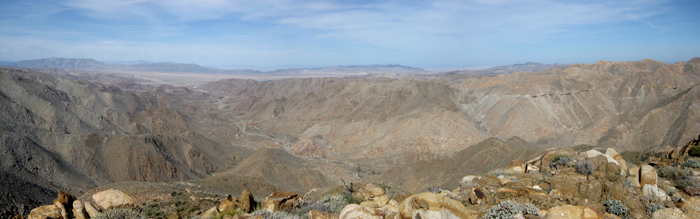
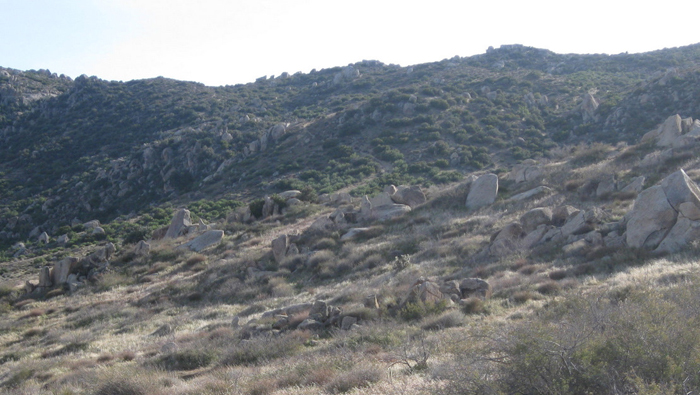
The going towards Groan was rather easy, and we traversed around the left side of what’s labeled P3679 on the topo map in order to avoid gaining unnecessary elevation. We eventually dropped to a saddle just below and south of Groan, having lost 2000 feet since our brief visit to Mt. Tule. A short but steep scramble from there got us to the Groan benchmark and outstanding views of Carrizo Gorge. Groan BM was really just a point near the end of a ridge that separates Carrizo Gorge from one of its tributaries, and has good views of the Goat Canyon Trestle (though not nearly as good as the views from Puff BM). The register dated back to 1982, and had but a fraction of the visitors that Tule had been seeing (note – the register on Groan could use a new sealable plastic bag).

The final section to Groan BM

Tom nearing the Groan benchmark

Almost there
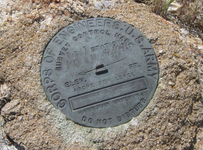
Groan, incorrectly labeled as Moan
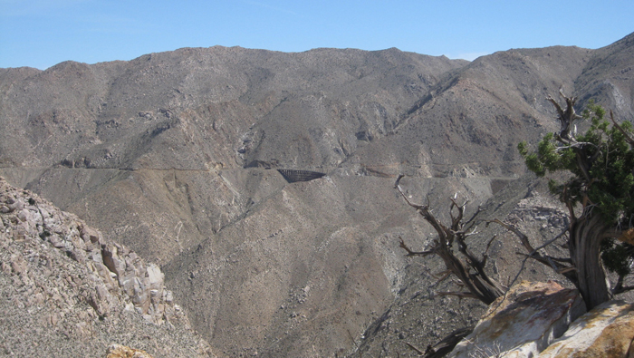
The Goat Canyon trestle
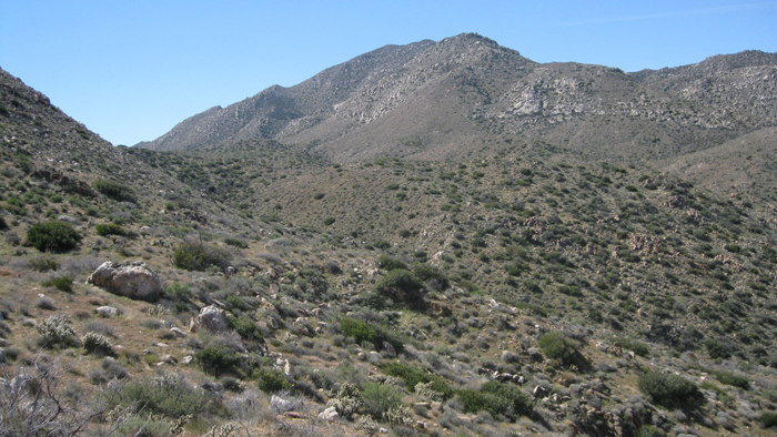
After Tom and I signed in to Groan, we backtracked down to the saddle and then proceeded to drop another 700 feet, this time towards the Gasp benchmark. The terrain was easier than I had expected, and we contoured towards the base of Gasp BM’s eastern ridge, just west of what’s labeled “Palm Grove” on the topo. There didn’t seem be any palms there, but there were small palm groves in several of the surrounding valleys.

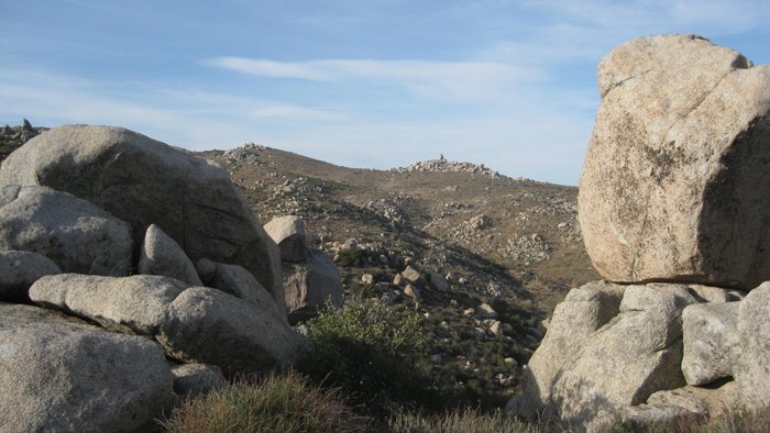
Gasp BM, as we drop down from Groan
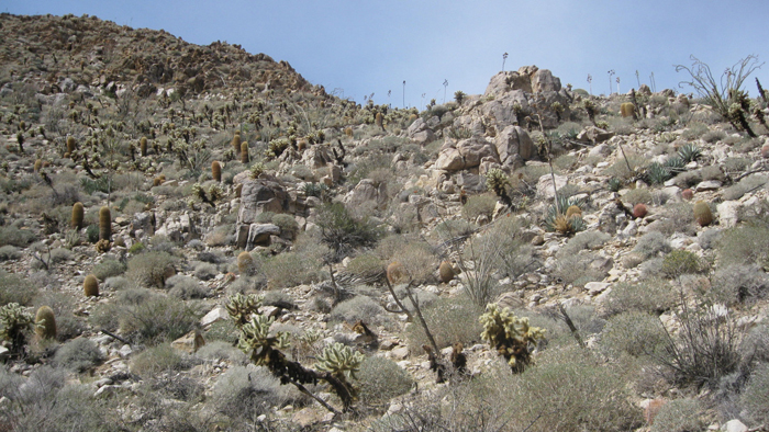
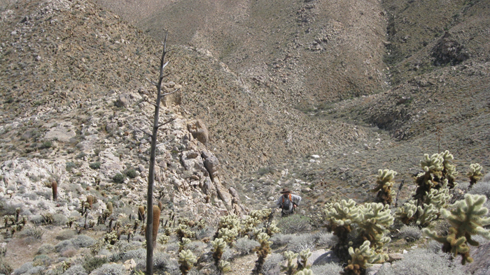
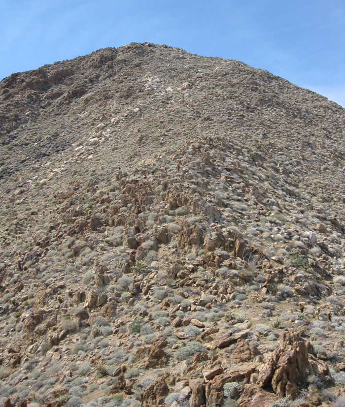
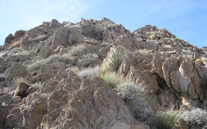
Tom and I had been riding the gravy train all morning, but that would change as we started working our way up 1500 feet of desert ridge, something I had been looking forward to. Having been out the previous four weekends and Tom having partially retired from the mountains for the last two years, I pulled away quickly before stopping to wait, where Tom insisted that I go ahead and meet him at the top. I went on ahead, staying near the center of the ridge, soon reaching a false summit at 3000 feet where I dropped 100 feet and then scrambled up the final 400. Though steep, the footing had been solid and all but just a few spots had been a hands-free affair. The real challenge for me was the wind; we were just 24 hours ahead of one of the more intense storms that would hit the area in the last year, and the wind was relentless. It had been getting increasingly windy throughout the day, and was really hammering the east ridge of Gasp, almost knocking me over a few times. Had the climb had any serious exposure I would not have been a happy camper, that’s for sure.
Starting Gasp’s east ridge
The first few hundred feet
Gasp’s east ridge
Looking back at Tom, just below and to the right of center
The upper east ridge
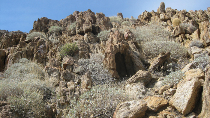
Windcaves
Looking down Gasp’s east ridge
Final little scramble to the Gasp benchmark
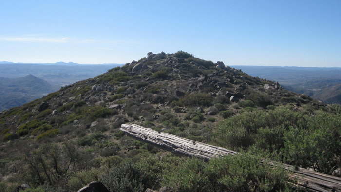
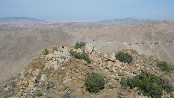
Once I topped out on the ridge, it took me some time to find the register and really what I found was more of a geocache, located next to a still standing survey pole. Its possible that the typical two-can register I had expected was around somewhere, but 10+ minutes of searching turned up nothing. I walked back over to the edge of the ridge and tried to locate Tom to no avail, so I figured I had some time and sought out some shade and shelter from the wind, and ate and drank and admired the spectacular views of Carrizo Gorge. When Tom reached the little sanctuary that I had dug myself into, he complained of muscle cramps and declined a break, wanting to continue on and finish the day, so off we went…

Carrizo Gorge, the railway visible on the left, P2993 in the foreground, Jacumba mountain far right on the horizon
The northern terminus of Carrizo Gorge

One of several palm oases in the area
Gasp with the railway on the right

Sombrero peak far center
From Gasp, Tom and I continued to gain another few hundred feet on milder terrain, up the ridge leading to McCain Valley. A couple of easy class two humps got us to a system of overgrown dirt roads that would eventually lead us all the way back to the truck, though for the sake of saving miles, we did leave the road to go over easy cross country through Redondo Flat. A few easy miles and another 500 feet of gain got us back to the truck, where Tom and I reveled in a great day and started home to enjoy the rest of the weekend, which would be spent indoors and out of the rain (it rained on the way home and the fence in my backyard some 60 miles from Carrizo Gorge had blown down 🙂)
The ridge leading back to the truck from Gasp
The start of the dirt roads
Redondo Flat
The old road leaving Redondo Flat, zig-zagging in the center of the photo
McCain Valley is a great place
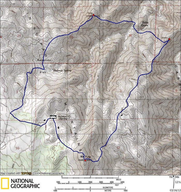
Tule/Gasp/Groan stats: 9.5 miles, 3800 feet gain/loss
*-I’ve added an intermediate point within the driving directions to direct you to McCain Valley Rd, as Google will re-route you onto Ribbonwood Rd.