
Palm Mesa (SDC #13, 4660′) • map • directions
Pike (SDC #12, 5571′)
Cody (SDC #15, 5587′)
I pulled up to the entrance of the Los Coyotes Indian Reservation Saturday morning, paid the entrance fee, and continued on past the pavement and onto well groomed dirt roads. I was familiar with the route to San Ignacio after hiking Squaretop the previous weekend, but it was easy enough to find anyhow. I again felt a little uneasy about passing through a gate with a sign stating that this part of the reservation was off limits to the public, but I had shown the girl at the kiosk where I intended to go and she seemed to think it was fine so I didn’t think too much of it. I stopped briefly at the San Ignacio cemetery, located between a few scattered houses that were long abandoned and in complete disrepair. Continuing on in the truck, I enlisted the use of my GPS to help me locate the trail shown on my topo map. I’d heard that it didn’t exist anymore, and when it became obvious that I wouldn’t find it, I backed the truck up and parked just a few hundred feet east of the cemetery on a small turnout, my starting point for the day’s adventure.
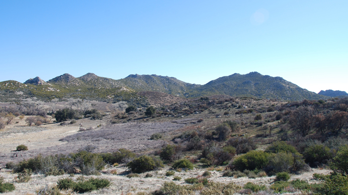
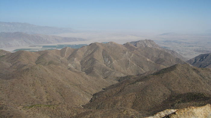
Pike and Cody on the drive in
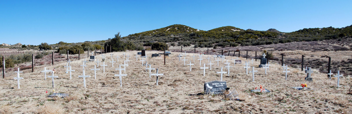
The San Ignacio cemetary
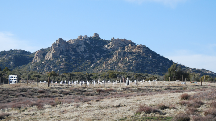
San Ignacio
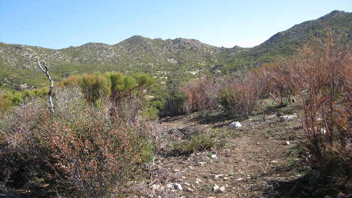
I threw on my small pack and started off on foot at 9:45am, quickly leaving the road and crossing under a large tree before working my up a small hill where the trail should have been. I did in fact find the leftovers from an old use trail at the top of the hill, and followed it down into a small wash. I was able to follow the trail for five or ten minutes, though its benefit over just going cross-country wasn’t much. Soon it fizzled out anyway and I took aim for the saddle between Pike and Cody, two benchmarks that I’d hope to get to after tackling Palm Mesa, the furthest of the three. After dropping 40-50 feet into a second wash and back up the other side, and then repeating that little exercise yet again, I sought out a better route. I could identify a larger wash that seemed to be coming down from the gap between Pike and Cody, so I crossed over one more small wash and into the larger one, which did indeed take me all the way to the saddle between the two peaks.
Heading east, the saddle between Pike and Cody in view
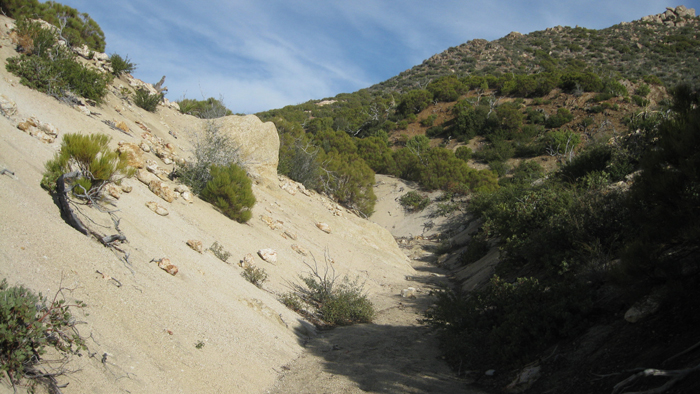
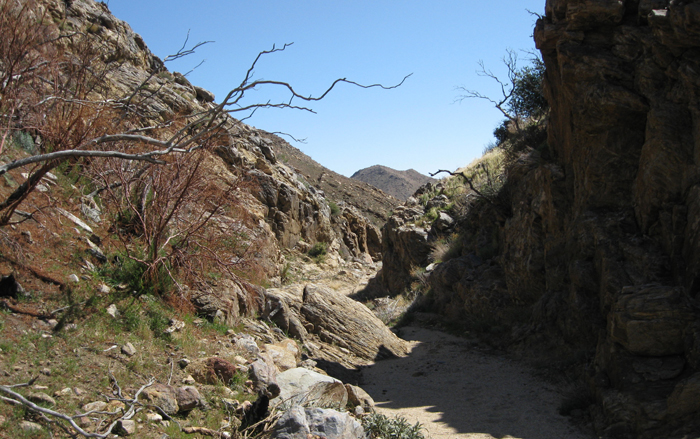
Part of the wash that led me east
Once I reached the saddle I again stumbled upon the old trail, this time more of a benefit than before. I followed it across the lower slopes of Pike, staying a few hundred feet above the wash below, and fixed my eyes on Palm Mesa about two miles out. I was slowly losing elevation, aiming for the uppermost reaches of the massive Borrego Palm Canyon, stopping just once to take a photo of a group of deer in the valley below. Eventually the trail vanished for good, though by this time the land was rather open and I didn’t miss it, and I continued around Pike’s eastern slopes looking for a way to drop in to Borrego Palm. I had a spot in mind that I had chosen from looking at the topo, but wasn’t absolutely sure it would work. When I reached a 10-foot wide notch looking down into the North Fork of Borrego Palm, the route did appear to be feasible. I bypassed a 20 foot tall dryfall across steep slopes on its right side, and dropped into the sandy bottom. It was great going with few obstacles for the first half mile, and then ran into a large dryfall and within sight of another that I did not wish to downclimb. Looking for an alternative, I climbed up a hard-packed dirt slope on my left side, traversed for a short time, then dropped down several hundred feet and met back up with the same wash just an eighth mile or so from the very base of Palm Mesa’s west ridge. I bypassed a final dryfall on its right side and walked out into the intersection of another fork feeding the North Fork of Borrego Palm Canyon, flat, sandy, and as wide as a road. It was cool being this high up in Borrego Palm Canyon. I’d been through its lower terminus just outside of Borrego Springs several times, most notably during two separate ascents (or descents to be more accurate) of Indianhead.
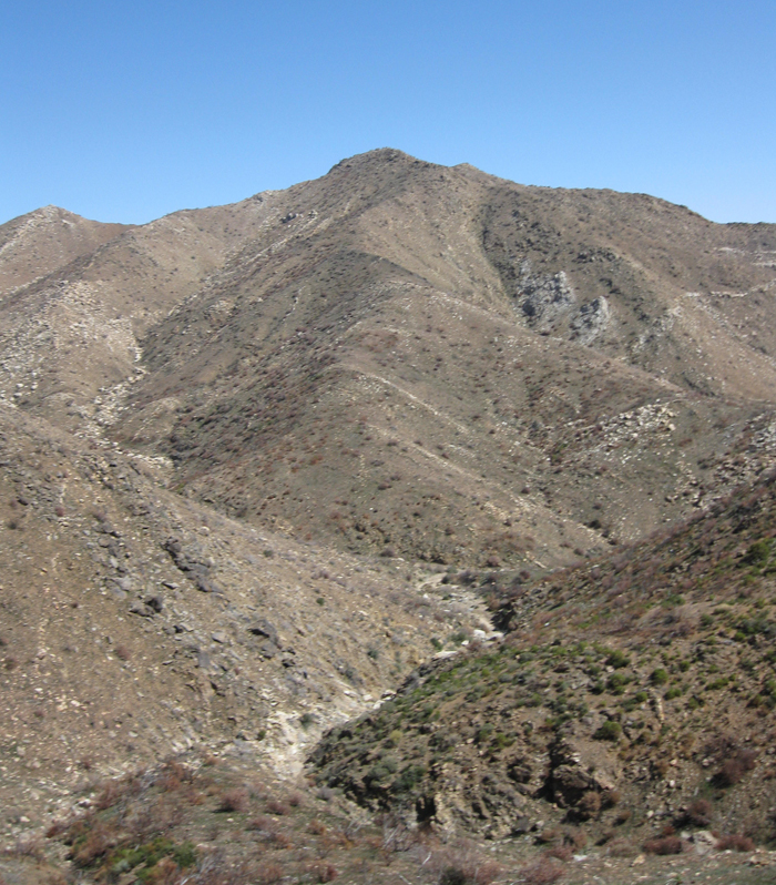
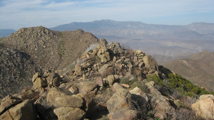
Palm Mesa about 2 miles out from the south slope of Pike
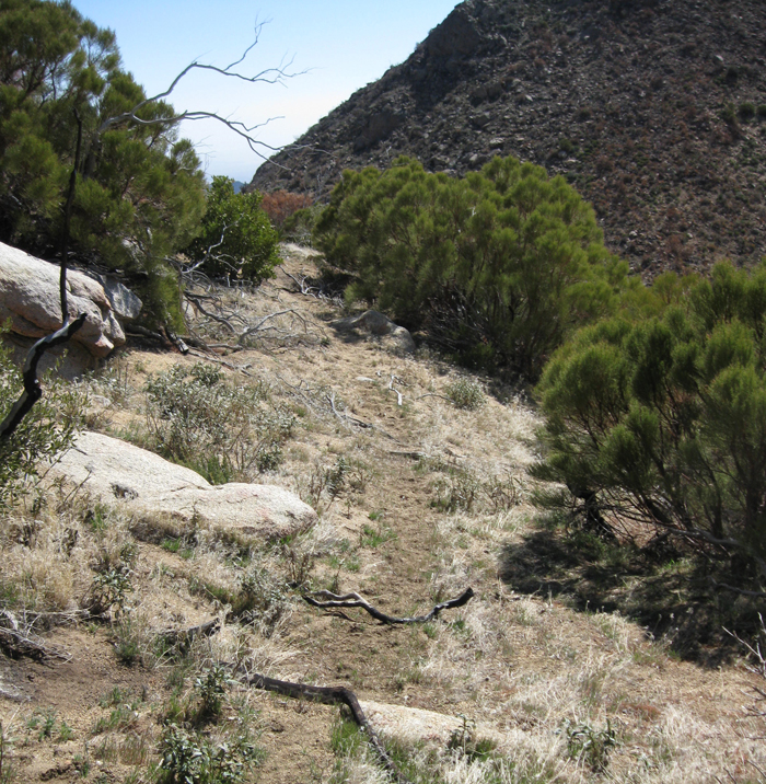
Part of the old trail (?)
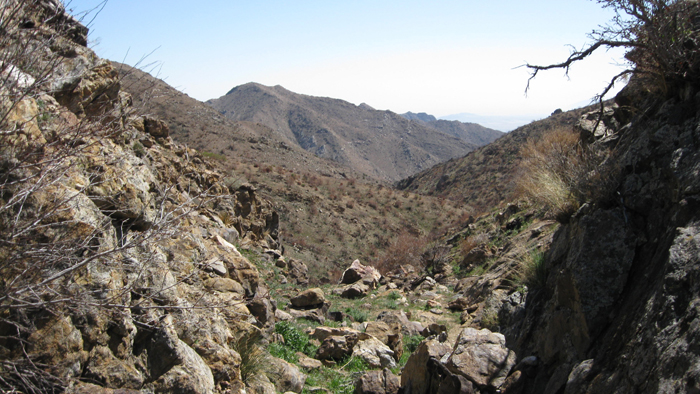
Looking through the notch I used to drop into the North Fork of Borrego Palm Canyon
In the North Fork of Borrego Palm
The west ridge of Palm Mesa, during my bypass of the dryfalls
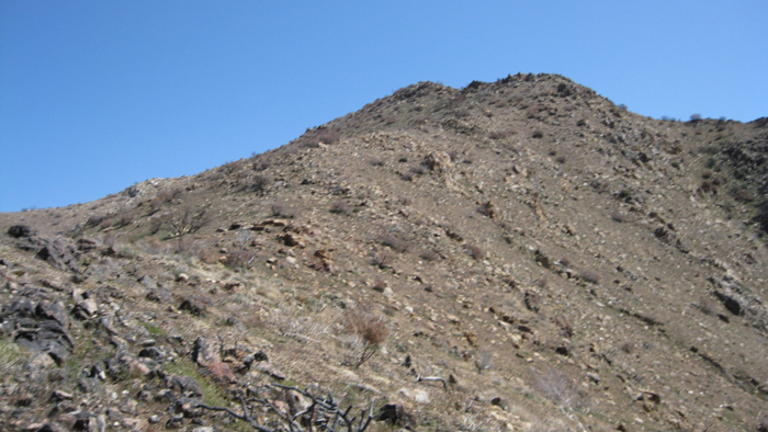
The upper west ridge of Palm Mesa
After losing almost 1500 feet from the saddle between Pike and Cody I was ready to start heading up to Palm Mesa, with about 800 feet to gain in a half mile, a direct but comfortable angle on solid ground with little vegetation to get in the way. It took just under half an hour to navigate the ridge, and I was signing into the register at 12:15pm. The views from Palm Mesa were outstanding, a quality that most Anza Borrego’s summits seemed to share. The register had been placed in 1981, and I thumbed through it before eating my Hostess cherry pie, as to not get cherry filling on the dated booklet. Palm Mesa had been visited by Don Raether just the day before, someone I had happened to meet the previous weekend on Squaretop’s summit. Wow, what a small world. Confident that my sinful yet satisfying 500 calorie snack would hold me over for a while, I walked back down the ridge and back up the way I had come, without pause until I had returned to the eastern slopes of Pike BM.
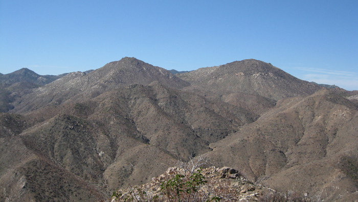
Pike and Cody from Palm Mesa
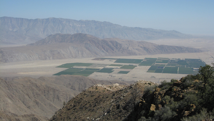
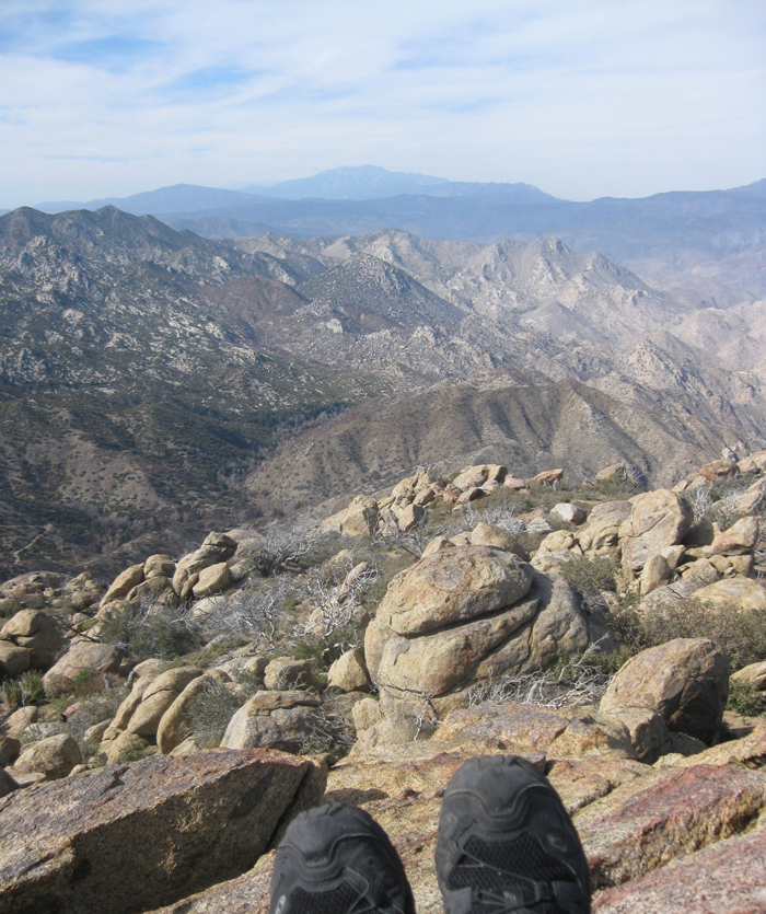
Borrego Springs, Coyote Mountain, and the Santa Rosas from Palm Mesa
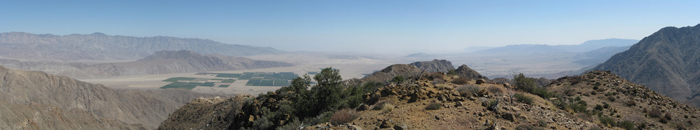
Pano from Palm Mesa
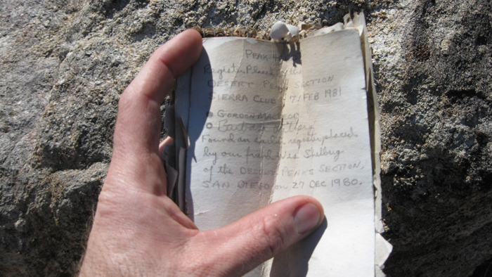
Palm Mesa’s summit register
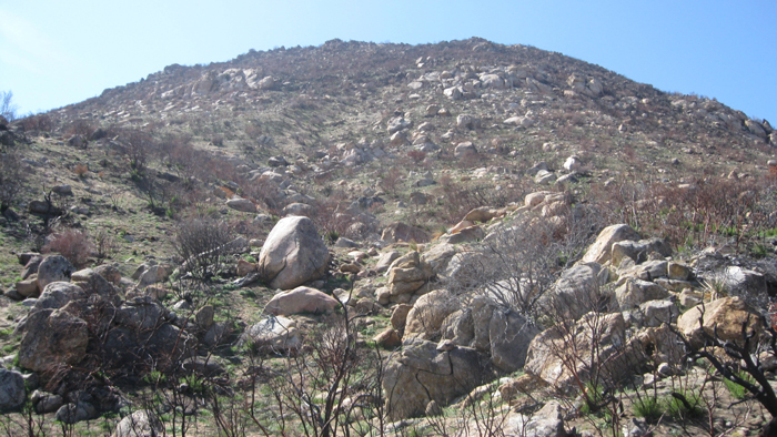
Now I hadn’t mentally committed to hiking both Pike and Cody after returning from Palm Mesa, as I was still supposed to be babying a knee injury. And I told myself that if I did hike them, it would be from the saddle between them as it wasn’t nearly as steep from that direction. But the east side of Pike looked totally doable, I was feeling good, and it was just oh so much more efficient and fun this way. So I covered the 900 feet up Pike’s east side in earnest, scrambling through some brush and rock near the top, and began looking for the register. I looked around the highest rock outcropping with no luck, then another, eventually coming back to the first place I looked. After ten minutes of searching, I finally found it deep within a crack between two rocks just a few feet away from a stick that someone had placed vertically to mark the spot. I signed in, never having found the actual Pike benchmark, and started off towards the high point of the mountain, P5600, just a short distance away (the Pike benchmark wasn’t the actual highpoint of the mountain, but was most likely selected for the SDC list for its amazing vantage point overlooking the Anza Borrego desert). I signed in to the register there also, and started down the southern slopes towards the saddle between Pike and Cody, beginning the descent at 2:45pm on the nose. I scrambled down through a short but steep section of boulders, continuing on to relatively sandy ground (quite welcomed for an easy descent), reaching the low point between the two mountains in no time. Still feeling good and with plenty of daylight remaining, I made my way towards Cody BM. Cody was brushier than Pike was, but it was still relatively easy going. Having the direct nature of the terrain to thank, I covered the 500 vertical feet faster than expected, reaching the Cody Benchmark just 30 minutes after leaving P5600.
Looking up Pike’s east side

Near Pike’s benchmark, P5600 on the left
Looking back at Palm Mesa from Pike
P5600
Cody’s register and benchmark were much less elusive than Pike’s, the register being obvious and the benchmark being partially buried about ten feet to the north. I signed in to the small booklet and admired the views looking east one last time for the day. After dropping down just west of Cody’s summit, I climbed over a short rocky section of the ridge, then contoured towards the highest point of the saddle between Pike and Cody. Ecstatic about the biggest hike I’ve had since my injury, I was loudly humming a few songs that rotated through my head. While I hike this usually ends up being something odd that I haven’t even heard in a long time, this particular day the original Japanese version of Sukiyaki being the most prevalent, haha.
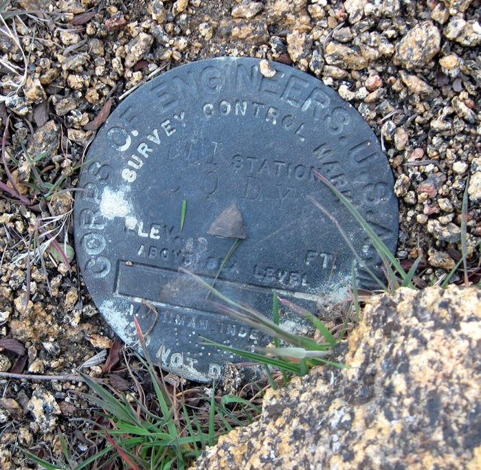
The Cody benchmark
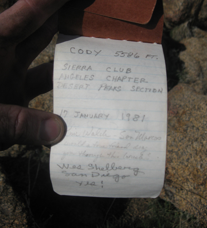
Cody’s register
Pike on the left, from Cody
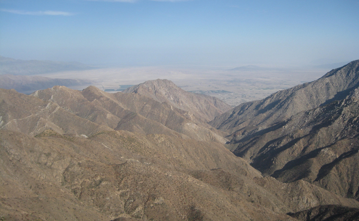
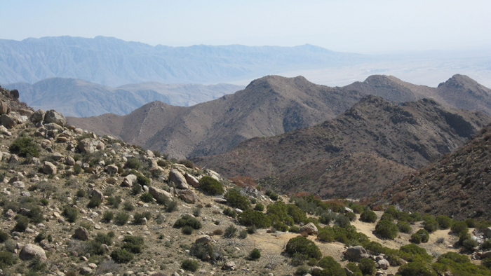
Indianhead and the massive Borrego Palm Canyon, leading out to Borrego Springs
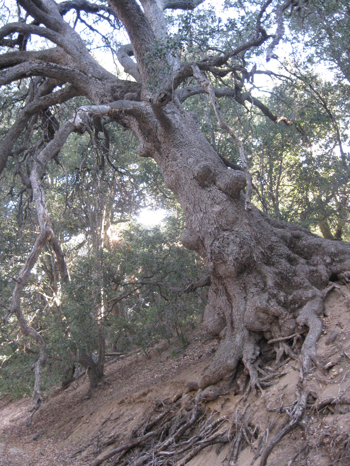
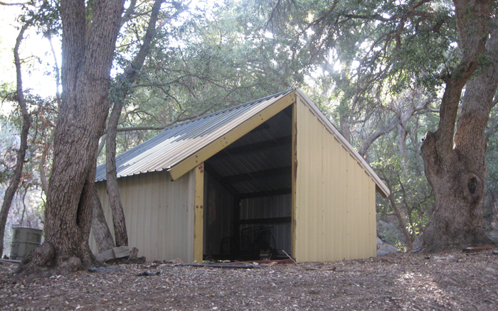
Upon my return to the saddle between Pike and Cody, I wasn’t too thrilled about crossing the many washes that I had crossed on my way in, so I followed the main wash east and then south all the way out to the road. It probably would have been faster to go back the way I came, but I didn’t mind the much lazier return and the area where the wash met the road was heavily wooded and quite nice. I passed an open building tucked back into the trees and some old industrial equipment lying around randomly to which I was curious about the origin, though I knew my curiosity would never be satisfied. I followed the road uphill back towards San Ignacio and my truck, taking my pack off and stretching my legs just after 4:15pm, satisfied with the day’s adventure. I said goodbye to the beautiful Los Coyotes Reservation for the last time, at least regarding the SDC peak list. I’m sure I’ll be back another day…
Back on the reservation
Middle of nowhere
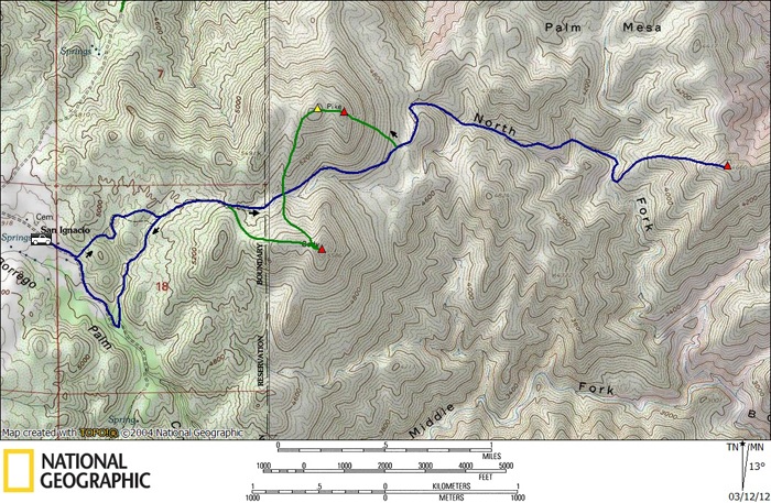
Palm Mesa, Pike, and Cody stats: 9.4 miles roundtrip, 3850 feet gain/loss