
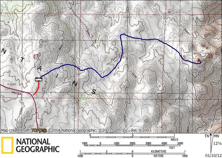
P3339 (SDC #74, 3339′) • map • directions*
I woke up just after 7am in the passenger seat of my Tacoma, the sole occupant of the Lark campground in McCain Valley. I was well rested after having paddled Lake Morena in my kayak the day before, but the wind had picked up quite a bit through night, making it challenging to get out of my warm cocoon and into the cold. Having organized my things before I went to sleep, I needed just a few minutes to brush my teeth, gobble down a bagel and cream cheese with smoked salmon, and drive the few miles of dirt road to my starting point for P3339.
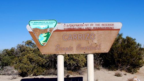
I had hoped to be able to drive down what’s called Lost Valley Road on the map, but the road I assumed to be the one I was looking for was too narrow, crowded with various desert shrubs and cactus. The paint on my truck would thank me… What I did find though, further down McCain Valley Rd, was a side road signed as the Carrizo Overlook, not shown on my map. I drove the short distance to the viewpoint, and to my surprise, there was a trail heading the way I intended to go. I consulted my GPS and decided that even if the trail disagreed with my intentions, off-trail travel would be minimal from here. So I piled on a few jackets, a pair of gloves, etc., and started the descent into the valley below.

Where I began
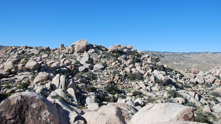
The trail surprisingly indicated at least moderate use, seemingly by mountain bikes and even motorcycles, though the motorcycles were forbidden. Not having seen anyone since the night before though, this side of Carrizo Gorge seemed rather lonely (not to differ from the rest of Carrizo Gorge), at least today. I followed the trail down, down, and down, taking left turns at the two intersections I encountered, to maintain an easterly direction. At a third split, more like a Y-junction this time, I went left again, but quickly backtracked to take the right side of the “Y”, the better option. The route, mostly downhill to an overlook, reminded me a lot of the hike to Roost, which I had quite enjoyed.
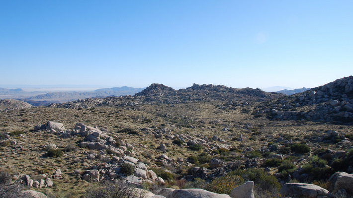
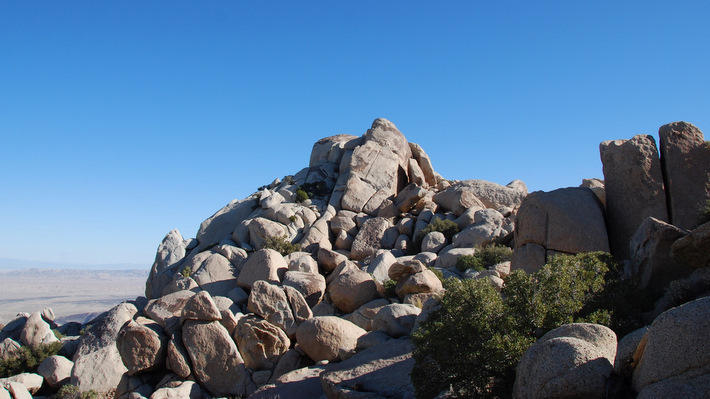
P3339 right of center
The trail continued heading east whilst losing elevation, until eventually turning north and away from P3339 (though I still couldn’t pick out exactly which point was P3339). I debated on parting with the trail to go cross-country, but stuck with it, following it as it again turned east and led me to within a ½ mile of my objective. Then with the first of P3339’s high points looming overhead, I left the trail over easy terrain with only a few hundred feet to gain.
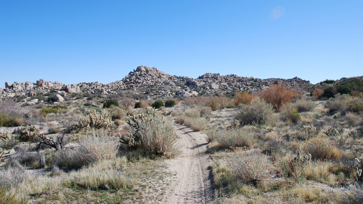
Looking towards P3339 just before I left the trail
On paper, P3339 seemed to be the middle of 3 sub-peaks all within a few hundred feet of each other, so I worked my way around the right side of the first, a prominent rocky tower, and kept in that direction. Climbing over a few small boulder piles, I soon ended up on the south side of the second “bump”, this one being more of a hill with a few massive boulders on top, and what would later be shown to be P3339 on my GPS (handy for these obscure points on the SDC list). From there, I probably had about 40 feet to go, but I could clearly see the third and eastern-most sub-peak, noticeably higher than the other two, and also noticeably tougher. I already suspected that the lower southwest summit (second bump) was the objective, but I wanted to at least give the higher point a go. It took me just a few minutes to get near its base, where I proceeded to climb to within 20 feet or so of the large class 5 summit block, but backed off when the climbing exceeded class 3. I then consulted my GPS, which pointed me back to the lower southwest summit.
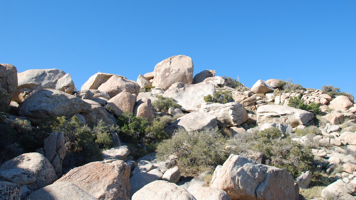
The SW highpoint of P3339
The easternmost and higher point
Looking back at P3339 from near the higher eastern point
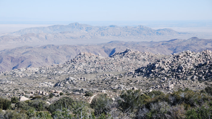
After making my way back to near the southwest summit, I walked around to the north side of the high point, hiking up and into a large gap between the massive summit boulders. I decided not to climb the spicy summit boulder, but instead climbed the second highest boulder with a slightly exposed mantle move, and peered down over the highest boulder, plenty good for me. All the scrambling had warmed me up, so I peeled off a layer and took a few minutes to admire the landscape, to identify a few peaks in the area, and to check out one of my favorite Anza Borrego attractions (thought quite a ways off), the Carrizo Gorge railway.

P3339’s summit block with the eastern summit behind
After a few photos of the fine view, a careful move got me down off the rock and soon after back onto dirt, where I took a few more photos and scrambled back down to the trail and started back for the truck. The return hike went quickly, my mind wandering as I kicked dirt, passing two hikers on their way down to P3339 just as I was almost back. I tried to keep my mouth closed as I drove past the destruction that was SDG+E’s Sunrise Powerlink, the annihilation of McCain Valley, on my drive out. I then took a detour to drive Old Highway 80 and see the obscure town of Jacumba, before heading home to ponder next weekend…

Looking back at P3339 from near the start of the hike, with super-zoom
P3339 stats: 5.4 miles roundtrip, 1200 feet gain/loss
*-I’ve added an intermediate point within the driving directions to direct you to McCain Valley Rd, as Google will re-route you onto Ribbonwood Rd.