
Squaretop (SDC #9, 4649′) • map • directions
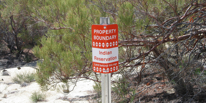
The easiest approach to reach Squaretop appears to be from within the Los Coyotes Indian reservation, so that’s where Christian and I headed this particular Saturday morning. We arrived at the front gate just before 9am, where we paid the entrance fee to the friendly girl at the kiosk. The road quickly turned to well-groomed dirt, and though there were many intersecting roads, it was easy to stay on course. We didn’t see anyone during our drive in, and passed just a handful of structures, ranging from new and modern to abandoned and irreparable. Keeping right at a fork at about 5.5 miles in, we crossed the road that heads east to San Ignacio, and descended on slightly rougher roads towards Squaretop. There were patches of snow on this part of the reservation, particularly on the north facing slopes, leftovers from a brief storm the previous Monday.
When we reached an obvious plateau, Squaretop came into view about 3 miles out, and a white 4Runner was parked near where the “good” road ended. I’d expected to have to hike down about 600 feet from here into the canyon below before turning towards Squaretop, but what was left of an old road seemed to be in alright shape, though probably hadn’t been driven in many years. Overconfident from navigating several other rough roads recently, I drove down the steep road with ease, hitting only minor trouble getting into an appropriate parking spot in loose dirt at the bottom of the canyon. Unbeknownst to us, we would have our share of trouble with the truck later, but the immediate task at hand was to reach Squaretop, so Christian and I set off in a northerly direction on foot.
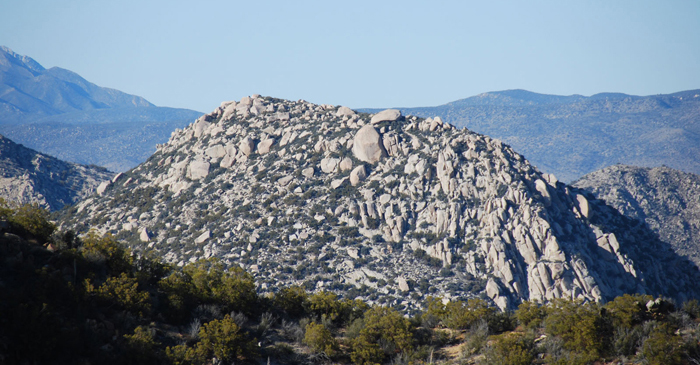
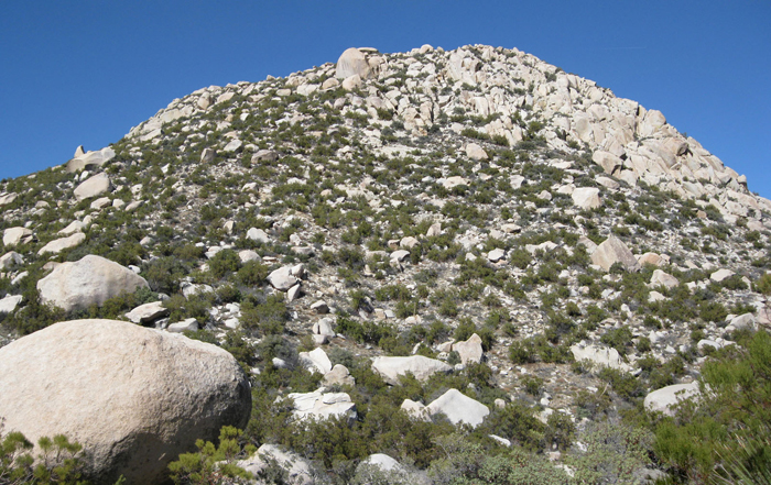
Squaretop from near the parking area, about 3 miles out (11x zoom)
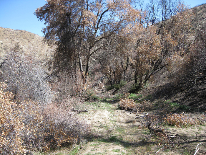
Part of the old road along the canyon bottom
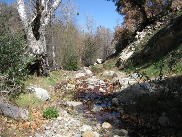
Running water
We followed portions of the old road alongside a shaded stream for the first mile, surely a nice setting. There were remnants of a use trail here and there when the road would fizzle out, and what seemed to be fresh footprints, assumedly from the owners of the 4runner. It would be surprising if there were another party on Squaretop as it received 1 or 2 ascents per year at most, though any other reason for the footprints would be even more unlikely, leading me to conclude that we’d be running into someone with a similar agenda. Even more surprising was that parts of the route had been “tagged” with plastic ribbons tied into trees and shrubs, and way overtagged at that. It seemed rather unnecessary, certainly anyone visiting Squaretop should posses the navigational skills necessary to follow a stream (I removed several of the tags on the way out, hoping to restore the feeling of obscurity that Squaretop offered).
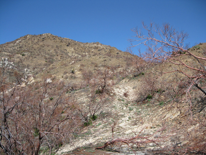
Just over a mile of hiking brought us to more of the old road, splitting left from the stream we had been following. We followed as best we could, soon passing a sign that marked the boundary of the reservation, and entered into Anza Borrego State Park. When the road fizzled out again, we crossed the upper reaches of Cougar Canyon, and again found a more prominent portion of the old road, this time more obvious than before. We followed it up to the east side of a barren hill, what appeared to be the only of many around that wasn’t capped in giant rock formations. After reaching a saddle on the east side of that hill, Squaretop appeared in front, just a stone’s throw away across the south fork of Sheep Canyon.
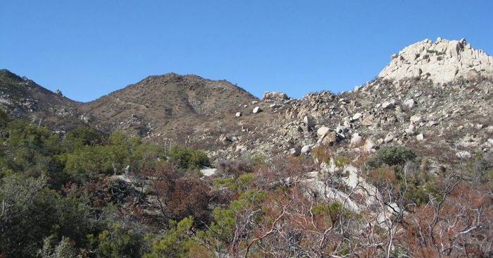
The barren hill, left of center. The old road eventually forks and runs along both sides of the hill.
Leaving the reservation and entering Anza Borrego
Following the old road to the east side of the barren hill
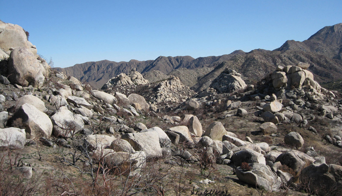
Numerous rock outcroppings
Squaretop from across Sheep Canyon
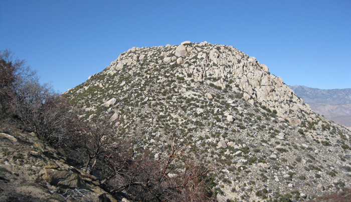
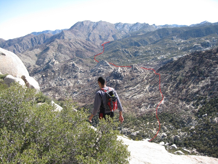
It was hard to tell just how challenging it would be to make it through all the brush and rock on Squaretop’s south side, but we’d find out soon enough. Christian and I dropped down a few hundred feet and climbed through some large boulders to cross the stream running through the south fork of Sheep Canyon, and started up the steep slope leading to Squaretop’s summit. We gained about fifty feet before squeezing around some brush and finding relatively open slopes, making for easy progress. There were frequent sections of brush and/or rock, but it was easy to find a way through and nothing was harder than class 2. We gained a cool 700 feet in a 1/4 mile to reach the summit plateau, and briefly fought through a denser landscape to reach the highpoint. Just as we pulled up, we met the owners of the footprints and the 4Runner, just about to head down. We introduced ourselves and shook hands, and had a chuckle about the unlikeliness of having 2 parties on the summit of Squaretop in one day.
Looking up at Squaretop

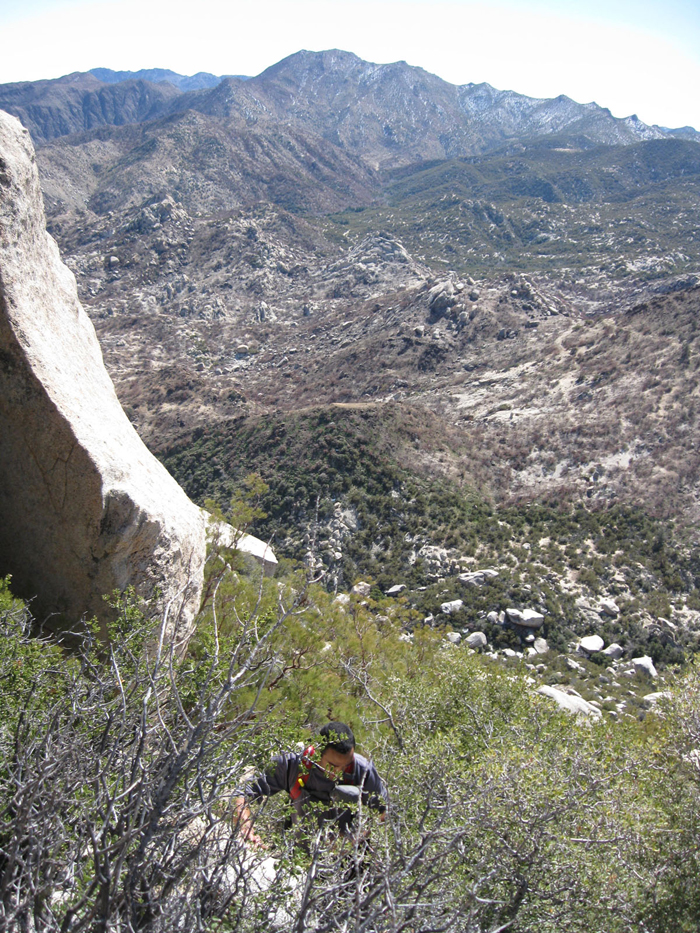
Christian about halfway up
Bushwacking
Reaching Squaretop’s summit plateau
Once the gentlemen began their descent, I examined the tall summit boulder, looking for the easiest way up. Squeezing through Manzanita, I circumnavigated the boulder, deciding that the west side would be easiest. I returned to the east side of the boulder and flaked out my 30 meter rope, then re-coiled most of it in my hand before tossing it over, making a good throw on the first try. I double checked Christian’s harness and belay setup before heading back to the west side of the boulder and tying in. The initial moves were challenging, with thin finger holds and steep smearing for the feet, but it quickly became an easy class 3 slab. I took a minute on top before I asked Christian to lower me, and we switched places. Christian surmounted the boulder a few minutes later and I unclipped to walk back and get a few photos of him, before lowering him down as he had me. After that bit of excitement, we ate a snack and read through the register, populated almost entirely by recognizable names. I snapped a few more pictures, attempting to preserve the views of El Toro, Rabbit Peak, and the rest of the Santa Rosa Mountains, a sliver of the Salton Sea, and Mt. Collins, just to name a few.
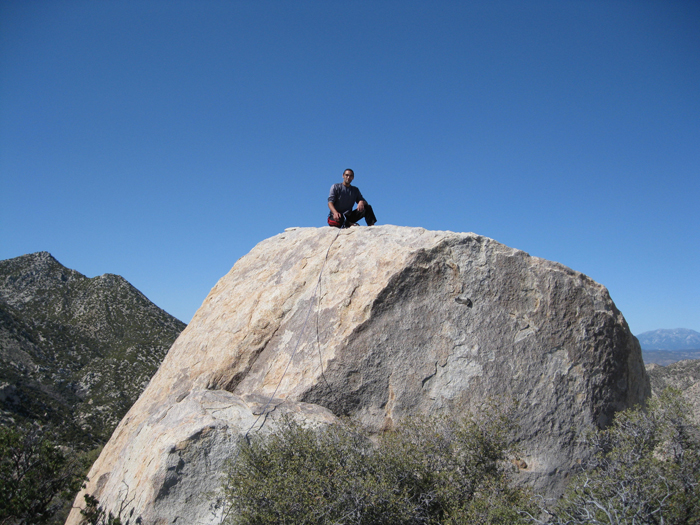
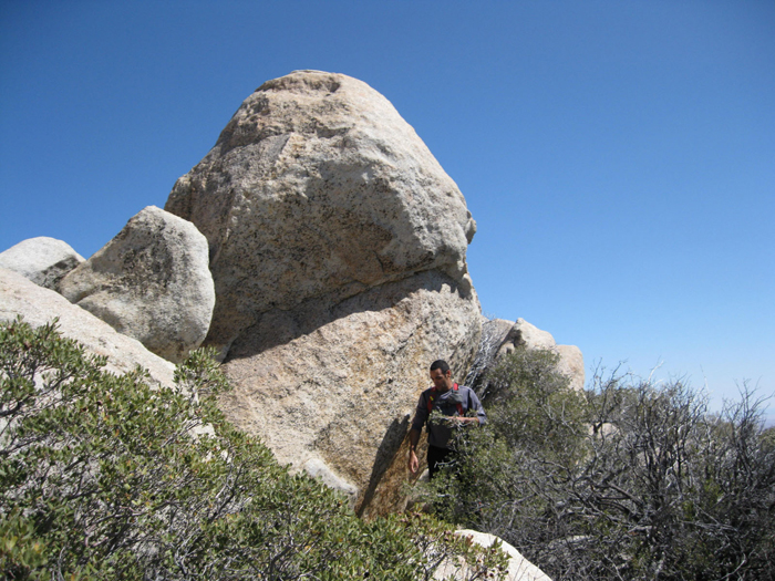
Christian on Squaretop’s summit block
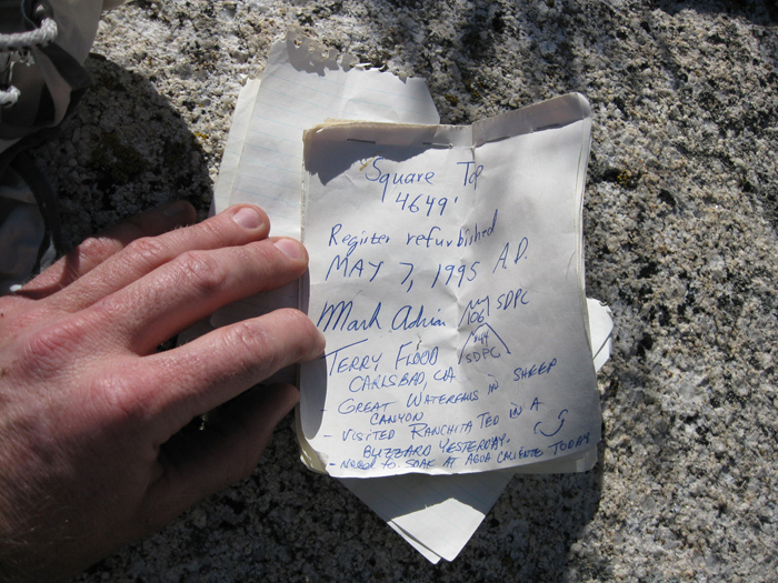
The register
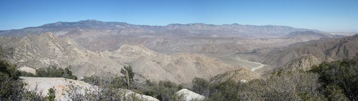
Pano from Squaretop, El Toro on the left horizon, Sheep Canyon below
Once Christian and I signed ourselves in, we began our descent, making good time once we found the more sparsely populated section of the slope where we had come up. Taking just one small break to dump sand out of our shoes, we made it back to the truck with time to spare. Perhaps even, with enough time to visit another peak on the reservation. After spending a few minutes drinking fluids and preparing the appropriate music, we started driving up the steep dirt road and made it just a few hundred feet before my rear wheels lost traction and started digging holes. What had appeared to be hard packed dirt had sections that were more like sand than anything, posing a problem for my 2WD vehicle. I let the truck roll backwards, engaged the rear locking differential, and gave it another go with the same results. Again I tried, and finally a 4th time, I backed up as far I could and went for it, spinning my back wheels and just barely making it through. I attempted to keep momentum to avoid a repeat, but hit a 2nd patch of soft stuff about halfway up. The tires blew away the soft medium, and I again let the truck roll back to harder ground and gunned it. The speedometer read 30mph but the truck inched along at under five, and eventually swam its way to firmer ground. Lucky for us the remainder of the road, though still steep (later calculated to have an 18% grade), went easy. We laughed, admittedly lucky that we weren’t faced with a 7-8 mile walk out to hire an expensive tow truck.
Starting the descent
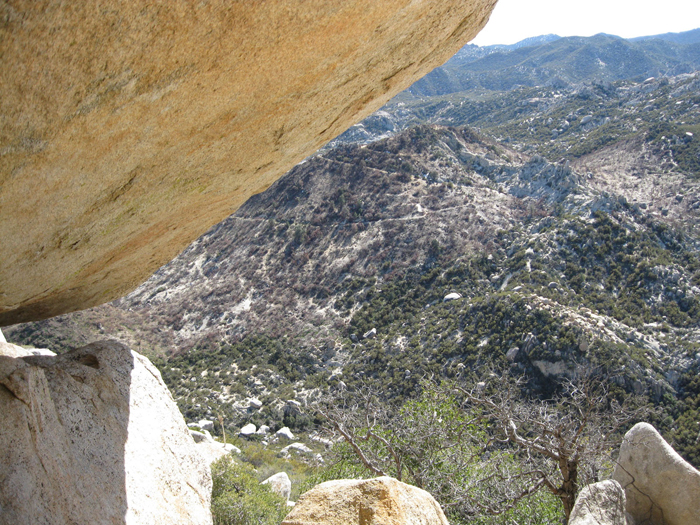
A portal, looking down Squaretop’s south side
Just after 4 o’clock, we were officially supposed to have checked out of the reservation, but I didn’t think a quick visit to San Diego County’s high point would hurt anyone. Hot Springs Mountain lies entirely within the reservation and is 21 feet higher than San Diego’s more famous 2nd highest peak, Cuyamaca, though a much easier ascent. Reports indicated that I’d be able to drive to the top, or close to it, but it turned out to not be our day for Hot Springs Mountain. After several miles of driving up a graded dirt road, we hit patches of snow, becoming more frequent and severe as we went higher, causing the truck to slide and spin the tires. Having pushed our luck with the vehicular gods just 30 minutes previous, we called it off within sight of, but still several miles from the lookout tower near the summit of Hot Springs Mountain. It was somewhat ironic, having reached the seldom-visited and semi-remote Squaretop with relative ease, and to be shafted on a popular drive-up mountain. We chuckled as it added to the oddness of the day, and made the drive out and home, stopping only to fill ourselves with greasy food. A satisfying adventure indeed.
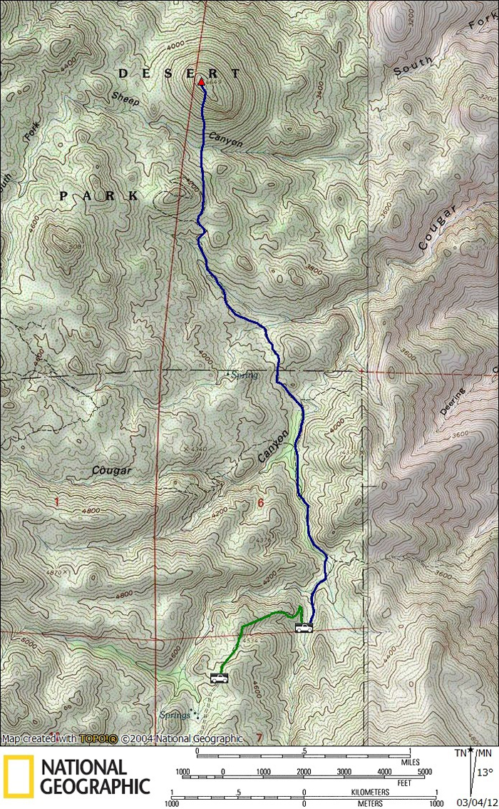
Squaretop stats: 6.0 mi RT, 2150 feet gain/loss (7.5mi RT 2750 feet gain/loss w/road)