
Vallecito (SDC #36, 3583′) • map • directions*
It had been almost one year (January 16th to be exact) since I had been able to tick off another SDC list peak. Certainly not by choice, but I had been forced to deal with a knee problem after biting off more than I could chew in 2009. A trip to Denali, a few trips to the Sierra, and an aggressive plan to annihilate the SDC peak list had proven to be too much, and a lengthy break was (and may still be) needed to get back to normal. Though I did travel and kayak quite a bit, I hadn’t done much hiking, so I was pretty excited about a new SDC peak, this time Vallecito (or P3583).
I chose Vallecito because it was one of the easier peaks I had left on the list, and because I had doubts as to whether we’d even be able to make it to the trailhead I had in mind. On the map, the shortest hiking route looked to be from Dave McCain spring, which meant driving 15 miles of dirt road through one of the more remote areas in Anza Borrego, Hapaha Flat. I’d spoken to two people that had been to Hapaha Flat, neither of whom instilled much confidence that I could get there with my high clearance 2WD Tacoma. To cast even further doubt on our adventure, the map that I’d been using to navigate dirt roads in Anza Borrego for the past few years labeled the roads I intended to use as “4WD.” Not that that has deterred me in the past, but one section even had a “one way only” label, normally saved for only the most severe obstacles. I’d been itching to see what this was all about, so along with my brother, a small air compressor, and a full size jack, we set off to find out.

Frigid temps in Anza
Knowing that we had a long drive, my brother Nick and I reluctantly left my house in San Diego at 5:30 am sharp, the agenda slightly pressed by the fact that Nick had to be back in Orange County by 9pm that night. It was cold out, very cold, with my truck’s temperature gauge falling down to 21F on the way to the desert. I was glad to have my brother with me, mostly because we don’t get the chance to go on too many adventures together, but also because he can keep up on hikes and he’d have no problems lending a hand if my truck got stuck.
We reached Split Mountain at the very eastern edge of San Diego county at 7:30am, and started in on the dirt roads. We started west through Split Mountain itself, then southwest towards the Diablo Drop, then north past the entrance to Sandstone Canyon (signed), and finally up and into Hapaha flat. We cruised the dirt roads with no problem, and there really had only been a few minor obstacles, all of which any vehicle with moderate clearance would be able to negotiate without trouble. There were some short sandy sections, but nothing 4WD would be needed for. And we never did pinpoint exactly what the “one way” label on the map was, but I suspect that etiquette may call this road an “exit” for Hapaha and Harper flats, as there is another one-way entrance called the Pinyon Drop. The entire drive in from Split Mountain had taken under an hour (3hrs from home), and soon after our arrival at the parking area for Dave McCain spring, we packed up and got on our way.
The “trailhead” for the Dave McCain Spring
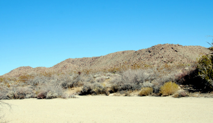
Heading up the wash a few minutes after leaving the truck
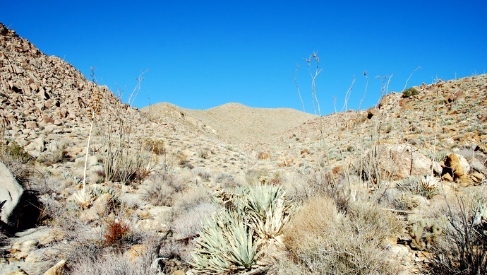
We followed a faint use trail heading from the parking area into the small wash leading to McCain spring, which we soon abandoned to climb up a steep boulder field, aiming for a sizable flat that sits southwest from Vallecito’s summit. After 15-20 minutes of navigating through and over the boulders, we came upon the flat, which did not look flat at all – more like a series of bumps covered with boulders and cactus that could easily double our expected hiking time and effort. We had the time though, so we continued on and soon stumbled upon a small path-sized sandy wash, that led from near the top of the boulder field, winding back and forth for less than a half mile to the large open area southwest of Vallecito. We had stopped only once up until this point, to examine a surprisingly massive and clean spine, broken into two pieces but otherwise intact (my guess it that it had belonged to a Bighorn Sheep, but I haven’t tried to look it up yet).
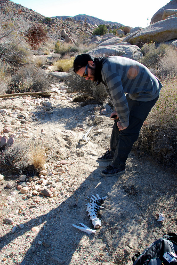
A spine en route to Vallecito
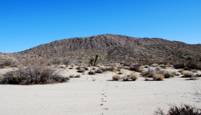
Once the flat opened up, it seemed obvious on where to go. Only it wasn’t. We almost set off for Vallecito’s slightly lower west summit, what looked to easily be the dominant peak from where we were. Further complicating things was a mysterious set of footprints heading off in that direction (I had definitely not expected fresh foot prints on Vallecito). My map however, pointed us north towards a series of rounded hills, uninspiring compared to the west summit in plain sight. After deliberating over a snack, I decided to trust the map over my eyes, so Nick and I booked it north, knowing that somewhere in that cluster of rocky summits was our destination.
The lower west summit of the Vallecito Mountains, w/footprints
The higher east summit of Vallecito, buried behind the point left of center
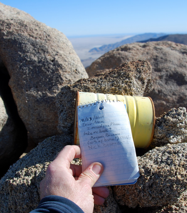
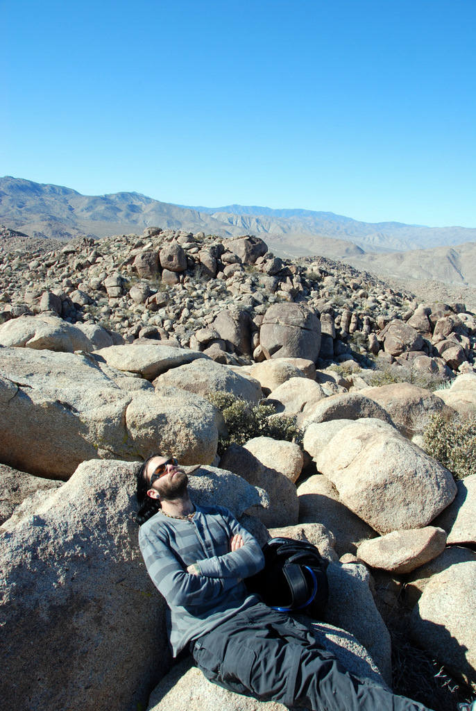
We aimed for a short boulder-filled gully, and began scrambling in earnest when the sand ran out, knowing we had just 300 vertical feet to go. Right as we were about to crest the high point, that feeling that I get only on a remote Anza Borrego summit started to wash over me, until seeing the real highpoint 15 minutes away, managed to squash that real quick. We scrambled down 75 feet and back up, finding the coveted summit log, first placed in 1980 and last signed just 5 days previous (by the owner of the mysterious footprints I presume). The summit log only had about 25-30 entries, and what seemed to be a 12 year gap in its early years. Accompanying the summit log of course was a spectacular view, especially in the east towards the Salton Sea.

Near the false summit
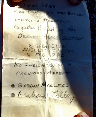
The register on Vallecito
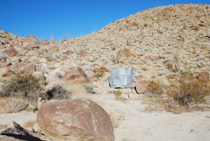
Though the weather had been pleasant on our way up, the cold and wind was less than ideal up top, so Nick and I signed in, took a few pictures, wolfed down a snack, and started back down the way we had come up. We found a slightly easier way to head down from the summit, but otherwise retraced our steps back to the truck. I took a small detour while Nick relaxed on a nice rock, to follow a metal pipe that I suspected led to where Dave McCain spring was (now dry). I had hopes of finding some Native American relics or broken pottery, which I had read could be found in the area. Instead what I found was a couple of water tanks, and a motion detecting camera set up to capture some wildlife. I’m not sure how many pictures it took of me as I snooped around, but I stuck my face in front of it for a close up that’s sure to either brighten or disappoint someone’s future day.
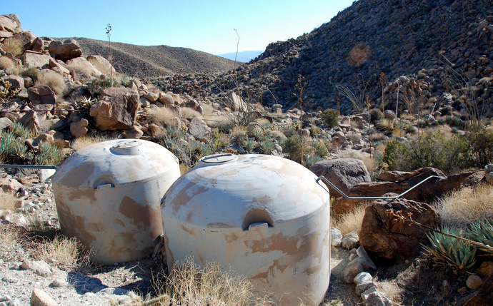
Water tanks – I believe from a bighorn sheep water project
Nick waiting near the trailhead
Upon completing our foot-journey, my brother and I relaxed near the truck before unsuccessfully looking for Split Rock and its petroglyphs on the other side of Hapaha Flat. Another hour of off-road driving got us onto paved roads, where we turned back for San Diego, got cleaned up, and got my brother home in Orange County at 8:55, 5 minutes to spare. I’d spend the next 3 days up there with him celebrating Christmas with our parents, my Christmas already off to a great start – back in Anza Borrego, and with my brother to boot.
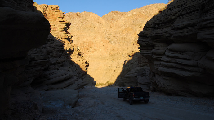
Driving through Split Mountain on the way out
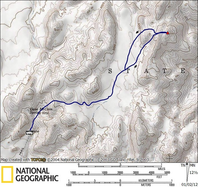
Vallecito stats: 5.1 miles roundtrip, 1100 feet gain/loss
Driving to Dave McCain Spring
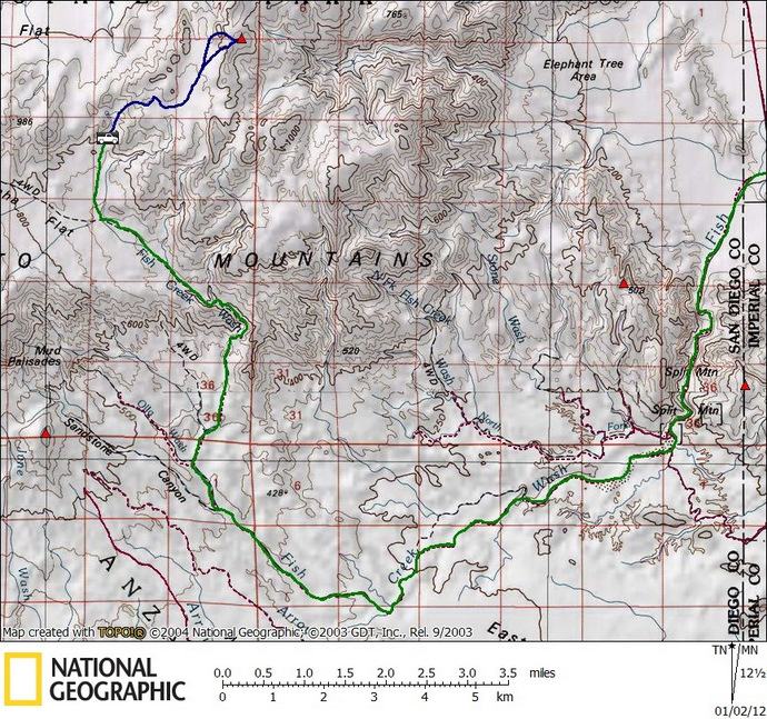
*the driving directions get you to Split Mountain. From there follow the green route on the above map, or even better, consult a Tom Harrison backcountry recreation map. Moderate clearance and ability to deal with small patches of sand is recommended.