
Jacumba (SDC #84, 4516′) • map • directions*
Looking for an easy hike this weekend, I set my sights on one of the only single-peak hikes I had left on the SDC list, Jacumba Mountain. Normally reached through Mortero Palm Canyon, I sought out something new since I had been up that way before. I studied maps around the southern end of the mountain and found a feasible route assuming that I could navigate the maze of dirt roads just north of Interstate 8. I was determined to make it happen.
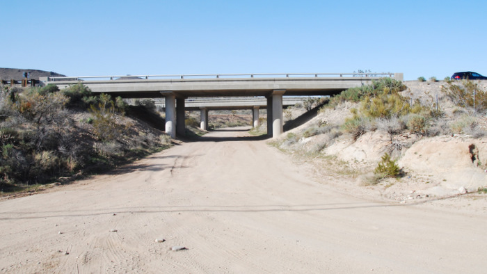
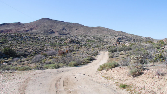
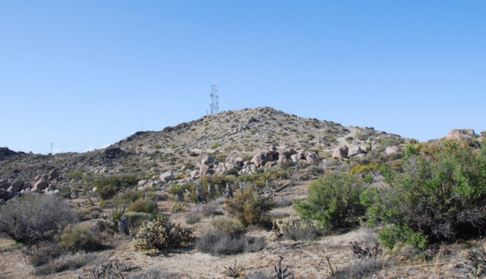
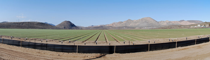
I left home just after 8am along with my friend Eris to keep me company. She wasn’t interested in boulder hopping and dodging cactus but she’d be fine keeping herself occupied while I thrashed about. Coffee in hand, we made the drive out on the 8 to the In-Ko-Pah exit then looped around and onto the dirt road that passed back underneath the 8. I’d tried to make sense of the network of dirt roads here ahead of time but luck and a sense of direction turned out to be more valuable. I just made sure to keep the obvious Table Mountain on my left until I was further north, then just kept heading towards the south ridge of Jacumba, passing a radio tower on its left side a little more than halfway there. We somehow got lucky and ended up exactly where we were trying to get to. The roads were okay, no problem with 2WD and high clearance.
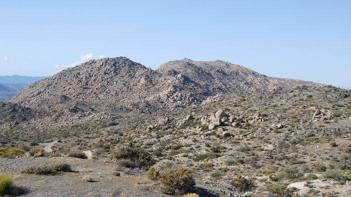
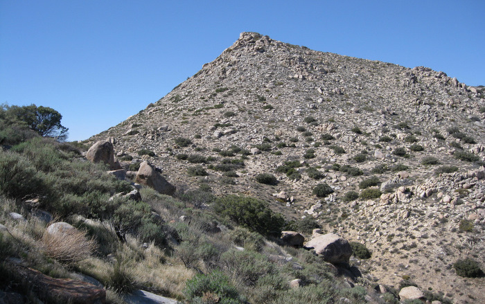
From where we parked, Jacumba appeared to be a jumbled mess of rocky points and I had a hard time deciding on an appropriate route. I kept my eyes fixed in that direction as I shoved some snacks and extra clothing in my backpack, and assured Eris that I’d be back soon. I hiked about half a mile to my right (east) before starting up, hoping to avoid a series of ups and downs while en route to the base of the peak.
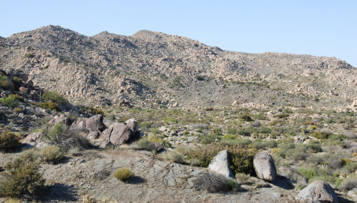
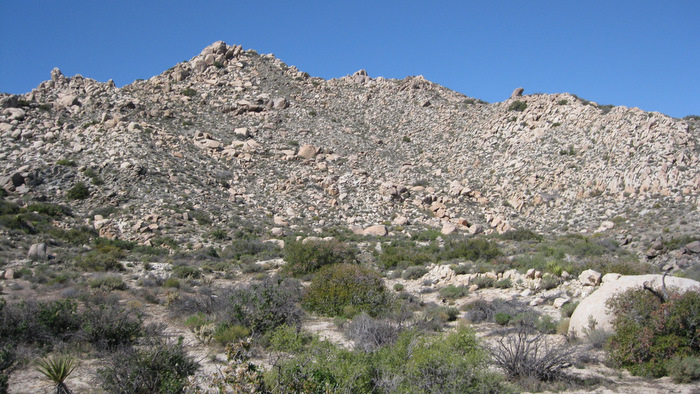
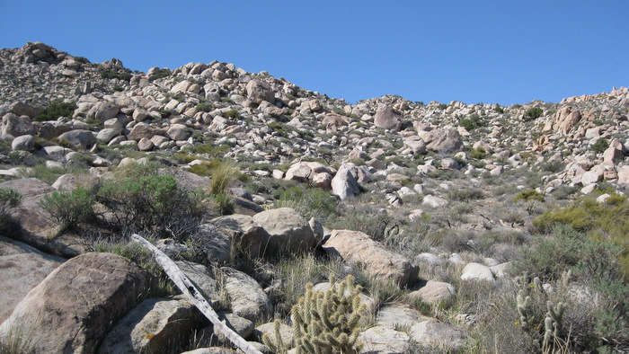
Initially the terrain was easier than it first appeared with open paths between cactus and rock, keeping the obstacle dodging to a minimum. I gained the first 500 feet or so rather quickly then side-hilled a boulder-strewn slope which required a more hands-on effort. Reaching steeper but easier terrain, I worked my way up a 300 foot slope to land on the upper plateau, where just ten more minutes of uphill effort got me to the highpoint and register.
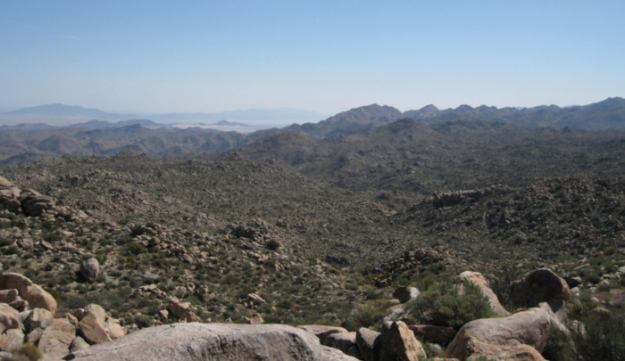

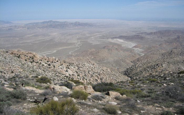
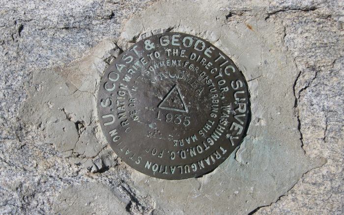
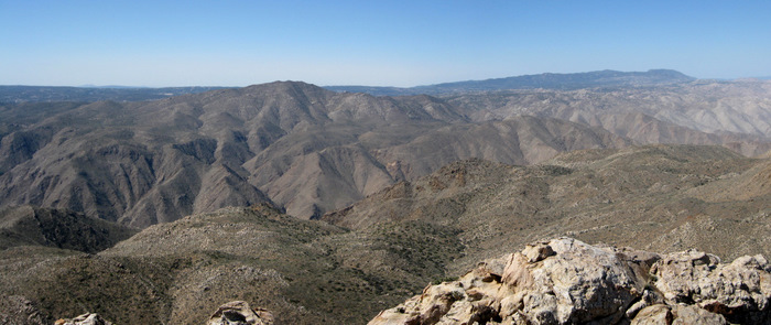

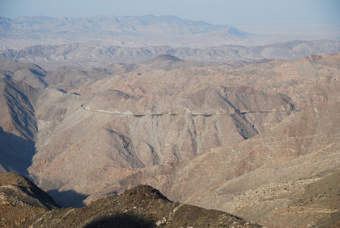
The views from Jacumba were impressive, looking into the upper reaches of Carrizo Gorge to the immediate west and to the desert floor to the east. Most of the major southern Anza Borrego peaks were in view and the weather was comfortable on the rocky summit. The register was popular compared to other Anza Borrego peaks, I’m guessing due to Jacumba’s inclusion in the DPS peak list. I swallowed a mouthful of energy gel and went back the way I’d come, returning to the truck three hours on the nose after leaving.

Eris had done some writing in her notebook, dabbled in desert photography, taken a nap, and was happily relaxed upon my return. About halfway back out to the 8, a guy on a quad whipped around a blind corner and came to stop with the help of my (stopped) front bumper. The damage was minimal, but we exchanged info and went on our separate ways (he ghosted me but my insurance went after him and covered repairs).
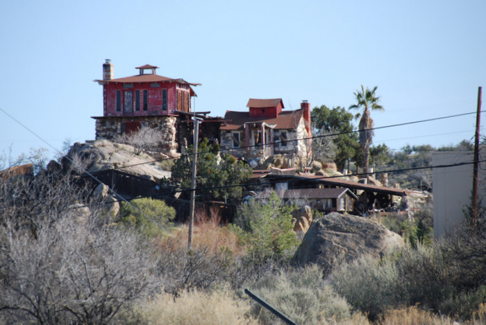
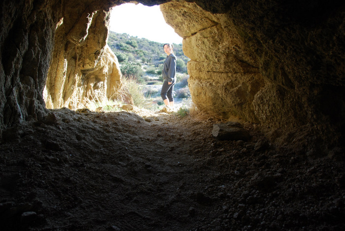
On the way home we visited the town of Jacumba, a small eclectic community that I’ve visited once before. The place is full of interesting and bizarre sights and I’d wanted to show Eris. We continued along Old Hwy 80 to McCain Valley Road to scout future hikes to Mt. Tule and the Gasp and Groan benchmarks. I debated on hiking Mt. Tule today but it made sense to loop it together with Gasp and Groan at a later date. Eris and I killed the rest of the day exploring a small cave in the area and taking in the views of Carrizo Gorge at the Sacotone Overlook.
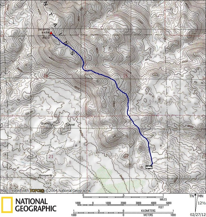
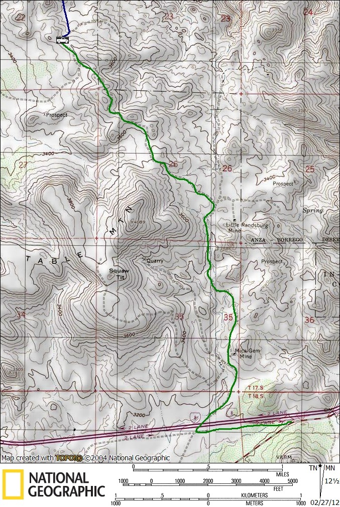
*- regarding the driving directions, Google gets you to the beginning of the dirt roads. It would be difficult to accurately describe the driving route from there, but to reach the south ridge of Jacumba, as a general rule of thumb, keep Table Mountain near to your left and pass the radio towers on their left, driving north turning northwest towards Jacumba Mountain. High clearance required.