
Split Mountain East (SDC #50, 1690′) • map • directions
Split Mountain West (SDC #49, 1690′)
Split Mountain East
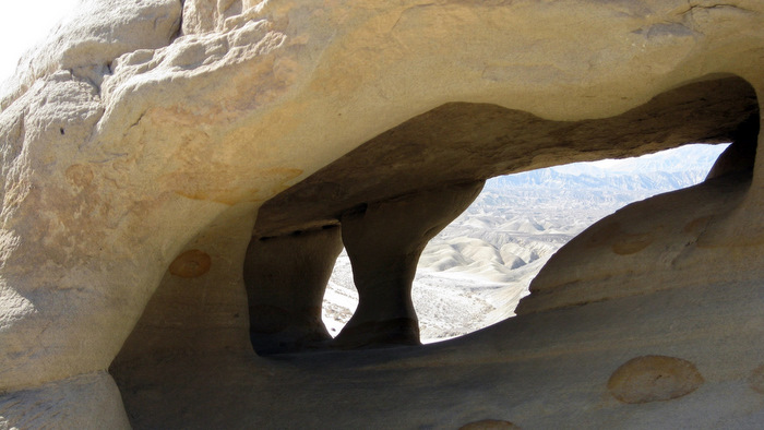
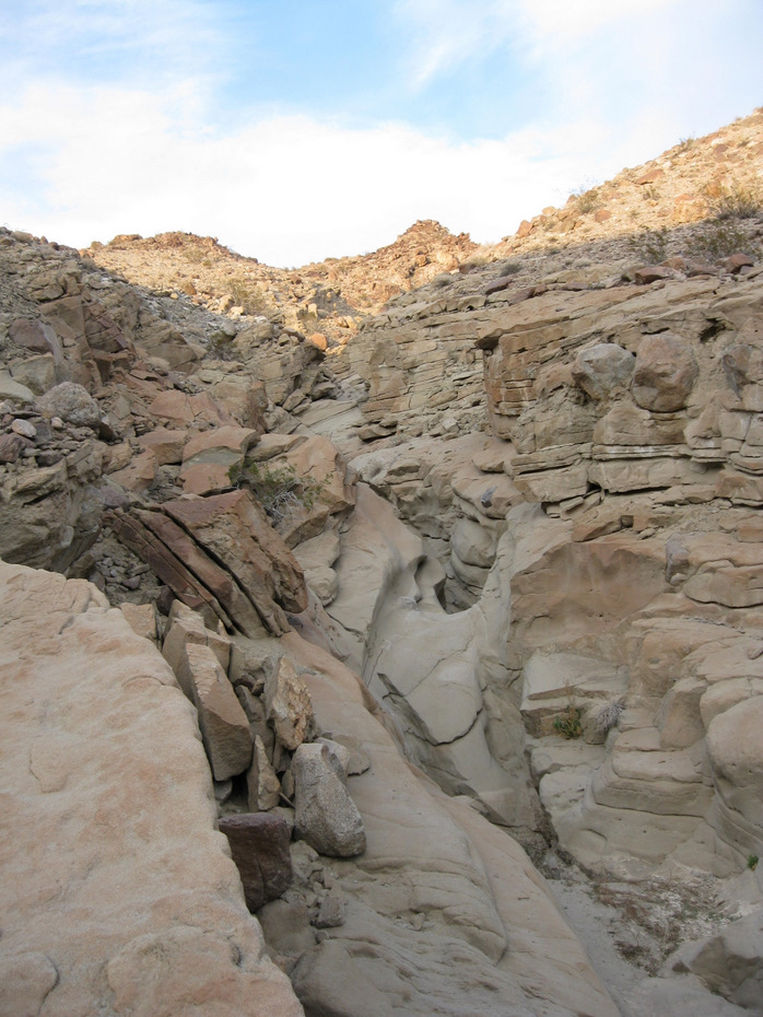
After two hours on the road, my friend Matt and I (in separate vehicles) pulled up to the trailhead for the Wind Caves. The trailhead was marked by a small sign on the left hand side, just after driving through the narrow walls of Split Mountain via the road that splits it in half. Both halves of Split Mountain would happen to be on the hiking menu for the day, starting off with the east summit. Once settled into our sandy parking spot, Matt and I didn’t waste much time getting our feet on the ground, and the trail to the wind caves gave us an easy start. We reached the caves in under 15 minutes, which were much larger than what I had expected. Impressive formations due to the fact that they were of course, carved out by the wind. We didn’t stay more than a minute or two however, eager to start gaining a few feet.
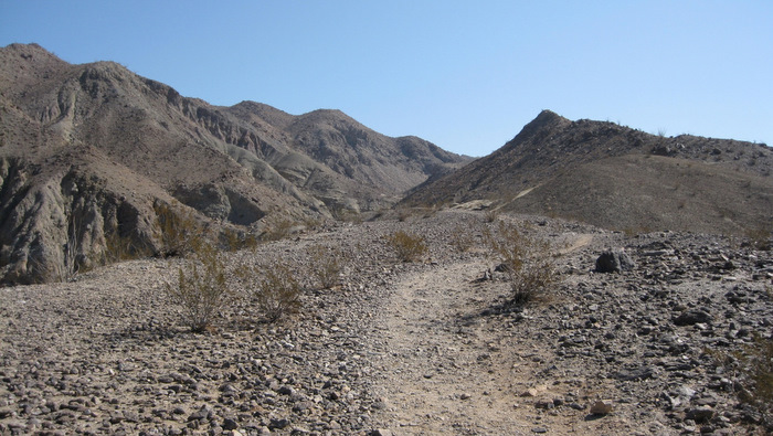
The trail to the wind caves
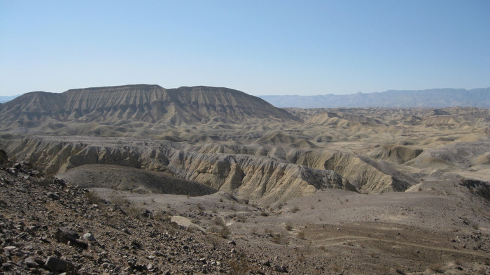
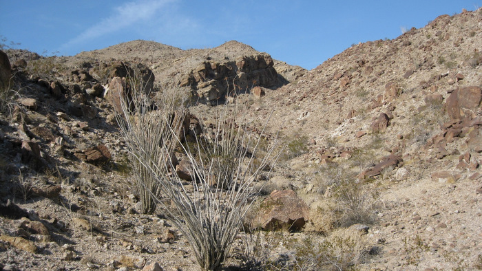
Interesting landscape
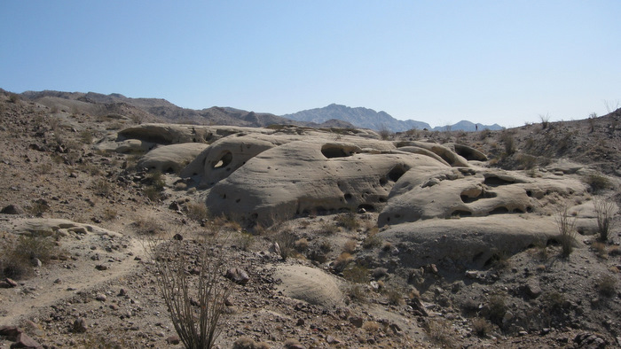
The wind caves
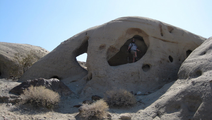
Matt in one of the larger caves
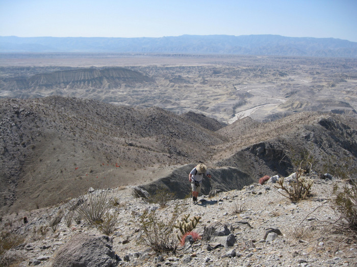
From the uppermost wind cave, Matt and I continued along a faint use trail that led to the southern bank of a prominent wash. We followed the trail and the wash eastward for a few minutes before both turned north, leading to within half a mile from the the eastern summit of Split Mountain, or P1690. From there the trail fizzled out, and the easiest route appeared to involve dropping a hundred feet or so into the narrow wash, then heading back up the other side and taking a short ridge to the top. So that’s exactly what we did. It went faster than it looked, and the views really started to open up when we were partway up the short ridge. We reached the top in a leisurely hour and twenty minutes after leaving the car.
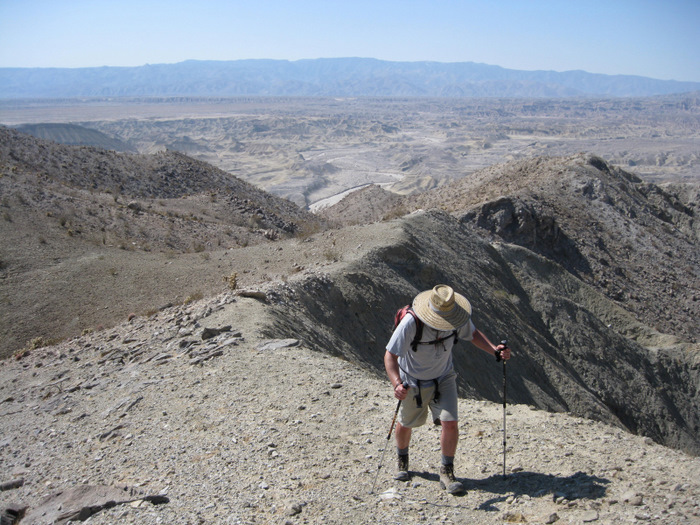
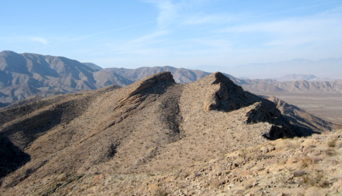
Matt on the ridge leading to P1690 East
Matt on the ridge
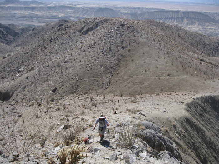
More ridge
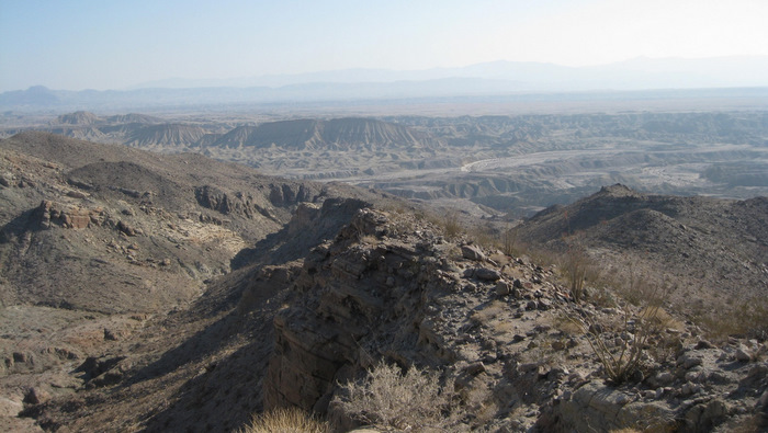
The 1690′ point designated by the SDC peak list as Split Mountain East isn’t actually the highpoint of the mountain, but it sure made for fine views. It was an uncharacteristically hazy day, but we could clearly see Vallecito, Whale, Sombrero, Stage, the Sawtooth mountains, and the Salton Sea. And of course the west side of Split Mountain was a stone’s throw away. I read through the register, which seemed to receive a few visits a year, and signed both Matt and I in – made extra special by the fact that this was the first peak I’d hit with Matt in several years. After about 10 minutes on top, Matt and I reversed our route down the ridge, but elected to follow the wash out rather than climbing back up to its opposite edge. Eventually we did climb up about 60 feet or so to get back on to the use trail leading back down to the wind caves. We stopped briefly at the caves to get some photos, and reached the truck shortly after, thrilled to still have the better half of the day.
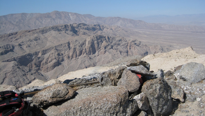
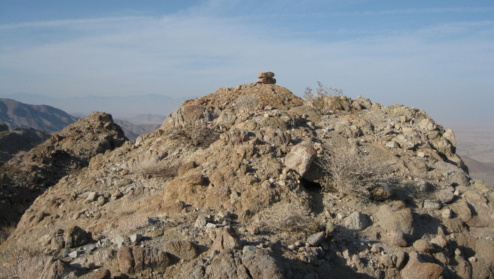
The summit register, with views of the west side of Split Mountain and Vallecito on the left skyline.

Matt near a giant wall within the wash during our descent
The Fish Creek wash down below, from the wind caves
After getting down from the east side of Split Mountain, Matt and I drove over to, as far as I could tell, the best starting point to reach the west side of Split Mountain. I had pre-programmed a waypoint into my GPS to help figure out where to start, since I suspected (and was right) that the area would consist of barely distinguishable washes and foothills. I ate a leftover half steak sandwich I’d stashed away in my cooler as I studied the map, and Matt peeled away in his truck to indulge in another desert hobby of his, shooting. We agreed to meet back at this spot in 3 hours, and I started up through Oyster Shell wash.
Terrain after leaving Oyster Shell Wash
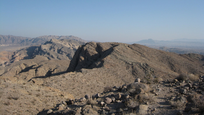
Looking back down the ridge, towards the Fish Creek wash
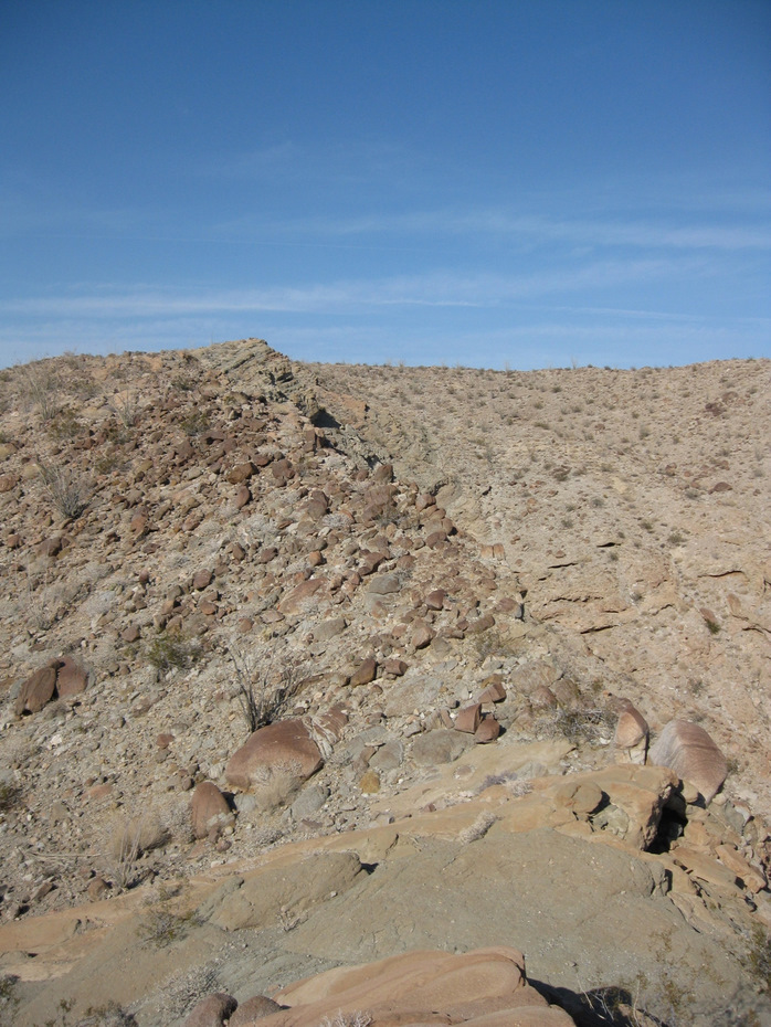
The ridge heading up
After just a few minutes, I scrambled up the right hand side of the wash and started on a direct path to Split Mountain West. I preferred to stay high, having an easier time on the mixed desert dirt and rock than dodging obstacles in the washes and valleys, and eventually found myself on a prominent ridge heading right towards the high point. Though I couldn’t see the entire ridge, it looked good on the map and the terrain so far was easy. I came across one “notch” where I had to lose just 20 feet or so, and reached what the map shows as Split Mountain West’s high point in under an hour from the truck. I found a few cheesy summit registers, mostly loose paper shoved into a several plastic Coke bottles that looked more like trash to me (extracting the papers to read would not be easy anyhow).
Now I knew that there was some discrepancy about which was the true high point of Split Mountain West, though I originally had no intentions of getting to both summits. The topo map indicates that the southernmost point is greater in elevation, but when I saw the double-pointed northern summit, it sure looked higher, and cooler for that matter. I consulted my GPS for a second opinion, and confirmed that the SDC listed point is the northernmost point. This was a little surprising because the elevation listed for the SDC peak matches the southernmost point on the map, but I was perfectly happy to visit both summits.
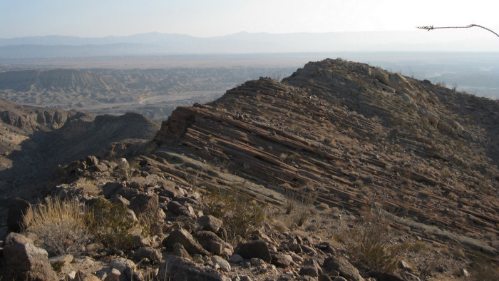
Looking towards the higher Split Mountain high point (the left point)
I gave myself 30 minutes to get over to the northern highpoint, but grossly overestimated and cruised it in just 15. I saw a stack of rocks on the right side of the double-pointed summit, and climbed up to it before realizing that the other side was definitely higher. I immediately climbed back down and worked my way over, staying to the left of the almost sheer wall until I climbed my way up an easy slope to the top, where I found the more traditional red-canned Anza Borrego summit register.
This lured me to the wrong side of the high point
Looking back at what the map calls the summit of Split Mountain West

An explanation of the high points
Without taking off my pack, I snapped a few pictures and started browsing the register. Wes Shelberg is easily the most prominent name in Anza Borrego summit registers, and he had placed this one along with an explanation of the Split Mountain West high points in 1993, one of the more recent Anza registers I’d seen. Once I finished thumbing through and signed myself in, I started thinking of all that good food down at the truck. I almost descended into Oyster Shell Wash, probably a more direct route back, but out of laziness I went back almost the exact way I had come up. I reached the truck just 5 minutes after Matt had arrived, you couldn’t ask for better timing. We set up camp right there, and spent the night eating campfire re-heated pizza, sausages, flavored marshmallows, and washing it all down with a few beers. Another way I like to enjoy the desert…
Heading back across the ridge I came up
A cool twisted dryfall near Oyster Shell Wash
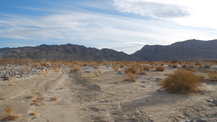
Looking at Split Mountain from the east
Split East is on the left, West on the right. Split Mountain Road passes between them

Split Mountain East stats: 4.0 miles roundtrip, 1400 feet gain/loss
Split Mountain West (both summits) stats: 3.7 miles roundtrip, 1400 feet gain/loss