
Split Mountain East (SDC #50, 1690′) • map • directions
Split Mountain West (SDC #49, 1690′)
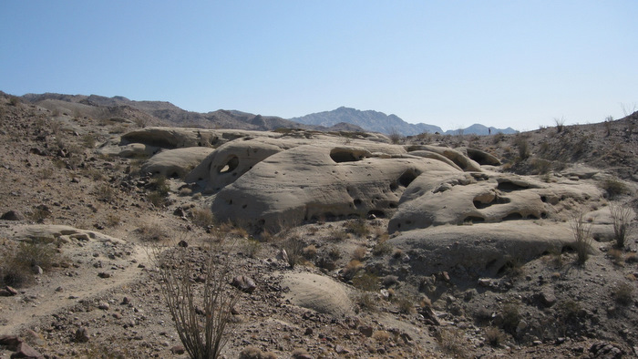
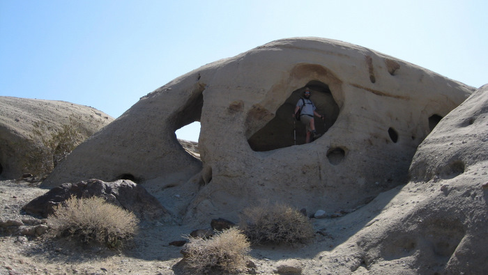
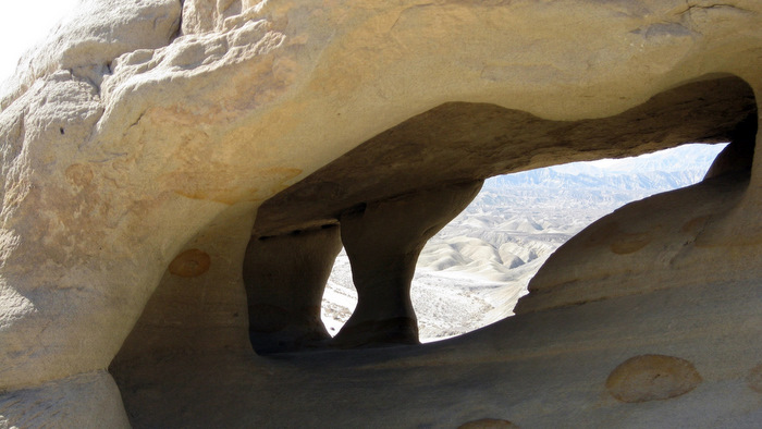
After two hours on the road my friend Matt and I (in separate vehicles) pulled up to the trailhead for the Wind Caves. The trailhead was marked by a small sign on the left hand side just after driving through the narrow walls of Split Mountain via the road that splits it in half. Both halves of Split Mountain were on the hiking menu for the day, starting off with the east summit. Once settled into our sandy parking spot Matt and I didn’t waste any time getting our feet on the ground and the trail to the wind caves proivded an easy start. We reached the caves in fifteen minutes and checked them out for a bit.
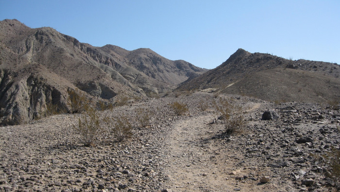
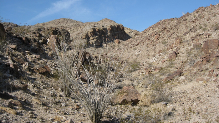
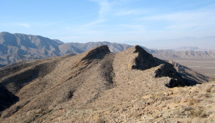
From the uppermost wind cave, Matt and I continued along a faint use trail that led to the southern bank of a prominent wash. We followed the trail and the wash eastward for a few minutes before both turned north, leading to within half a mile from the the eastern summit of Split Mountain. From there the trail fizzled and the easiest route appeared to involve dropping a hundred feet or so into the narrow wash then back up the other side, so that’s exactly what we did. It went faster than it looked and the views really started to open up along the ridge above. We reached the summit in a leisurely hour and twenty minutes after leaving the car.
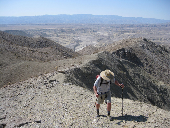
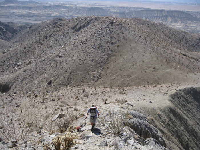
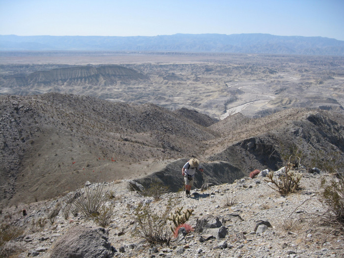
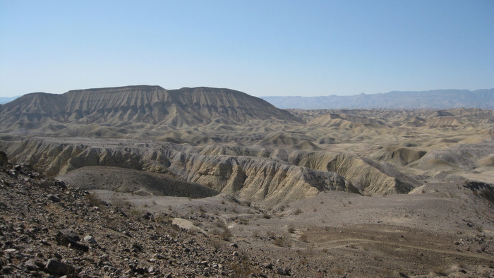
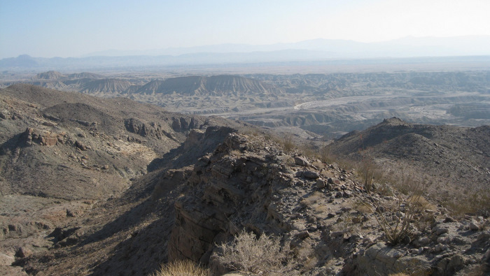
The 1690′ point designated by the SDC peak list as Split Mountain East isn’t actually the highpoint of the mountain but it sure made for fine views. It was an uncharacteristically hazy day but we could clearly see Vallecito, Whale, Sombrero, Stage, the Sawtooth mountains, and the Salton Sea. I thumbed through the register,which seemed to receive a few visits a year, and signed both Matt and I in – made extra special by the fact that this was the first peak I’d hit with Matt in several years. After ten minutes on top, Matt and I reversed our route down the ridge but elected to follow the wash out rather than climbing back up to its opposite edge. Eventually we did have to climb up 60 feet or so to get back on to the use trail leading back down to the wind caves. We explored the caves again and reached the truck shortly after.

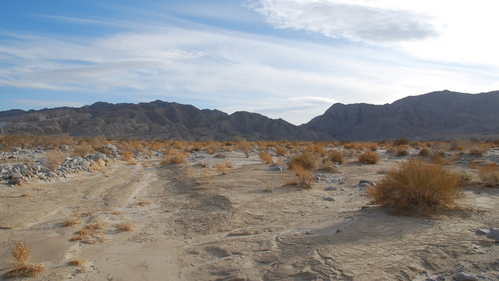
Matt and I drove over to, as far as I could tell, the best starting point to reach the west side of Split Mountain. I ate a leftover half steak sandwich I’d stashed away in my cooler as I studied the map, and Matt peeled away in his truck to indulge in another desert hobby of his, shooting. We agreed to meet back at this spot in three hours and I started up through Oyster Shell wash.
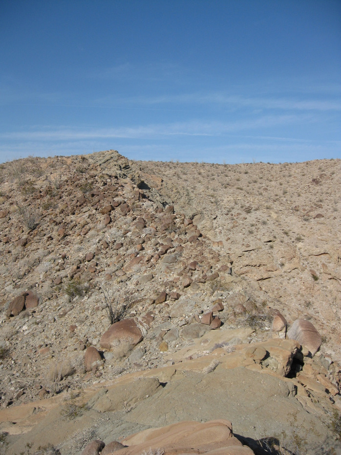
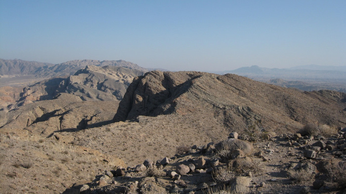
After just a few minutes I hiked up the right hand side of the wash and started on a direct path to Split Mountain West. I preferred to stay high, having easier time on the mixed desert dirt and rock than dodging obstacles in the washes. I eventually found myself on a prominent ridge heading right towards the high point. I couldn’t see the entire ridge but it looked good on the map and the terrain so far was easy. I came across one “notch” where I had to lose and regain twenty feet or so, then reached what the map shows as Split Mountain West, topping out in under an hour from the truck.
I knew there was some debate about which was the true high point of Split Mountain West and while the topo indicated that the southernmost point is greater in elevation, the double-pointed northern summit sure looked higher. I consulted my GPS for a second opinion and confirmed that the SDC listed point is the northernmost point.
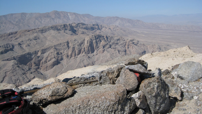
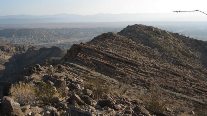
I thought it woldl take minutes to get over to the northern highpoint but I’d overestimated and cruised it in just fifteen. I saw a stack of rocks on the right side of the double-pointed summit and climbed up to it before realizing that the other side was definitely higher. I worked my way over, staying to the left of the short vertical wall and found an easy slope to the top. Here I found the more traditional red-canned Anza Borrego summit register.

Without taking off my pack, I snapped a few pictures and browsed the register. Wes Shelberg is the most prolific name in early Anza Borrego summit registers and he had placed this one along with an explanation of the Split Mountain West high points in 1993. After adding my name I starting thinking of all the good food we had down at the truck. I almost descended into Oyster Shell Wash which may have been more direct, but retraced my steps instead, reaching the truck just five minutes after Matt arrived. We set up camp right there and spent the night eating campfire re-heated pizza, grilling sausages, roasting marshmallows, and washing it all down with a few beers. The good life in the desert…

Split Mountain West (both summits) stats: 3.7 miles roundtrip, 1400 feet gain/loss