Red Top (SDC #64, 4467′) • map • directions
Sawtooth (SDC #65, 4684′)
For no particular reason, I’d had Sawtooth in mind for my San Diego County peaks list finish. Just the name I suppose. Either way, the time had come and I was excited. I picked up my friend Aaron Cook in North Park at 5am, grabbed a coffee at the 24hr corner café, and drove out to the north fork of Indian Valley in Anza Borrego State Park (actually BLM land on the edge of the park). We were both sleepy-eyed but excited about what we knew would be a long day in the desert.
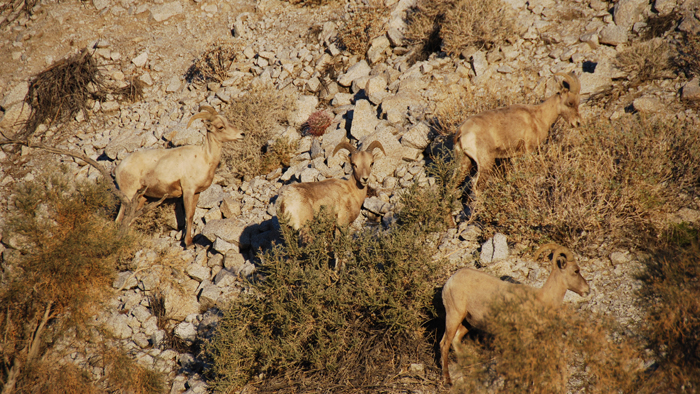
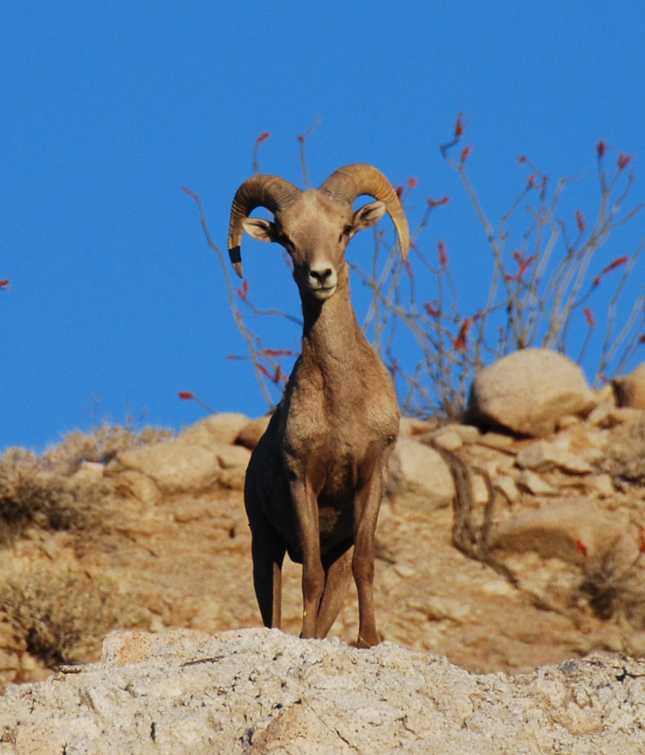
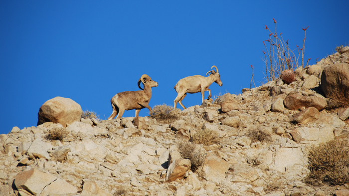
As we drove the dirt road into the narrow canyon, I was telling Aaron how I’d driven the road once before to hike the Sombreros, and how we’d seen bighorn sheep high on the steep slopes during our drive out. Not a minute later, we slammed the truck into park when we saw a pack of sheep on the desert floor just a few hundred feet away! I should explain that I’m somewhat obsessed with the bighorns, and have felt deprived of a close encounter up to this point. In my opinion, the bighorn sheep are the prized possesion of Anza Borrego, and what unbelievable luck to get so close on my planned list finish day. Perfection.
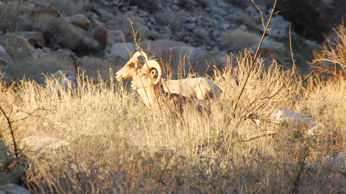
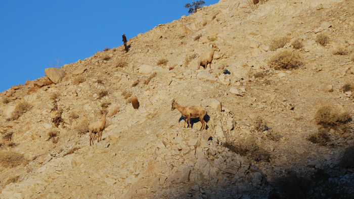
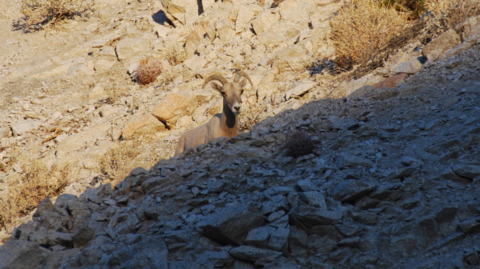
I always kept my SLR camera in the truck just in case, and quickly pulled it out and snapped picture after picture of the sheep. There were four females lingering just a few feet from the road and starting slowly up the north wall of Indian Valley. A young male was off on the desert floor to the left, keeping close watch on us and the females. I crept closer and followed from a distance as he made his way towards the females and ate flowers off of some Ocotillo. I took way too many pictures as he went on to repeatedly head-butt a rock and then a cactus, before the five of them eventually made their way up and out of sight. The day felt like a success before it had even begun, the hike now seeming like just an added bonus.
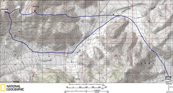
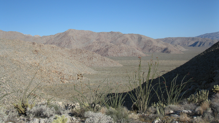
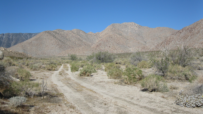
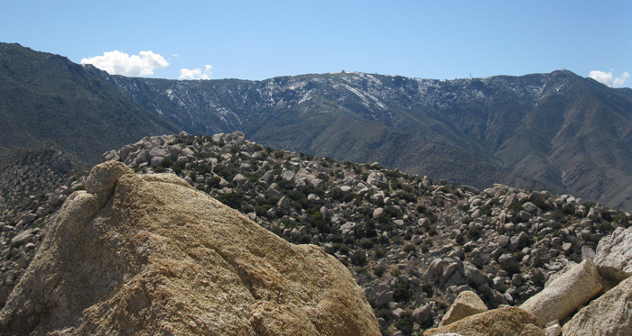
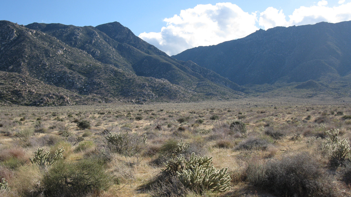
It was 8am when Aaron and I set off towards the Inner Pasture, a flat piece of land measuring many miles across, enclosed on all sides by mountains. Most Anza Borrego enthusiasts have some level of fascination with the Inner Pasture, being one of the more remote and least accessible areas around the park. Our destinations for the day, Red Top and the Sawtooth Mountains high point, rise from the desert floor near the center. While there are leftovers of old roads running through, they haven’t been driven in decades and the narrow entrance is closed off by private property. This leaves several options for getting in, all of which contribute to a long day. I’d read or heard of three different approaches, and I chose a fourth option that looked comparable in difficulty on the map.
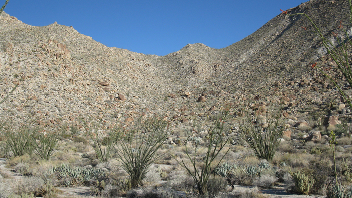
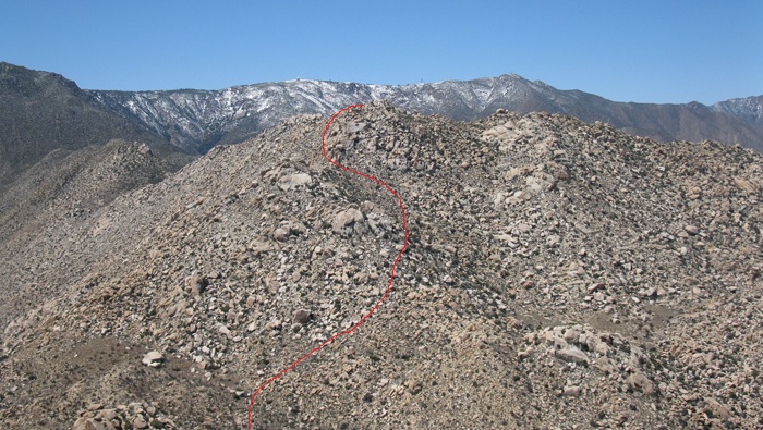
The approach that Aaron and I used, gaining 400 feet up and over a pass into the Inner Pasture, did prove to be fairly easy. We were on the floor of the Canebrake Wash less than an hour after leaving the truck, and took aim for the ridge leading due east from Red Top’s summit. It was a relaxed walk to the ridge, using part of an old road along the way. We took a second to eat a quick bite before starting up, and starting gaining elevation in earnest.
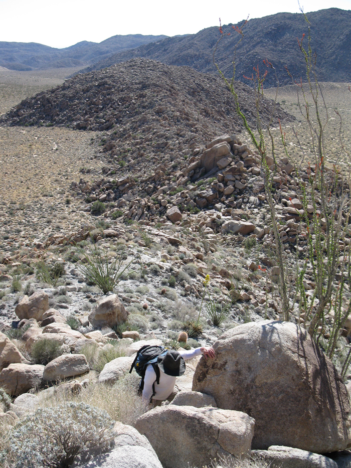
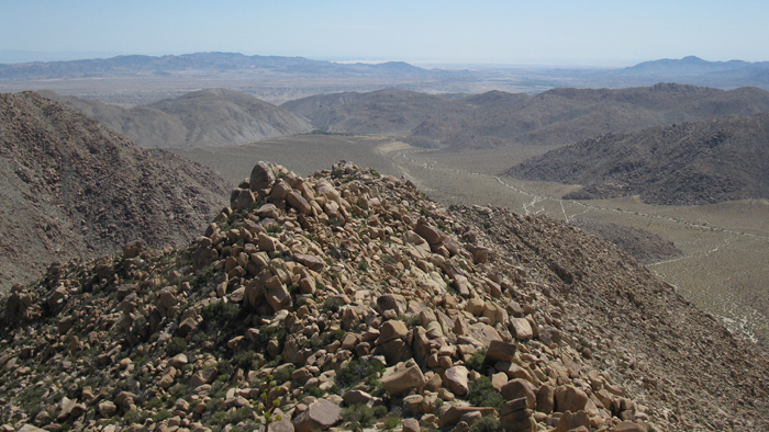
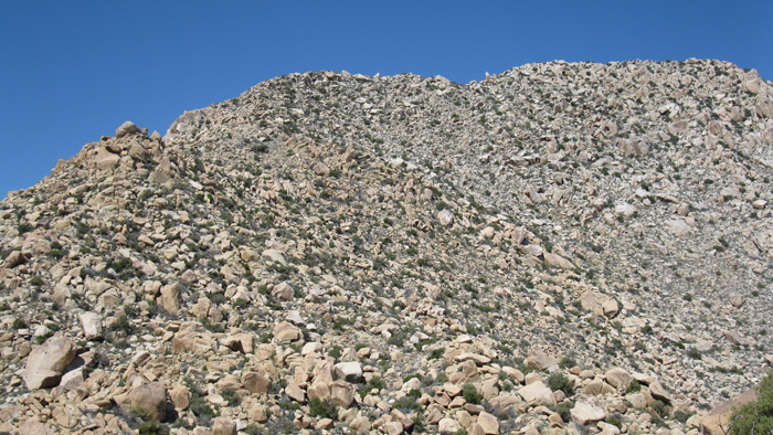
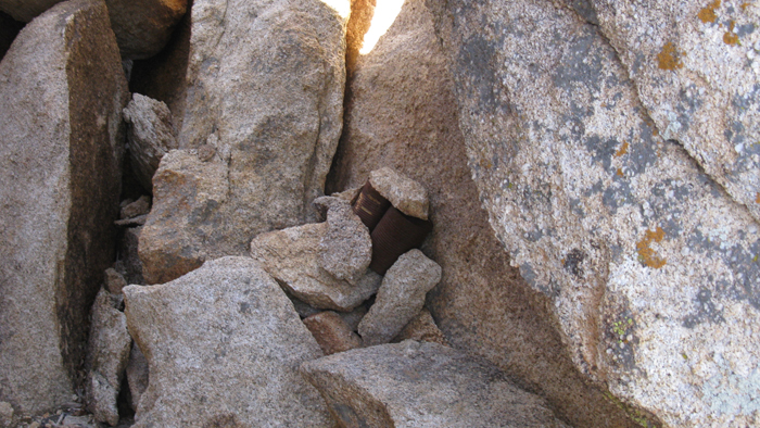
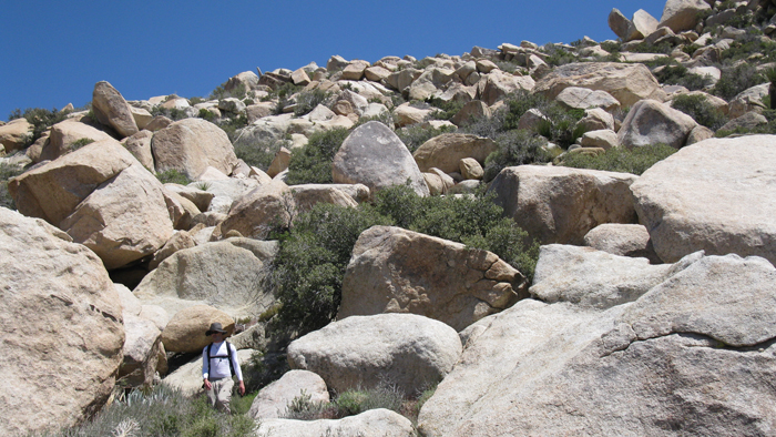
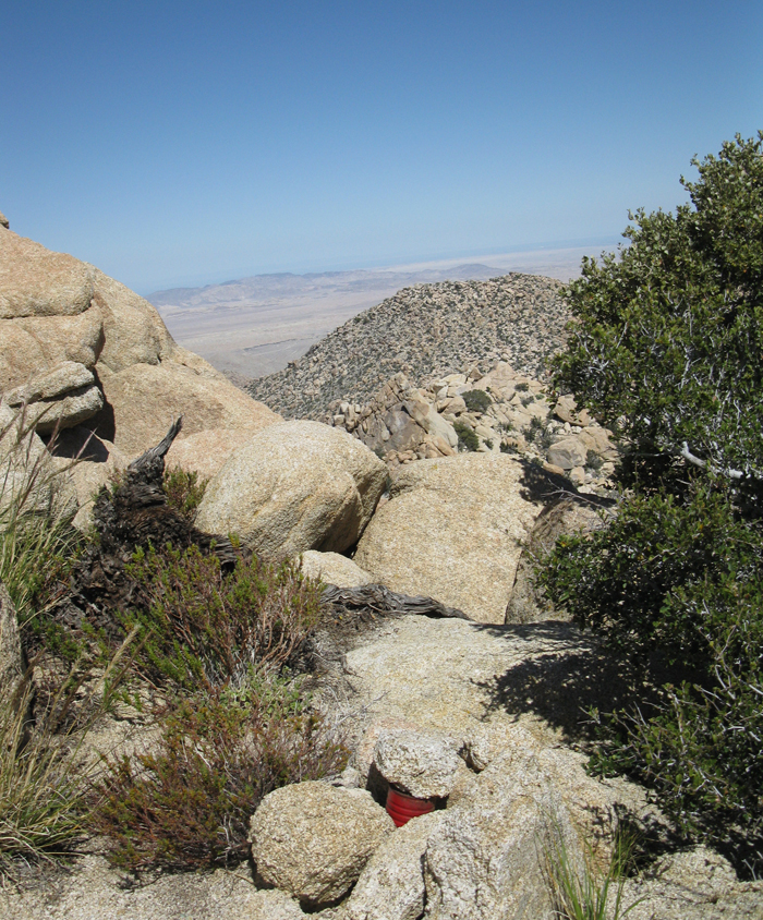
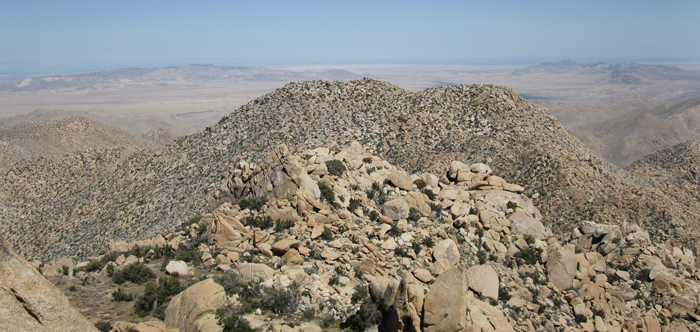
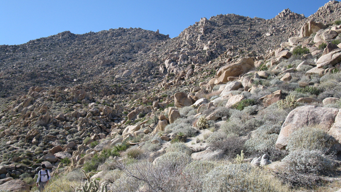
The ridge, typical of many of the desert peaks in the area, meets the desert floor at an exact measurable spot. One step you’re on the desert floor, next you’re on the ridge. We gained the first few hundred feet quickly, but slowed down when the boulders got huge, like car to house sized, and we spent more time on routefinding. We climbed over and between some of the large boulders, entering class three climbing territory. Though some of the rock was crumbly (I broke one handhold), most of it was solid and made for fun climbing. We took a break about halfway up the ridge at an obvious flat spot, where the terrain subsided to mostly class 2. From there we curved to our right as we climbed up to the summit, pulling ourselves over more large boulders, and topped out right next to the mass of huge summit rocks. With a bit of good fortune, we almost immediately stumbled upon the summit register in sort of a cave, underneath a massive rock leaning against the highest boulder.

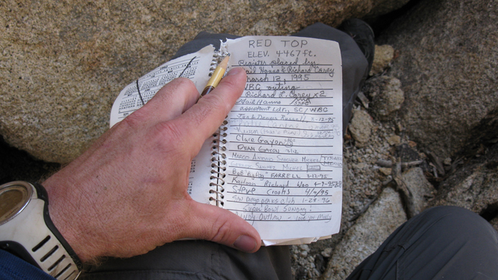
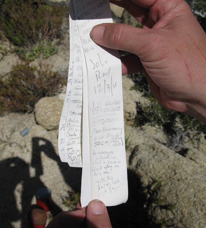
Red Top received more visits than I had expected, and Aaron and I signed in at fifteen after noon. I believe this to be Aaron’s first summit, and I was glad to have him along. I actually owe a lot to Aaron, as he deserves some of the credit for getting me out to begin with. I’d taken an involuntary eleven-month sabbatical from the mountains due to what was becoming a hopeless injury. Aaron is actually my acupuncturist, whose treatments had gotten me back on the trail. It is quite amazing the results I had with acupuncture, but that is a story in itself.
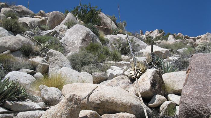
Moving on towards our next destination, it took some time to drop down to the flat between Sawtooth and Red Top, squeezing around more huge pieces of rock on steep slopes. We descended about 600 feet before starting up the 800 feet towards Sawtooth, on similar terrain as what we had come up. The dry, hot, air was slowing our pace, but with a short ways to go we continued up, saving a significant break for the summit. We chose our route a hundred feet or two at a time, trying to stay on the hard-packed dirt. We contoured around to the south side of Sawtooth, and onto a small flatish area just east of its summit. From there we started working our way up the north side of the summit blocks, before I realized I had left my camera few hundred feet back when I had stopped to consult my GPS regarding the highpont. Doh! After retrieving the small point-n-shoot, we decided to start up the south side of the summit boulders, and soon found the register just south of the highest point.
The Sawtooth register dated back to 1981, and was last signed by George Zelenz, a fellow SDPL peakbagger who I’d recently been in touch with. I felt no huge sense of accomplishment or any of that as I signed in on the last of my San Diego 100 peaks, at least no more than usual. It always felt great reaching the top of any peak, big or small, and this one wasn’t much different. I was actually just as excited for Aaron’s success on his first (and hopefully not last) day of desert peak-bagging, with a monster of a start. We congratulated each other and started back down Sawtooth’s south slopes to the Canebrake Wash.
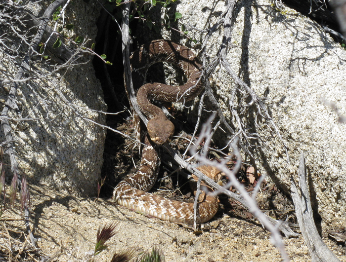
Though I’d brought over a gallon of fluids with me, I was running lower than I hoped, so when we passed a tiny patch of snow left from an intense storm just two days before, I scooped a dirty mass into an empty bottle just in case. Then Just a few hundred feet down, I stepped off of a two-and-a-half foot tall rock, to be startled and stunned when a fat rattlesnake warned us, not too happy about our unexpected visit. Though a fascinating animal, we wanted nothing to do with him, and he with us. Fair enough, and we continued with our descent.
We were blessed with easy going sand for a short time, before it turned to boulders and thick unfriendly desert shrubs. Both of our pants took a beating from the thorns that we plowed through to get between sections of jumbled rock, Aaron’s much more than mine. Aaron’s pants will look pretty hardcore with some thick stitches though, reminders of what would turn out to be a longer day than expected.
It was almost 5pm when we reached Canebrake, and I almost thought my watch was broken. It had taken four and a half hours to get from Red Top to Sawtooth and back to the desert floor, and I still can’t imagine where the time went, it certainly didn’t seem that long. Either way we were happy to relax a bit since the bulk of the work was over.
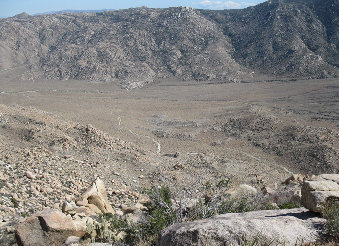
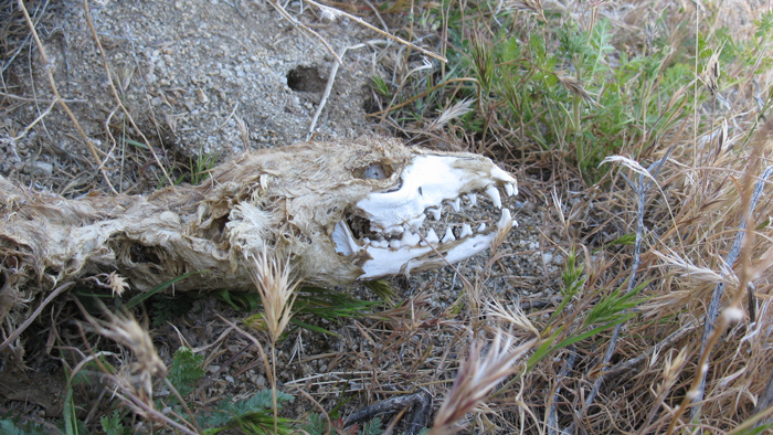
I snapped a few pictures of an intact but unfortunately deceased fox or small coyote, and we started the long walk out and back to the truck. Fortunately the six plus miles we had to go to get back were almost flat and we could spend some time zoning out, at least I was partly dazed by the long day and hypnotic desert floor. I squeezed an energy gel into my mouth for an extra little boost to get over the pass and into Indian Valley, and entered the Twilight Zone once again as I knew we were nearing the truck and it still didn’t appear. Fortunately, it did eventually appear when we were just a few hundred feet from its comfortable seats, which we were able to climb into just before 7pm.
Aaron and I celebrated with a single ice cold beer each that I’d stashed in a cooler, and I was stoked that Aaron enjoyed the long yet rewarding day as much as I had. A few friends and family members have already asked me how I feel to be done with the list. The only answer I can give is “lucky.” Lucky to have had the opportunity to get out there the way I have, and lucky to live in such an amazing place. I feel a great sense of connection with the land I’ve been through countless times, but stop at letting myself feel that I’ve explored every inch, because I know there is so much more out there. To be continued…