Red Top (SDC #64, 4467′) • map • directions
Sawtooth (SDC #65, 4684′)
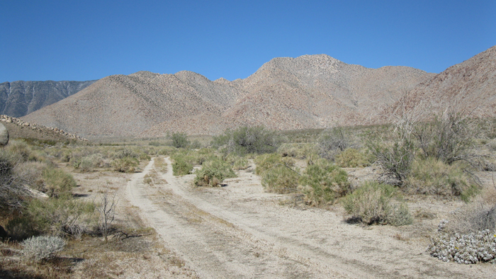
For no particular reason, I’d had Sawtooth in mind for my San Diego County peaks list finish. Just the name I suppose. The time had finally come and I was excited. I picked up my friend Aaron Cook in North Park at 5am, grabbed a coffee at the 24hr corner café, and drove out to the north fork of Indian Valley in Anza Borrego State Park (actually BLM land on the edge of the park). We were both sleepy-eyed but excited for what we knew would be a long day in the desert.
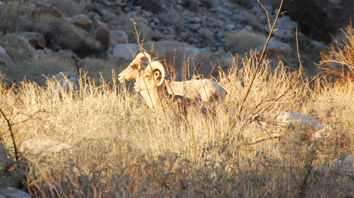
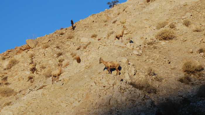
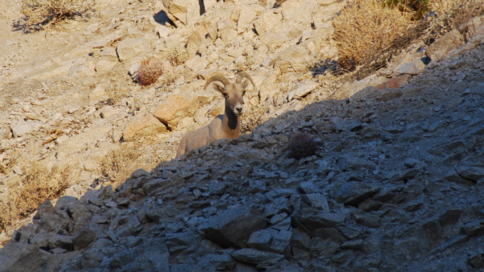
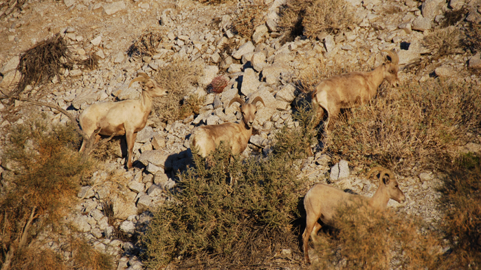
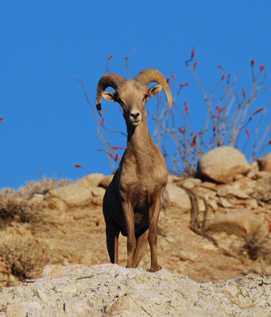
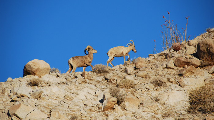
As we drove the dirt road into the narrow canyon, I was telling Aaron how I’d been here once before to hike the Sombreros, and how we’d seen bighorn sheep high on the steep slopes during our drive out. Not a minute later I slammed the truck into park, seeing a band of sheep on the desert floor just a few hundred feet away! I’ve been somewhat obsessed with the bighorns and have felt deprived of a close encounter up to this point. The bighorn sheep are the prized possesion of Anza Borrego, what unbelievable luck to get close on my planned list finish day. Perfection.
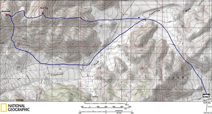
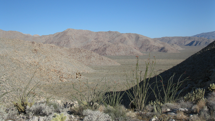
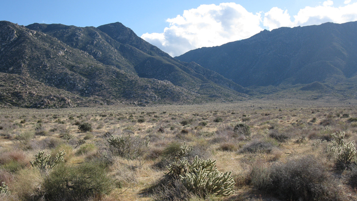
It was 8am when Aaron and I set off towards the Inner Pasture. The Inner Pasture is a flat horseshoe-shaped piece of land enclosed by mountains. Anza Borrego enthusiasts often have some level of fascination with this area, myself included. Our destinations for the day, Red Top and the Sawtooth Mountains high point, rise from the desert floor near the center. Leftovers of old roads running through haven’t been driven in decades and the narrow entrance is closed off by private property. I was familiar with three ways to get into the Inner Pasture, for today I chose a fourth that I believed to be most efficient for our plans.
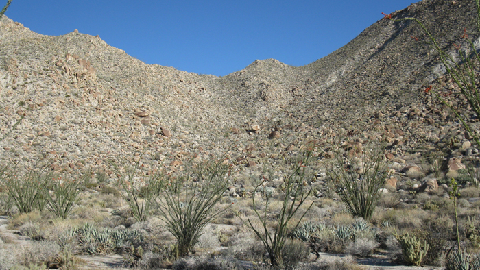
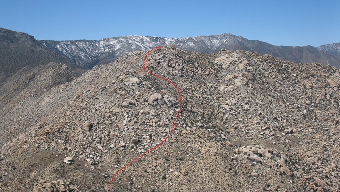
The approach that Aaron and I used gained 400 feet up and over a pass into the Inner Pasture and went well. We were on the floor of the Canebrake Wash less than an hour after leaving the truck and took aim for the ridge leading due east from Red Top’s summit. It was a relaxed walk to the ridge, using part of an old road along the way. We took a second to eat a quick bite before starting up, soon to be gaining elevation in earnest.
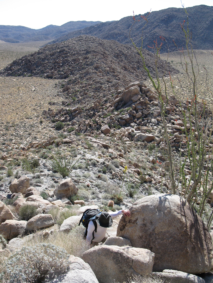
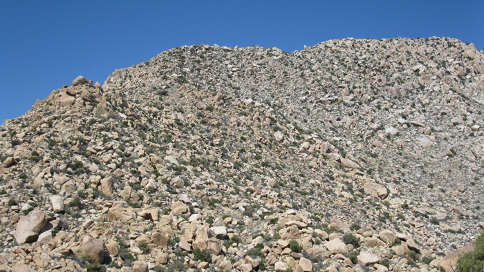
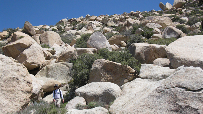
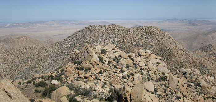
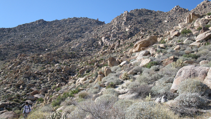
Typical of many of the desert peaks in the area, the east ridge of Red Top meets the desert floor at an exact measurable spot. One step you’re on the desert floor, next you’re on the ridge. We gained the first few hundred feet quickly and slowed when the boulders got huge, like car to house sized pieces of rock. This required more time with routefinding.
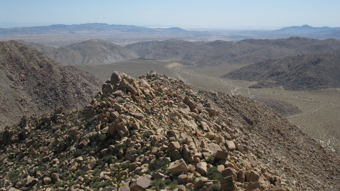
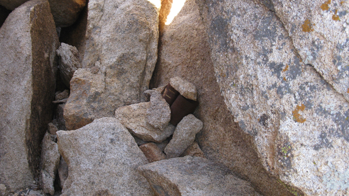
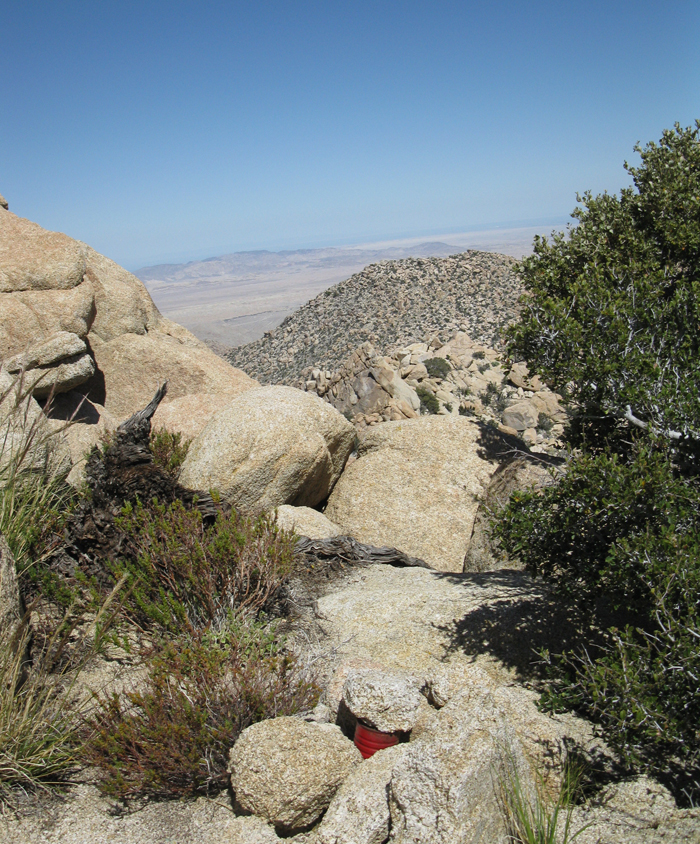
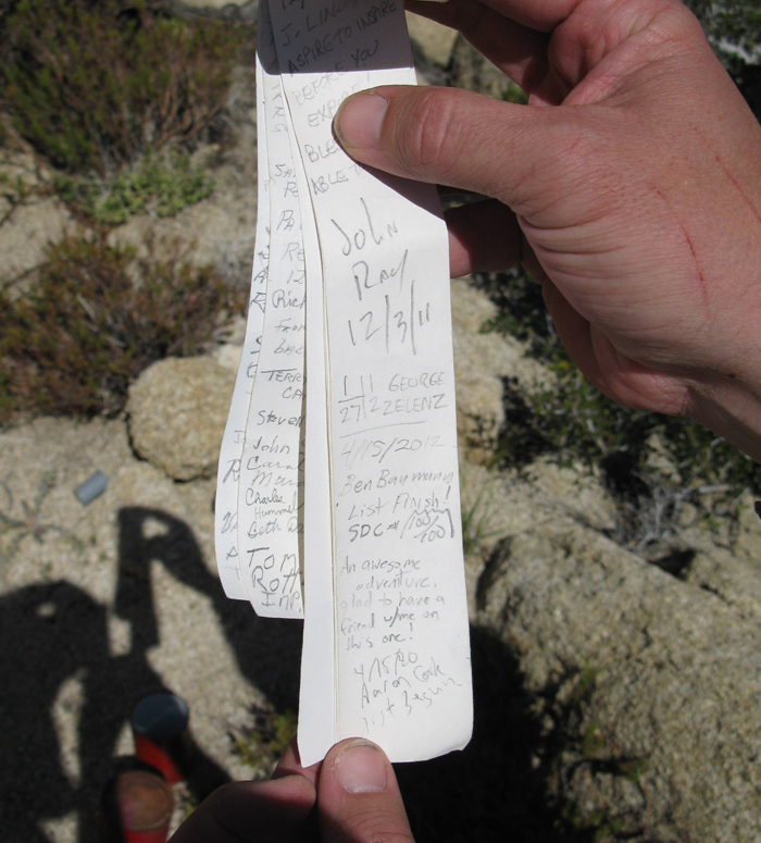
We climbed over and between some of the large boulders, sometimes easy class 3. Some of the rock was crumbly but most was solid and fun. We took a break about halfway up where the boulders subsided a bit. From there we curved to our right as we neared the summit, pulling ourselves over more large boulders, topping out right next to the mass of huge summit rocks. With a bit of luck we stumbled upon the summit register in sort of a cave, underneath a massive rock leaning against the highest boulder.

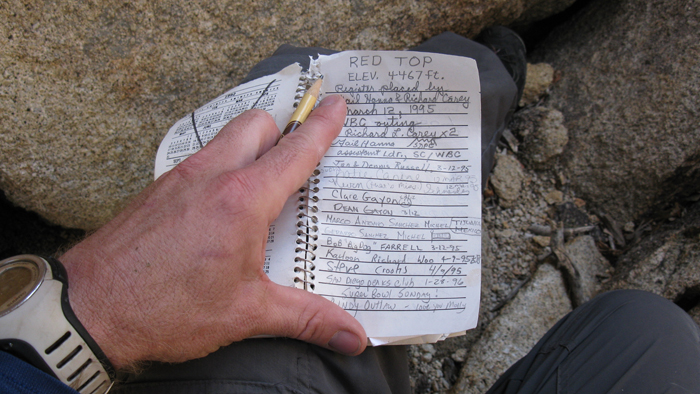
Red Top received more visits than I’d expected, and Aaron and I signed in at 12:15pm. I believe this to be Aaron’s first summit and I was glad to have him along. I owe a lot to Aaron who was actually my acupuncturist. His treatments had helped me avoid surgery and get back on the trail after struggling with an overuse injury for nearly a year. That’s a separate story in itself.
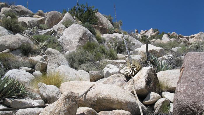
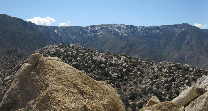
It took some time to drop down to the flat between Sawtooth and Red Top, squeezing around more huge pieces of rock on steep slopes. We descended 600 feet before starting up the 800 feet towards Sawtooth on similar terrain. The dry, hot, air was slowing our pace, but we elected to save a significant break for the summit. We chose our route a hundred feet or two at a time trying to stay on the hard-packed dirt. We contoured south around Sawtooth and onto a small flattish area just east of its summit. From there we started up the north side of the summit blocks before I realized I’d left my camera a few hundred feet back when I’d stopped to check my GPS. Doh! After retrieving the small point-n-shoot we changed our route, instead heading up the south side of the summit boulders.
The Sawtooth register dated back to 1981 and was last signed by George Zelenz, a fellow SDC peakbagger who I’d recently been in touch with (and who would become a great friend). I felt no special sense of accomplishment or any of that as I signed in on the last of my San Diego 100 peaks, no more than usual anyway. I was just as excited for Aaron’s success on his first day of desert peak-bagging, with a monster of a start. We congratulated each other and started back down Sawtooth’s south slopes to the Canebrake Wash.
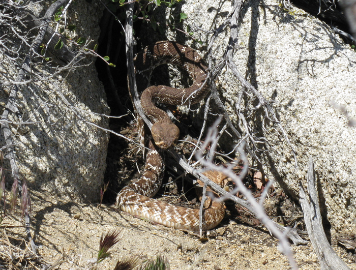
I’d started with over a gallon of fluids and was running lower than I’d like, so when we passed a tiny patch of snow I scooped a dirty mass into an empty bottle just in case. Continuing the descent, I stepped off a two-and-a-half foot tall rock and a fat rattlesnake scared the $#it out of me. I’d jumped down over him, within easy striking distance of the back of my calves. Luckily he gave me a chance to step away, the rattle making his desire for space clear.
Both Aaron’s and my pants took a beating from the thorns we’d plowed through between sections of jumbled rock, Aaron’s much worse than mine. It was almost 5pm when we reached Canebrake and I questioned whether my watch was broken. It had taken four and a half hours to get from Red Top to Sawtooth and back to the desert floor, I can’t imagine where the time went. We were happy to relax a bit now since the bulk of the work was over.
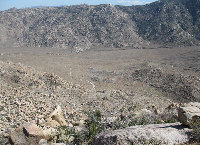
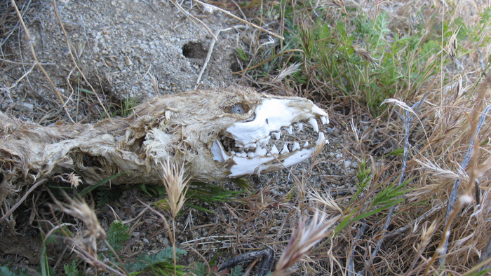
We found an intact but deceased Coyote then started the long walk out and back to the truck. The six plus miles we had to go were almost flat and we zoned out, dazed by the long day and hypnotic desert floor. I squeezed an energy gel into my mouth to boost me over the pass and back into Indian Valley, entering the Twilight Zone as the truck wouldn’t appear. Fortunately, it did eventually appear when we were just a hundred feet from its comfortable seats, arriving just before 7pm.
Aaron and I celebrated with an ice cold beer that I’d stashed in a cooler. I was stoked that Aaron enjoyed the long day as much as I had. A few friends and family members have asked me how I feel to be done with the list. “Lucky.” Lucky to have the opportunity to get out there and lucky to live in such an amazing place. I feel a sense of connection with each peak on the list and the land I hiked to get there. I’ve also come to realize how much more there is to explore. To be continued…