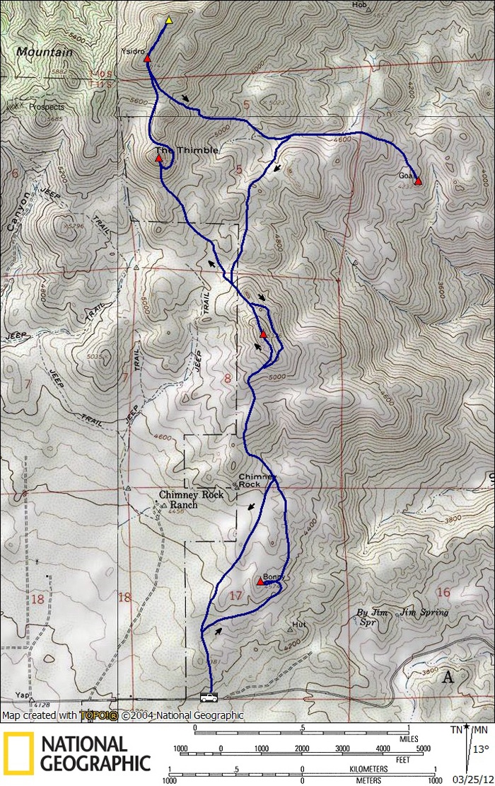
Bonny (SDC #27, 4574′) • map • directions
White (SDC #26, 5326′)
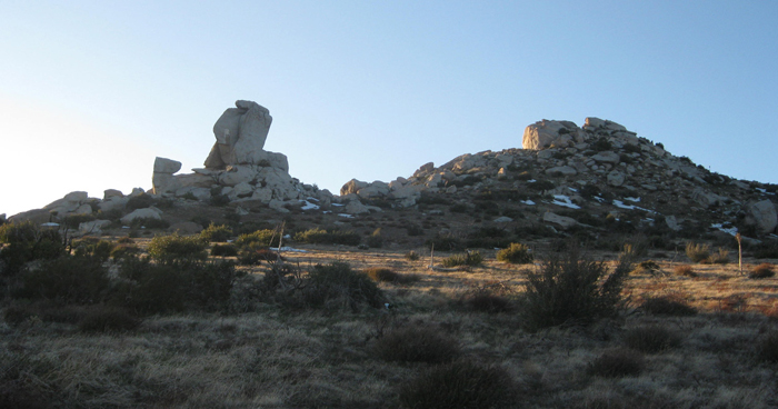
The Thimble (SDC #22, 5779′)
San Ysidro(SDC #21, 6147′)
Goat (SDC #24, 4232′)
I’d been to the starting point for The Thimble and San Ysidro exactly two years and one day previous but had only gone as far as the White benchmark. That was long before I’d stumbled upon the San Diego peaks list. This time I’d return with out-of-state friend Josh Kinser.
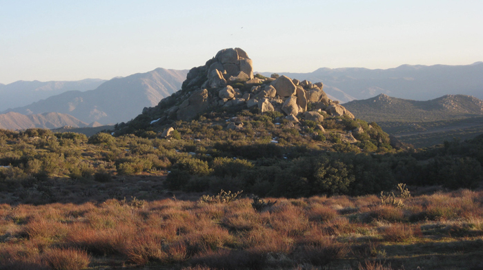
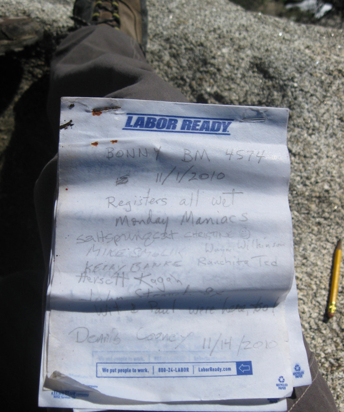
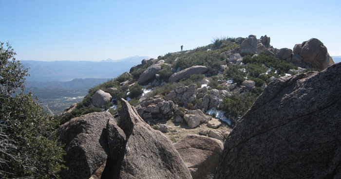
Josh and I parked at the dirt turnout at an obvious apex of the S22, just east of the center of Ranchita. The dogs at the nearby residence noticed our presence and weren’t too happy about it so we stayed as far to the east as we could. We squeezed through light brush to reach increasingly open terrain and topped out at our first destination, Bonny BM, in just 20 minutes. We’d scrambled up Bonny’s east side before traversing around to the west side of the summit block, walking an easy and slightly exposed ledge to the register. The register was sitting in a pool of water so we were unable to add our signatures to the soggy pages, a common complaint with a few who had scribbled their names before us.
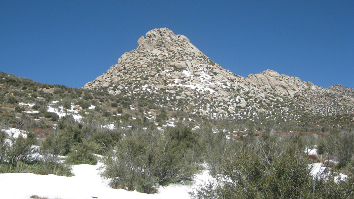
Not wasting any time, we continued on towards White, trudging through the occasional patch of snow, leftovers from a storm the previous weekend. White was a straightforward ascent and we reached its summit without issue. An easy ten foot scramble to its highest point afforded intimidating views of our next objective, The Thimble, and I thumbed through the register to find my previous entry. Josh confessed that he had drank half of the two liters of water he had brought already, which instilled a sense of doom until I remembered the old snow in the bottle trick. The melting snow that would add effort to our day would also be our savior.
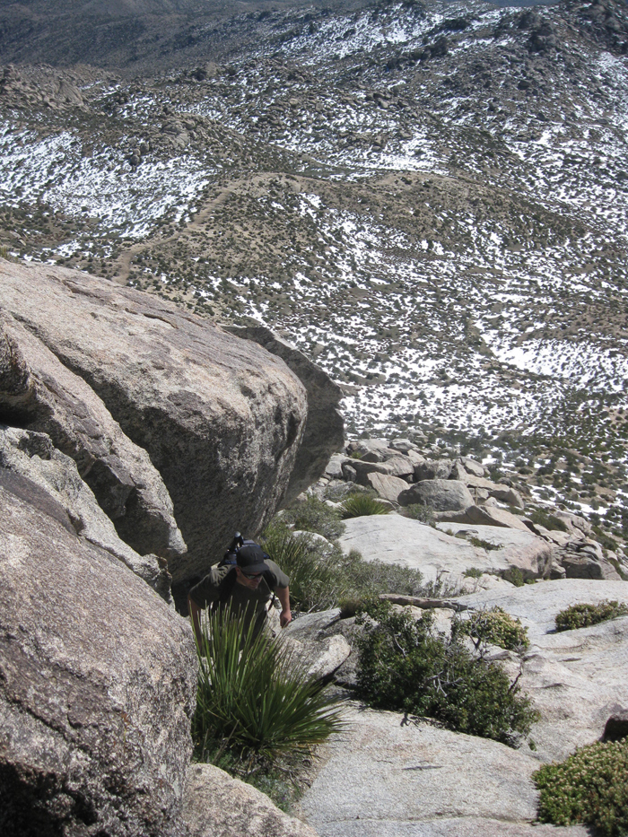
After filling his bottles with snow, Josh and I dropped down the north side of White, climbing over some boulders then on to easier terrain. We took a direct path to The Thimble and unknowingly crossed into private property, only realizing our misstep when we had to escape by crawling under a barbed wire fence. The Thimble looked imposing and though I knew these things tended to look worse than they really were, Josh wasn’t convinced. “Can I do that?!”
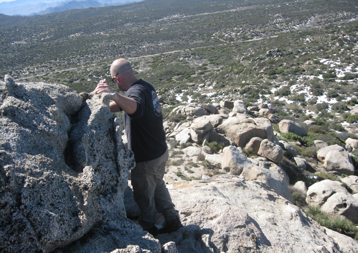
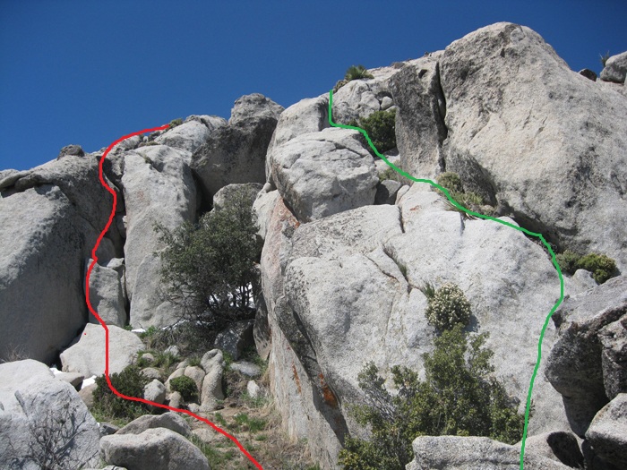
I coaxed Josh up behind me as we made our way up the steep south side of The Thimble, stopping a few times to reevaluate. I searched for the easiest, finding a rock and plant filled chute to get within a short climb to the top. With fifty feet to go, the climbing got more vertical and I looked at several possibilities before deciding on a narrow chimney on the south side. I started to climb up, using all of the few holds with some reachy moves. I realized I must be off route and did a poor job of inspiring confidence so I wasn’t surprised when Josh stated that he wouldn’t be following. He urged me on, I mantled to get on top and within easy reach of the register. From there I searched for an easier route but Josh re-emphasized that he had no interest and was enjoying the views from where he was. I signed in to the register and did find a slightly easier way down, a short ways further east from where I climbed up.


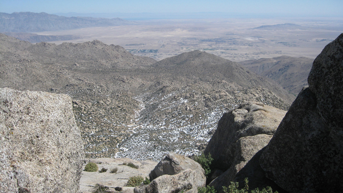
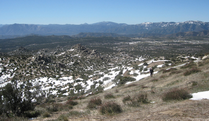
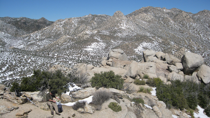
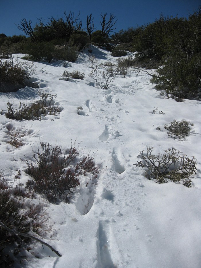
Anxious to get to our fourth and highest peak of the day, Josh and I traversed around the east side of the Thimble, with some concern about all the snow between our current position and the top of San Ysidro. We assumed that the snow would be a slushfest and that’s exactly what it was, quite the energy sucker. Looking for an alternative, we crossed between The Thimble’s summit and another rocky tower on the ridge to San Ysidro, putting us on the west side. As I’d hoped the west side held a fraction of the snow as the east side. The hiking was easy here through light brush, relatively effortless until the final slope to the summit. The last 600 vertical feet was steep but less so than what we had hiked to get near the summit of the Thimble. We stumbled across a use trail that helped but Josh started losing steam on this final section. The summit lookin farther away than it really was, Josh took a break and declined to proceed. Some heavy encouragement got him going and we were soon celebrating from the top of San Ysidro.
The register was easily found but I knew this wasn’t the actual high point of San Ysidro, so I made my way over while Josh took in the views and made light of my foolishness. It took me longer than expected to cover the ¼ mile, with thick brush, large boulders, and deep pockets of snow. Upon reaching the actual highpoint I felt foolish myself, realizing that this was a less enjoyable place to be. I returned and we started back down the way we had come.
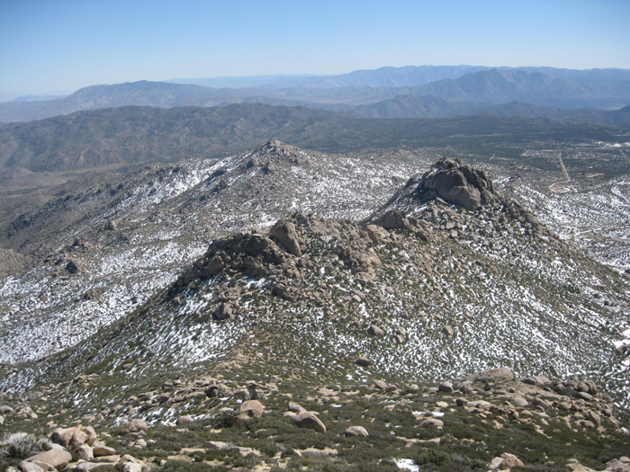
We dropped down to the east side of San Ysidro through the deepest snow we’d encountered so far on the hike. My feet were already soaked from all the postholing, but now they were getting quite cold. Freezing toes on a San Diego peak, an experience I’d yet to have so close to home. We dropped down to get away from the sloppy snow before I let Josh in on a little secret – I had one more benchmark I hoped to reach. Josh had no interest in joining but he assured me he’d be fine on his own. I dropped the 600 feet and covered the 3/4s of a mile down a wash leading east towards the Goat benchmark, reaching it in just 20 minutes from where Josh and I had split up.


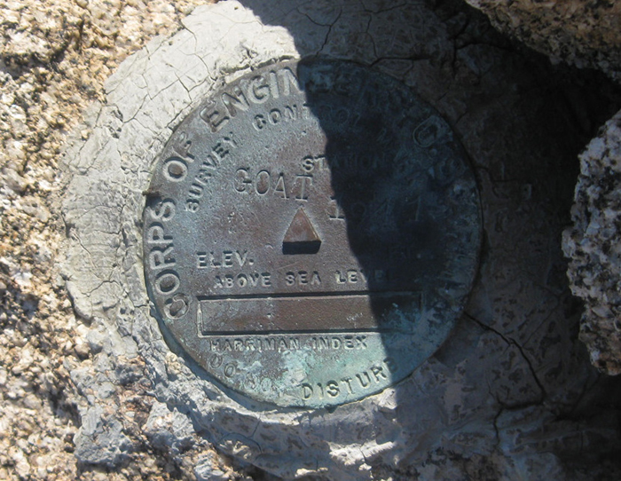
The Goat benchmark is a nice granite-crusted viewpoint near the upper reaches of Hellhole Flat and I enjoyed the spot immensely. I recognized most of the names in the register and after signing in I started back towards Josh, deciding against an alternate return route that had looked good on the map. Josh had started up the first few hundred feet towards the White benchmark to an obvious meeting point, so we were well into our return hike when we met up again.
With more than a few hundred feet to gain to get back near White’s summit, we despised the unfortunate return route forced by the terrain – private property to the west and deep snow on a traverse or a drop to the east. Josh and I reached the south side of White soon enough though, then enjoyed the mellow downhill ascent back to the car. We drove into Borrego Springs for a hot meal and a cold beer and I congratulated Josh on his efforts. He was elated to have reached San Ysidro. After loitering for some time after dinner we drove further east and set up camp near the Calcite Mine, resting for what would prove to be another few exciting days in Anza Borrego State Park.