
Otay (SDC #99, 3569′) • map • directions*
Tecate (SDC #100, 3885′) • map • directions*
Combs (SDC #1, 6193′) • map • directions
Palomar (SDC #42, 6142′) • map • directions*
The San Diego peaks list has a handful of peaks that are easily accessed by driving to the summit. While hiking is of course still possible I tend to lack the enthusiasm to hike to a summit I’ll share with a vehicle especially if it means hiking on roads. I also don’t mind off-road driving adventures…Anna and I took a day off work to do what I called our SDC Peak truck tour. Since I knew we’d be driving a lot in one day including some rough roads, and I get a swinging deal on rental cars, we rented an SUV to take the beating and let my truck sit this one out. The only hitch was that we couldn’t pick up the rental until 9am, so we’d be getting a late start.
Otay
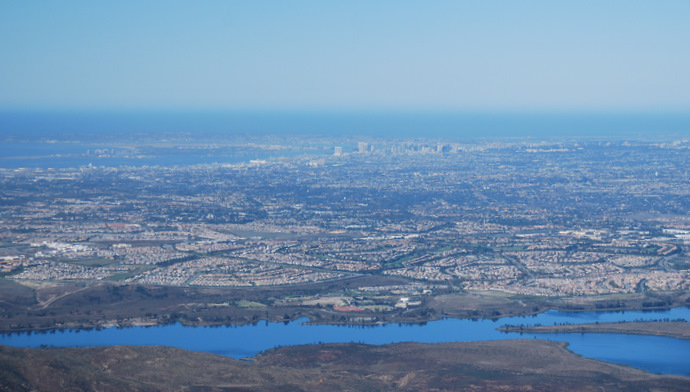
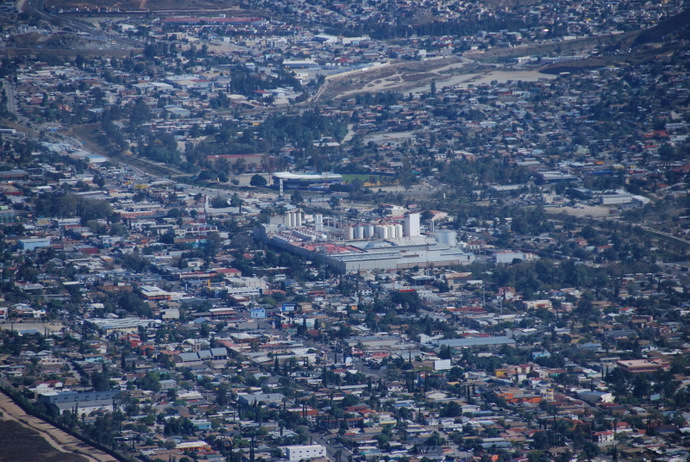
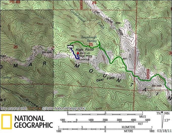
We started off with Otay Mountain, a peak that towers over Chula Vista and is visible from much of San Diego. I’d been up the peak once before on a dual-sport (DS) motorcycle and I wasn’t really looking forward to doing it again. The area is crawling with border patrol agents and the one lane dirt road has some sketchy blind turns. A close friend witnessed a head on collision near the summit of Otay between a border patrol agent and another DS rider a few years back.
Anna and I stopped at the RV park on Otay Lakes Road, where the entrance to the road running to Otay’s summit (labeled as the Minnewawa Truck Trail on my map) begins. A group of about fifteen DS riders were preparing to head up, so I asked them if they’d like to go first to which they graciously accepted. We took our time on the 5+ mile long road to the summit which improved as we went higher, in good enough shape to be driven by most passenger vehicles. We reached the summit at 10:14am and stepped out of the truck to enjoy the views and take a few pictures. We only stayed a few minutes, passing a few border patrol agents on ATVs on the way back down.
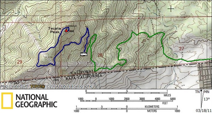
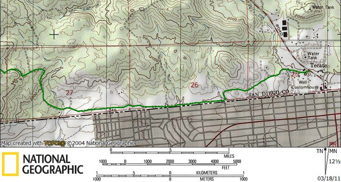
Our next objective was Tecate, another cone-shaped peak just half a mile from the border with Mexico. I wasn’t sure how far we’d be able to drive up the mountain but I expected to finish the last few miles on foot. From the turnoff for Otay, we drove 15 miles east. We followed the 94 and turned right onto Tecate Rd, following the signs to the brewery town of Tecate. Per the route descriptions, I had expected to find a dirt road to the right (west) just a quarter mile before the border but I was not able to locate it. We tried a few other dirt roads but they either dead-ended or quickly became un-drivable. I could see the road running along the border fence that we needed to get to so I drove closer to the border on Tecate Rd and turned right onto a paved road that passed a school (visible from Tecate Rd) and found our way. We drove alongside the border fence, cris-crossing a few times with parallel dirt roads. The road was rough in a few spots and ground clearance helped, though 2WD was sufficient. Border patrol agents were crawling about and the area made Anna nervous. We passed through a few open gates as our expected hike kept getting shorter.
Just as we started to gain elevation we came head to head with a few construction vehicles on their way down and I pulled over to let them pass. The first one stopped, the driver got out and walked up to my window. He warned us that his crew was performing major repairs on the road just ahead and that we’d never get through. I told him we’d head up on foot, to which he tried to dissuade, advising that we come back another day. I insisted and he let us on our way.
Anna and I drove up the switchbacks and eventually caught a glimpse of fresh road work around the next bend, so we parked at the nearest pullout and continued on foot. We crossed through a 50 foot section of road that had just been groomed and spotted a parked grader around the next bend. Three construction workers taking a break in the shade waved to us, that was the extent of the crew and roadwork that we were warned about. We continued along the road to the summit and easily could have driven the entire thing.
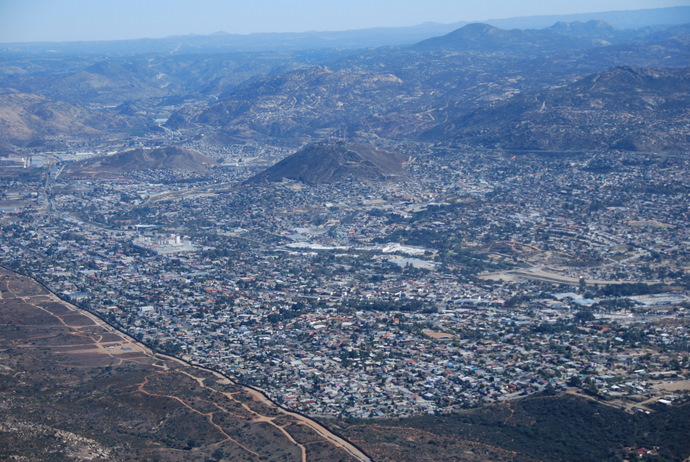
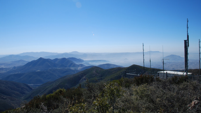
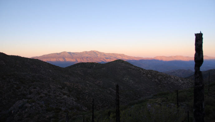
The views from the summit of Tecate were awesome, peering right down into Mexico. We were even able to pick out the Tecate brewery, very cool. We snapped a few shots and started back down at 12:10pm, passing one border patrol agent, and settled back in to the comfort of our vehicle. We drove back out to the highway, passing another 3 or 4 border patrol agents, and continued on our merry way. Having been stopped by border patrol agents a few times on other near-border excursions, I was surprised we hadn’t been questioned at all on this trip.
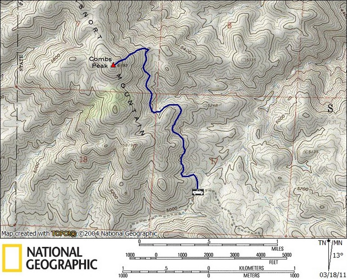
Combs
Combs would be the only peak of the day that did not offer the possibility of driving to the summit and we were looking forward to it. Including a stop for lunch, it took over three hours hours to drive from Tecate to the turnoff onto Chihuahua Rd, and I never get tired of the drive up the 79 and through Warner Springs. We followed the excellent directions found here, and were able to drive faster than I expected on the well groomed dirt road (navigable by passenger cars). The trailhead was easy to find, a signed junction with the Pacific Crest Trail (PCT). There was a water cache left for the PCTers, helping them through one of the driest sections of the 2600 mile long trail.

Starting off at 4:15pm, we were slightly concerned that it would be dark soon and we’d have a hard time finding the use trail that leaves the PCT for the summit of Combs. We booked it as fast as we could, heading north on the PCT, taking less than 30 minutes to reach the east slope of the mountain. I expected to see a cairn marking the turnoff for Combs and was wondering if we’d missed it once we started passing north of the summit. Eventually we did find the use trial and watched the sun set as we scrambled the final 500 feet to the summit.
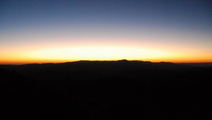
Once the sun set the wind started whipping and we didn’t stay more than a few minutes on top. We started back down towards the PCT, now struggling a bit in the dark. We finished the rest of the hike with our hands in our pockets to keep warm, making the roundtrip back to the truck in 2 hours flat.
Palomar
It wasn’t easy to find the turnoff for forest route 9S07 (aka Palomar Divide Road) in the dark but I had programmed a waypoint into my GPS just in case. The road began at a dirt turnout on highway 79, then winds its way 13 miles up the mountain. We couldn’t see farther than our headlights but the sharp turns and rough terrain limited our speed anyway. We ran into one steep and deeply rutted section about 3/4s up and I bottomed the car out pretty hard trying to get through it.
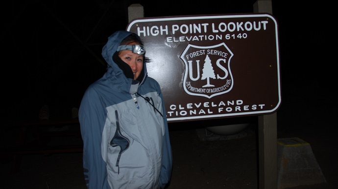
The HPS directions were spot on and we made it to just below the summit in a tick under an hour. We couldn’t believe how cold and windy it was when we got out of the car, bundling up for the ¼ mile hike to the summit, to which we arrived at 8:10pm. The summit of Palomar is one of a handful of summits in Southern California that still has a fire lookout, this one being the tallest in the state. I’d wanted to climb up but the thing was shaking violently in the wind and a sign prohibiting entry anyway. There was a barbeque chained down near the tower and it crossed my mind that this would be a good spot for a list finish.
Anna and I returned to the truck and made the long drive down, arriving back home around 11pm, a long and fulfilling day. The next morning I did a sweep of the inside of the rental to make sure we hadn’t left anything inside and I found a souvenir from the road on Palomar. The vehicle had storage compartments in front of where the rear passengers’ feet would rest and one of them had popped out. When I pulled out the plastic liner I saw that the floor board had been smashed up into the car. I knew the floor was malleable so I grabbed my sledge hammer and beat it back into place. I returned the car 300 miles wiser (60 of which were on dirt), with 2.5 summits under its tires.
*-The Otay driving directions will get you to the start of the Minnewawa Truck Trail. The Tecate driving directions will get you to Tecate Mission Rd. Use my provided trail maps for the remainder of the driving route. The Palomar driving directions will get you to the beginning of the Palomar Divide Truck Trail, use the HPS directions (route 1), found here to complete the route.