Manza (SDC #67, 5556′) • map • directions*
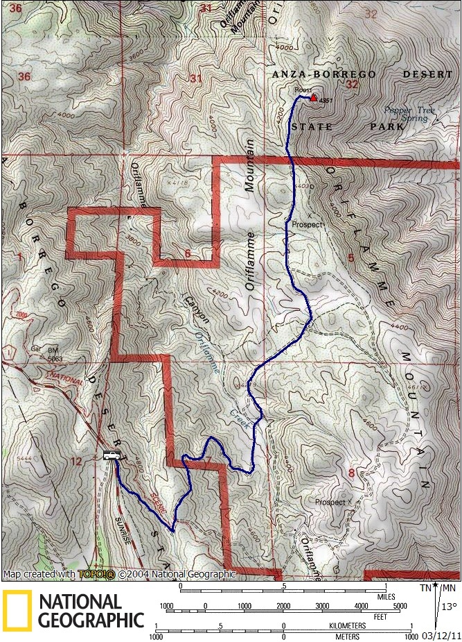
Roost (SDC #52, 4351′) • map • directions
Anna and I set off again on our 2nd consecutive multi-peak weekend. Last weekend was focused around Earthquake Valley in Anza Borrego, this weekend was to be focused around San Diego’s Sunrise Highway. There were eight peaks on the San Diego County peak list that were accessible from Sunrise Highway and we hoped to bag four on Saturday and four on Sunday. Most of the peaks appeared to be quite easy so this isn’t the feat it may sound like, but we would have our hands full.
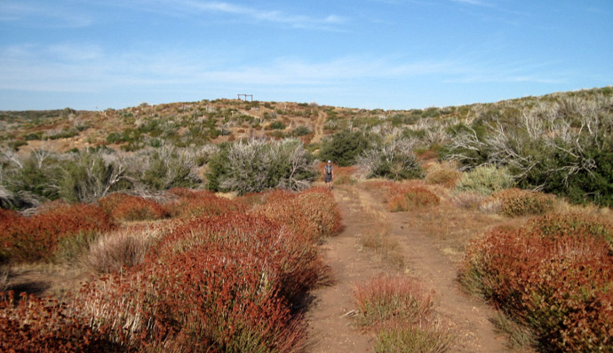
Manza was to be first and I had expected it to be one of the easiest. It was, after all, just 500 feet of gain and a mile from the road. How hard could it be? Well, it turned out to be more elusive than expected.
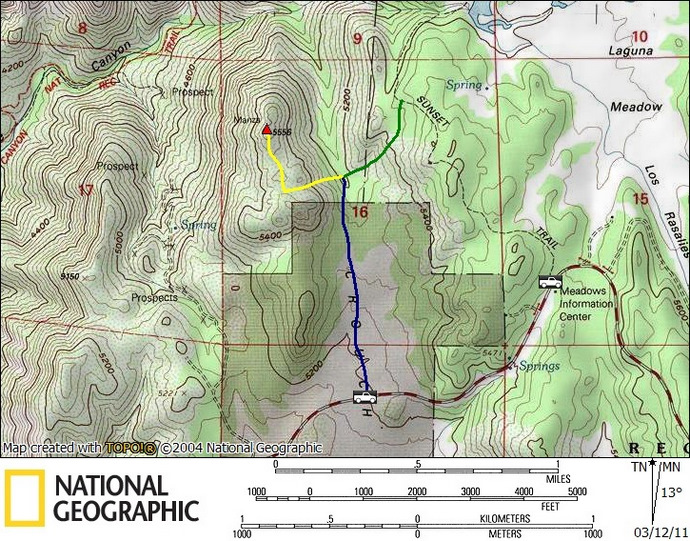
We first tried approaching Manza from the east via the Sunset Trail, never seeing a feasible route through the dense manzanita. We attempted to bushwhack our way from a few different spots with no luck. The manzanita was so dense that it was impossible to fit our bodies through, it just wasn’t happening. We returned to the truck to try a different approach and reluctantly decided to hop over a locked gate (unsigned but likely private), approaching Manza via Crouch Valley. This got us to within a 1/4 mile and 300 vertical feet from Manza’s summit before the intense manzanita again turned us away. Back to the truck again, I rechecked the map and saw a dirt road leaving the Sunrise Highway just southwest of Manza. We drove over to check it out, and again, not happening. Not even close.
At this point several hours had gone by, our weekend being dismantled by this little peak. I’d searched for info on Manza before the trip and had found nothing so I was probably never going to have more info than I had now, and decided we just had to make it happen. So, again we tried the Crouch Valley approach. Just southeast of the peak at about the 5200 foot contour, we started to force our way up. There was a line of trees that ran from near the summit ridge down to where we were, so we tried to stick near them, proving to be a slightly easier path. It was just enough for us to be able to fight through it, setting my lifetime record for doing the limbo. Finally reaching the summit ridge, we found a use trail – score. Someone had clipped a path through the manzanita and we followed it to the summit. It was still a bit rough but it would have been next to impossible to reach the summit without it.
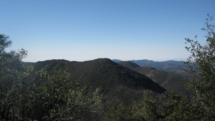
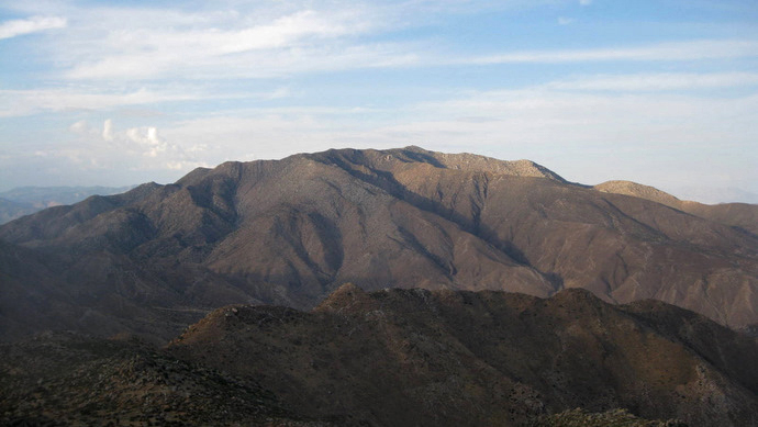
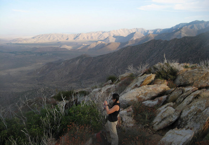
Boulders on the summit provided a clear opening and views from the top were great, especially looking north into Noble Canyon. After a few minutes on top, in a slight daze about how the day had panned out, we followed the clipped use trail back to the north end of Crouch Valley where Anna and I returned via the locked gate. It took less than 30 minutes to get from the summit to the truck.
I had warned a friend about Manza and I passed him the info I had about the clipped use trail. He put two and two together and found the remainder of the clipped use trail from the Sunset Trail, making sense out of Manza. Anna and I had just missed it and since our hike there I’ve now heard of Manza’s reputation, having turned away several peak-bagging veterans on their first try.
Roost
After spending all that time on Manza, it was after 2pm by the time we started thinking about which peak to go for next. We weren’t going to get the four peaks that we had hoped but we’d shoot for what we expected to be our most time-consuming peak. We followed the scenic Sunrise Highway north, stopping to score a campsite at the Burnt Ranchita campground, and made our way to an intersection with a dirt road that would take us to Roost BM.
We parked at a turnout on the west side of the Sunrise Highway, walked across, then started down the dirt road on foot. Roost was below our starting point so we’d have to drop some elevation and regain on the way back. An unlocked gate blocked this road and it would have been possible to drive in but we were happy to be walking. We soon passed a parked van that looked like it was being lived in.
We followed the road about a thousand feet down, across the Oriflamme Creek bed, and then northeast until it thinned out and disappeared, just over 3 miles after leaving the truck. From there we pushed through some thin brush for a few hundred feet until we eventually saw what must be Roost.

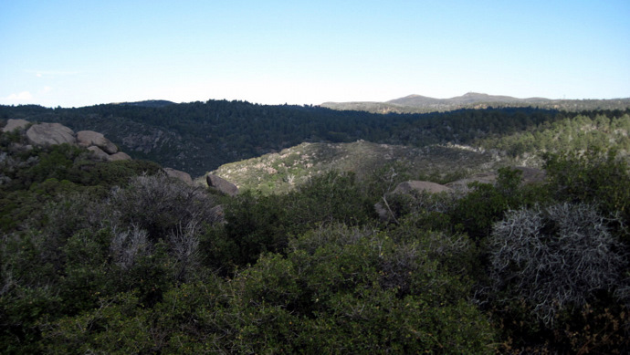
Going cross-country from there was over easy terrain. The landscape changed this last half mile, with orange colored rock mixed in with green grass and the occasional stripped manzanita.

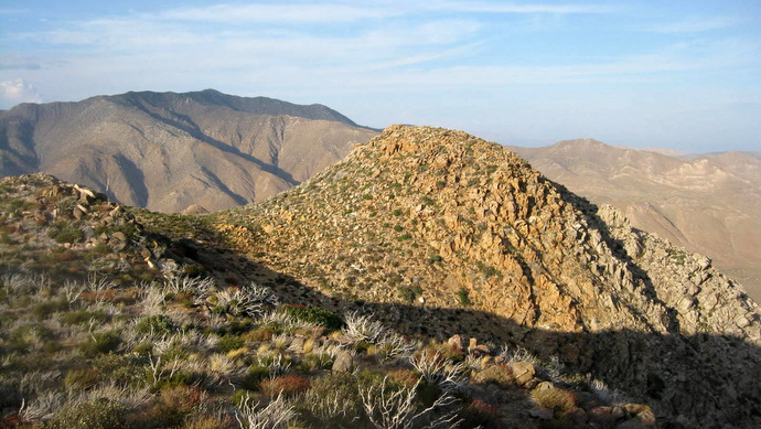
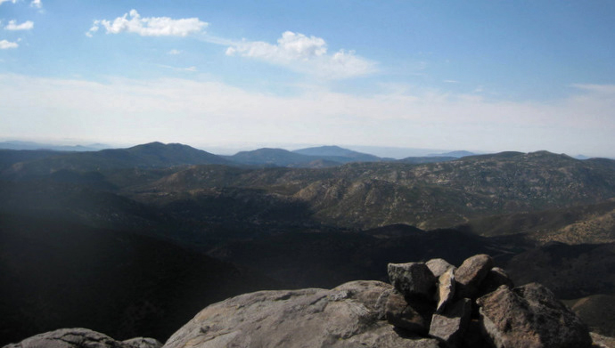
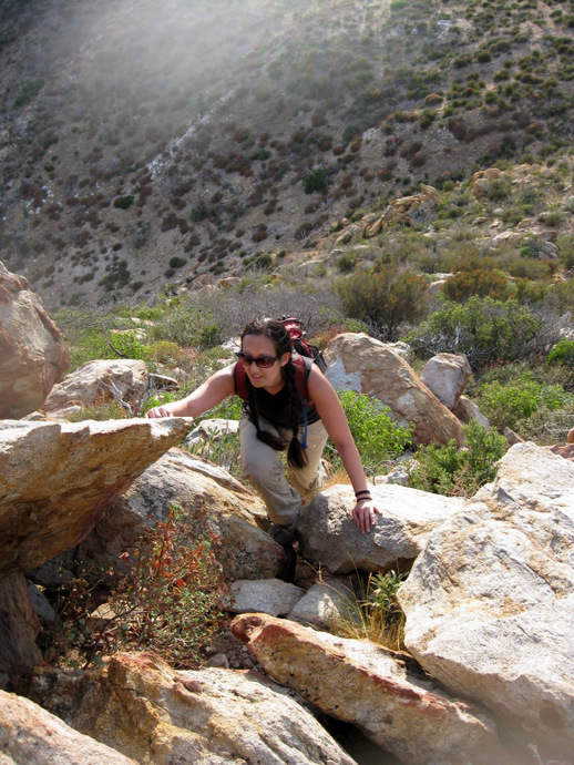
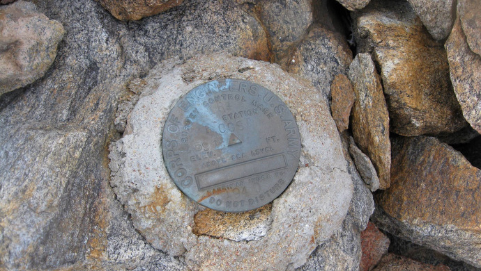
We continued towards Roost BM, hiking up and down over a few small hills, with a bit of a steep class 2 scramble the last 100 feet to the summit. The views from Roost were amazing, with 180 degree views straight down to the desert floor.
With unique terrain the last 1/2 mile, the awesome views, and the short but fun scramble up to the summit, Roost was a blast and made the day. We signed the summit register and started back for the truck, the dirt road now feeling long and monotonous. We passed by a couple of dove hunters that had driven in from the south and were setting up camp near the creek bed. We hoofed the last 1000 vertical feet back up the dirt road and then ran into the guy that was living in the van near where we started on Sunrise Highway. He was sitting outside when we passed by listening to a Mexican radio station. He was from San Diego and had come out to this spot to camp in his van for years, spending his nights teaching himself Spanish. We talked to him for a good 20 minutes before heading back to our campground at Burnt Ranchita, getting settled in for another day of hiking tomorrow.
Manza stats (our route): 2.5 miles roundtrip, 450 feet gain/loss
Note: The yellow path is a clipped use trail, vital for reaching the summit. The blue path is the route that Anna and I used to reach the summit and is likely trespassing – I’m leaving this here for legacy purposes but should not be used. The green path is the remainder of the clipped use trail that a friend found, accessible from the Sunset Trail.