El Cajon (SDC #89, 3675′) • map • directions
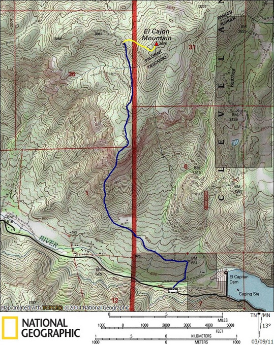
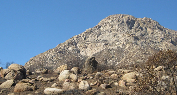
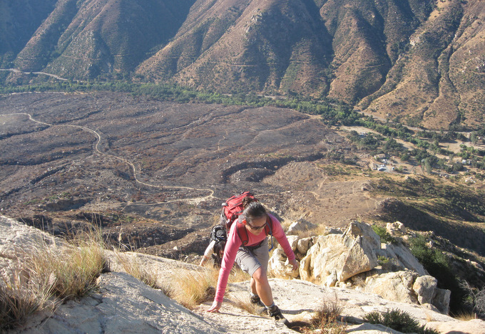
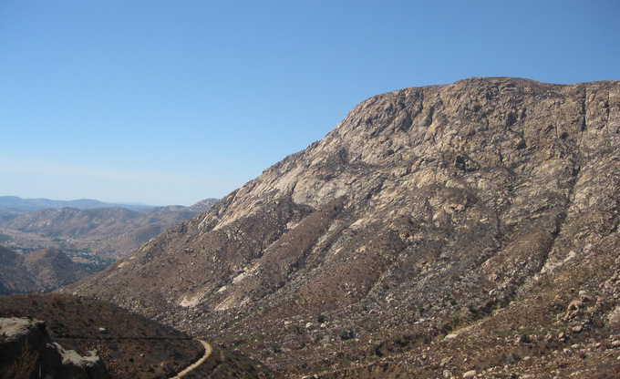
For the fourth time in four years I parked the car on El Monte Rd and stared up at the South Arete of El Cajon. The South Arete is the prominent ridge on the South side of El Cajon mountain, the unmistakable profile being visible from many parts of San Diego and loads of other San Diego County peaks. Its one of my favorite local scrambles so I didn’t mind a return visit, plus this trip I had my brother Nick along with Anna and I. This was my first class 3 route back in 2006, and it would be Nick’s and Anna’s first class 3 route, now in 2010.
The three of us crossed through the wooded area near the road and chose one of several trails heading towards the base of the South Arete. It took us 20 or 25 minutes to get to the steep stuff where a worn use trail winds its way up the lower part of the ridge.

The ridge was a mix of solid rock and loose dirt and ash from the recent fire, and is mostly class 2 with a few short class 3 sections to keep things interesting. There are several variations to get through the rockier sections, all without much technical difficulty, so we just chose what looked like the most fun.

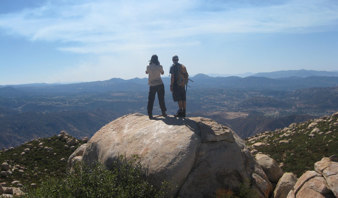
After scrambling 1700 feet on the ridge itself, we topped out and began the long walk to the summit. The remnants of an old road heads north from near the top of the South Arete and passes by the west side of the summit, leading to a use trail that’s part of the standard approach to the summit. The use trail was further north than I had remembered and it was tempting to head up to the top without it, but once we found it we were glad we did. We found the summit boulder at 10:30am, just as we really started feeling the day’s heat. We shared the views on top with a lone hiker who had come up the standard route.
I’ve descended El Cajon several ways including the preferred route reversal, but this particular trip we decided to explore the east side of the mountain. A short but stout bushwhack got us down to a dirt road labeled as “Westside” on my map, the heat as intense as ever. The road made for an easy and thoughtless descent, though at some point we wound up on the inside of a locked gate with a “No Trespassing” sign. The gate was decorated with barbed wire and it took some effort to find a way around, which we did quickly. I’ve omitted our descent route from the map as to not promote trespassing, and descending the South Arete is the best option after climbing it anyway.
Sometime while losing the last 1000 feet of elevation, the heat really hit us hard. I could in fact write an entire article about what happened over the last hour of our hike. My brother and I both suffered from mild heat exhaustion, and in 100s of trips to the mountains, this one registers as one of the worst situations I’ve ever experienced. I stopped sweating, my limbs were going numb, and I couldn’t keep water down. My body refused to absorb any water at all, and I would throw it up minutes after drinking. We got slower and slower, and just a 1/4 mile from the truck it seemed impossible. Nick and I crouched into the shade of a large boulder but I knew our condition would continue to worsen. I got up and motivated Nick to keep moving as I went ahead to get the truck.
For some reason Anna hadn’t been stricken by the heat to the degree that we had and she really began to worry at this point. She followed close behind as I stumbled slowly to the truck, where we finally all clambered inside with our last reserves of energy. I drove to the 7 Eleven a few minutes away, where we put down several liters of fluid in the truck with the AC on full blast, and I in turn threw up several liters of fluid right onto the 7 Eleven parking lot. It took thirty minutes of sitting in the truck’s AC and sipping fluids before I found the strength to drive home and it took another 24 hours to feel normal again.