
Garnet Mountain (SDC #57, 5700′) • map • directions
Pine (SDC #60, 5660′) • map • directions
Garnet Peak (SDC #59, 5900′) • map • directions
Monument (SDC #62, 6271′) • map • directions
Sheephead (SDC #72, 5896′) • map • directions
Wooded Hill (SDC #69, 6223′) • map • directions
Garnet Mountain
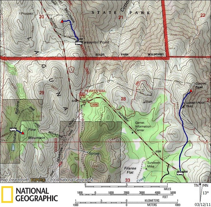
After yesterday’s debacle on Manza, we had six peaks we wanted to get to before the day was over instead of the four we had originally planned for. It wasn’t enough to get me out of bed before sunrise, but we did get up soon after, not wasting any time getting over to Garnet Mountain. We drove north on the Sunrise Highway from our campsite at Burnt Ranchita, and followed the turnoff for Kwaaymii Point. The Pacific Crest Trail crossed right through the parking lot, and you could see down to the desert floor without having to go anywhere.
The Pacific Crest Trail (PCT) from the parking lot (not the route for Garnet)
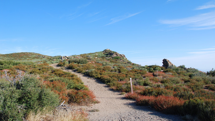
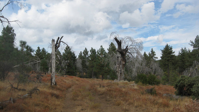
Anna and I started up the gated dirt road (not the PCT) and walked a third of a mile before turning left towards the high point of Garnet Mountain, arriving to the top at 8:51am. It took less than 15 minutes to get there, and surprisingly there was a summit register. The view towards Anza Borrego was great, but being further back on a relatively flat plateau prevented us from seeing much more than the horizon, and I imagined we’d have much better views throughout the day. I’d even argue that the parking lot that we started from has better views. We returned to the truck just as quickly as we left, and spent some time enjoying the view from the collection of memorials at the south end of the lot.
The view from Garnet Mountain
Pine
We turned south onto Sunrise Highway after leaving Garnet Mountain, and hung a right onto a dirt road almost exactly a mile down. We were headed towards Pine Mountain, and I wasn’t quite sure where it was exactly so I used my GPS to point the way. I kept on the rough dirt road (2WD high clearance ok), keeping right at an intersection, and ended up wrapping around to the northeast side of Pine Mountain, not quite believing that my GPS was pointing me to the tiny hill less than a quarter of a mile away. We parked and spent a total of 5 minutes walking up to the summit with only our cameras in hand, arriving at the top at 9:33am.

The summit of Pine Mountain (?)
We looked for any kind of a summit log but all we came up with was a pile of rocks near the center of the rounded hill. The trees blocked much of whatever view there was, but being one of the only higher mountains in San Diego with trees on top, I imagined that the pines were intended to be the attraction. Overall driving the road to Pine Mountain was the hardest part of the visit, and though we had originally expected to walk the extra mile and a half, I was glad we didn’t.
Views from Pine Mountain
Garnet Peak
Just another mile and a half south on the Sunrise Highway was the trailhead for Garnet Peak, not to be confused with the Garnet Mountain we’d visited just an hour previous. Garnet Peak promised more of a hike and better views than what we’d had so far this morning, and Anna and I were anxious to stretch our legs.
Garnet Peak from near the trailhead
A crowded trailhead further south on the highway gives the option of taking the PCT to Garnet Peak, but in the interest of time we started at the more obscure trailhead closer to the peak. We could see the summit from near the beginning of the hike, and the trail was very easy to follow. We crossed the PCT and took the path that led up the west slope of Garnet Peak, arriving at the summit at 10:27am. A group of three guys and a dog were on their way down, leaving the entire mountain for Anna and myself to enjoy.
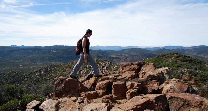
Looking west from the summit of Garnet Peak
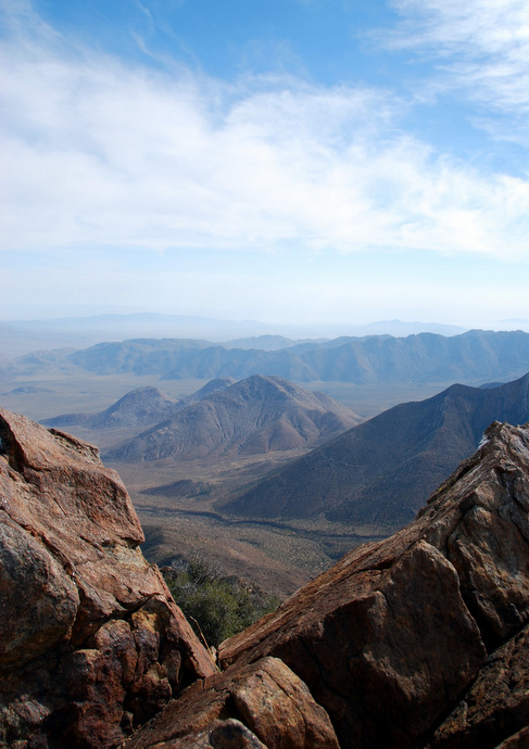
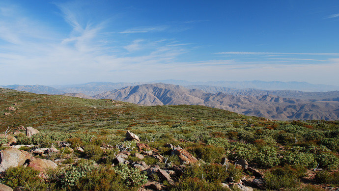
Anza Borrego from Garnet Peak
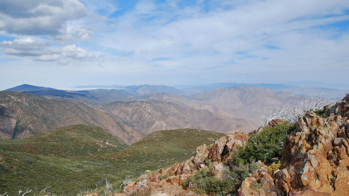
The view northwest from Garnet Peak
Monument
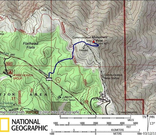
Monument Peak was the last peak we had planned to hike that was part of the desert divide, the chain of mountains that made up the eastern edge of the Colorado Desert. As described in Jerry Schad’s “Afoot and Afield in San Diego County, we parked in a dirt turnout near mile-marker 25 on the east side of the Sunrise Highway and started up the Big Laguna Trail.
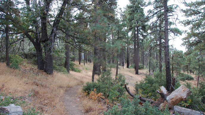
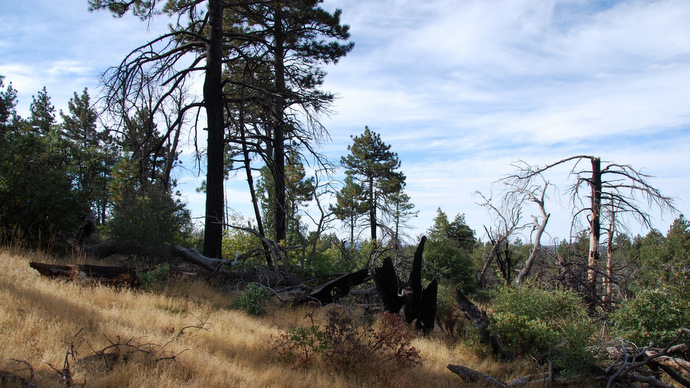
The trail just after leaving the highway
Ten minutes of hiking brought us to a junction with the Pacific Crest Trail, where we turned left (north), following the PCT for another 5 or 10 minutes until it curved around to the right (east). When the trail took a sharp left, we continued straight (east) on a worn path through the trees. The path was easy to follow and we continued up and south, eventually reaching a chain link fence, a helipad, and a paved road running the final quarter mile to the summit. Though the summit was decorated with towers and small buildings, I thought that Monument was the best summit of the day, and the view east into the desert was again awesome. We left the summit at 11:55 am, taking just over half an hour for the return hike.

The western edge of the Colorado Desert

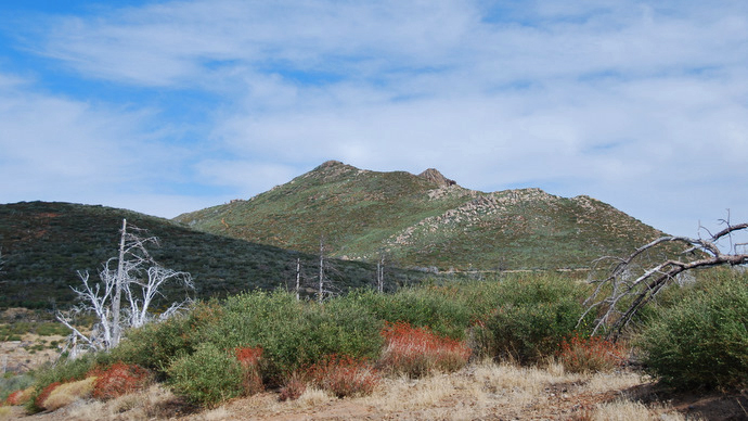
Garnet Peak from Monument
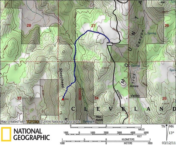
Sheephead
Once settled into the truck after returning from Monument Peak, Anna and I continued towards the southern end of the Sunrise Highway. This part of the highway took us a few miles west and away from the edge of the desert, near where we’d been on Manza the day before. We were headed for Sheephead Mountain, what would be our longest hike of the day, though still not very long as far as hikes go. We turned left onto Kitchen Creek Road, followed it down for 1.5 miles, and parked where the road took a sharp left. Here was an intersection with a gated dirt road, which would serve as our trailhead.
Headed towards Sheephead Mountain
We climbed over the gate and followed an old overgrown road, losing a few hundred feet of elevation in the process. There seemed to be more than one way to go, but I knew as long as we kept heading west we’d hit Sheephead mountain road and we’d be able to find our way, which we did in a matter of 15 minutes after leaving the truck. Turning south on Sheephead Mountain Rd, we came to a second locked gate that blocked progress. Though the route descriptions that I’ve read mention the locked gates and insist that this route is all on public property, it certainly seemed suspect. We squeezed underneath the barbed wire next to the gate when a group of 6 or 7 startled cows ran out from behind the nearby bushes, which cast even further doubt as to whether we should be there or not.
We began to look for the clipped use trail that was the key to getting up Sheephead. As in the route description, I kept my eyes open for a wash that ran down this side of the mountain and intersected the road. We did find the wash, and it did intersect the road at a noticeable low point, but there was no evidence of a trail. We walked up and down the wash, exploring both sides, and came up with nothing, no evidence of anyone. Since Sheephead was an HPS peak, I had expected the route to be more obvious, but I was sure that we were in the correct place. Eventually we just started heading up, staying either in or close to the wash, and we were ultimately funneled into the clipped trail that we knew was there.
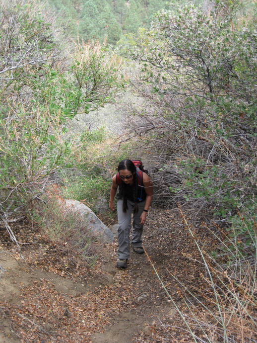
Anna on the clipped use trail on Sheephead Mountain
The manzanita covering this side of Sheephead Mountain was so tall and dense that the trail was more of a tunnel, making navigation nonexistent. The only challenge was the few boulders along the way that we had to climb over, and the steepness of the trail. Most of the elevation gain was in this passageway, which was fairly direct at 600 feet in a third of a mile. I guess if I was the one who clipped the trail I’d make it direct too; it sure seemed like a great deal of work. We followed the path all the way to the summit boulders, the shape of which supposedly gave Sheephead Mountain its name.
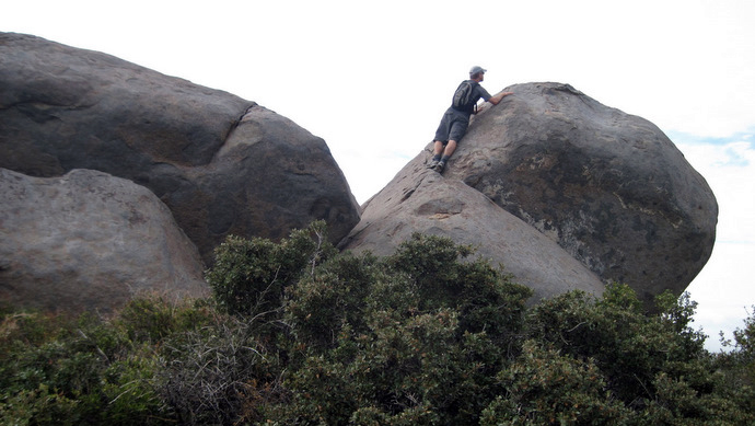
The summit block on Sheephead
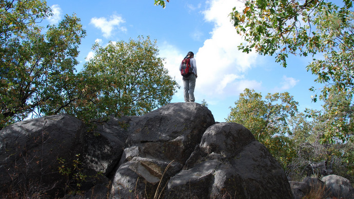
I was surprised to find that climbing the summit block on Sheephead’s summit was more committing than I had expected. I found two possible ways up, both requiring more than one awkward move, and both offering potential to land in not such a great spot if I blew one of those moves. In the end I squeezed up the south side of the boulders, jamming my hands into a crack and stepping on a bush to boost myself up. Though Anna was disinterested in climbing the summit block herself, she enjoyed cheering me on and taking pictures. The very top of the highest boulder was fairly exposed and I decided not to make the final mantle move to stand on top of it, though I was higher than the highest point. Not that it was so important anyway, really it was just extra fun for me.
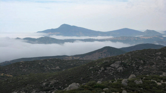
Weather rolling in over Cuyamaca
Once finished messing around on the summit boulders, we paid more attention to the weather and the views. We had almost forgotten that rain had been forecast in San Diego throughout the weekend, and it looked like the mountains we’d spent the last two days in had been keeping the storm at bay. Between climbing the boulders, snapping a few pictures, and catching up on our snacks, Anna and I spent almost 30 minutes on top, and we started back down at 1:53pm.
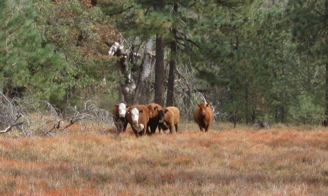
Evil cows
On the hike down from Sheephead mountain, we again crossed paths with the cows that we had seen on our way in. The cows acted very strangely, they did not enjoy our company one bit. At first the group of cows seemed to pace us, stopping in formation, always facing directly towards us and keeping eye contact. Then two of the larger cows seemed to become more aggressive, getting in between us and the rest of the cows, and for a second I thought they were going to charge (cows do charge by the way!). I dind’t know whether to laugh or to run, but Anna failed to find any humor in the situation. After a few minutes however, the cows lost interest and let us on our way.
Wooded Hill
It wasn’t until we were near the summit of Sheephead Mountain that I realized that we would get to the top of all 6 mountains we were shooting for today. Though I knew our last hike of the day, Wooded Hill, was easy, I hadn’t quite realized how easy. After parking at the trailhead just .3 miles off of Sunrise Highway, we were at the summit of Wooded Hill within 15 minutes. Though unimpressive as far as an actual hike, Wooded Hill gets points for its flora. The mix of interesting plants and trees was quite diverse, making for a pleasant final hike of the day, and actually, I would be inclined to recommend a hike like Wooded Hill to someone like my parents, who are far less interested in the chest-thumping activity of reaching some high point.
Anna on the summit of Wooded Hill

Sheephead Mountain with its unmistakable summit boulders, from Wooded Hill
It was 4:30pm by the time Anna and I walked up to the truck for the final time, where like last weekend, we relaxed and celebrated with a single beer before heading home. This weekend had been more of a challenge of logistics rather than hiking effort, though we certainly earned a hot meal in that aspect as well. Ten minutes after getting onto highway 8, we descended towards San Diego and into the rain that we had missed all weekend.
Garnet Mountain stats: 1.0 miles roundtrip, 250 feet gain/loss
Pine stats: .25 miles roundtrip, 100 feet gain/loss
Garnet Peak stats: 2.5 miles roundtrip, 500 feet gain/loss
Monument stats: 3.0 miles roundtrip, 500 feet gain/loss
Sheephead stats: 3.2 miles roundtrip, 1000 feet gain/loss

Wooded Hill stats: 1.2 miles roundtrip, 250 feet gain/loss