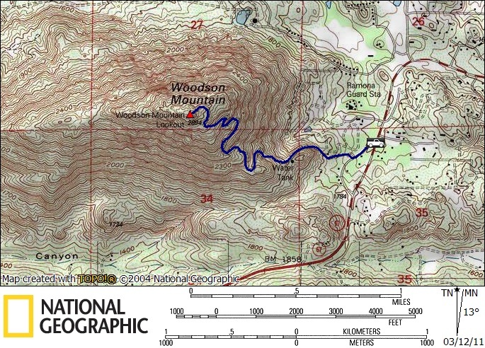
Woodson (SDC #48, 2901′) • map • directions
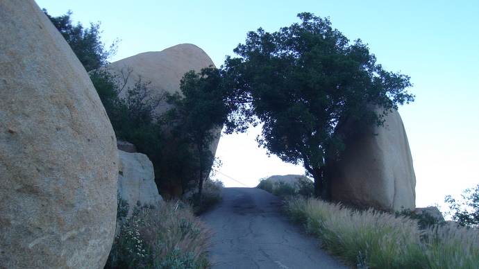
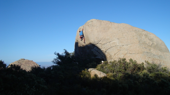
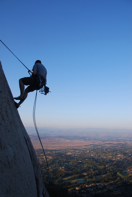
Mt. Woodson is a popular mountain in Poway, easily recognizable with its unique shape and tower covered summit. There are two main trails to the summit, the more popular approach via paved service road from the east, and a longer dirt trail with more elevation gain from Poway Lake on the west side. Woodson is widely known for its rich rock climbing history, with some of the sport’s greats (including some of Yosemite’s pioneers) developing routes on the east side of the mountain in the 1960s and 70s, and lots more notable activity throughout the 80s and early 90s. With its highball boulder problems and challenging crack climbs, its an awesome and unique place to rock climb, with literally hundreds of routes on the high quality house-sized boulders scattered about the mountain.
I’d visited Woodson several times before, having been up the trail from the west a few years ago, and most of the way up the road from the east several times to sample some of that good rock climbing. I much prefer the trail on the west when the summit is the objective, but this time out would be an after work hike and Lake Poway would be closed, so Anna and I planned on heading up the easier route from the east.
Though it was already dark when we pulled onto the shoulder of Highway 67, there were quite a few cars parked near the California Forestry fire station, an indication of how popular this hike is no matter the hour. We hiked on single track dirt trail parallel to the highway for a quarter mile before turning right onto the paved service road running to Woodson’s summit. We passed by a few houses while starting to gain elevation, crossing paths with a handful of hiking groups on their way down. The paved road switches back and forth, weaving around the enormous orange boulders, continuing until we reached the extensive array of towers on the summit. I eyed what I thought was the high point, a 20 foot tall rounded boulder seemingly void of any holds, beyond what I was willing to climb without a rope. Anna and I strolled back down the same route, passing another few groups of hikers on their way up.
The photos below are from various hikes/climbs on Woodson.